![](/images/other/stat-length.png)
Bavaria, Germany, On foot: Best trails, routes and walks
Bavaria: Discover the best trails: 4131 on foot, 39 walking and 1 running. All these trails, routes and outdoor activities are available in our SityTrail applications for smartphones and tablets.
The best trails (4171)
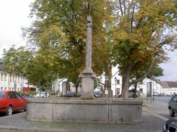
![Trail On foot Bärnau - Goldsteig Verbindungsweg Bärnau - Tachov - Photo](https://media.geolcdn.com/t/350/260/9d4c2b1a-5286-473e-ad9f-026784264d66.jpeg&format=jpg&maxdim=2)
![On foot On foot](https://static1.geolcdn.com/sitytour/trail-icons/100.png)
Km
On foot
![](/images/other/stat-length.png)
![](https://static1.geolcdn.com/siteimages/upload/files/1508320355ic_sort_den_pos_24dp.png)
![](https://static1.geolcdn.com/siteimages/upload/files/1508320355ic_sort_den_neg_24dp.png)
![](https://static1.geolcdn.com/siteimages/upload/files/16400158638029165_repeat_loop_refresh_sync_direction_icon.png)
• Symbol: blauer, stilisierter s-förmiger Weg auf weißem, rechteckigen Grund Website: https://zlatoustezkou.cz/route/...
![Trail On foot Furth im Wald - Goldsteig Verbindungsweg Furth im Wald - Domažlice - Photo](https://media.geolcdn.com/t/350/260/60a477b6-95cf-4661-b49b-f07c7a68b041.jpeg&format=jpg&maxdim=2)
![On foot On foot](https://static1.geolcdn.com/sitytour/trail-icons/100.png)
Km
On foot
![](/images/other/stat-length.png)
![](https://static1.geolcdn.com/siteimages/upload/files/1508320355ic_sort_den_pos_24dp.png)
![](https://static1.geolcdn.com/siteimages/upload/files/1508320355ic_sort_den_neg_24dp.png)
![](https://static1.geolcdn.com/siteimages/upload/files/16400158638029165_repeat_loop_refresh_sync_direction_icon.png)
• Symbol: blauer, stilisierter s-förmiger Weg auf weißem, rechteckigen Grund Website: https://zlatoustezkou.cz/route/...
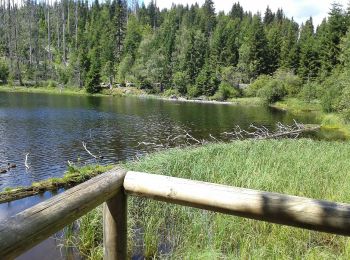
![Trail On foot Lindberg - Europas Wildes Herz (Ruckowitzschachten - D/CZ Lackabruck) - Photo](https://media.geolcdn.com/t/350/260/0e1df0bc-b218-40c3-9e5f-9638b6b4985a.jpeg&format=jpg&maxdim=2)
![On foot On foot](https://static1.geolcdn.com/sitytour/trail-icons/100.png)
Km
On foot
![](/images/other/stat-length.png)
![](https://static1.geolcdn.com/siteimages/upload/files/1508320355ic_sort_den_pos_24dp.png)
![](https://static1.geolcdn.com/siteimages/upload/files/1508320355ic_sort_den_neg_24dp.png)
![](https://static1.geolcdn.com/siteimages/upload/files/16400158638029165_repeat_loop_refresh_sync_direction_icon.png)
• Trail created by Nationalpark Bayerischer Wald. Symbol: »Europas wildes Herz«: auf weißem, quadratischem Grund ein s...
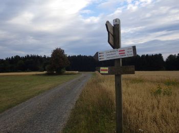
![Trail On foot Stadlern - Bayern-Böhmen-Runde 1 - Photo](https://media.geolcdn.com/t/350/260/5c6815e6-3769-4191-92da-29f50be62a8f.jpeg&format=jpg&maxdim=2)
![On foot On foot](https://static1.geolcdn.com/sitytour/trail-icons/100.png)
Km
On foot
![](/images/other/stat-length.png)
![](https://static1.geolcdn.com/siteimages/upload/files/1508320355ic_sort_den_pos_24dp.png)
![](https://static1.geolcdn.com/siteimages/upload/files/1508320355ic_sort_den_neg_24dp.png)
![](https://static1.geolcdn.com/siteimages/upload/files/16400158638029165_repeat_loop_refresh_sync_direction_icon.png)
• Symbol: auf gelben Grund in schwarz "BB1"
![Trail On foot Schönsee - Bayern-Böhmen-Runde 2 - Photo](https://media.geolcdn.com/t/350/260/1bf5b631-87d9-4d98-a1f8-ac378680ac95.jpeg&format=jpg&maxdim=2)
![On foot On foot](https://static1.geolcdn.com/sitytour/trail-icons/100.png)
Km
On foot
![](/images/other/stat-length.png)
![](https://static1.geolcdn.com/siteimages/upload/files/1508320355ic_sort_den_pos_24dp.png)
![](https://static1.geolcdn.com/siteimages/upload/files/1508320355ic_sort_den_neg_24dp.png)
![](https://static1.geolcdn.com/siteimages/upload/files/16400158638029165_repeat_loop_refresh_sync_direction_icon.png)
• Symbol: auf gelben Grund in schwarz "BB2"
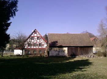
![Trail On foot Neualbenreuth - Neualbenreuth: Auf stillen Waldpfaden zur Grenze - Photo](https://media.geolcdn.com/t/350/260/da23ae0e-15a2-4ebb-81d9-23741e0bbc84.jpeg&format=jpg&maxdim=2)
![On foot On foot](https://static1.geolcdn.com/sitytour/trail-icons/100.png)
Km
On foot
![](/images/other/stat-length.png)
![](https://static1.geolcdn.com/siteimages/upload/files/1508320355ic_sort_den_pos_24dp.png)
![](https://static1.geolcdn.com/siteimages/upload/files/1508320355ic_sort_den_neg_24dp.png)
![](https://static1.geolcdn.com/siteimages/upload/files/16400158638029165_repeat_loop_refresh_sync_direction_icon.png)
• Symbol: auf weißem Hintergrund ein gelber Punkt
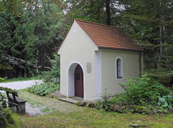
![Trail On foot Neualbenreuth - Neualbenreuth: In einem Tag durch das Fraisch-Gebiet - Photo](https://media.geolcdn.com/t/350/260/03a83182-60a3-4efd-ae3e-013f5ce67585.jpeg&format=jpg&maxdim=2)
![On foot On foot](https://static1.geolcdn.com/sitytour/trail-icons/100.png)
Km
On foot
![](/images/other/stat-length.png)
![](https://static1.geolcdn.com/siteimages/upload/files/1508320355ic_sort_den_pos_24dp.png)
![](https://static1.geolcdn.com/siteimages/upload/files/1508320355ic_sort_den_neg_24dp.png)
![](https://static1.geolcdn.com/siteimages/upload/files/16400158638029165_repeat_loop_refresh_sync_direction_icon.png)
• Trail created by Oberpfälzer Waldverein. Symbol: Weißer Punkt auf grünem Hintergrund Website: http://wandern-in-ne...
![Trail On foot Neualbenreuth - Alter Herrgott - Granatbrunnen - Photo](https://media.geolcdn.com/t/350/260/f00bb44f-3a31-494e-b91b-cb23ec59b052.jpeg&format=jpg&maxdim=2)
![On foot On foot](https://static1.geolcdn.com/sitytour/trail-icons/100.png)
Km
On foot
![](/images/other/stat-length.png)
![](https://static1.geolcdn.com/siteimages/upload/files/1508320355ic_sort_den_pos_24dp.png)
![](https://static1.geolcdn.com/siteimages/upload/files/1508320355ic_sort_den_neg_24dp.png)
![](https://static1.geolcdn.com/siteimages/upload/files/16400158638029165_repeat_loop_refresh_sync_direction_icon.png)
• Trail created by Oberpfälzer Waldverein Neualbenreuth. Symbol: auf weißem Hintergrund ein diagonal steigender roter ...
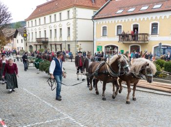
![Trail On foot Lam - L 3 Lam - Osser (Osser-Riesensteig) - Photo](https://media.geolcdn.com/t/350/260/d755e85e-340b-44f3-a7ce-860e3e150c9e.jpeg&format=jpg&maxdim=2)
![On foot On foot](https://static1.geolcdn.com/sitytour/trail-icons/100.png)
Km
On foot
![](/images/other/stat-length.png)
![](https://static1.geolcdn.com/siteimages/upload/files/1508320355ic_sort_den_pos_24dp.png)
![](https://static1.geolcdn.com/siteimages/upload/files/1508320355ic_sort_den_neg_24dp.png)
![](https://static1.geolcdn.com/siteimages/upload/files/16400158638029165_repeat_loop_refresh_sync_direction_icon.png)
• Trail created by Naturpark Oberer Bayerischer Wald. Symbol: Schwarze Wegnummer im weißen Bereich des oben weißen / u...
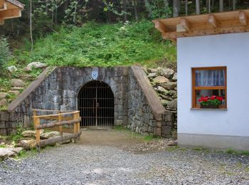
![Trail On foot Lam - La 1 Lam - Osser (Künischer Grenzweg) - Photo](https://media.geolcdn.com/t/350/260/0c66b4d2-1a83-4e3d-a6fc-f5c33503c4c0.jpeg&format=jpg&maxdim=2)
![On foot On foot](https://static1.geolcdn.com/sitytour/trail-icons/100.png)
Km
On foot
![](/images/other/stat-length.png)
![](https://static1.geolcdn.com/siteimages/upload/files/1508320355ic_sort_den_pos_24dp.png)
![](https://static1.geolcdn.com/siteimages/upload/files/1508320355ic_sort_den_neg_24dp.png)
![](https://static1.geolcdn.com/siteimages/upload/files/16400158638029165_repeat_loop_refresh_sync_direction_icon.png)
• Trail created by Naturpark Oberer Bayerischer Wald. Symbol: Schwarze Wegnummer im weißen Bereich des oben weißen / u...
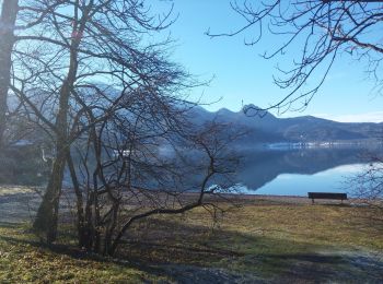
![Trail On foot - Lo 5 Zwerchecker-Steig (Lohberg) - Photo](https://media.geolcdn.com/t/350/260/afdf211f-3378-4ccf-a493-44a5d1b4a1ef.jpeg&format=jpg&maxdim=2)
![On foot On foot](https://static1.geolcdn.com/sitytour/trail-icons/100.png)
Km
On foot
![](/images/other/stat-length.png)
![](https://static1.geolcdn.com/siteimages/upload/files/1508320355ic_sort_den_pos_24dp.png)
![](https://static1.geolcdn.com/siteimages/upload/files/1508320355ic_sort_den_neg_24dp.png)
![](https://static1.geolcdn.com/siteimages/upload/files/16400158638029165_repeat_loop_refresh_sync_direction_icon.png)
• Trail created by Naturpark Oberer Bayerischer Wald. Symbol: Auf oben weißem / unten rotem, rechteckigem Hintergrund ...
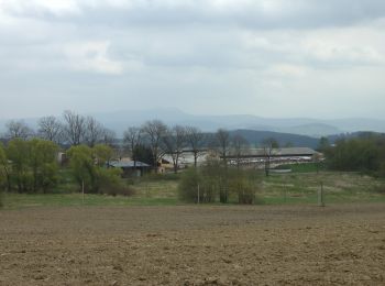
![Trail On foot Furth im Wald - Fu61 (Daberger Rundweg) - Photo](https://media.geolcdn.com/t/350/260/60c41f63-9e32-418a-93ca-fb61973d7b29.jpeg&format=jpg&maxdim=2)
![On foot On foot](https://static1.geolcdn.com/sitytour/trail-icons/100.png)
Km
On foot
![](/images/other/stat-length.png)
![](https://static1.geolcdn.com/siteimages/upload/files/1508320355ic_sort_den_pos_24dp.png)
![](https://static1.geolcdn.com/siteimages/upload/files/1508320355ic_sort_den_neg_24dp.png)
![](https://static1.geolcdn.com/siteimages/upload/files/16400158638029165_repeat_loop_refresh_sync_direction_icon.png)
• Trail created by ARGE Further Wanderwege. Symbol: rot Fu61 auf Weiß, darunter rot
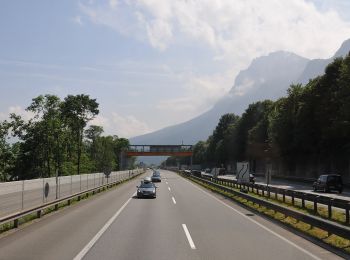
![Trail On foot Kiefersfelden - Kaiser Max Weg - Photo](https://media.geolcdn.com/t/350/260/d9479138-c4d4-4de4-9913-7bba84071432.jpeg&format=jpg&maxdim=2)
![On foot On foot](https://static1.geolcdn.com/sitytour/trail-icons/100.png)
Km
On foot
![](/images/other/stat-length.png)
![](https://static1.geolcdn.com/siteimages/upload/files/1508320355ic_sort_den_pos_24dp.png)
![](https://static1.geolcdn.com/siteimages/upload/files/1508320355ic_sort_den_neg_24dp.png)
![](https://static1.geolcdn.com/siteimages/upload/files/16400158638029165_repeat_loop_refresh_sync_direction_icon.png)
• Trail created by IVV. Im Bereich Kieferfelden sehr schlecht ausgeschildert (2020) Symbol: Grüne Rechtecke mit Reich...
![Trail On foot Bad Hindelang - Grenzgänger - Photo](https://media.geolcdn.com/t/350/260/63e3f942-d2a7-45f2-9c48-50e91e2a0be1.jpeg&format=jpg&maxdim=2)
![On foot On foot](https://static1.geolcdn.com/sitytour/trail-icons/100.png)
Km
On foot
![](/images/other/stat-length.png)
![](https://static1.geolcdn.com/siteimages/upload/files/1508320355ic_sort_den_pos_24dp.png)
![](https://static1.geolcdn.com/siteimages/upload/files/1508320355ic_sort_den_neg_24dp.png)
![](https://static1.geolcdn.com/siteimages/upload/files/16400158638029165_repeat_loop_refresh_sync_direction_icon.png)
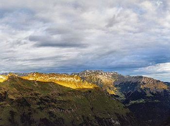
• Beim »Grenzgänger« handelt es sich um eine Mehrtagestour inmitten der Allgäuer Alpen Website: https://www.grenzgaeng...
![Trail On foot Reit im Winkl - Wanderweg 14 - Reit im Winkl - Photo](https://media.geolcdn.com/t/350/260/1c890e26-e4a9-4d0e-b97b-8f5a1969d3b8.jpeg&format=jpg&maxdim=2)
![On foot On foot](https://static1.geolcdn.com/sitytour/trail-icons/100.png)
Km
On foot
![](/images/other/stat-length.png)
![](https://static1.geolcdn.com/siteimages/upload/files/1508320355ic_sort_den_pos_24dp.png)
![](https://static1.geolcdn.com/siteimages/upload/files/1508320355ic_sort_den_neg_24dp.png)
![](https://static1.geolcdn.com/siteimages/upload/files/16400158638029165_repeat_loop_refresh_sync_direction_icon.png)
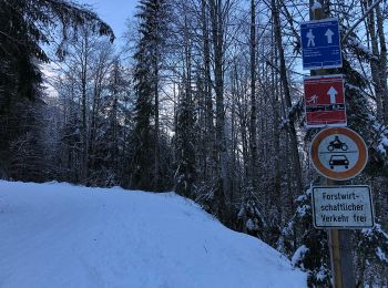
• Symbol: Gelbe Wegweisschilder mit Text und Zahl
![Trail On foot Nußdorf am Inn - Kranzhorn über Bubenaualm - Photo](https://media.geolcdn.com/t/350/260/e3c5b70e-000e-4248-8f68-0461d1126b7e.jpeg&format=jpg&maxdim=2)
![On foot On foot](https://static1.geolcdn.com/sitytour/trail-icons/100.png)
Km
On foot
![](/images/other/stat-length.png)
![](https://static1.geolcdn.com/siteimages/upload/files/1508320355ic_sort_den_pos_24dp.png)
![](https://static1.geolcdn.com/siteimages/upload/files/1508320355ic_sort_den_neg_24dp.png)
![](https://static1.geolcdn.com/siteimages/upload/files/16400158638029165_repeat_loop_refresh_sync_direction_icon.png)
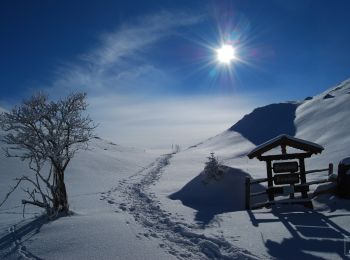
• Symbol: Blaue Farbstreifen auf Steinen
![Trail On foot Rottach-Egern - Valepp-Schinder - Photo](https://media.geolcdn.com/t/350/260/1e21333e-a75f-43a7-8f43-21fc4f91f731.jpeg&format=jpg&maxdim=2)
![On foot On foot](https://static1.geolcdn.com/sitytour/trail-icons/100.png)
Km
On foot
![](/images/other/stat-length.png)
![](https://static1.geolcdn.com/siteimages/upload/files/1508320355ic_sort_den_pos_24dp.png)
![](https://static1.geolcdn.com/siteimages/upload/files/1508320355ic_sort_den_neg_24dp.png)
![](https://static1.geolcdn.com/siteimages/upload/files/16400158638029165_repeat_loop_refresh_sync_direction_icon.png)
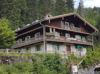
• Trail created by DAV Sektion Bergbund Hausham.
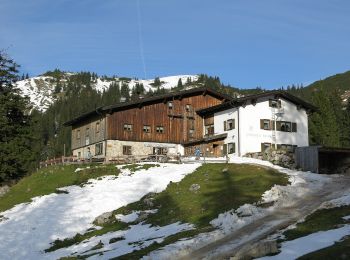
![Trail On foot Schleching - Schlechinger Wanderweg 8 - Photo](https://media.geolcdn.com/t/350/260/5ec9d0f0-d307-4335-b7ef-61782e26c4fb.jpeg&format=jpg&maxdim=2)
![On foot On foot](https://static1.geolcdn.com/sitytour/trail-icons/100.png)
Km
On foot
![](/images/other/stat-length.png)
![](https://static1.geolcdn.com/siteimages/upload/files/1508320355ic_sort_den_pos_24dp.png)
![](https://static1.geolcdn.com/siteimages/upload/files/1508320355ic_sort_den_neg_24dp.png)
![](https://static1.geolcdn.com/siteimages/upload/files/16400158638029165_repeat_loop_refresh_sync_direction_icon.png)
• Trail created by Verkehrsverein Schleching e.V.. Symbol: Weiße Schilder mit schwarzer Schrift und Zahl oder rote Pun...
![Trail On foot Schleching - Schlechinger Wanderweg 29 - Photo](https://media.geolcdn.com/t/350/260/10da69ce-51cb-4072-bdcf-2837bf3a9f48.jpeg&format=jpg&maxdim=2)
![On foot On foot](https://static1.geolcdn.com/sitytour/trail-icons/100.png)
Km
On foot
![](/images/other/stat-length.png)
![](https://static1.geolcdn.com/siteimages/upload/files/1508320355ic_sort_den_pos_24dp.png)
![](https://static1.geolcdn.com/siteimages/upload/files/1508320355ic_sort_den_neg_24dp.png)
![](https://static1.geolcdn.com/siteimages/upload/files/16400158638029165_repeat_loop_refresh_sync_direction_icon.png)
• Trail created by Verkehrsverein Schleching e.V.. Symbol: Weiße Schilder mit schwarzer Schrift und Zahl, Rote Punkte ...
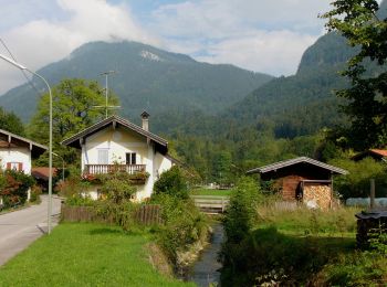
![Trail On foot Aschau im Chiemgau - Wanderweg 1 - Von Sachrang nach Walchsee - Photo](https://media.geolcdn.com/t/350/260/d0aba310-1364-491c-a5a9-de0387879306.jpeg&format=jpg&maxdim=2)
![On foot On foot](https://static1.geolcdn.com/sitytour/trail-icons/100.png)
Km
On foot
![](/images/other/stat-length.png)
![](https://static1.geolcdn.com/siteimages/upload/files/1508320355ic_sort_den_pos_24dp.png)
![](https://static1.geolcdn.com/siteimages/upload/files/1508320355ic_sort_den_neg_24dp.png)
![](https://static1.geolcdn.com/siteimages/upload/files/16400158638029165_repeat_loop_refresh_sync_direction_icon.png)
• Trail created by Tourist Info Aschau i.Ch.. Symbol: Grüne Schilder mit weißer Schrift
20 trails displayed on 4171
FREE GPS app for hiking
Activities
Nearby regions
- Amberg
- Ansbach (district)
- Aschaffenburg
- Augsburg
- Augsburg (district)
- Bamberg
- Bayreuth
- Coburg
- Erlangen
- Fürth
- Fürth (district)
- Hof
- Ingolstadt
- Kaufbeuren
- Kempten (Allgäu)
- Landkreis Aichach-Friedberg
- Landkreis Altötting
- Landkreis Amberg-Sulzbach
- Landkreis Aschaffenburg
- Landkreis Bad Kissingen
- Landkreis Bad Tölz-Wolfratshausen
- Landkreis Bamberg
- Landkreis Bayreuth
- Landkreis Berchtesgadener Land
- Landkreis Cham
- Landkreis Coburg
- Landkreis Dachau
- Landkreis Deggendorf
- Landkreis Dillingen an der Donau
- Landkreis Donau-Ries
- Landkreis Ebersberg
- Landkreis Eichstätt
- Landkreis Erding
- Landkreis Erlangen-Höchstadt
- Landkreis Forchheim
- Landkreis Freising
- Landkreis Freyung-Grafenau
- Landkreis Fürstenfeldbruck
- Landkreis Garmisch-Partenkirchen
- Landkreis Günzburg
- Landkreis Haßberge
- Landkreis Hof
- Landkreis Kelheim
- Landkreis Kitzingen
- Landkreis Kronach
- Landkreis Kulmbach
- Landkreis Landsberg am Lech
- Landkreis Landshut
- Landkreis Lichtenfels
- Landkreis Lindau
- Landkreis Main-Spessart
- Landkreis Miesbach
- Landkreis Miltenberg
- Landkreis Mühldorf am Inn
- Landkreis München
- Landkreis Neu-Ulm
- Landkreis Neuburg-Schrobenhausen
- Landkreis Neumarkt in der Oberpfalz
- Landkreis Neustadt an der Aisch-Bad Windsheim
- Landkreis Neustadt an der Waldnaab
- Landkreis Oberallgäu
- Landkreis Ostallgäu
- Landkreis Passau
- Landkreis Pfaffenhofen an der Ilm
- Landkreis Regen
- Landkreis Regensburg
- Landkreis Rhön-Grabfeld
- Landkreis Rosenheim
- Landkreis Rottal-Inn
- Landkreis Schwandorf
- Landkreis Schweinfurt
- Landkreis Starnberg
- Landkreis Straubing-Bogen
- Landkreis Tirschenreuth
- Landkreis Traunstein
- Landkreis Unterallgäu
- Landkreis Weilheim-Schongau
- Landkreis Wunsiedel im Fichtelgebirge
- Landkreis Würzburg
- Memmingen
- Munich
- Nuremberg
- Nürnberger Land
- Passau
- Regensburg
- Rosenheim
- Roth
- Schweinfurt
- Straubing
- Weiden in der Oberpfalz
- Weißenburg-Gunzenhausen
- Würzburg