![](/images/other/stat-length.png)
Landkreis Neu-Ulm, Bavaria, On foot: Best trails, routes and walks
Landkreis Neu-Ulm: Discover the best trails: 14 on foot. All these trails, routes and outdoor activities are available in our SityTrail applications for smartphones and tablets.
The best trails (14)
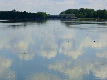
![Trail On foot Elchingen - Donausteg- Tour - Photo](https://media.geolcdn.com/t/350/260/f955fa6b-802b-47d1-9170-2fca5bc28eff.jpeg&format=jpg&maxdim=2)
![On foot On foot](https://static1.geolcdn.com/sitytour/trail-icons/100.png)
Km
On foot
![](/images/other/stat-length.png)
![](https://static1.geolcdn.com/siteimages/upload/files/1508320355ic_sort_den_pos_24dp.png)
![](https://static1.geolcdn.com/siteimages/upload/files/1508320355ic_sort_den_neg_24dp.png)
![](https://static1.geolcdn.com/siteimages/upload/files/16400158638029165_repeat_loop_refresh_sync_direction_icon.png)
• Trail created by Elchingen. Symbol: purple
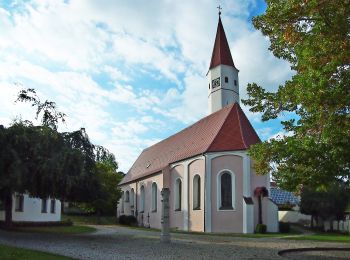
![Trail On foot Elchingen - Wiesental-Tour - Photo](https://media.geolcdn.com/t/350/260/d8c6e76f-17fa-487b-afe6-02865f8f84c3.jpeg&format=jpg&maxdim=2)
![On foot On foot](https://static1.geolcdn.com/sitytour/trail-icons/100.png)
Km
On foot
![](/images/other/stat-length.png)
![](https://static1.geolcdn.com/siteimages/upload/files/1508320355ic_sort_den_pos_24dp.png)
![](https://static1.geolcdn.com/siteimages/upload/files/1508320355ic_sort_den_neg_24dp.png)
![](https://static1.geolcdn.com/siteimages/upload/files/16400158638029165_repeat_loop_refresh_sync_direction_icon.png)
• Trail created by Elchingen. Symbol: green
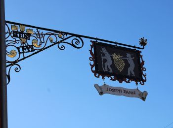
![Trail On foot Elchingen - Postweg - Photo](https://media.geolcdn.com/t/350/260/3cb4ac6e-b19c-44d2-bd40-c69f1061d5a1.jpeg&format=jpg&maxdim=2)
![On foot On foot](https://static1.geolcdn.com/sitytour/trail-icons/100.png)
Km
On foot
![](/images/other/stat-length.png)
![](https://static1.geolcdn.com/siteimages/upload/files/1508320355ic_sort_den_pos_24dp.png)
![](https://static1.geolcdn.com/siteimages/upload/files/1508320355ic_sort_den_neg_24dp.png)
![](https://static1.geolcdn.com/siteimages/upload/files/16400158638029165_repeat_loop_refresh_sync_direction_icon.png)
• Trail created by Elchingen. Symbol: yellow
![Trail On foot Elchingen - Panorama- Höhenweg - Photo](https://media.geolcdn.com/t/350/260/d8c6e76f-17fa-487b-afe6-02865f8f84c3.jpeg&format=jpg&maxdim=2)
![On foot On foot](https://static1.geolcdn.com/sitytour/trail-icons/100.png)
Km
On foot
![](/images/other/stat-length.png)
![](https://static1.geolcdn.com/siteimages/upload/files/1508320355ic_sort_den_pos_24dp.png)
![](https://static1.geolcdn.com/siteimages/upload/files/1508320355ic_sort_den_neg_24dp.png)
![](https://static1.geolcdn.com/siteimages/upload/files/16400158638029165_repeat_loop_refresh_sync_direction_icon.png)
• Trail created by Elchingen. Symbol: orange
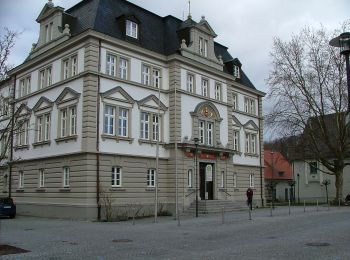
![Trail On foot Illertissen - Illertisser Bienenweg, lange Strecke - Photo](https://media.geolcdn.com/t/350/260/0b29c615-6a38-4dfb-9315-8c8d2a2fb603.jpeg&format=jpg&maxdim=2)
![On foot On foot](https://static1.geolcdn.com/sitytour/trail-icons/100.png)
Km
On foot
![](/images/other/stat-length.png)
![](https://static1.geolcdn.com/siteimages/upload/files/1508320355ic_sort_den_pos_24dp.png)
![](https://static1.geolcdn.com/siteimages/upload/files/1508320355ic_sort_den_neg_24dp.png)
![](https://static1.geolcdn.com/siteimages/upload/files/16400158638029165_repeat_loop_refresh_sync_direction_icon.png)
• Trail created by Stadt Illertissen. Symbol: Biene mit blauem Viereck
![Trail On foot Illertissen - Illertisser Bienenweg, kurze Strecke - Photo](https://media.geolcdn.com/t/350/260/0b29c615-6a38-4dfb-9315-8c8d2a2fb603.jpeg&format=jpg&maxdim=2)
![On foot On foot](https://static1.geolcdn.com/sitytour/trail-icons/100.png)
Km
On foot
![](/images/other/stat-length.png)
![](https://static1.geolcdn.com/siteimages/upload/files/1508320355ic_sort_den_pos_24dp.png)
![](https://static1.geolcdn.com/siteimages/upload/files/1508320355ic_sort_den_neg_24dp.png)
![](https://static1.geolcdn.com/siteimages/upload/files/16400158638029165_repeat_loop_refresh_sync_direction_icon.png)
• Trail created by Stadt Illertissen. Symbol: Biene mit rotem Viereck
![Trail On foot Illertissen - Wanderweg 6 Stadt Illertissen - Photo](https://media.geolcdn.com/t/350/260/0b29c615-6a38-4dfb-9315-8c8d2a2fb603.jpeg&format=jpg&maxdim=2)
![On foot On foot](https://static1.geolcdn.com/sitytour/trail-icons/100.png)
Km
On foot
![](/images/other/stat-length.png)
![](https://static1.geolcdn.com/siteimages/upload/files/1508320355ic_sort_den_pos_24dp.png)
![](https://static1.geolcdn.com/siteimages/upload/files/1508320355ic_sort_den_neg_24dp.png)
![](https://static1.geolcdn.com/siteimages/upload/files/16400158638029165_repeat_loop_refresh_sync_direction_icon.png)
• Trail created by Stadt Illertissen. Symbol: weiße 6 auf blauem Rechteck
![Trail On foot Illertissen - Wanderweg 5 Stadt Illertissen - Photo](https://media.geolcdn.com/t/350/260/0b29c615-6a38-4dfb-9315-8c8d2a2fb603.jpeg&format=jpg&maxdim=2)
![On foot On foot](https://static1.geolcdn.com/sitytour/trail-icons/100.png)
Km
On foot
![](/images/other/stat-length.png)
![](https://static1.geolcdn.com/siteimages/upload/files/1508320355ic_sort_den_pos_24dp.png)
![](https://static1.geolcdn.com/siteimages/upload/files/1508320355ic_sort_den_neg_24dp.png)
![](https://static1.geolcdn.com/siteimages/upload/files/16400158638029165_repeat_loop_refresh_sync_direction_icon.png)
• Trail created by Stadt Illertissen. Symbol: weiße 5 auf blauem Rechteck
![Trail On foot Illertissen - Wanderweg 4 Stadt Illertissen - Photo](https://media.geolcdn.com/t/350/260/0b29c615-6a38-4dfb-9315-8c8d2a2fb603.jpeg&format=jpg&maxdim=2)
![On foot On foot](https://static1.geolcdn.com/sitytour/trail-icons/100.png)
Km
On foot
![](/images/other/stat-length.png)
![](https://static1.geolcdn.com/siteimages/upload/files/1508320355ic_sort_den_pos_24dp.png)
![](https://static1.geolcdn.com/siteimages/upload/files/1508320355ic_sort_den_neg_24dp.png)
![](https://static1.geolcdn.com/siteimages/upload/files/16400158638029165_repeat_loop_refresh_sync_direction_icon.png)
• Trail created by Stadt Illertissen. Symbol: weiße 4 auf blauem Rechteck
![Trail On foot Illertissen - Wanderweg 3 Stadt Illertissen - Photo](https://media.geolcdn.com/t/350/260/0b29c615-6a38-4dfb-9315-8c8d2a2fb603.jpeg&format=jpg&maxdim=2)
![On foot On foot](https://static1.geolcdn.com/sitytour/trail-icons/100.png)
Km
On foot
![](/images/other/stat-length.png)
![](https://static1.geolcdn.com/siteimages/upload/files/1508320355ic_sort_den_pos_24dp.png)
![](https://static1.geolcdn.com/siteimages/upload/files/1508320355ic_sort_den_neg_24dp.png)
![](https://static1.geolcdn.com/siteimages/upload/files/16400158638029165_repeat_loop_refresh_sync_direction_icon.png)
• Trail created by Stadt Illertissen. Symbol: weiße 3 auf blauem Rechteck
![Trail On foot Illertissen - Wanderweg 2 Stadt Illertissen - Photo](https://media.geolcdn.com/t/350/260/0b29c615-6a38-4dfb-9315-8c8d2a2fb603.jpeg&format=jpg&maxdim=2)
![On foot On foot](https://static1.geolcdn.com/sitytour/trail-icons/100.png)
Km
On foot
![](/images/other/stat-length.png)
![](https://static1.geolcdn.com/siteimages/upload/files/1508320355ic_sort_den_pos_24dp.png)
![](https://static1.geolcdn.com/siteimages/upload/files/1508320355ic_sort_den_neg_24dp.png)
![](https://static1.geolcdn.com/siteimages/upload/files/16400158638029165_repeat_loop_refresh_sync_direction_icon.png)
• Trail created by Stadt Illertissen. Symbol: weiße 2 auf blauem Rechteck
![Trail On foot Illertissen - Wanderweg 1 Stadt Illertissen - Photo](https://media.geolcdn.com/t/350/260/0b29c615-6a38-4dfb-9315-8c8d2a2fb603.jpeg&format=jpg&maxdim=2)
![On foot On foot](https://static1.geolcdn.com/sitytour/trail-icons/100.png)
Km
On foot
![](/images/other/stat-length.png)
![](https://static1.geolcdn.com/siteimages/upload/files/1508320355ic_sort_den_pos_24dp.png)
![](https://static1.geolcdn.com/siteimages/upload/files/1508320355ic_sort_den_neg_24dp.png)
![](https://static1.geolcdn.com/siteimages/upload/files/16400158638029165_repeat_loop_refresh_sync_direction_icon.png)
• Trail created by Stadt Illertissen. Symbol: weiße 1 auf blauem Rechteck
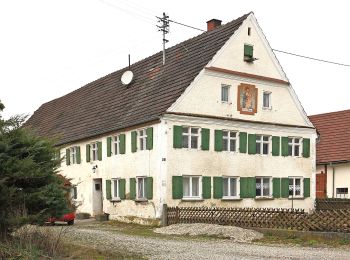
![Trail On foot Roggenburg - Weiherweg - Photo](https://media.geolcdn.com/t/350/260/c74d219c-a627-49fa-9c06-8ae4a498476c.jpeg&format=jpg&maxdim=2)
![On foot On foot](https://static1.geolcdn.com/sitytour/trail-icons/100.png)
Km
On foot
![](/images/other/stat-length.png)
![](https://static1.geolcdn.com/siteimages/upload/files/1508320355ic_sort_den_pos_24dp.png)
![](https://static1.geolcdn.com/siteimages/upload/files/1508320355ic_sort_den_neg_24dp.png)
![](https://static1.geolcdn.com/siteimages/upload/files/16400158638029165_repeat_loop_refresh_sync_direction_icon.png)
• Trail created by Gemeinde Roggenburg. Symbol: Name Weiherweg auf Holzwegweiser
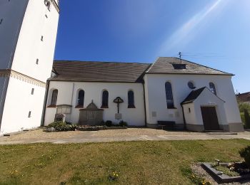
![Trail On foot Pfaffenhofen an der Roth - Dreitäler-/Kapellen- und Kirchenwanderung - Photo](https://media.geolcdn.com/t/350/260/d55ce1cc-a82a-43af-9195-ac01f7f773e6.jpeg&format=jpg&maxdim=2)
![On foot On foot](https://static1.geolcdn.com/sitytour/trail-icons/100.png)
Km
On foot
![](/images/other/stat-length.png)
![](https://static1.geolcdn.com/siteimages/upload/files/1508320355ic_sort_den_pos_24dp.png)
![](https://static1.geolcdn.com/siteimages/upload/files/1508320355ic_sort_den_neg_24dp.png)
![](https://static1.geolcdn.com/siteimages/upload/files/16400158638029165_repeat_loop_refresh_sync_direction_icon.png)
14 trails displayed on 14
FREE GPS app for hiking