![](/images/other/stat-length.png)
Landkreis Würzburg, Bavaria, On foot: Best trails, routes and walks
Landkreis Würzburg: Discover the best trails: 36 on foot. All these trails, routes and outdoor activities are available in our SityTrail applications for smartphones and tablets.
The best trails (36)
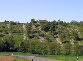
![Trail On foot Rottendorf - Würzburgs Stadtgrenze in 7 Teilen - Photo](https://media.geolcdn.com/t/350/260/408aaa79-6d82-4e63-80eb-47913b213ef1.jpeg&format=jpg&maxdim=2)
![On foot On foot](https://static1.geolcdn.com/sitytour/trail-icons/100.png)
Km
On foot
![](/images/other/stat-length.png)
![](https://static1.geolcdn.com/siteimages/upload/files/1508320355ic_sort_den_pos_24dp.png)
![](https://static1.geolcdn.com/siteimages/upload/files/1508320355ic_sort_den_neg_24dp.png)
![](https://static1.geolcdn.com/siteimages/upload/files/16400158638029165_repeat_loop_refresh_sync_direction_icon.png)
• Trail created by Stadt Würzburg, Baureferat, Fachbereich Tiefbau und Verkehrswesen.
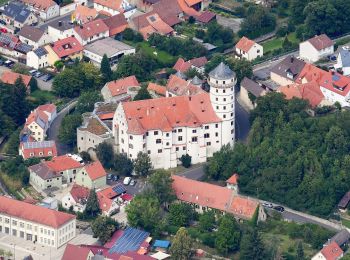
![Trail On foot Rottendorf - Würzburgs Stadtgrenze, 1. Teil - Photo](https://media.geolcdn.com/t/350/260/ca2faa3f-2d45-4dec-8084-83501c9c33fb.jpeg&format=jpg&maxdim=2)
![On foot On foot](https://static1.geolcdn.com/sitytour/trail-icons/100.png)
Km
On foot
![](/images/other/stat-length.png)
![](https://static1.geolcdn.com/siteimages/upload/files/1508320355ic_sort_den_pos_24dp.png)
![](https://static1.geolcdn.com/siteimages/upload/files/1508320355ic_sort_den_neg_24dp.png)
![](https://static1.geolcdn.com/siteimages/upload/files/16400158638029165_repeat_loop_refresh_sync_direction_icon.png)
• Trail created by Stadt Würzburg, Baureferat, Fachbereich Tiefbau und Verkehrswesen.
![Trail On foot Veitshöchheim - Würzburgs Stadtgrenze, 3. Teil - Photo](https://media.geolcdn.com/t/350/260/b9a693b6-0aa6-4282-a627-29e6f50ca0e7.jpeg&format=jpg&maxdim=2)
![On foot On foot](https://static1.geolcdn.com/sitytour/trail-icons/100.png)
Km
On foot
![](/images/other/stat-length.png)
![](https://static1.geolcdn.com/siteimages/upload/files/1508320355ic_sort_den_pos_24dp.png)
![](https://static1.geolcdn.com/siteimages/upload/files/1508320355ic_sort_den_neg_24dp.png)
![](https://static1.geolcdn.com/siteimages/upload/files/16400158638029165_repeat_loop_refresh_sync_direction_icon.png)
• Trail created by Stadt Würzburg, Baureferat, Fachbereich Tiefbau und Verkehrswesen.
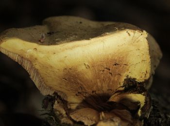
![Trail On foot Guttenberger Wald - Würzburgs Stadtgrenze, 5. Teil - Photo](https://media.geolcdn.com/t/350/260/06ab2004-3d2a-4a1e-9304-ba841a053812.jpeg&format=jpg&maxdim=2)
![On foot On foot](https://static1.geolcdn.com/sitytour/trail-icons/100.png)
Km
On foot
![](/images/other/stat-length.png)
![](https://static1.geolcdn.com/siteimages/upload/files/1508320355ic_sort_den_pos_24dp.png)
![](https://static1.geolcdn.com/siteimages/upload/files/1508320355ic_sort_den_neg_24dp.png)
![](https://static1.geolcdn.com/siteimages/upload/files/16400158638029165_repeat_loop_refresh_sync_direction_icon.png)
• Trail created by Stadt Würzburg, Baureferat, Fachbereich Tiefbau und Verkehrswesen.
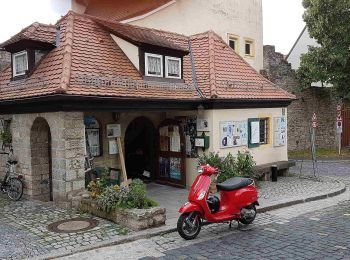
![Trail On foot Randersacker - Kulturweg](https://media.geolcdn.com/t/350/260/12dc0318-530b-4c2a-bdf8-f4d1fffd1787.jpeg&format=jpg&maxdim=2)
![On foot On foot](https://static1.geolcdn.com/sitytour/trail-icons/100.png)
Km
On foot
![](/images/other/stat-length.png)
![](https://static1.geolcdn.com/siteimages/upload/files/1508320355ic_sort_den_pos_24dp.png)
![](https://static1.geolcdn.com/siteimages/upload/files/1508320355ic_sort_den_neg_24dp.png)
![](https://static1.geolcdn.com/siteimages/upload/files/16400158638029165_repeat_loop_refresh_sync_direction_icon.png)
• Trail created by Archäologisches Spessartprojekt. Symbol: Gelbes EU-Schiffchen auf blauem Grund
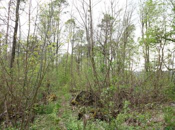
![Trail On foot Tauberrettersheim - Kulturweg Tauberrettersheim / Schäftersheim - Photo](https://media.geolcdn.com/t/350/260/a209def5-0b9b-4a6e-8e0a-e48b79464c7b.jpeg&format=jpg&maxdim=2)
![On foot On foot](https://static1.geolcdn.com/sitytour/trail-icons/100.png)
Km
On foot
![](/images/other/stat-length.png)
![](https://static1.geolcdn.com/siteimages/upload/files/1508320355ic_sort_den_pos_24dp.png)
![](https://static1.geolcdn.com/siteimages/upload/files/1508320355ic_sort_den_neg_24dp.png)
![](https://static1.geolcdn.com/siteimages/upload/files/16400158638029165_repeat_loop_refresh_sync_direction_icon.png)
• Trail created by Archäologisches Spessartprojekt. Website: https://www.spessartprojekt.de/?page_id=24281
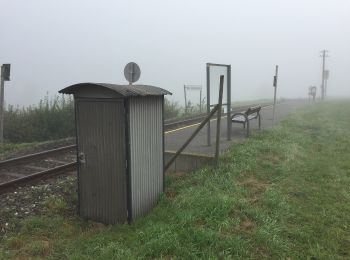
![Trail On foot Eisenheim - Eisenheimer Bildstockweg - Photo](https://media.geolcdn.com/t/350/260/29b89c0e-a7a0-40e6-97db-83fc3e1f49c3.jpeg&format=jpg&maxdim=2)
![On foot On foot](https://static1.geolcdn.com/sitytour/trail-icons/100.png)
Km
On foot
![](/images/other/stat-length.png)
![](https://static1.geolcdn.com/siteimages/upload/files/1508320355ic_sort_den_pos_24dp.png)
![](https://static1.geolcdn.com/siteimages/upload/files/1508320355ic_sort_den_neg_24dp.png)
![](https://static1.geolcdn.com/siteimages/upload/files/16400158638029165_repeat_loop_refresh_sync_direction_icon.png)
• Symbol: B
![Trail On foot Aub - Liebliches Taubertal 26 Zur St. Kunigunde - Photo](https://media.geolcdn.com/t/350/260/946fdf04-47e8-411e-8959-2837805fe24b.jpeg&format=jpg&maxdim=2)
![On foot On foot](https://static1.geolcdn.com/sitytour/trail-icons/100.png)
Km
On foot
![](/images/other/stat-length.png)
![](https://static1.geolcdn.com/siteimages/upload/files/1508320355ic_sort_den_pos_24dp.png)
![](https://static1.geolcdn.com/siteimages/upload/files/1508320355ic_sort_den_neg_24dp.png)
![](https://static1.geolcdn.com/siteimages/upload/files/16400158638029165_repeat_loop_refresh_sync_direction_icon.png)
• Symbol: blaues Schild mit weißer Schrift, in der Mitte durch eine weiße Linie getrennt. Obehalb "LT", darunter "26"
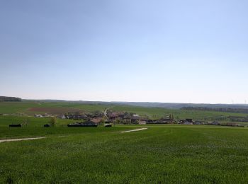
![Trail On foot Röttingen - Liebliches Taubertal 25 Sonnenuhren und Brücken - Photo](https://media.geolcdn.com/t/350/260/4dc51e81-5447-4351-ad0e-60941ddc5e20.jpeg&format=jpg&maxdim=2)
![On foot On foot](https://static1.geolcdn.com/sitytour/trail-icons/100.png)
Km
On foot
![](/images/other/stat-length.png)
![](https://static1.geolcdn.com/siteimages/upload/files/1508320355ic_sort_den_pos_24dp.png)
![](https://static1.geolcdn.com/siteimages/upload/files/1508320355ic_sort_den_neg_24dp.png)
![](https://static1.geolcdn.com/siteimages/upload/files/16400158638029165_repeat_loop_refresh_sync_direction_icon.png)
• Symbol: blaues Schild mit weißer Schrift, in der Mitte durch eine weiße Linie getrennt. Obehalb "LT", darunter "25" ...
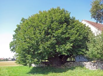
![Trail On foot Bieberehren - Kulturweg Bieberehren 1 - Photo](https://media.geolcdn.com/t/350/260/8f4c942b-b83e-4367-9ab9-eb870987410e.jpeg&format=jpg&maxdim=2)
![On foot On foot](https://static1.geolcdn.com/sitytour/trail-icons/100.png)
Km
On foot
![](/images/other/stat-length.png)
![](https://static1.geolcdn.com/siteimages/upload/files/1508320355ic_sort_den_pos_24dp.png)
![](https://static1.geolcdn.com/siteimages/upload/files/1508320355ic_sort_den_neg_24dp.png)
![](https://static1.geolcdn.com/siteimages/upload/files/16400158638029165_repeat_loop_refresh_sync_direction_icon.png)
• Trail created by Archäologisches Spessartprojekt. Zwischen Käppele und Kunigundenkapelle lernen Sie spannende Seiten...
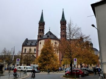
![Trail On foot Sommerhausen - Panoramaweg - Photo](https://media.geolcdn.com/t/350/260/2250dbab-18ec-4474-bcf6-c9bd78d52258.jpeg&format=jpg&maxdim=2)
![On foot On foot](https://static1.geolcdn.com/sitytour/trail-icons/100.png)
Km
On foot
![](/images/other/stat-length.png)
![](https://static1.geolcdn.com/siteimages/upload/files/1508320355ic_sort_den_pos_24dp.png)
![](https://static1.geolcdn.com/siteimages/upload/files/1508320355ic_sort_den_neg_24dp.png)
![](https://static1.geolcdn.com/siteimages/upload/files/16400158638029165_repeat_loop_refresh_sync_direction_icon.png)
• Trail created by Gemeindeverbund Wandern im südlichen Maindreieck. Symbol: Wimpel, braun auf weiß
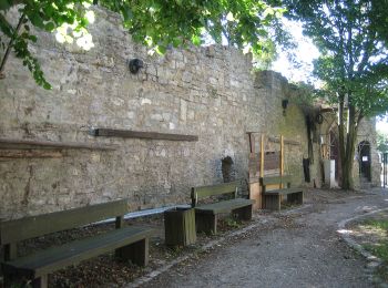
![Trail On foot Giebelstadt - Kulturweg Giebelstadt 1 - Photo](https://media.geolcdn.com/t/350/260/c8d5052d-0156-4d23-b564-c607770db5c6.jpeg&format=jpg&maxdim=2)
![On foot On foot](https://static1.geolcdn.com/sitytour/trail-icons/100.png)
Km
On foot
![](/images/other/stat-length.png)
![](https://static1.geolcdn.com/siteimages/upload/files/1508320355ic_sort_den_pos_24dp.png)
![](https://static1.geolcdn.com/siteimages/upload/files/1508320355ic_sort_den_neg_24dp.png)
![](https://static1.geolcdn.com/siteimages/upload/files/16400158638029165_repeat_loop_refresh_sync_direction_icon.png)
• Trail created by Archäologisches Spessartprojekt. Symbol: Gelbes EU-Schiffchen auf blauem Grund Website: https://w...
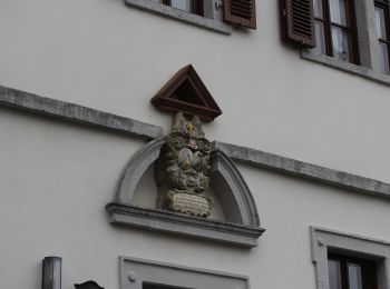
![Trail On foot Randersacker - Weinwanderung 'Teufelskeller' - Photo](https://media.geolcdn.com/t/350/260/58d3a30f-26c2-467f-8560-fc384f8b94ec.jpeg&format=jpg&maxdim=2)
![On foot On foot](https://static1.geolcdn.com/sitytour/trail-icons/100.png)
Km
On foot
![](/images/other/stat-length.png)
![](https://static1.geolcdn.com/siteimages/upload/files/1508320355ic_sort_den_pos_24dp.png)
![](https://static1.geolcdn.com/siteimages/upload/files/1508320355ic_sort_den_neg_24dp.png)
![](https://static1.geolcdn.com/siteimages/upload/files/16400158638029165_repeat_loop_refresh_sync_direction_icon.png)
• Trail created by CSU Ortsverband Randersacker.
![Trail On foot Randersacker - Weinwanderung 'Dabug' - Photo](https://media.geolcdn.com/t/350/260/12dc0318-530b-4c2a-bdf8-f4d1fffd1787.jpeg&format=jpg&maxdim=2)
![On foot On foot](https://static1.geolcdn.com/sitytour/trail-icons/100.png)
Km
On foot
![](/images/other/stat-length.png)
![](https://static1.geolcdn.com/siteimages/upload/files/1508320355ic_sort_den_pos_24dp.png)
![](https://static1.geolcdn.com/siteimages/upload/files/1508320355ic_sort_den_neg_24dp.png)
![](https://static1.geolcdn.com/siteimages/upload/files/16400158638029165_repeat_loop_refresh_sync_direction_icon.png)
• Trail created by CSU Ortsverband Randersacker.
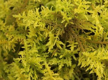
![Trail On foot Randersacker - Weinwanderung 'Sonnenstuhl' - Photo](https://media.geolcdn.com/t/350/260/74646b68-9d66-4631-a3b7-d98532cee10b.jpeg&format=jpg&maxdim=2)
![On foot On foot](https://static1.geolcdn.com/sitytour/trail-icons/100.png)
Km
On foot
![](/images/other/stat-length.png)
![](https://static1.geolcdn.com/siteimages/upload/files/1508320355ic_sort_den_pos_24dp.png)
![](https://static1.geolcdn.com/siteimages/upload/files/1508320355ic_sort_den_neg_24dp.png)
![](https://static1.geolcdn.com/siteimages/upload/files/16400158638029165_repeat_loop_refresh_sync_direction_icon.png)
• Trail created by CSU Ortsverband Randersacker.
![Trail On foot Randersacker - Weinwanderung 'Ewig Leben' - Photo](https://media.geolcdn.com/t/350/260/58d3a30f-26c2-467f-8560-fc384f8b94ec.jpeg&format=jpg&maxdim=2)
![On foot On foot](https://static1.geolcdn.com/sitytour/trail-icons/100.png)
Km
On foot
![](/images/other/stat-length.png)
![](https://static1.geolcdn.com/siteimages/upload/files/1508320355ic_sort_den_pos_24dp.png)
![](https://static1.geolcdn.com/siteimages/upload/files/1508320355ic_sort_den_neg_24dp.png)
![](https://static1.geolcdn.com/siteimages/upload/files/16400158638029165_repeat_loop_refresh_sync_direction_icon.png)
• Trail created by CSU Ortsverband Randersacker.
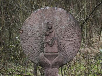
![Trail On foot Randersacker - Weinwanderung 'Marsberg' - Photo](https://media.geolcdn.com/t/350/260/e5acda0c-e305-4f12-97a0-c42f680f37fd.jpeg&format=jpg&maxdim=2)
![On foot On foot](https://static1.geolcdn.com/sitytour/trail-icons/100.png)
Km
On foot
![](/images/other/stat-length.png)
![](https://static1.geolcdn.com/siteimages/upload/files/1508320355ic_sort_den_pos_24dp.png)
![](https://static1.geolcdn.com/siteimages/upload/files/1508320355ic_sort_den_neg_24dp.png)
![](https://static1.geolcdn.com/siteimages/upload/files/16400158638029165_repeat_loop_refresh_sync_direction_icon.png)
• Trail created by CSU Ortsverband Randersacker.
![Trail On foot Randersacker - Weinwanderung 'Lämmerberg' - Photo](https://media.geolcdn.com/t/350/260/58d3a30f-26c2-467f-8560-fc384f8b94ec.jpeg&format=jpg&maxdim=2)
![On foot On foot](https://static1.geolcdn.com/sitytour/trail-icons/100.png)
Km
On foot
![](/images/other/stat-length.png)
![](https://static1.geolcdn.com/siteimages/upload/files/1508320355ic_sort_den_pos_24dp.png)
![](https://static1.geolcdn.com/siteimages/upload/files/1508320355ic_sort_den_neg_24dp.png)
![](https://static1.geolcdn.com/siteimages/upload/files/16400158638029165_repeat_loop_refresh_sync_direction_icon.png)
• Trail created by CSU Ortsverband Randersacker.
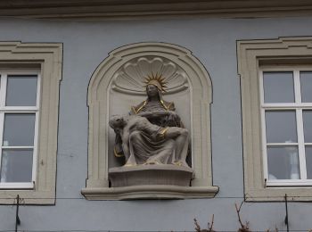
![Trail On foot Randersacker - Weinwanderung 'Pfülben' - Photo](https://media.geolcdn.com/t/350/260/5dbf0ce4-574a-4577-983c-4caf9e615fd6.jpeg&format=jpg&maxdim=2)
![On foot On foot](https://static1.geolcdn.com/sitytour/trail-icons/100.png)
Km
On foot
![](/images/other/stat-length.png)
![](https://static1.geolcdn.com/siteimages/upload/files/1508320355ic_sort_den_pos_24dp.png)
![](https://static1.geolcdn.com/siteimages/upload/files/1508320355ic_sort_den_neg_24dp.png)
![](https://static1.geolcdn.com/siteimages/upload/files/16400158638029165_repeat_loop_refresh_sync_direction_icon.png)
• Trail created by CSU Ortsverband Randersacker.
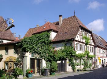
![Trail On foot Sommerhausen - Sommerhausen - Sulzfeld - Photo](https://media.geolcdn.com/t/350/260/a751f7f2-e042-429b-94a4-f89ddb178483.jpeg&format=jpg&maxdim=2)
![On foot On foot](https://static1.geolcdn.com/sitytour/trail-icons/100.png)
Km
On foot
![](/images/other/stat-length.png)
![](https://static1.geolcdn.com/siteimages/upload/files/1508320355ic_sort_den_pos_24dp.png)
![](https://static1.geolcdn.com/siteimages/upload/files/1508320355ic_sort_den_neg_24dp.png)
![](https://static1.geolcdn.com/siteimages/upload/files/16400158638029165_repeat_loop_refresh_sync_direction_icon.png)
• Symbol: Rote Raute auf weißem Quadrat
20 trails displayed on 36
FREE GPS app for hiking