![](/images/other/stat-length.png)
Landkreis Main-Spessart, Bavaria, On foot: Best trails, routes and walks
Landkreis Main-Spessart: Discover the best trails: 141 on foot. All these trails, routes and outdoor activities are available in our SityTrail applications for smartphones and tablets.
The best trails (141)
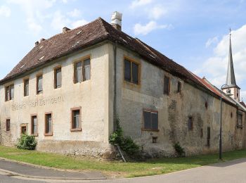
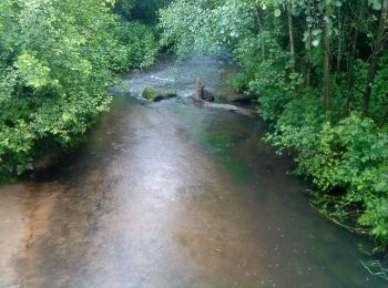
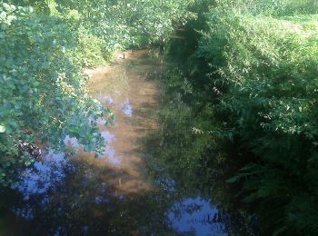
![Trail On foot Himmelstadt - Ortswanderweg Himmelstadt 1 - Photo](https://media.geolcdn.com/t/350/260/b00fcdc8-84d7-4689-ae43-42c4af0ba3eb.jpeg&format=jpg&maxdim=2)
![On foot On foot](https://static1.geolcdn.com/sitytour/trail-icons/100.png)
Km
On foot
![](/images/other/stat-length.png)
![](https://static1.geolcdn.com/siteimages/upload/files/1508320355ic_sort_den_pos_24dp.png)
![](https://static1.geolcdn.com/siteimages/upload/files/1508320355ic_sort_den_neg_24dp.png)
![](https://static1.geolcdn.com/siteimages/upload/files/16400158638029165_repeat_loop_refresh_sync_direction_icon.png)
• Trail created by Gemeinde Himmelstadt.
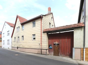
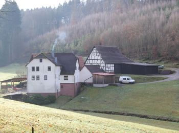
![Trail On foot Himmelstadt - Ortswanderweg Himmelstadt 3 - Photo](https://media.geolcdn.com/t/350/260/d13580d5-c299-40f4-a047-606e009062c5.jpeg&format=jpg&maxdim=2)
![On foot On foot](https://static1.geolcdn.com/sitytour/trail-icons/100.png)
Km
On foot
![](/images/other/stat-length.png)
![](https://static1.geolcdn.com/siteimages/upload/files/1508320355ic_sort_den_pos_24dp.png)
![](https://static1.geolcdn.com/siteimages/upload/files/1508320355ic_sort_den_neg_24dp.png)
![](https://static1.geolcdn.com/siteimages/upload/files/16400158638029165_repeat_loop_refresh_sync_direction_icon.png)
• Trail created by Gemeinde Himmelstadt.
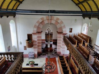
![Trail On foot Karlstadt - Ortswanderweg Karlstadt 3 - Photo](https://media.geolcdn.com/t/350/260/42180b53-2ecd-43ec-8e4d-6d51fff27480.jpeg&format=jpg&maxdim=2)
![On foot On foot](https://static1.geolcdn.com/sitytour/trail-icons/100.png)
Km
On foot
![](/images/other/stat-length.png)
![](https://static1.geolcdn.com/siteimages/upload/files/1508320355ic_sort_den_pos_24dp.png)
![](https://static1.geolcdn.com/siteimages/upload/files/1508320355ic_sort_den_neg_24dp.png)
![](https://static1.geolcdn.com/siteimages/upload/files/16400158638029165_repeat_loop_refresh_sync_direction_icon.png)
• Trail created by Stadt Karlstadt.
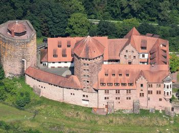
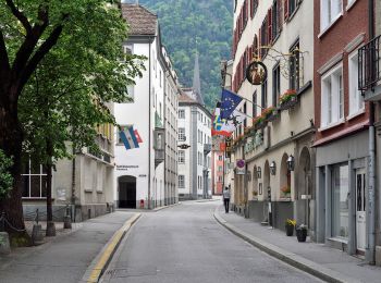
![Trail On foot Rieneck - Nordic Walking 2 Rieneck - Photo](https://media.geolcdn.com/t/350/260/dde0c5e0-039c-41f7-82d1-b2b74b8ef30f.jpeg&format=jpg&maxdim=2)
![On foot On foot](https://static1.geolcdn.com/sitytour/trail-icons/100.png)
Km
On foot
![](/images/other/stat-length.png)
![](https://static1.geolcdn.com/siteimages/upload/files/1508320355ic_sort_den_pos_24dp.png)
![](https://static1.geolcdn.com/siteimages/upload/files/1508320355ic_sort_den_neg_24dp.png)
![](https://static1.geolcdn.com/siteimages/upload/files/16400158638029165_repeat_loop_refresh_sync_direction_icon.png)
• Trail created by Rieneck. Symbol: Orangener Walker und 2 auf weißem Grund
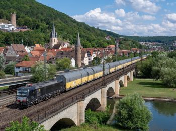
![Trail On foot Gemünden am Main - Rote Schnepfe, Gemünden - Kloster Schönau - Photo](https://media.geolcdn.com/t/350/260/614299b5-c768-47b1-b26c-9be8e81a9b75.jpeg&format=jpg&maxdim=2)
![On foot On foot](https://static1.geolcdn.com/sitytour/trail-icons/100.png)
Km
On foot
![](/images/other/stat-length.png)
![](https://static1.geolcdn.com/siteimages/upload/files/1508320355ic_sort_den_pos_24dp.png)
![](https://static1.geolcdn.com/siteimages/upload/files/1508320355ic_sort_den_neg_24dp.png)
![](https://static1.geolcdn.com/siteimages/upload/files/16400158638029165_repeat_loop_refresh_sync_direction_icon.png)
• Trail created by Naturpark Spessart. Symbol: Rote Schnepfe auf weißem Quadrat
![Trail On foot Burgsinn - Ortswanderweg Rieneck 1 - Photo](https://media.geolcdn.com/t/350/260/dde0c5e0-039c-41f7-82d1-b2b74b8ef30f.jpeg&format=jpg&maxdim=2)
![On foot On foot](https://static1.geolcdn.com/sitytour/trail-icons/100.png)
Km
On foot
![](/images/other/stat-length.png)
![](https://static1.geolcdn.com/siteimages/upload/files/1508320355ic_sort_den_pos_24dp.png)
![](https://static1.geolcdn.com/siteimages/upload/files/1508320355ic_sort_den_neg_24dp.png)
![](https://static1.geolcdn.com/siteimages/upload/files/16400158638029165_repeat_loop_refresh_sync_direction_icon.png)
• Trail created by Spessartbund.
![Trail On foot Rieneck - Ortswanderweg Rieneck 0 - Photo](https://media.geolcdn.com/t/350/260/dde0c5e0-039c-41f7-82d1-b2b74b8ef30f.jpeg&format=jpg&maxdim=2)
![On foot On foot](https://static1.geolcdn.com/sitytour/trail-icons/100.png)
Km
On foot
![](/images/other/stat-length.png)
![](https://static1.geolcdn.com/siteimages/upload/files/1508320355ic_sort_den_pos_24dp.png)
![](https://static1.geolcdn.com/siteimages/upload/files/1508320355ic_sort_den_neg_24dp.png)
![](https://static1.geolcdn.com/siteimages/upload/files/16400158638029165_repeat_loop_refresh_sync_direction_icon.png)
• Trail created by Spessartbund.
![Trail On foot Frammersbach - Rote Schnepfe - Rundwanderweg Frammersbach Sportplatz - Photo](https://media.geolcdn.com/t/350/260/62850d97-5e0d-4ed9-9d16-83fae11bc2e4.jpeg&format=jpg&maxdim=2)
![On foot On foot](https://static1.geolcdn.com/sitytour/trail-icons/100.png)
Km
On foot
![](/images/other/stat-length.png)
![](https://static1.geolcdn.com/siteimages/upload/files/1508320355ic_sort_den_pos_24dp.png)
![](https://static1.geolcdn.com/siteimages/upload/files/1508320355ic_sort_den_neg_24dp.png)
![](https://static1.geolcdn.com/siteimages/upload/files/16400158638029165_repeat_loop_refresh_sync_direction_icon.png)
• Trail created by Naturpark Spessart.
![Trail On foot Neuhütten - Örtlicher Wanderweg Wiesthal 4 - Photo](https://media.geolcdn.com/t/350/260/a73328f4-f1d2-40d3-81b2-cec67c9182ba.jpeg&format=jpg&maxdim=2)
![On foot On foot](https://static1.geolcdn.com/sitytour/trail-icons/100.png)
Km
On foot
![](/images/other/stat-length.png)
![](https://static1.geolcdn.com/siteimages/upload/files/1508320355ic_sort_den_pos_24dp.png)
![](https://static1.geolcdn.com/siteimages/upload/files/1508320355ic_sort_den_neg_24dp.png)
![](https://static1.geolcdn.com/siteimages/upload/files/16400158638029165_repeat_loop_refresh_sync_direction_icon.png)
• Trail created by Wanderverein Wanderfreunde Wiesthal.
![Trail On foot Wiesthal - Rote Schnepfe, Rundwanderweg Wiesthal - Photo](https://media.geolcdn.com/t/350/260/a73328f4-f1d2-40d3-81b2-cec67c9182ba.jpeg&format=jpg&maxdim=2)
![On foot On foot](https://static1.geolcdn.com/sitytour/trail-icons/100.png)
Km
On foot
![](/images/other/stat-length.png)
![](https://static1.geolcdn.com/siteimages/upload/files/1508320355ic_sort_den_pos_24dp.png)
![](https://static1.geolcdn.com/siteimages/upload/files/1508320355ic_sort_den_neg_24dp.png)
![](https://static1.geolcdn.com/siteimages/upload/files/16400158638029165_repeat_loop_refresh_sync_direction_icon.png)
• Trail created by Naturpark Spessart.
![Trail On foot Rothenfels - Ortswanderweg Rothenfels 1 - Photo](https://media.geolcdn.com/t/350/260/e92e1742-9d87-4f2f-a51f-5dde71bb21f3.jpeg&format=jpg&maxdim=2)
![On foot On foot](https://static1.geolcdn.com/sitytour/trail-icons/100.png)
Km
On foot
![](/images/other/stat-length.png)
![](https://static1.geolcdn.com/siteimages/upload/files/1508320355ic_sort_den_pos_24dp.png)
![](https://static1.geolcdn.com/siteimages/upload/files/1508320355ic_sort_den_neg_24dp.png)
![](https://static1.geolcdn.com/siteimages/upload/files/16400158638029165_repeat_loop_refresh_sync_direction_icon.png)
• Trail created by Spessartbund.
![Trail On foot Rothenfels - Ortswanderweg Rothenfels 2 - Photo](https://media.geolcdn.com/t/350/260/e92e1742-9d87-4f2f-a51f-5dde71bb21f3.jpeg&format=jpg&maxdim=2)
![On foot On foot](https://static1.geolcdn.com/sitytour/trail-icons/100.png)
Km
On foot
![](/images/other/stat-length.png)
![](https://static1.geolcdn.com/siteimages/upload/files/1508320355ic_sort_den_pos_24dp.png)
![](https://static1.geolcdn.com/siteimages/upload/files/1508320355ic_sort_den_neg_24dp.png)
![](https://static1.geolcdn.com/siteimages/upload/files/16400158638029165_repeat_loop_refresh_sync_direction_icon.png)
• Trail created by Spessartbund.
![Trail On foot Esselbach - Ortswanderweg Hafenlohr 5 - Photo](https://media.geolcdn.com/t/350/260/05e74058-ad4f-419d-91de-28c351c0d83b.jpeg&format=jpg&maxdim=2)
![On foot On foot](https://static1.geolcdn.com/sitytour/trail-icons/100.png)
Km
On foot
![](/images/other/stat-length.png)
![](https://static1.geolcdn.com/siteimages/upload/files/1508320355ic_sort_den_pos_24dp.png)
![](https://static1.geolcdn.com/siteimages/upload/files/1508320355ic_sort_den_neg_24dp.png)
![](https://static1.geolcdn.com/siteimages/upload/files/16400158638029165_repeat_loop_refresh_sync_direction_icon.png)
• Trail created by Spessartbund.
![Trail On foot Marktheidenfeld - Ortswanderweg Marktheidenfeld 4 - Photo](https://media.geolcdn.com/t/350/260/bcd90cb3-c9a8-44d0-aa81-640096959061.jpeg&format=jpg&maxdim=2)
![On foot On foot](https://static1.geolcdn.com/sitytour/trail-icons/100.png)
Km
On foot
![](/images/other/stat-length.png)
![](https://static1.geolcdn.com/siteimages/upload/files/1508320355ic_sort_den_pos_24dp.png)
![](https://static1.geolcdn.com/siteimages/upload/files/1508320355ic_sort_den_neg_24dp.png)
![](https://static1.geolcdn.com/siteimages/upload/files/16400158638029165_repeat_loop_refresh_sync_direction_icon.png)
• Trail created by Spessartbund.
![Trail On foot Esselbach - Ortswanderweg Esselbach 5 - Photo](https://media.geolcdn.com/t/350/260/5d40fa64-ace5-41c5-89d4-c6e8db64cc9b.jpeg&format=jpg&maxdim=2)
![On foot On foot](https://static1.geolcdn.com/sitytour/trail-icons/100.png)
Km
On foot
![](/images/other/stat-length.png)
![](https://static1.geolcdn.com/siteimages/upload/files/1508320355ic_sort_den_pos_24dp.png)
![](https://static1.geolcdn.com/siteimages/upload/files/1508320355ic_sort_den_neg_24dp.png)
![](https://static1.geolcdn.com/siteimages/upload/files/16400158638029165_repeat_loop_refresh_sync_direction_icon.png)
• Trail created by Spessartbund.
![Trail On foot Esselbach - Ortswanderweg Esselbach 6 - Photo](https://media.geolcdn.com/t/350/260/5d40fa64-ace5-41c5-89d4-c6e8db64cc9b.jpeg&format=jpg&maxdim=2)
![On foot On foot](https://static1.geolcdn.com/sitytour/trail-icons/100.png)
Km
On foot
![](/images/other/stat-length.png)
![](https://static1.geolcdn.com/siteimages/upload/files/1508320355ic_sort_den_pos_24dp.png)
![](https://static1.geolcdn.com/siteimages/upload/files/1508320355ic_sort_den_neg_24dp.png)
![](https://static1.geolcdn.com/siteimages/upload/files/16400158638029165_repeat_loop_refresh_sync_direction_icon.png)
• Trail created by Spessartbund.
![Trail On foot Esselbach - Ortswanderweg Esselbach 7 - Photo](https://media.geolcdn.com/t/350/260/5d40fa64-ace5-41c5-89d4-c6e8db64cc9b.jpeg&format=jpg&maxdim=2)
![On foot On foot](https://static1.geolcdn.com/sitytour/trail-icons/100.png)
Km
On foot
![](/images/other/stat-length.png)
![](https://static1.geolcdn.com/siteimages/upload/files/1508320355ic_sort_den_pos_24dp.png)
![](https://static1.geolcdn.com/siteimages/upload/files/1508320355ic_sort_den_neg_24dp.png)
![](https://static1.geolcdn.com/siteimages/upload/files/16400158638029165_repeat_loop_refresh_sync_direction_icon.png)
• Trail created by Spessartbund.
![Trail On foot Kreuzwertheim - Ortswanderweg Hasselberg 4 - Photo](https://media.geolcdn.com/t/350/260/92c854c0-566b-4860-a46a-cb631d0aa7e4.jpeg&format=jpg&maxdim=2)
![On foot On foot](https://static1.geolcdn.com/sitytour/trail-icons/100.png)
Km
On foot
![](/images/other/stat-length.png)
![](https://static1.geolcdn.com/siteimages/upload/files/1508320355ic_sort_den_pos_24dp.png)
![](https://static1.geolcdn.com/siteimages/upload/files/1508320355ic_sort_den_neg_24dp.png)
![](https://static1.geolcdn.com/siteimages/upload/files/16400158638029165_repeat_loop_refresh_sync_direction_icon.png)
• Trail created by Spessartbund. Symbol: Schwarze H4 auf weißem Grund
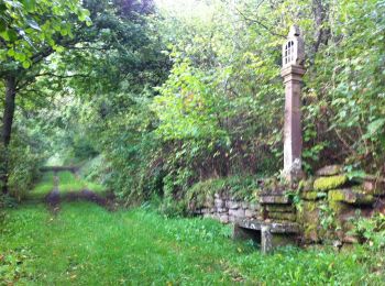
![Trail On foot Marktheidenfeld - Kulturweg Marktheidenfeld 3 - Photo](https://media.geolcdn.com/t/350/260/fdae736d-99ec-4667-aed1-e16d1b2cc3b9.jpeg&format=jpg&maxdim=2)
![On foot On foot](https://static1.geolcdn.com/sitytour/trail-icons/100.png)
Km
On foot
![](/images/other/stat-length.png)
![](https://static1.geolcdn.com/siteimages/upload/files/1508320355ic_sort_den_pos_24dp.png)
![](https://static1.geolcdn.com/siteimages/upload/files/1508320355ic_sort_den_neg_24dp.png)
![](https://static1.geolcdn.com/siteimages/upload/files/16400158638029165_repeat_loop_refresh_sync_direction_icon.png)
• Trail created by Archäologisches Spessartprojekt. Symbol: Gelber keltischer Wagen mit EU-Sternen auf blauem Grund
![Trail On foot Frammersbach - Ortswanderweg Frammersbach 1 - Photo](https://media.geolcdn.com/t/350/260/7a0915e1-1309-41b4-8519-c2711f21d5f5.jpeg&format=jpg&maxdim=2)
![On foot On foot](https://static1.geolcdn.com/sitytour/trail-icons/100.png)
Km
On foot
![](/images/other/stat-length.png)
![](https://static1.geolcdn.com/siteimages/upload/files/1508320355ic_sort_den_pos_24dp.png)
![](https://static1.geolcdn.com/siteimages/upload/files/1508320355ic_sort_den_neg_24dp.png)
![](https://static1.geolcdn.com/siteimages/upload/files/16400158638029165_repeat_loop_refresh_sync_direction_icon.png)
• Trail created by Spessartbund. Symbol: hikingsymbolSchwarzes F1 auf weißem Grund
20 trails displayed on 141
FREE GPS app for hiking
Activities
Nearby regions
- Arnstein
- Bischbrunn
- Burgjoß
- Burgsinn
- Erlenbach b.Marktheidenfeld
- Esselbach
- Fellen
- Forst Aura
- Frammersbach
- Frammersbacher Forst
- Gemünden am Main
- Gräfendorf
- Hafenlohr
- Hasloch
- Haurain
- Himmelstadt
- Karlstadt
- Kreuzwertheim
- Langenprozeltener Forst
- Lohr am Main
- Marktheidenfeld
- Mittelsinn
- Neuhütten
- Neustadt a.Main
- Obersinn
- Partenstein
- Partensteiner Forst
- Rechtenbach
- Rieneck
- Rothenfels
- Schollbrunn
- Steinfeld
- Triefenstein
- Wiesthal
- Zellingen