![](/images/other/stat-length.png)
- Randonnées
- A pied
- France
- Provence-Alpes-Côte d'Azur
- Hautes-Alpes
Hautes-Alpes, Provence-Alpes-Côte d'Azur, A pied : Les meilleures randonnées, itinéraires, parcours, balades et promenades
Hautes-Alpes : découvrez les meilleures randonnées : 198 a pied, 7456 marche, 86 marche nordique, 125 course à pied et 60 trail. Tous ces circuits, parcours, itinéraires et activités en plein air sont disponibles dans nos applications SityTrail pour smartphones et tablettes.
Les meilleurs parcours (7904)
![Randonnée Marche Crévoux - La Cascade de Razis - Photo](https://media.geolcdn.com/t/350/260/ext.jpg?maxdim=2&url=https%3A%2F%2Fservices.sitytrail.com%2FGeolivesWS%2FDownloadMedia.ashx%3FTrailID%3D109634%26Media%3D4275_1.jpg)
![Marche Marche](https://static1.geolcdn.com/sitytour/trail-icons/101.png)
Km
Marche
![](/images/other/stat-length.png)
![](https://static1.geolcdn.com/siteimages/upload/files/1508320355ic_sort_den_pos_24dp.png)
![](https://static1.geolcdn.com/siteimages/upload/files/1508320355ic_sort_den_neg_24dp.png)
![](https://static1.geolcdn.com/siteimages/upload/files/16400158638029165_repeat_loop_refresh_sync_direction_icon.png)
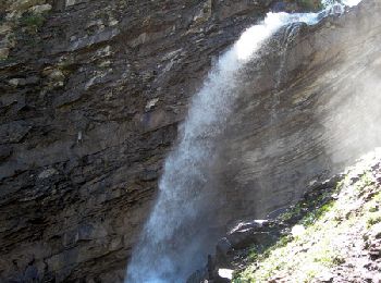
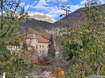
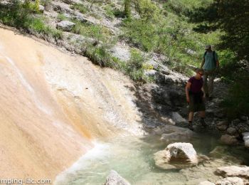
• La Cascade de Razis. Au dessus d'Embrun, la vallée de Crévoux nous offre de belles occasions de randonnées. En voici ...
![Randonnée Marche Crots - Le Cirque de Morgon - Photo](https://media.geolcdn.com/t/350/260/ext.jpg?maxdim=2&url=https%3A%2F%2Fservices.sitytrail.com%2FGeolivesWS%2FDownloadMedia.ashx%3FTrailID%3D109626%26Media%3D4261_1.jpg)
![Marche Marche](https://static1.geolcdn.com/sitytour/trail-icons/101.png)
Km
Marche
![](/images/other/stat-length.png)
![](https://static1.geolcdn.com/siteimages/upload/files/1508320355ic_sort_den_pos_24dp.png)
![](https://static1.geolcdn.com/siteimages/upload/files/1508320355ic_sort_den_neg_24dp.png)
![](https://static1.geolcdn.com/siteimages/upload/files/16400158638029165_repeat_loop_refresh_sync_direction_icon.png)
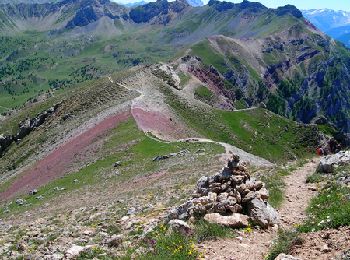
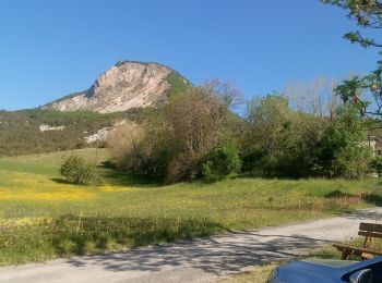
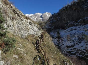
• Le Grand Morgon est l'un des plus beaux objectifs de randonnée dans l'Embrunais. Généralement réalisé sur un aller & ...
![Randonnée Marche Les Orres - le pic de Boussolenc par la tête du vallon Rémollon - Photo](https://media.geolcdn.com/t/350/260/dc7c46d6-3322-431d-b0a0-00b91a699c85.jpg&format=jpg&maxdim=2)
![Marche Marche](https://static1.geolcdn.com/sitytour/trail-icons/101.png)
Km
Marche
![](/images/other/stat-length.png)
![](https://static1.geolcdn.com/siteimages/upload/files/1508320355ic_sort_den_pos_24dp.png)
![](https://static1.geolcdn.com/siteimages/upload/files/1508320355ic_sort_den_neg_24dp.png)
![](https://static1.geolcdn.com/siteimages/upload/files/16400158638029165_repeat_loop_refresh_sync_direction_icon.png)
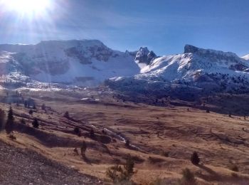
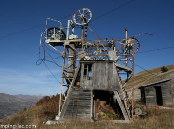
• Randonnée effectuée le 31 juillet 2022. Départ du télésiège de Pousterle (9€ / pers). compter 140 m de dénivelée supp...
![Marche Marche](https://static1.geolcdn.com/sitytour/trail-icons/101.png)
Km
Marche
![](/images/other/stat-length.png)
![](https://static1.geolcdn.com/siteimages/upload/files/1508320355ic_sort_den_pos_24dp.png)
![](https://static1.geolcdn.com/siteimages/upload/files/1508320355ic_sort_den_neg_24dp.png)
![](https://static1.geolcdn.com/siteimages/upload/files/16400158638029165_repeat_loop_refresh_sync_direction_icon.png)
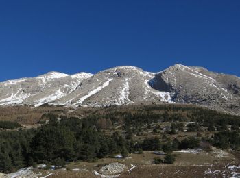
• A mon avis, un des plus beaux endroits du Valgaudemar. Le stationnement se situe au lieu dit "Le Rif du sap". Attenti...
![Randonnée Marche Montmaur - Montmaur Le Terrail - Photo](https://media.geolcdn.com/t/350/260/cf7c7087-0021-4399-a05e-062d9e564785.jpg&format=jpg&maxdim=2)
![Marche Marche](https://static1.geolcdn.com/sitytour/trail-icons/101.png)
Km
Marche
![](/images/other/stat-length.png)
![](https://static1.geolcdn.com/siteimages/upload/files/1508320355ic_sort_den_pos_24dp.png)
![](https://static1.geolcdn.com/siteimages/upload/files/1508320355ic_sort_den_neg_24dp.png)
![](https://static1.geolcdn.com/siteimages/upload/files/16400158638029165_repeat_loop_refresh_sync_direction_icon.png)
• Petite ballade sur la commune de Montmaur. Passage devant les chateaux du Terrail et de Montmaur.
![Randonnée Marche Veynes - Charajaille - Photo](https://media.geolcdn.com/t/350/260/5bb4b28d-a657-442c-b20e-962c61a2ca83.jpg&format=jpg&maxdim=2)
![Marche Marche](https://static1.geolcdn.com/sitytour/trail-icons/101.png)
Km
Marche
![](/images/other/stat-length.png)
![](https://static1.geolcdn.com/siteimages/upload/files/1508320355ic_sort_den_pos_24dp.png)
![](https://static1.geolcdn.com/siteimages/upload/files/1508320355ic_sort_den_neg_24dp.png)
![](https://static1.geolcdn.com/siteimages/upload/files/16400158638029165_repeat_loop_refresh_sync_direction_icon.png)
• Randonnée au nord de Veynes. Suivre la direction de Glaise. Stationner 500m avant le village. Prendre la piste à gauc...
![Randonnée Marche Orcières - Le Forest des marches - Photo](https://media.geolcdn.com/t/350/260/1bbb2305-7ec0-44b0-abf9-1e50226e1407.jpg&format=jpg&maxdim=2)
![Marche Marche](https://static1.geolcdn.com/sitytour/trail-icons/101.png)
Km
Marche
![](/images/other/stat-length.png)
![](https://static1.geolcdn.com/siteimages/upload/files/1508320355ic_sort_den_pos_24dp.png)
![](https://static1.geolcdn.com/siteimages/upload/files/1508320355ic_sort_den_neg_24dp.png)
![](https://static1.geolcdn.com/siteimages/upload/files/16400158638029165_repeat_loop_refresh_sync_direction_icon.png)
• au départ d'Orcières Merlette
![Randonnée Marche Val-Buëch-Méouge - ANTONAVES, LES GORGES DE LA MEOUGE , ROCHER DU CHATEAU o s - Photo](https://media.geolcdn.com/t/350/260/1487f017-eb98-446f-a2df-e1c366eb0d18.jpg&format=jpg&maxdim=2)
![Marche Marche](https://static1.geolcdn.com/sitytour/trail-icons/101.png)
Km
Marche
![](/images/other/stat-length.png)
![](https://static1.geolcdn.com/siteimages/upload/files/1508320355ic_sort_den_pos_24dp.png)
![](https://static1.geolcdn.com/siteimages/upload/files/1508320355ic_sort_den_neg_24dp.png)
![](https://static1.geolcdn.com/siteimages/upload/files/16400158638029165_repeat_loop_refresh_sync_direction_icon.png)
• Rando sympa , sentier au dessus des gorges , retour par bois de chenes ombrager , facile , agreable
![Randonnée Marche Vallouise-Pelvoux - 2020-09-09 Marche Lac de L'Eychauda - Photo](https://media.geolcdn.com/t/350/260/57ca78cd-05b4-40d6-869c-fa9a8977c3f1.jpg&format=jpg&maxdim=2)
![Marche Marche](https://static1.geolcdn.com/sitytour/trail-icons/101.png)
Km
Marche
![](/images/other/stat-length.png)
![](https://static1.geolcdn.com/siteimages/upload/files/1508320355ic_sort_den_pos_24dp.png)
![](https://static1.geolcdn.com/siteimages/upload/files/1508320355ic_sort_den_neg_24dp.png)
![](https://static1.geolcdn.com/siteimages/upload/files/16400158638029165_repeat_loop_refresh_sync_direction_icon.png)
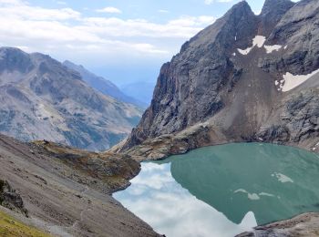
• Depuis le parking du Chambran, ascension en direct vers le lac de l’Eychauda (alt 2539m) et la col des Grangettes (al...
![Marche Marche](https://static1.geolcdn.com/sitytour/trail-icons/101.png)
Km
Marche
![](/images/other/stat-length.png)
![](https://static1.geolcdn.com/siteimages/upload/files/1508320355ic_sort_den_pos_24dp.png)
![](https://static1.geolcdn.com/siteimages/upload/files/1508320355ic_sort_den_neg_24dp.png)
![](https://static1.geolcdn.com/siteimages/upload/files/16400158638029165_repeat_loop_refresh_sync_direction_icon.png)
• La Méouge est une rivière du sud-est de la France qui prend sa source dans la Drôme sur la commune de Barret-de-Liour...
![Randonnée Marche Le Saix - R08 La boucle des cascades jaunes - Photo](https://media.geolcdn.com/t/350/260/f26960bc-bc04-44ac-ad0b-fda399df743b.jpg&format=jpg&maxdim=2)
![Marche Marche](https://static1.geolcdn.com/sitytour/trail-icons/101.png)
Km
Marche
![](/images/other/stat-length.png)
![](https://static1.geolcdn.com/siteimages/upload/files/1508320355ic_sort_den_pos_24dp.png)
![](https://static1.geolcdn.com/siteimages/upload/files/1508320355ic_sort_den_neg_24dp.png)
![](https://static1.geolcdn.com/siteimages/upload/files/16400158638029165_repeat_loop_refresh_sync_direction_icon.png)
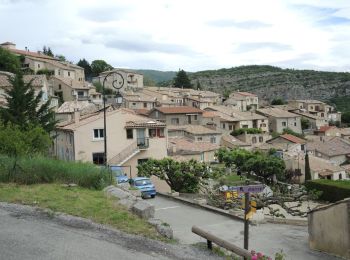
• Très jolie randonnée depuis le village du Saix (810m). Le départ se fait à la croix de métal située à l’arrière de l’...
![Randonnée Marche Théus - R47 Les Demoiselles Coiffees - Photo](https://media.geolcdn.com/t/350/260/ext.jpg?maxdim=2&url=https%3A%2F%2Fservices.sitytrail.com%2FGeolivesWS%2FDownloadMedia.ashx%3FTrailID%3D890906%26Media%3Dc8a3e36a-3aa2-4d75-b341-12feab72a468.jpg)
![Marche Marche](https://static1.geolcdn.com/sitytour/trail-icons/101.png)
Km
Marche
![](/images/other/stat-length.png)
![](https://static1.geolcdn.com/siteimages/upload/files/1508320355ic_sort_den_pos_24dp.png)
![](https://static1.geolcdn.com/siteimages/upload/files/1508320355ic_sort_den_neg_24dp.png)
![](https://static1.geolcdn.com/siteimages/upload/files/16400158638029165_repeat_loop_refresh_sync_direction_icon.png)
• Une randonnée d’environ 3 heures (sentier bleu) vous permet de découvrir ce très beau site et de passer à travers « ...
![Randonnée Marche La Faurie - R40 Les Marmites du Diable - Photo](https://media.geolcdn.com/t/350/260/ext.jpg?maxdim=2&url=https%3A%2F%2Fservices.sitytrail.com%2FGeolivesWS%2FDownloadMedia.ashx%3FTrailID%3D890898%26Media%3D4cd300c4-1399-4070-a62f-7c6bb96deff3.jpg)
![Marche Marche](https://static1.geolcdn.com/sitytour/trail-icons/101.png)
Km
Marche
![](/images/other/stat-length.png)
![](https://static1.geolcdn.com/siteimages/upload/files/1508320355ic_sort_den_pos_24dp.png)
![](https://static1.geolcdn.com/siteimages/upload/files/1508320355ic_sort_den_neg_24dp.png)
![](https://static1.geolcdn.com/siteimages/upload/files/16400158638029165_repeat_loop_refresh_sync_direction_icon.png)
• Randonnée très variée, débutant le long des marmites (où vous pouvez vous baigner), traversant ensuite une forêt avan...
![Randonnée Marche Le Dévoluy - R29 La crete des Beaumes - Photo](https://media.geolcdn.com/t/350/260/ext.jpg?maxdim=2&url=https%3A%2F%2Fservices.sitytrail.com%2FGeolivesWS%2FDownloadMedia.ashx%3FTrailID%3D890888%26Media%3Da26bb0d1-74cd-455a-a17c-3db0bb6ab810.jpg)
![Marche Marche](https://static1.geolcdn.com/sitytour/trail-icons/101.png)
Km
Marche
![](/images/other/stat-length.png)
![](https://static1.geolcdn.com/siteimages/upload/files/1508320355ic_sort_den_pos_24dp.png)
![](https://static1.geolcdn.com/siteimages/upload/files/1508320355ic_sort_den_neg_24dp.png)
![](https://static1.geolcdn.com/siteimages/upload/files/16400158638029165_repeat_loop_refresh_sync_direction_icon.png)
• Une randonnée assez courte et facile mais qui offre un point de vue circulaire sur l’ensemble du massif. A faire si ...
![Randonnée Marche Le Dévoluy - R28 Le Col de Rabou - Photo](https://media.geolcdn.com/t/350/260/ext.jpg?maxdim=2&url=https%3A%2F%2Fservices.sitytrail.com%2FGeolivesWS%2FDownloadMedia.ashx%3FTrailID%3D890887%26Media%3D6a4babdc-bd98-40ff-bea6-0d96c76c9150.jpg)
![Marche Marche](https://static1.geolcdn.com/sitytour/trail-icons/101.png)
Km
Marche
![](/images/other/stat-length.png)
![](https://static1.geolcdn.com/siteimages/upload/files/1508320355ic_sort_den_pos_24dp.png)
![](https://static1.geolcdn.com/siteimages/upload/files/1508320355ic_sort_den_neg_24dp.png)
![](https://static1.geolcdn.com/siteimages/upload/files/16400158638029165_repeat_loop_refresh_sync_direction_icon.png)
• Randonnée sans aucune difficulté, montée très douce. En partant de l'Enclus, vous empruntez le petit sentier puis sui...
![Randonnée Marche Le Dévoluy - R27 Les gorges du Rif - Photo](https://media.geolcdn.com/t/350/260/ext.jpg?maxdim=2&url=https%3A%2F%2Fservices.sitytrail.com%2FGeolivesWS%2FDownloadMedia.ashx%3FTrailID%3D890885%26Media%3Dcec0c897-28b2-484d-9e1f-9a7c0ab1ea05.jpg)
![Marche Marche](https://static1.geolcdn.com/sitytour/trail-icons/101.png)
Km
Marche
![](/images/other/stat-length.png)
![](https://static1.geolcdn.com/siteimages/upload/files/1508320355ic_sort_den_pos_24dp.png)
![](https://static1.geolcdn.com/siteimages/upload/files/1508320355ic_sort_den_neg_24dp.png)
![](https://static1.geolcdn.com/siteimages/upload/files/16400158638029165_repeat_loop_refresh_sync_direction_icon.png)
• Randonnée facile, passant par les magnifiques Gorges du Rif . Belle vue sur Bure et les montagnes de Faraut Cette ran...
![Randonnée Marche Manteyer - R14 Pic de Ceuze - Photo](https://media.geolcdn.com/t/350/260/ext.jpg?maxdim=2&url=https%3A%2F%2Fservices.sitytrail.com%2FGeolivesWS%2FDownloadMedia.ashx%3FTrailID%3D890870%26Media%3D0ba1b82b-7041-4a22-9f15-1bc2a79485cb.jpg)
![Marche Marche](https://static1.geolcdn.com/sitytour/trail-icons/101.png)
Km
Marche
![](/images/other/stat-length.png)
![](https://static1.geolcdn.com/siteimages/upload/files/1508320355ic_sort_den_pos_24dp.png)
![](https://static1.geolcdn.com/siteimages/upload/files/1508320355ic_sort_den_neg_24dp.png)
![](https://static1.geolcdn.com/siteimages/upload/files/16400158638029165_repeat_loop_refresh_sync_direction_icon.png)
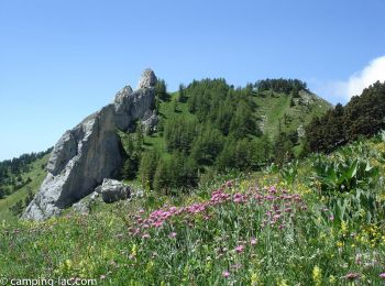
• La falaise de Céüse offre l’un des plus beaux points de vue sur les Alpes. Commencez plutôt la randonnée en partant ...
![Randonnée Marche Le Dévoluy - R13 Le Col de Lauteret - Photo](https://media.geolcdn.com/t/350/260/ext.jpg?maxdim=2&url=https%3A%2F%2Fservices.sitytrail.com%2FGeolivesWS%2FDownloadMedia.ashx%3FTrailID%3D890869%26Media%3D3ddec85f-ff9e-4fa0-b708-df941654a773.jpg)
![Marche Marche](https://static1.geolcdn.com/sitytour/trail-icons/101.png)
Km
Marche
![](/images/other/stat-length.png)
![](https://static1.geolcdn.com/siteimages/upload/files/1508320355ic_sort_den_pos_24dp.png)
![](https://static1.geolcdn.com/siteimages/upload/files/1508320355ic_sort_den_neg_24dp.png)
![](https://static1.geolcdn.com/siteimages/upload/files/16400158638029165_repeat_loop_refresh_sync_direction_icon.png)
• Un sentier part dans un magnifique vallon puis suit une prairie. Randonnée facile avec une belle vue sur le massif de...
![Randonnée Marche Le Dévoluy - R12 Le Col des Aiguilles - Photo](https://media.geolcdn.com/t/350/260/ext.jpg?maxdim=2&url=https%3A%2F%2Fservices.sitytrail.com%2FGeolivesWS%2FDownloadMedia.ashx%3FTrailID%3D890868%26Media%3Da17a685b-d707-4ec8-9ad3-ca551d593978.jpg)
![Marche Marche](https://static1.geolcdn.com/sitytour/trail-icons/101.png)
Km
Marche
![](/images/other/stat-length.png)
![](https://static1.geolcdn.com/siteimages/upload/files/1508320355ic_sort_den_pos_24dp.png)
![](https://static1.geolcdn.com/siteimages/upload/files/1508320355ic_sort_den_neg_24dp.png)
![](https://static1.geolcdn.com/siteimages/upload/files/16400158638029165_repeat_loop_refresh_sync_direction_icon.png)
• Une magnifique randonnée empruntant le GR94 depuis le col du Festre, dans un vallon protégé. Beau passage au dessus d...
![Randonnée Marche Le Dévoluy - R11 Cabane Rama - Photo](https://media.geolcdn.com/t/350/260/ext.jpg?maxdim=2&url=https%3A%2F%2Fservices.sitytrail.com%2FGeolivesWS%2FDownloadMedia.ashx%3FTrailID%3D890866%26Media%3D15965f3b-d395-4eb7-8005-d43c93878ecf.jpg)
![Marche Marche](https://static1.geolcdn.com/sitytour/trail-icons/101.png)
Km
Marche
![](/images/other/stat-length.png)
![](https://static1.geolcdn.com/siteimages/upload/files/1508320355ic_sort_den_pos_24dp.png)
![](https://static1.geolcdn.com/siteimages/upload/files/1508320355ic_sort_den_neg_24dp.png)
![](https://static1.geolcdn.com/siteimages/upload/files/16400158638029165_repeat_loop_refresh_sync_direction_icon.png)
• Le col du Festre constitue la limite entre Buëch et Dévoluy ainsi qu’une importante barrière climatique entre Alpes d...
20 randonnées affichées sur 7904
Application GPS de randonnée GRATUITE
Activités
Régions proches
- Abriès-Ristolas
- Aiguilles
- Ancelle
- Aspremont
- Aspres-lès-Corps
- Aspres-sur-Buëch
- Aubessagne
- Avançon
- Baratier
- Barcillonnette
- Barret-sur-Méouge
- Bréziers
- Briançon
- Buissard
- Ceillac
- Cervières
- Chabestan
- Chabottes
- Champcella
- Champoléon
- Chanousse
- Château-Ville-Vieille
- Châteauneuf-d'Oze
- Châteauroux-les-Alpes
- Châteauvieux
- Chorges
- Crévoux
- Crots
- Embrun
- Éourres
- Esparron
- Espinasses
- Étoile-Saint-Cyrice
- Eygliers
- Forest-Saint-Julien
- Fouillouse
- Freissinières
- Furmeyer
- Gap
- Garde-Colombe
- Guillestre
- Jarjayes
- L'Argentière-la-Bessée
- L'Épine
- La Bâtie-Montsaléon
- La Bâtie-Neuve
- La Bâtie-Vieille
- La Beaume
- La Chapelle-en-Valgaudémar
- La Fare-en-Champsaur
- La Faurie
- La Freissinouse
- La Grave
- La Haute-Beaume
- La Motte-en-Champsaur
- La Piarre
- La Roche-de-Rame
- La Roche-des-Arnauds
- La Rochette
- La Salle-les-Alpes
- La Saulce
- Laragne-Montéglin
- Lardier-et-Valença
- Laye
- Lazer
- Le Bersac
- Le Dévoluy
- Le Glaizil
- Le Monêtier-les-Bains
- Le Noyer
- Le Petit Jardin
- Le Poët
- Le Saix
- Le Sauze-du-Lac
- Les Orres
- Les Vigneaux
- Lettret
- Manteyer
- Méreuil
- Molines-en-Queyras
- Monêtier-Allemont
- Mont-Dauphin
- Montbrand
- Montclus
- Montgardin
- Montgenèvre
- Montjay
- Montmaur
- Montrond
- Moydans
- Neffes
- Névache
- Nossage-et-Bénévent
- Orcières
- Orpierre
- Oze
- Pelleautier
- Poligny
- Prunières
- Puy-Saint-André
- Puy-Saint-Eusèbe
- Puy-Saint-Pierre
- Puy-Saint-Vincent
- Puy-Sanières
- Rabou
- Rambaud
- Réallon
- Remollon
- Réotier
- Ribeyret
- Risoul
- Rochebrune
- Rosans
- Rousset
- Saint-André-d'Embrun
- Saint-André-de-Rosans
- Saint-Apollinaire
- Saint-Auban-d'Oze
- Saint-Bonnet-en-Champsaur
- Saint-Chaffrey
- Saint-Clément-sur-Durance
- Saint-Crépin
- Saint-Étienne-le-Laus
- Saint-Firmin
- Saint-Jacques-en-Valgodemard
- Saint-Jean-Saint-Nicolas
- Saint-Julien-en-Beauchêne
- Saint-Julien-en-Champsaur
- Saint-Laurent-du-Cros
- Saint-Léger-les-Mélèzes
- Saint-Martin-de-Queyrières
- Saint-Maurice-en-Valgodemard
- Saint-Michel-de-Chaillol
- Saint-Pierre-Avez
- Saint-Pierre-d'Argençon
- Saint-Sauveur
- Saint-Véran
- Sainte-Colombe
- Saléon
- Salérans
- Savines-le-Lac
- Savournon
- Serres
- Sigottier
- Sigoyer
- Sorbiers
- Tallard
- Théus
- Trescléoux
- Upaix
- Val-Buëch-Méouge
- Val-des-Prés
- Valdoule
- Vallouise-Pelvoux
- Valserres
- Vars
- Ventavon
- Veynes
- Villar-Loubière
- Villar-Saint-Pancrace
- Villar-d'Arêne
- Vitrolles