![](/images/other/stat-length.png)
Baden-Württemberg, Germany, Te voet: Top van de beste wandelroutes, trajecten, tochten en wandelingen
Baden-Württemberg: Ontdek de beste tochten: 1783 te voet, 335 stappen, 1 noords wandelen, 1 lopen en 1 trail. Al deze tochten, trajecten, routes en outdoor activiteiten zijn beschikbaar in onze SityTrail-apps voor smartphones en tablets.
De beste trajecten (2120)
![Tocht Te voet - Yburg Rundweg - Photo](https://media.geolcdn.com/t/350/260/9465470a-9321-4702-8d92-bf53a6692fd2.jpeg&format=jpg&maxdim=2)
![Te voet Te voet](https://static1.geolcdn.com/sitytour/trail-icons/100.png)
Km
Te voet
![](/images/other/stat-length.png)
![](https://static1.geolcdn.com/siteimages/upload/files/1508320355ic_sort_den_pos_24dp.png)
![](https://static1.geolcdn.com/siteimages/upload/files/1508320355ic_sort_den_neg_24dp.png)
![](https://static1.geolcdn.com/siteimages/upload/files/16400158638029165_repeat_loop_refresh_sync_direction_icon.png)
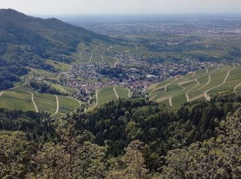
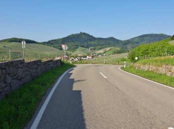
• Wandern im Rebland Website: https://visit.baden-baden.de/media/touren/yburg-rundweg
![Tocht Stappen Bad Wildbad - Baumwipfelpfad et Wildline à Bad Wildbad dans le Schwarzwald - Photo](https://media.geolcdn.com/t/350/260/4beb9631-7b24-4c38-a845-51b017bb32bb.jpg&format=jpg&maxdim=2)
![Stappen Stappen](https://static1.geolcdn.com/sitytour/trail-icons/101.png)
Km
Stappen
![](/images/other/stat-length.png)
![](https://static1.geolcdn.com/siteimages/upload/files/1508320355ic_sort_den_pos_24dp.png)
![](https://static1.geolcdn.com/siteimages/upload/files/1508320355ic_sort_den_neg_24dp.png)
![](https://static1.geolcdn.com/siteimages/upload/files/16400158638029165_repeat_loop_refresh_sync_direction_icon.png)
![Tocht Stappen Lahr/Schwarzwald - suuntoapp-Hiking-2024-04-01T08-10-15Z - Photo](https://media.geolcdn.com/t/350/260/10059e06-b36e-4a5b-8ab2-d9bfde83146b.jpg&format=jpg&maxdim=2)
![Stappen Stappen](https://static1.geolcdn.com/sitytour/trail-icons/101.png)
Km
Stappen
![](/images/other/stat-length.png)
![](https://static1.geolcdn.com/siteimages/upload/files/1508320355ic_sort_den_pos_24dp.png)
![](https://static1.geolcdn.com/siteimages/upload/files/1508320355ic_sort_den_neg_24dp.png)
![](https://static1.geolcdn.com/siteimages/upload/files/16400158638029165_repeat_loop_refresh_sync_direction_icon.png)
![Tocht Te voet Konstanz - Planetenweg Nord - Photo](https://media.geolcdn.com/t/350/260/474a2e9d-35f8-46f1-8ecf-aef524e411c9.jpeg&format=jpg&maxdim=2)
![Te voet Te voet](https://static1.geolcdn.com/sitytour/trail-icons/100.png)
Km
Te voet
![](/images/other/stat-length.png)
![](https://static1.geolcdn.com/siteimages/upload/files/1508320355ic_sort_den_pos_24dp.png)
![](https://static1.geolcdn.com/siteimages/upload/files/1508320355ic_sort_den_neg_24dp.png)
![](https://static1.geolcdn.com/siteimages/upload/files/16400158638029165_repeat_loop_refresh_sync_direction_icon.png)
• Trail created by Astronomische Vereinigung Kreuzlingen. Website: https://www.avk.space/clubdesk/www
![Tocht Te voet Lottstetten - Ziegelhütte - Fähre Ellikon am Rhein (Hochwasser Alternativroute) - Photo](https://media.geolcdn.com/t/350/260/daccca04-78af-4d11-ac2d-cc1fe3034220.jpeg&format=jpg&maxdim=2)
![Te voet Te voet](https://static1.geolcdn.com/sitytour/trail-icons/100.png)
Km
Te voet
![](/images/other/stat-length.png)
![](https://static1.geolcdn.com/siteimages/upload/files/1508320355ic_sort_den_pos_24dp.png)
![](https://static1.geolcdn.com/siteimages/upload/files/1508320355ic_sort_den_neg_24dp.png)
![](https://static1.geolcdn.com/siteimages/upload/files/16400158638029165_repeat_loop_refresh_sync_direction_icon.png)
• Symbol: gelbe Raute
![Tocht Te voet Weil der Stadt - Johannes-Kepler-Planetenweg - Photo](https://media.geolcdn.com/t/350/260/4775634c-8bd8-4b5f-92ab-bc3017f1b51f.jpeg&format=jpg&maxdim=2)
![Te voet Te voet](https://static1.geolcdn.com/sitytour/trail-icons/100.png)
Km
Te voet
![](/images/other/stat-length.png)
![](https://static1.geolcdn.com/siteimages/upload/files/1508320355ic_sort_den_pos_24dp.png)
![](https://static1.geolcdn.com/siteimages/upload/files/1508320355ic_sort_den_neg_24dp.png)
![](https://static1.geolcdn.com/siteimages/upload/files/16400158638029165_repeat_loop_refresh_sync_direction_icon.png)
• Trail created by Kepler-Gesellschaft e.V..
![Tocht Te voet St. Märgen - DE-Habstmoos - Bannwald Zweribach - Photo](https://media.geolcdn.com/t/350/260/643c08f1-48c7-4bd5-bbc7-fddc0a235ea5.jpeg&format=jpg&maxdim=2)
![Te voet Te voet](https://static1.geolcdn.com/sitytour/trail-icons/100.png)
Km
Te voet
![](/images/other/stat-length.png)
![](https://static1.geolcdn.com/siteimages/upload/files/1508320355ic_sort_den_pos_24dp.png)
![](https://static1.geolcdn.com/siteimages/upload/files/1508320355ic_sort_den_neg_24dp.png)
![](https://static1.geolcdn.com/siteimages/upload/files/16400158638029165_repeat_loop_refresh_sync_direction_icon.png)
• Trail created by Schwarzwaldverein. Habstmoos - Bannwald Zweribach Symbol: Gelbe Raute auf weißem Grund
![Tocht Te voet Sachsenheim - Weitblickweg Hohenhaslach - Photo](https://media.geolcdn.com/t/350/260/73a964b1-a005-48ed-b878-27938e88a5ff.jpeg&format=jpg&maxdim=2)
![Te voet Te voet](https://static1.geolcdn.com/sitytour/trail-icons/100.png)
Km
Te voet
![](/images/other/stat-length.png)
![](https://static1.geolcdn.com/siteimages/upload/files/1508320355ic_sort_den_pos_24dp.png)
![](https://static1.geolcdn.com/siteimages/upload/files/1508320355ic_sort_den_neg_24dp.png)
![](https://static1.geolcdn.com/siteimages/upload/files/16400158638029165_repeat_loop_refresh_sync_direction_icon.png)
• Website: https://www.weitblickweg.de/
![Tocht Te voet Herrenberg - Streuobsterlebnisweg Kuppingen - Photo](https://media.geolcdn.com/t/350/260/eb0fd420-8e7f-46cf-8af7-96bf08a0fd2d.jpeg&format=jpg&maxdim=2)
![Te voet Te voet](https://static1.geolcdn.com/sitytour/trail-icons/100.png)
Km
Te voet
![](/images/other/stat-length.png)
![](https://static1.geolcdn.com/siteimages/upload/files/1508320355ic_sort_den_pos_24dp.png)
![](https://static1.geolcdn.com/siteimages/upload/files/1508320355ic_sort_den_neg_24dp.png)
![](https://static1.geolcdn.com/siteimages/upload/files/16400158638029165_repeat_loop_refresh_sync_direction_icon.png)
• Website: https://streuobsterlebnis.mitmachstadt-herrenberg.de/erlebniswege/kuppingen
![Tocht Te voet - AugenBlickrunde Baden-Baden-Neuweier - Photo](https://media.geolcdn.com/t/350/260/d1172795-6511-4e52-b758-160061946c72.jpeg&format=jpg&maxdim=2)
![Te voet Te voet](https://static1.geolcdn.com/sitytour/trail-icons/100.png)
Km
Te voet
![](/images/other/stat-length.png)
![](https://static1.geolcdn.com/siteimages/upload/files/1508320355ic_sort_den_pos_24dp.png)
![](https://static1.geolcdn.com/siteimages/upload/files/1508320355ic_sort_den_neg_24dp.png)
![](https://static1.geolcdn.com/siteimages/upload/files/16400158638029165_repeat_loop_refresh_sync_direction_icon.png)
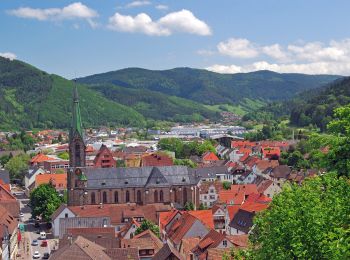
• Trail created by Stadt Baden-Baden. Website: https://www.naturpark-augenblicke.de/augenblicke/badenbaden.html
![Tocht Te voet Hausach - Genießerpfad - Hausacher Bergsteig - Photo](https://media.geolcdn.com/t/350/260/d4994c40-350d-4ca2-98c8-f636682ae31f.jpeg&format=jpg&maxdim=2)
![Te voet Te voet](https://static1.geolcdn.com/sitytour/trail-icons/100.png)
Km
Te voet
![](/images/other/stat-length.png)
![](https://static1.geolcdn.com/siteimages/upload/files/1508320355ic_sort_den_pos_24dp.png)
![](https://static1.geolcdn.com/siteimages/upload/files/1508320355ic_sort_den_neg_24dp.png)
![](https://static1.geolcdn.com/siteimages/upload/files/16400158638029165_repeat_loop_refresh_sync_direction_icon.png)
• Die insgesamt 44 Genießerpfade im Schwarzwald greifen alle ein bestimmtes Genussthema auf. Website: https://www.schw...
![Tocht Te voet Feldberg - Altglashütten - Feldberg-Caritashaus - Photo](https://media.geolcdn.com/t/350/260/09e36bd8-d689-4eac-b51e-56f2a9bb44ed.jpeg&format=jpg&maxdim=2)
![Te voet Te voet](https://static1.geolcdn.com/sitytour/trail-icons/100.png)
Km
Te voet
![](/images/other/stat-length.png)
![](https://static1.geolcdn.com/siteimages/upload/files/1508320355ic_sort_den_pos_24dp.png)
![](https://static1.geolcdn.com/siteimages/upload/files/1508320355ic_sort_den_neg_24dp.png)
![](https://static1.geolcdn.com/siteimages/upload/files/16400158638029165_repeat_loop_refresh_sync_direction_icon.png)
• Trail created by Schwarzwaldverein e.V.. Symbol: Blaue Raute auf weißem Grund
![Tocht Te voet Forbach - Ziegenpfad - Photo](https://media.geolcdn.com/t/350/260/981fefff-718c-4962-a482-304184b5e899.jpeg&format=jpg&maxdim=2)
![Te voet Te voet](https://static1.geolcdn.com/sitytour/trail-icons/100.png)
Km
Te voet
![](/images/other/stat-length.png)
![](https://static1.geolcdn.com/siteimages/upload/files/1508320355ic_sort_den_pos_24dp.png)
![](https://static1.geolcdn.com/siteimages/upload/files/1508320355ic_sort_den_neg_24dp.png)
![](https://static1.geolcdn.com/siteimages/upload/files/16400158638029165_repeat_loop_refresh_sync_direction_icon.png)
• Trail created by Bermersbacher Wandererlebnis.
![Tocht Te voet Forbach - Heimatweg - Photo](https://media.geolcdn.com/t/350/260/00a23653-c851-473b-8713-9bfb67757f2b.jpeg&format=jpg&maxdim=2)
![Te voet Te voet](https://static1.geolcdn.com/sitytour/trail-icons/100.png)
Km
Te voet
![](/images/other/stat-length.png)
![](https://static1.geolcdn.com/siteimages/upload/files/1508320355ic_sort_den_pos_24dp.png)
![](https://static1.geolcdn.com/siteimages/upload/files/1508320355ic_sort_den_neg_24dp.png)
![](https://static1.geolcdn.com/siteimages/upload/files/16400158638029165_repeat_loop_refresh_sync_direction_icon.png)
• Trail created by Bermersbacher Wandererlebnis.
![Tocht Te voet Forbach - Hölleweg - Photo](https://media.geolcdn.com/t/350/260/ffbb1037-d636-464f-bd54-e42f82948e57.jpeg&format=jpg&maxdim=2)
![Te voet Te voet](https://static1.geolcdn.com/sitytour/trail-icons/100.png)
Km
Te voet
![](/images/other/stat-length.png)
![](https://static1.geolcdn.com/siteimages/upload/files/1508320355ic_sort_den_pos_24dp.png)
![](https://static1.geolcdn.com/siteimages/upload/files/1508320355ic_sort_den_neg_24dp.png)
![](https://static1.geolcdn.com/siteimages/upload/files/16400158638029165_repeat_loop_refresh_sync_direction_icon.png)
• Trail created by Bermersbacher Wandererlebnis.
![Tocht Te voet Forbach - Riedkopfrundweg - Photo](https://media.geolcdn.com/t/350/260/a590b01a-ee10-4d9f-beb6-8980dc73ca0d.jpeg&format=jpg&maxdim=2)
![Te voet Te voet](https://static1.geolcdn.com/sitytour/trail-icons/100.png)
Km
Te voet
![](/images/other/stat-length.png)
![](https://static1.geolcdn.com/siteimages/upload/files/1508320355ic_sort_den_pos_24dp.png)
![](https://static1.geolcdn.com/siteimages/upload/files/1508320355ic_sort_den_neg_24dp.png)
![](https://static1.geolcdn.com/siteimages/upload/files/16400158638029165_repeat_loop_refresh_sync_direction_icon.png)
• Trail created by Bermersbacher Wandererlebnis.
![Tocht Te voet Forbach - Glücksweg - Photo](https://media.geolcdn.com/t/350/260/ecc156b9-baa3-4401-a228-dd3a18f21f12.jpeg&format=jpg&maxdim=2)
![Te voet Te voet](https://static1.geolcdn.com/sitytour/trail-icons/100.png)
Km
Te voet
![](/images/other/stat-length.png)
![](https://static1.geolcdn.com/siteimages/upload/files/1508320355ic_sort_den_pos_24dp.png)
![](https://static1.geolcdn.com/siteimages/upload/files/1508320355ic_sort_den_neg_24dp.png)
![](https://static1.geolcdn.com/siteimages/upload/files/16400158638029165_repeat_loop_refresh_sync_direction_icon.png)
• Trail created by Bermersbacher Wandererlebnis.
![Tocht Te voet Forbach - Panoramaweg - Photo](https://media.geolcdn.com/t/350/260/ecc156b9-baa3-4401-a228-dd3a18f21f12.jpeg&format=jpg&maxdim=2)
![Te voet Te voet](https://static1.geolcdn.com/sitytour/trail-icons/100.png)
Km
Te voet
![](/images/other/stat-length.png)
![](https://static1.geolcdn.com/siteimages/upload/files/1508320355ic_sort_den_pos_24dp.png)
![](https://static1.geolcdn.com/siteimages/upload/files/1508320355ic_sort_den_neg_24dp.png)
![](https://static1.geolcdn.com/siteimages/upload/files/16400158638029165_repeat_loop_refresh_sync_direction_icon.png)
• Trail created by Bermersbacher Wandererlebnis.
![Tocht Te voet Forbach - Hardtkopfrundweg - Photo](https://media.geolcdn.com/t/350/260/a590b01a-ee10-4d9f-beb6-8980dc73ca0d.jpeg&format=jpg&maxdim=2)
![Te voet Te voet](https://static1.geolcdn.com/sitytour/trail-icons/100.png)
Km
Te voet
![](/images/other/stat-length.png)
![](https://static1.geolcdn.com/siteimages/upload/files/1508320355ic_sort_den_pos_24dp.png)
![](https://static1.geolcdn.com/siteimages/upload/files/1508320355ic_sort_den_neg_24dp.png)
![](https://static1.geolcdn.com/siteimages/upload/files/16400158638029165_repeat_loop_refresh_sync_direction_icon.png)
• Trail created by Bermersbacher Wandererlebnis.
![Tocht Te voet Forbach - Birket-Kirren-Rundweg - Photo](https://media.geolcdn.com/t/350/260/ffbb1037-d636-464f-bd54-e42f82948e57.jpeg&format=jpg&maxdim=2)
![Te voet Te voet](https://static1.geolcdn.com/sitytour/trail-icons/100.png)
Km
Te voet
![](/images/other/stat-length.png)
![](https://static1.geolcdn.com/siteimages/upload/files/1508320355ic_sort_den_pos_24dp.png)
![](https://static1.geolcdn.com/siteimages/upload/files/1508320355ic_sort_den_neg_24dp.png)
![](https://static1.geolcdn.com/siteimages/upload/files/16400158638029165_repeat_loop_refresh_sync_direction_icon.png)
• Trail created by Bermersbacher Wandererlebnis.
20 tochten weergegeven op 2120
Gratisgps-wandelapplicatie
Activiteiten
Nabije regio's
- Alb-Donau-Kreis
- Baden-Baden
- Bodenseekreis
- Enzkreis
- Freiburg im Breisgau
- Heidelberg
- Heilbronn
- Hohenlohekreis
- Karlsruhe
- Landkreis Biberach
- Landkreis Böblingen
- Landkreis Breisgau-Hochschwarzwald
- Landkreis Calw
- Landkreis Emmendingen
- Landkreis Esslingen
- Landkreis Freudenstadt
- Landkreis Göppingen
- Landkreis Heidenheim
- Landkreis Heilbronn
- Landkreis Karlsruhe
- Landkreis Konstanz
- Landkreis Lörrach
- Landkreis Ludwigsburg
- Landkreis Rastatt
- Landkreis Ravensburg
- Landkreis Reutlingen
- Landkreis Rottweil
- Landkreis Schwäbisch Hall
- Landkreis Sigmaringen
- Landkreis Tübingen
- Landkreis Tuttlingen
- Landkreis Waldshut
- Main-Tauber-Kreis
- Mannheim
- Neckar-Odenwald-Kreis
- Ortenaukreis
- Ostalbkreis
- Pforzheim
- Rems-Murr-Kreis
- Rhein-Neckar-Kreis
- Schwarzwald-Baar-Kreis
- Stuttgart
- Ulm
- Zollernalbkreis