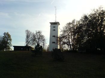
![](/images/other/stat-length.png)
- Tochten
- Te voet
- Germany
- Baden-Württemberg
- Landkreis Reutlingen
Landkreis Reutlingen, Baden-Württemberg, Te voet: Top van de beste wandelroutes, trajecten, tochten en wandelingen
Landkreis Reutlingen: Ontdek de beste tochten: 261 te voet en 2 stappen. Al deze tochten, trajecten, routes en outdoor activiteiten zijn beschikbaar in onze SityTrail-apps voor smartphones en tablets.
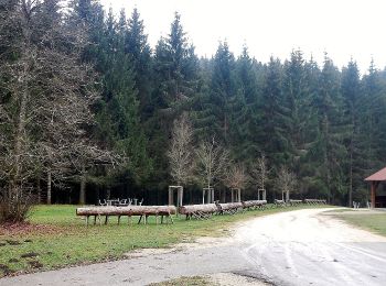
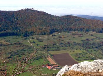
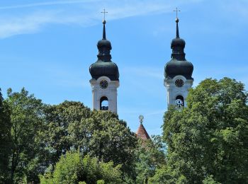
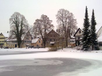
De beste trajecten (263)
![Tocht Te voet Gomadingen - hochgehkeltert - Photo](https://media.geolcdn.com/t/350/260/53ddbc86-8ab3-4a12-ad5d-28232526d880.jpeg&format=jpg&maxdim=2)
![Te voet Te voet](https://static1.geolcdn.com/sitytour/trail-icons/100.png)
Km
Te voet
![](/images/other/stat-length.png)
![](https://static1.geolcdn.com/siteimages/upload/files/1508320355ic_sort_den_pos_24dp.png)
![](https://static1.geolcdn.com/siteimages/upload/files/1508320355ic_sort_den_neg_24dp.png)
![](https://static1.geolcdn.com/siteimages/upload/files/16400158638029165_repeat_loop_refresh_sync_direction_icon.png)
• Trail created by Wanderregion »hochgehberge«. Website: https://hochgehberge.de/touren/hochgehkeltert-premiumwander...
![Tocht Te voet Gomadingen - hochgehsiedelt - Photo](https://media.geolcdn.com/t/350/260/ddeecde5-3ad4-49f8-9dbd-9619c6cd1200.jpeg&format=jpg&maxdim=2)
![Te voet Te voet](https://static1.geolcdn.com/sitytour/trail-icons/100.png)
Km
Te voet
![](/images/other/stat-length.png)
![](https://static1.geolcdn.com/siteimages/upload/files/1508320355ic_sort_den_pos_24dp.png)
![](https://static1.geolcdn.com/siteimages/upload/files/1508320355ic_sort_den_neg_24dp.png)
![](https://static1.geolcdn.com/siteimages/upload/files/16400158638029165_repeat_loop_refresh_sync_direction_icon.png)
• Wandern Schwäbische Alb: Wanderwege, Wandertouren, Premiumwanderwege, Rundwanderwege, Genusswandern, Natur erleben, K...
![Tocht Te voet Gomadingen - hochgehackert - Photo](https://media.geolcdn.com/t/350/260/2dca7dff-ee94-4051-8b75-0ea452a512f9.jpeg&format=jpg&maxdim=2)
![Te voet Te voet](https://static1.geolcdn.com/sitytour/trail-icons/100.png)
Km
Te voet
![](/images/other/stat-length.png)
![](https://static1.geolcdn.com/siteimages/upload/files/1508320355ic_sort_den_pos_24dp.png)
![](https://static1.geolcdn.com/siteimages/upload/files/1508320355ic_sort_den_neg_24dp.png)
![](https://static1.geolcdn.com/siteimages/upload/files/16400158638029165_repeat_loop_refresh_sync_direction_icon.png)
• Trail created by Wanderregion »hochgehberge«. Website: https://hochgehberge.de/touren/hochgehackert-premiumwanderw...
![Tocht Te voet Gomadingen - hochgehswiggert - Photo](https://media.geolcdn.com/t/350/260/9083d221-2db2-4dcc-bfb3-5f556f5dd0ca.jpeg&format=jpg&maxdim=2)
![Te voet Te voet](https://static1.geolcdn.com/sitytour/trail-icons/100.png)
Km
Te voet
![](/images/other/stat-length.png)
![](https://static1.geolcdn.com/siteimages/upload/files/1508320355ic_sort_den_pos_24dp.png)
![](https://static1.geolcdn.com/siteimages/upload/files/1508320355ic_sort_den_neg_24dp.png)
![](https://static1.geolcdn.com/siteimages/upload/files/16400158638029165_repeat_loop_refresh_sync_direction_icon.png)
• Wandern Schwäbische Alb: Wanderwege, Wandertouren, Premiumwanderwege, Rundwanderwege, Genusswandern, Natur erleben, K...
![Tocht Te voet Gomadingen - hochgehflogen - Photo](https://media.geolcdn.com/t/350/260/888ed909-a23d-4dca-8b36-5989f4832cd6.jpeg&format=jpg&maxdim=2)
![Te voet Te voet](https://static1.geolcdn.com/sitytour/trail-icons/100.png)
Km
Te voet
![](/images/other/stat-length.png)
![](https://static1.geolcdn.com/siteimages/upload/files/1508320355ic_sort_den_pos_24dp.png)
![](https://static1.geolcdn.com/siteimages/upload/files/1508320355ic_sort_den_neg_24dp.png)
![](https://static1.geolcdn.com/siteimages/upload/files/16400158638029165_repeat_loop_refresh_sync_direction_icon.png)
• Wandern Schwäbische Alb: Wanderwege, Wandertouren, Premiumwanderwege, Rundwanderwege, Genusswandern, Natur erleben, K...
![Tocht Te voet Gomadingen - hochgehschätzt - Photo](https://media.geolcdn.com/t/350/260/2d6c90c8-519d-43f8-977e-d2d00fe2bd1e.jpeg&format=jpg&maxdim=2)
![Te voet Te voet](https://static1.geolcdn.com/sitytour/trail-icons/100.png)
Km
Te voet
![](/images/other/stat-length.png)
![](https://static1.geolcdn.com/siteimages/upload/files/1508320355ic_sort_den_pos_24dp.png)
![](https://static1.geolcdn.com/siteimages/upload/files/1508320355ic_sort_den_neg_24dp.png)
![](https://static1.geolcdn.com/siteimages/upload/files/16400158638029165_repeat_loop_refresh_sync_direction_icon.png)
• Trail created by Wanderregion »hochgehberge«. Website: https://hochgehberge.de/touren/hochgehschaetzt-premiumwande...
![Tocht Te voet Gomadingen - Hoch-Geh-Adelt Abkürzung - Photo](https://media.geolcdn.com/t/350/260/c274d950-6d6f-4ae4-94e5-c99588e76650.jpeg&format=jpg&maxdim=2)
![Te voet Te voet](https://static1.geolcdn.com/sitytour/trail-icons/100.png)
Km
Te voet
![](/images/other/stat-length.png)
![](https://static1.geolcdn.com/siteimages/upload/files/1508320355ic_sort_den_pos_24dp.png)
![](https://static1.geolcdn.com/siteimages/upload/files/1508320355ic_sort_den_neg_24dp.png)
![](https://static1.geolcdn.com/siteimages/upload/files/16400158638029165_repeat_loop_refresh_sync_direction_icon.png)
• Trail created by Wanderregion »hochgehberge«.
![Tocht Te voet Zwiefalten - hochgehpilgert - Photo](https://media.geolcdn.com/t/350/260/441a9b10-966c-42d2-9093-bfed8a4485ed.jpeg&format=jpg&maxdim=2)
![Te voet Te voet](https://static1.geolcdn.com/sitytour/trail-icons/100.png)
Km
Te voet
![](/images/other/stat-length.png)
![](https://static1.geolcdn.com/siteimages/upload/files/1508320355ic_sort_den_pos_24dp.png)
![](https://static1.geolcdn.com/siteimages/upload/files/1508320355ic_sort_den_neg_24dp.png)
![](https://static1.geolcdn.com/siteimages/upload/files/16400158638029165_repeat_loop_refresh_sync_direction_icon.png)
• Wandern Schwäbische Alb: Wanderwege, Wandertouren, Premiumwanderwege, Rundwanderwege, Genusswandern, Natur erleben, K...
![Tocht Te voet Gomadingen - Fischburgtal - Zainingen - Photo](https://media.geolcdn.com/t/350/260/583d2710-4cbb-40f2-896d-467f9518cb7e.jpeg&format=jpg&maxdim=2)
![Te voet Te voet](https://static1.geolcdn.com/sitytour/trail-icons/100.png)
Km
Te voet
![](/images/other/stat-length.png)
![](https://static1.geolcdn.com/siteimages/upload/files/1508320355ic_sort_den_pos_24dp.png)
![](https://static1.geolcdn.com/siteimages/upload/files/1508320355ic_sort_den_neg_24dp.png)
![](https://static1.geolcdn.com/siteimages/upload/files/16400158638029165_repeat_loop_refresh_sync_direction_icon.png)
• Trail created by Schwäbischer Albverein.
![Tocht Te voet Gomadingen - Rundwanderweg Oberkochen Nr. 3 - Photo](https://media.geolcdn.com/t/350/260/ea70fcd7-67c1-4dda-9306-d036c7528130.jpeg&format=jpg&maxdim=2)
![Te voet Te voet](https://static1.geolcdn.com/sitytour/trail-icons/100.png)
Km
Te voet
![](/images/other/stat-length.png)
![](https://static1.geolcdn.com/siteimages/upload/files/1508320355ic_sort_den_pos_24dp.png)
![](https://static1.geolcdn.com/siteimages/upload/files/1508320355ic_sort_den_neg_24dp.png)
![](https://static1.geolcdn.com/siteimages/upload/files/16400158638029165_repeat_loop_refresh_sync_direction_icon.png)
• Trail created by Schwäbischer Albverein. Symbol: Schwarze 3 auf weißem Grund
![Tocht Te voet Gomadingen - Fleggaronde - Photo](https://media.geolcdn.com/t/350/260/59a2e980-7250-410f-a2f0-ce22858309a7.jpeg&format=jpg&maxdim=2)
![Te voet Te voet](https://static1.geolcdn.com/sitytour/trail-icons/100.png)
Km
Te voet
![](/images/other/stat-length.png)
![](https://static1.geolcdn.com/siteimages/upload/files/1508320355ic_sort_den_pos_24dp.png)
![](https://static1.geolcdn.com/siteimages/upload/files/1508320355ic_sort_den_neg_24dp.png)
![](https://static1.geolcdn.com/siteimages/upload/files/16400158638029165_repeat_loop_refresh_sync_direction_icon.png)
• Trail created by Erkenbrechtsweiler-Hülben-Grabenstetten.
![Tocht Te voet Dettingen an der Erms - blaues Dreieck Dettingen - Glems - Photo](https://media.geolcdn.com/t/350/260/a01fbeba-1e34-4c62-803c-4f38c746c9c5.jpeg&format=jpg&maxdim=2)
![Te voet Te voet](https://static1.geolcdn.com/sitytour/trail-icons/100.png)
Km
Te voet
![](/images/other/stat-length.png)
![](https://static1.geolcdn.com/siteimages/upload/files/1508320355ic_sort_den_pos_24dp.png)
![](https://static1.geolcdn.com/siteimages/upload/files/1508320355ic_sort_den_neg_24dp.png)
![](https://static1.geolcdn.com/siteimages/upload/files/16400158638029165_repeat_loop_refresh_sync_direction_icon.png)
• Trail created by Schwäbischer Albverein. TODO: vervollständige den Weg bis nach Dettingen Symbol: blaues Dreieck au...
![Tocht Te voet Metzingen - blaues Dreieck Metzingen - Neuhausen - Rossfeld - Grüner Fels - St.Johann - Photo](https://media.geolcdn.com/t/350/260/62960ec4-1a3a-4e4d-8a0e-82c1d764a7ad.jpeg&format=jpg&maxdim=2)
![Te voet Te voet](https://static1.geolcdn.com/sitytour/trail-icons/100.png)
Km
Te voet
![](/images/other/stat-length.png)
![](https://static1.geolcdn.com/siteimages/upload/files/1508320355ic_sort_den_pos_24dp.png)
![](https://static1.geolcdn.com/siteimages/upload/files/1508320355ic_sort_den_neg_24dp.png)
![](https://static1.geolcdn.com/siteimages/upload/files/16400158638029165_repeat_loop_refresh_sync_direction_icon.png)
• Trail created by Schwäbischer Albverein. vervollständige die Relation bis zum Grüner Fels - St.Johann Symbol: blaue...
![Tocht Te voet Gomadingen - blaues Dreieck Metzingen - Stausee - Grasberg - St. Johann - Photo](https://media.geolcdn.com/t/350/260/62960ec4-1a3a-4e4d-8a0e-82c1d764a7ad.jpeg&format=jpg&maxdim=2)
![Te voet Te voet](https://static1.geolcdn.com/sitytour/trail-icons/100.png)
Km
Te voet
![](/images/other/stat-length.png)
![](https://static1.geolcdn.com/siteimages/upload/files/1508320355ic_sort_den_pos_24dp.png)
![](https://static1.geolcdn.com/siteimages/upload/files/1508320355ic_sort_den_neg_24dp.png)
![](https://static1.geolcdn.com/siteimages/upload/files/16400158638029165_repeat_loop_refresh_sync_direction_icon.png)
• Trail created by Schwäbischer Albverein. TODO: vervollständige die Relation bis nach St. Johann Symbol: blaues Drei...
![Tocht Te voet Eningen unter Achalm - blaues Dreieck Metzingen - Eningen - Photo](https://media.geolcdn.com/t/350/260/ac84d683-5903-49a1-a1a2-4cf6da3192fc.jpeg&format=jpg&maxdim=2)
![Te voet Te voet](https://static1.geolcdn.com/sitytour/trail-icons/100.png)
Km
Te voet
![](/images/other/stat-length.png)
![](https://static1.geolcdn.com/siteimages/upload/files/1508320355ic_sort_den_pos_24dp.png)
![](https://static1.geolcdn.com/siteimages/upload/files/1508320355ic_sort_den_neg_24dp.png)
![](https://static1.geolcdn.com/siteimages/upload/files/16400158638029165_repeat_loop_refresh_sync_direction_icon.png)
• Trail created by Schwäbischer Albverein. Symbol: blaues Dreieck auf weißem Grund
![Tocht Te voet Reutlingen - blaue Gabel Reutlingen Bhf - Maienwald - Bongertwasen - Metzingen - Photo](https://media.geolcdn.com/t/350/260/48ee30b4-4bb1-4e45-8a38-e7eef88c9925.jpeg&format=jpg&maxdim=2)
![Te voet Te voet](https://static1.geolcdn.com/sitytour/trail-icons/100.png)
Km
Te voet
![](/images/other/stat-length.png)
![](https://static1.geolcdn.com/siteimages/upload/files/1508320355ic_sort_den_pos_24dp.png)
![](https://static1.geolcdn.com/siteimages/upload/files/1508320355ic_sort_den_neg_24dp.png)
![](https://static1.geolcdn.com/siteimages/upload/files/16400158638029165_repeat_loop_refresh_sync_direction_icon.png)
• Trail created by Schwäbischer Albverein. Symbol: blaue Gabel auf weißem Grund
![Tocht Te voet Gomadingen - Hermaringen - Schloss Burgberg - Stetten o.L. - Photo](https://media.geolcdn.com/t/350/260/122110db-ab2e-48e0-9fd9-2235f898fffd.jpeg&format=jpg&maxdim=2)
![Te voet Te voet](https://static1.geolcdn.com/sitytour/trail-icons/100.png)
Km
Te voet
![](/images/other/stat-length.png)
![](https://static1.geolcdn.com/siteimages/upload/files/1508320355ic_sort_den_pos_24dp.png)
![](https://static1.geolcdn.com/siteimages/upload/files/1508320355ic_sort_den_neg_24dp.png)
![](https://static1.geolcdn.com/siteimages/upload/files/16400158638029165_repeat_loop_refresh_sync_direction_icon.png)
• Trail created by Schwäbischer Albverein.
![Tocht Te voet Gomadingen - Hermaringen - Burgberg - Charlottenhöhle - Photo](https://media.geolcdn.com/t/350/260/dd7eeace-e251-4e5e-bcf5-863536a00976.jpeg&format=jpg&maxdim=2)
![Te voet Te voet](https://static1.geolcdn.com/sitytour/trail-icons/100.png)
Km
Te voet
![](/images/other/stat-length.png)
![](https://static1.geolcdn.com/siteimages/upload/files/1508320355ic_sort_den_pos_24dp.png)
![](https://static1.geolcdn.com/siteimages/upload/files/1508320355ic_sort_den_neg_24dp.png)
![](https://static1.geolcdn.com/siteimages/upload/files/16400158638029165_repeat_loop_refresh_sync_direction_icon.png)
• Trail created by Schwäbischer Albverein.
![Tocht Te voet Gomadingen - Oggenhausen - Heidenheim - Photo](https://media.geolcdn.com/t/350/260/03f14fa3-cd3f-4bbd-a943-4c69b26280c2.jpeg&format=jpg&maxdim=2)
![Te voet Te voet](https://static1.geolcdn.com/sitytour/trail-icons/100.png)
Km
Te voet
![](/images/other/stat-length.png)
![](https://static1.geolcdn.com/siteimages/upload/files/1508320355ic_sort_den_pos_24dp.png)
![](https://static1.geolcdn.com/siteimages/upload/files/1508320355ic_sort_den_neg_24dp.png)
![](https://static1.geolcdn.com/siteimages/upload/files/16400158638029165_repeat_loop_refresh_sync_direction_icon.png)
• Trail created by Schwäbischer Albverein.
![Tocht Te voet Dettingen an der Erms - blaues Dreieck Metzingen - Kohlberg - Flugplatz Hülben - HW1 - Photo](https://media.geolcdn.com/t/350/260/1e146b8b-02ac-4a49-9f1e-b61a74897125.jpeg&format=jpg&maxdim=2)
![Te voet Te voet](https://static1.geolcdn.com/sitytour/trail-icons/100.png)
Km
Te voet
![](/images/other/stat-length.png)
![](https://static1.geolcdn.com/siteimages/upload/files/1508320355ic_sort_den_pos_24dp.png)
![](https://static1.geolcdn.com/siteimages/upload/files/1508320355ic_sort_den_neg_24dp.png)
![](https://static1.geolcdn.com/siteimages/upload/files/16400158638029165_repeat_loop_refresh_sync_direction_icon.png)
• Trail created by Schwäbischer Albverein. Symbol: blaues Dreieck auf weißem Grund
20 tochten weergegeven op 263
Gratisgps-wandelapplicatie