![](/images/other/stat-length.png)
- Randonnées
- A pied
- France
- Auvergne-Rhône-Alpes
- Savoie
- La Léchère
La Léchère, Savoie, A pied : Les meilleures randonnées, itinéraires, parcours, balades et promenades
La Léchère : découvrez les meilleures randonnées : 86 marche, 2 course à pied, 2 marche nordique, 1 trail et 3 a pied. Tous ces circuits, parcours, itinéraires et activités en plein air sont disponibles dans nos applications SityTrail pour smartphones et tablettes.
Les meilleurs parcours (94)
![Randonnée Marche La Léchère - pte de Glais rouge, des Arangles et Roche brisée - Photo](https://media.geolcdn.com/t/350/260/1baaaa90-37a8-4237-b92e-53be672474e7.jpg&format=jpg&maxdim=2)
![Marche Marche](https://static1.geolcdn.com/sitytour/trail-icons/101.png)
Km
Marche
![](/images/other/stat-length.png)
![](https://static1.geolcdn.com/siteimages/upload/files/1508320355ic_sort_den_pos_24dp.png)
![](https://static1.geolcdn.com/siteimages/upload/files/1508320355ic_sort_den_neg_24dp.png)
![](https://static1.geolcdn.com/siteimages/upload/files/16400158638029165_repeat_loop_refresh_sync_direction_icon.png)
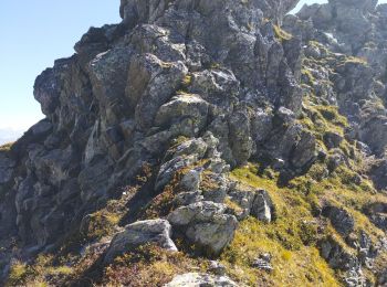
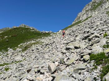
• Une gde partie de passe hors sentier ou traces d'animaux. Parfois il faut mettre les mains. Prévoir de bonnes chaussu...
![Randonnée Marche La Léchère - les marmottes noires et Bellacha - Photo](https://media.geolcdn.com/t/350/260/2e4efe3f-cf03-4e44-8f86-163d48b8b315.jpg&format=jpg&maxdim=2)
![Marche Marche](https://static1.geolcdn.com/sitytour/trail-icons/101.png)
Km
Marche
![](/images/other/stat-length.png)
![](https://static1.geolcdn.com/siteimages/upload/files/1508320355ic_sort_den_pos_24dp.png)
![](https://static1.geolcdn.com/siteimages/upload/files/1508320355ic_sort_den_neg_24dp.png)
![](https://static1.geolcdn.com/siteimages/upload/files/16400158638029165_repeat_loop_refresh_sync_direction_icon.png)
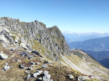
• Départ de Gelon. Attention au retour si vous passez par les crêtes, c'est aérien et il faut avoir le pied sûr. Ce son...
![Randonnée Marche La Léchère - lac de Clartan et grande muraille - Photo](https://media.geolcdn.com/t/350/260/4b4bb2ac-ceed-47da-944d-e4142550d609.jpg&format=jpg&maxdim=2)
![Marche Marche](https://static1.geolcdn.com/sitytour/trail-icons/101.png)
Km
Marche
![](/images/other/stat-length.png)
![](https://static1.geolcdn.com/siteimages/upload/files/1508320355ic_sort_den_pos_24dp.png)
![](https://static1.geolcdn.com/siteimages/upload/files/1508320355ic_sort_den_neg_24dp.png)
![](https://static1.geolcdn.com/siteimages/upload/files/16400158638029165_repeat_loop_refresh_sync_direction_icon.png)
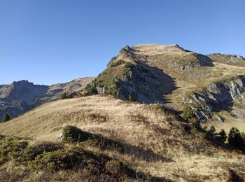
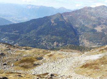
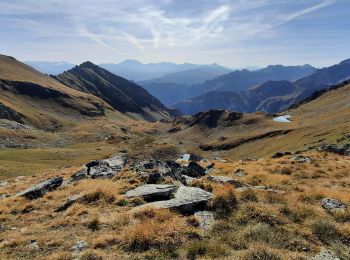
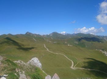
• Attention cette randonnée est hors sentiers et aérienne. La descente sous la pointe de Freydon est difficile. Un piol...
![Randonnée Marche La Léchère - Col des Génisses par le refuge du Nant du Beurre - Photo](https://media.geolcdn.com/t/350/260/c621086d-e802-4fc9-b77f-57f582faf42d.jpg&format=jpg&maxdim=2)
![Marche Marche](https://static1.geolcdn.com/sitytour/trail-icons/101.png)
Km
Marche
![](/images/other/stat-length.png)
![](https://static1.geolcdn.com/siteimages/upload/files/1508320355ic_sort_den_pos_24dp.png)
![](https://static1.geolcdn.com/siteimages/upload/files/1508320355ic_sort_den_neg_24dp.png)
![](https://static1.geolcdn.com/siteimages/upload/files/16400158638029165_repeat_loop_refresh_sync_direction_icon.png)
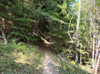
• Montée au refuge du Nant du Beurre par un mixte de chemin empierré et de sentier et terminer par le sentier balcon po...
![Randonnée Marche La Léchère - Le Cheval Noir - Photo](https://media.geolcdn.com/t/350/260/788ca868-0447-42b1-943c-c45c9c1958b3.jpg&format=jpg&maxdim=2)
![Marche Marche](https://static1.geolcdn.com/sitytour/trail-icons/101.png)
Km
Marche
![](/images/other/stat-length.png)
![](https://static1.geolcdn.com/siteimages/upload/files/1508320355ic_sort_den_pos_24dp.png)
![](https://static1.geolcdn.com/siteimages/upload/files/1508320355ic_sort_den_neg_24dp.png)
![](https://static1.geolcdn.com/siteimages/upload/files/16400158638029165_repeat_loop_refresh_sync_direction_icon.png)
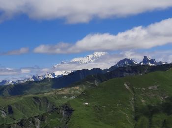
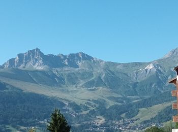
• Traversée pour ce beau sommet en extrémité du massif de la Maurienne. Le départ à partir du Col de la Madeleine empru...
![Randonnée Marche La Léchère - tour de la pointe de Colomban - Photo](https://media.geolcdn.com/t/350/260/6b862b00-e860-4382-9f07-73cf873794c9.jpg&format=jpg&maxdim=2)
![Marche Marche](https://static1.geolcdn.com/sitytour/trail-icons/101.png)
Km
Marche
![](/images/other/stat-length.png)
![](https://static1.geolcdn.com/siteimages/upload/files/1508320355ic_sort_den_pos_24dp.png)
![](https://static1.geolcdn.com/siteimages/upload/files/1508320355ic_sort_den_neg_24dp.png)
![](https://static1.geolcdn.com/siteimages/upload/files/16400158638029165_repeat_loop_refresh_sync_direction_icon.png)
![Randonnée Marche La Léchère - lacs de la tempête - Photo](https://media.geolcdn.com/t/350/260/7ab3266a-90e4-4e18-93e8-1f9644da26a2.jpg&format=jpg&maxdim=2)
![Marche Marche](https://static1.geolcdn.com/sitytour/trail-icons/101.png)
Km
Marche
![](/images/other/stat-length.png)
![](https://static1.geolcdn.com/siteimages/upload/files/1508320355ic_sort_den_pos_24dp.png)
![](https://static1.geolcdn.com/siteimages/upload/files/1508320355ic_sort_den_neg_24dp.png)
![](https://static1.geolcdn.com/siteimages/upload/files/16400158638029165_repeat_loop_refresh_sync_direction_icon.png)
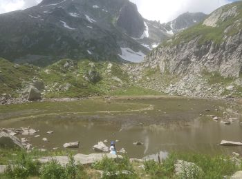
• Les lacs de la tempête en Aller/Retour depuis Naves. Pour le départ de la rando, il faut remonter la piste forestière...
![Randonnée Marche La Léchère - Les portes de Montmélian - Valmorel - Photo](https://media.geolcdn.com/t/350/260/fdbdf5c4-563d-4405-9050-500e2b712495.jpg&format=jpg&maxdim=2)
![Marche Marche](https://static1.geolcdn.com/sitytour/trail-icons/101.png)
Km
Marche
![](/images/other/stat-length.png)
![](https://static1.geolcdn.com/siteimages/upload/files/1508320355ic_sort_den_pos_24dp.png)
![](https://static1.geolcdn.com/siteimages/upload/files/1508320355ic_sort_den_neg_24dp.png)
![](https://static1.geolcdn.com/siteimages/upload/files/16400158638029165_repeat_loop_refresh_sync_direction_icon.png)
• Toujours une randonnée classique du massif depuis l'arrivée du télécabine en boucle avec redescente au village par le...
![Randonnée A pied La Léchère - Doucy station-découverte-juillet 2022 - Photo](https://media.geolcdn.com/t/350/260/4dfae08c-174e-469c-899c-e93c814cf26f.jpg&format=jpg&maxdim=2)
![A pied A pied](https://static1.geolcdn.com/sitytour/trail-icons/100.png)
Km
A pied
![](/images/other/stat-length.png)
![](https://static1.geolcdn.com/siteimages/upload/files/1508320355ic_sort_den_pos_24dp.png)
![](https://static1.geolcdn.com/siteimages/upload/files/1508320355ic_sort_den_neg_24dp.png)
![](https://static1.geolcdn.com/siteimages/upload/files/16400158638029165_repeat_loop_refresh_sync_direction_icon.png)
• VTF-les Sétéries-la roche blanche-les Echapeaux-Pierre Plate-granges du Villaret-granges dessus-VTF.
![Randonnée A pied La Léchère - Valmorel-juillet 2022 - Photo](https://media.geolcdn.com/t/350/260/4a0b082f-18d7-473a-9167-6b0b0a3ea56e.jpg&format=jpg&maxdim=2)
![A pied A pied](https://static1.geolcdn.com/sitytour/trail-icons/100.png)
Km
A pied
![](/images/other/stat-length.png)
![](https://static1.geolcdn.com/siteimages/upload/files/1508320355ic_sort_den_pos_24dp.png)
![](https://static1.geolcdn.com/siteimages/upload/files/1508320355ic_sort_den_neg_24dp.png)
![](https://static1.geolcdn.com/siteimages/upload/files/16400158638029165_repeat_loop_refresh_sync_direction_icon.png)
• VTF Doucy Combelouvière-granges du Villaret-le Meiller-Lancheverne-Valmorel-Montolivet-Quarante Planes-granges Neuve-...
![Randonnée A pied La Léchère - La Douceraine-juillet 2022 - Photo](https://media.geolcdn.com/t/350/260/22001f04-cd1d-4ac6-b51f-a80cdb9adc1b.jpg&format=jpg&maxdim=2)
![A pied A pied](https://static1.geolcdn.com/sitytour/trail-icons/100.png)
Km
A pied
![](/images/other/stat-length.png)
![](https://static1.geolcdn.com/siteimages/upload/files/1508320355ic_sort_den_pos_24dp.png)
![](https://static1.geolcdn.com/siteimages/upload/files/1508320355ic_sort_den_neg_24dp.png)
![](https://static1.geolcdn.com/siteimages/upload/files/16400158638029165_repeat_loop_refresh_sync_direction_icon.png)
• Combelouvière-Doucy-le Villaret-les Granges.
![Randonnée Marche La Léchère - Doucy station-Valmorel en AR-2207-22 - Photo](https://media.geolcdn.com/t/350/260/28f6f729-77f8-4e8a-bf12-96ff682117ad.jpg&format=jpg&maxdim=2)
![Marche Marche](https://static1.geolcdn.com/sitytour/trail-icons/101.png)
Km
Marche
![](/images/other/stat-length.png)
![](https://static1.geolcdn.com/siteimages/upload/files/1508320355ic_sort_den_pos_24dp.png)
![](https://static1.geolcdn.com/siteimages/upload/files/1508320355ic_sort_den_neg_24dp.png)
![](https://static1.geolcdn.com/siteimages/upload/files/16400158638029165_repeat_loop_refresh_sync_direction_icon.png)
• Doucy Combelouvière-Chantemerle-grange de Reposière-grange dessous-le Meiller-Lancheverne-Valmorel-Montolivet-Quarant...
![Randonnée Marche La Léchère - Doucy station-Doucy Village en AR-19-07-22 - Photo](https://media.geolcdn.com/t/350/260/15707868-7c22-4add-9bf7-7647105cef76.jpg&format=jpg&maxdim=2)
![Marche Marche](https://static1.geolcdn.com/sitytour/trail-icons/101.png)
Km
Marche
![](/images/other/stat-length.png)
![](https://static1.geolcdn.com/siteimages/upload/files/1508320355ic_sort_den_pos_24dp.png)
![](https://static1.geolcdn.com/siteimages/upload/files/1508320355ic_sort_den_neg_24dp.png)
![](https://static1.geolcdn.com/siteimages/upload/files/16400158638029165_repeat_loop_refresh_sync_direction_icon.png)
• Doucy Combelouvière-la grande forêt-les grands plans-le Crétet- les Cochettes-Doucy village-en Mélan-granges de Racla...
![Randonnée Marche La Léchère - Doucy Combelouvière-18-07-22 - Photo](https://media.geolcdn.com/t/350/260/54e59be4-b967-49b0-95ff-d463b7902a8c.jpg&format=jpg&maxdim=2)
![Marche Marche](https://static1.geolcdn.com/sitytour/trail-icons/101.png)
Km
Marche
![](/images/other/stat-length.png)
![](https://static1.geolcdn.com/siteimages/upload/files/1508320355ic_sort_den_pos_24dp.png)
![](https://static1.geolcdn.com/siteimages/upload/files/1508320355ic_sort_den_neg_24dp.png)
![](https://static1.geolcdn.com/siteimages/upload/files/16400158638029165_repeat_loop_refresh_sync_direction_icon.png)
• VTF de Doucy station-les Séterée-la Flachère-les Echapeaux-pierre plate-granges du Villaret-granges dessus les Lots- ...
![Randonnée Marche La Léchère - Tour du Quermoz par Grand Naves - Photo](https://media.geolcdn.com/t/350/260/b6009670-ce5c-4d7e-9ab7-0ee7a59863d7.jpg&format=jpg&maxdim=2)
![Marche Marche](https://static1.geolcdn.com/sitytour/trail-icons/101.png)
Km
Marche
![](/images/other/stat-length.png)
![](https://static1.geolcdn.com/siteimages/upload/files/1508320355ic_sort_den_pos_24dp.png)
![](https://static1.geolcdn.com/siteimages/upload/files/1508320355ic_sort_den_neg_24dp.png)
![](https://static1.geolcdn.com/siteimages/upload/files/16400158638029165_repeat_loop_refresh_sync_direction_icon.png)
• Au départ de Grand Naves, parking à l'entrée du village à côté de la maison des montagnes (pratique pour obtenir des ...
![Randonnée Marche La Léchère - Ronchat La Cudraz Navette Plan des Heures Balcon des Adrets de Tarentaise - Photo](https://media.geolcdn.com/t/350/260/31bbd3e5-7eb6-4ecd-afbb-fb24a4602b0f.jpg&format=jpg&maxdim=2)
![Marche Marche](https://static1.geolcdn.com/sitytour/trail-icons/101.png)
Km
Marche
![](/images/other/stat-length.png)
![](https://static1.geolcdn.com/siteimages/upload/files/1508320355ic_sort_den_pos_24dp.png)
![](https://static1.geolcdn.com/siteimages/upload/files/1508320355ic_sort_den_neg_24dp.png)
![](https://static1.geolcdn.com/siteimages/upload/files/16400158638029165_repeat_loop_refresh_sync_direction_icon.png)
• Randonnée en boucle à l'ombre (80%environ) des résineux. Il est préférable de passer par Le Chantelard plutôt que pa...
![Randonnée Marche La Léchère - lac de branlay - Photo](https://media.geolcdn.com/t/350/260/72b93580-97fa-4f76-a55e-6aef80af4676.jpg&format=jpg&maxdim=2)
![Marche Marche](https://static1.geolcdn.com/sitytour/trail-icons/101.png)
Km
Marche
![](/images/other/stat-length.png)
![](https://static1.geolcdn.com/siteimages/upload/files/1508320355ic_sort_den_pos_24dp.png)
![](https://static1.geolcdn.com/siteimages/upload/files/1508320355ic_sort_den_neg_24dp.png)
![](https://static1.geolcdn.com/siteimages/upload/files/16400158638029165_repeat_loop_refresh_sync_direction_icon.png)
• Très facile. Temps calculé avec un enfant de 4 ans. Prévoir 2h30
![Randonnée Marche La Léchère - Boucle Doucy Le Crêtet - Photo](https://media.geolcdn.com/t/350/260/ext.jpg?maxdim=2&url=https%3A%2F%2Fservices.sitytrail.com%2FGeolivesWS%2FDownloadMedia.ashx%3FTrailID%3D962722%26Media%3Dfix__20180504171734.jpg)
![Marche Marche](https://static1.geolcdn.com/sitytour/trail-icons/101.png)
Km
Marche
![](/images/other/stat-length.png)
![](https://static1.geolcdn.com/siteimages/upload/files/1508320355ic_sort_den_pos_24dp.png)
![](https://static1.geolcdn.com/siteimages/upload/files/1508320355ic_sort_den_neg_24dp.png)
![](https://static1.geolcdn.com/siteimages/upload/files/16400158638029165_repeat_loop_refresh_sync_direction_icon.png)
• Au départ de Doucy (monument aux Morts) vers le Crêtet et Sécheron
![Randonnée Marche La Léchère - grand naves Beaufortain - Photo](https://media.geolcdn.com/t/350/260/0d5c1464-9afe-40cd-a3c1-52f7950d0659.jpg&format=jpg&maxdim=2)
![Marche Marche](https://static1.geolcdn.com/sitytour/trail-icons/101.png)
Km
Marche
![](/images/other/stat-length.png)
![](https://static1.geolcdn.com/siteimages/upload/files/1508320355ic_sort_den_pos_24dp.png)
![](https://static1.geolcdn.com/siteimages/upload/files/1508320355ic_sort_den_neg_24dp.png)
![](https://static1.geolcdn.com/siteimages/upload/files/16400158638029165_repeat_loop_refresh_sync_direction_icon.png)
![Randonnée Marche La Léchère - la grande forêt-17-07-22 - Photo](https://media.geolcdn.com/t/350/260/c007581d-77a7-490e-ab9a-96bc75f9110f.jpg&format=jpg&maxdim=2)
![Marche Marche](https://static1.geolcdn.com/sitytour/trail-icons/101.png)
Km
Marche
![](/images/other/stat-length.png)
![](https://static1.geolcdn.com/siteimages/upload/files/1508320355ic_sort_den_pos_24dp.png)
![](https://static1.geolcdn.com/siteimages/upload/files/1508320355ic_sort_den_neg_24dp.png)
![](https://static1.geolcdn.com/siteimages/upload/files/16400158638029165_repeat_loop_refresh_sync_direction_icon.png)
• Doucy station--la grande forêt-les étangs-les grands plans-le Crétet-VTF.
20 randonnées affichées sur 94
Application GPS de randonnée GRATUITE