RobinMicheline

GUIDE Offline

Trails

Trail Walking Selonnet - CHABANON Fanget Negrôn - Photo
Walking
GUIDE
RobinMicheline

Walking

Very easy
Selonnet, Provence-Alpes-Côte d'Azur, Alpes-de-Haute-Provence, France
8.1 km | 10.6 km-effort
4h 7min
No
Trail Walking Saint-Martin-les-Eaux - SAINT MARTIN LES EAUX  .La Rousselle - Photo
Walking
GUIDE
RobinMicheline

Walking

Easy
Saint-Martin-les-Eaux, Provence-Alpes-Côte d'Azur, Alpes-de-Haute-Provence, France
7.2 km | 10.4 km-effort
2h 41min
Yes
Trail Walking Lioux - VAUCLUSE Lioux Vaumalle  - Photo
Walking
GUIDE
RobinMicheline

Walking

Medium
(1)
Lioux, Provence-Alpes-Côte d'Azur, Vaucluse, France
14.1 km | 19.1 km-effort
7h 17min
Yes
Trail Walking Saint-Pierre-Avez - SAINT PIERRE AVEZ . Col de Blauri. Mont Burlet  - Photo
Walking
GUIDE
RobinMicheline

Walking

Difficult
Saint-Pierre-Avez, Provence-Alpes-Côte d'Azur, Hautes-Alpes, France
12 km | 22 km-effort
5h 21min
Yes
Trail Walking Les Mées - MEES  Les Apollinaire. Chemin de la Haute Montagne. La Haute Montagne .San Peyre. Chapelle Saint Roch  - Photo
Walking
GUIDE
RobinMicheline

Walking

Medium
Les Mées, Provence-Alpes-Côte d'Azur, Alpes-de-Haute-Provence, France
15.4 km | 22 km-effort
6h 12min
Yes
Trail Walking Le Poët - MISON Le Poet - Photo
Walking
GUIDE
RobinMicheline

Walking

Very easy
Le Poët, Provence-Alpes-Côte d'Azur, Hautes-Alpes, France
9 km | 11.7 km-effort
2h 46min
Yes
Trail Walking Volonne - VOLONNE Tour de Tignes - Photo
Walking
GUIDE
RobinMicheline

Walking

Easy
Volonne, Provence-Alpes-Côte d'Azur, Alpes-de-Haute-Provence, France
6.7 km | 10.4 km-effort
2h 54min
Yes
Trail Walking Valbelle - VALBELLE  .tour de Sumiou. grotte - Photo
Walking
GUIDE
RobinMicheline

Walking

Very easy
Valbelle, Provence-Alpes-Côte d'Azur, Alpes-de-Haute-Provence, France
14.6 km | 25 km-effort
5h 0min
Yes
Trail Walking Saint-Geniez - SAINT GENIEZ Aiguës Champ - Photo
Walking
GUIDE
RobinMicheline

Walking

Medium
Saint-Geniez, Provence-Alpes-Côte d'Azur, Alpes-de-Haute-Provence, France
17.5 km | 25 km-effort
5h 18min
Yes
Trail Walking Sigonce - SIGONCE. La Blache. Le Revest. Saint Martin - Photo
Walking
GUIDE
RobinMicheline

Walking

Easy
Sigonce, Provence-Alpes-Côte d'Azur, Alpes-de-Haute-Provence, France
10.5 km | 14.6 km-effort
3h 5min
Yes
Trail Walking Le Vernet -  VERNET   Col de Mario .  Les Béliers  o  - Photo
Walking
GUIDE
RobinMicheline

Walking

Medium
Le Vernet, Provence-Alpes-Côte d'Azur, Alpes-de-Haute-Provence, France
10 km | 18 km-effort
6h 9min
Yes
Trail On foot Allons - Crete des Serres - Photo
On foot
GUIDE
RobinMicheline

On foot

Very easy
Allons, Provence-Alpes-Côte d'Azur, Alpes-de-Haute-Provence, France
14.1 km | 24 km-effort
Unknown
Yes
Trail On foot Lurs - LURS . bois du Crepon , Notre dame du Plan , la Casse o - Photo
On foot
GUIDE
RobinMicheline

On foot

Medium
Lurs, Provence-Alpes-Côte d'Azur, Alpes-de-Haute-Provence, France
14.3 km | 18.6 km-effort
Unknown
Yes
Trail On foot Saint-Geniez - tour-de-la-montagne-de-gache_gpx - Photo
On foot
GUIDE
RobinMicheline

On foot

Easy
(1)
Saint-Geniez, Provence-Alpes-Côte d'Azur, Alpes-de-Haute-Provence, France
12.2 km | 22 km-effort
Unknown
Yes
Trail Walking Le Vernet - VERNET   col de Mariaud le tour des villages abandonnés o - Photo
Walking
GUIDE
RobinMicheline

Walking

Difficult
Le Vernet, Provence-Alpes-Côte d'Azur, Alpes-de-Haute-Provence, France
15.8 km | 28 km-effort
7h 54min
No
Trail Walking Éourres - EOURRES   Pied du Mulet .   Col de Verdun.  Col Saint Pierre . o - Photo
Walking
GUIDE
RobinMicheline

Walking

Medium
Éourres, Provence-Alpes-Côte d'Azur, Hautes-Alpes, France
14 km | 26 km-effort
6h 43min
No
Trail Walking Estoublon - ESTOUBLON Les gorges de Trevans , chapelle Saint Andre , pont Roman o - Photo
Walking
GUIDE
RobinMicheline

Walking

Difficult
Estoublon, Provence-Alpes-Côte d'Azur, Alpes-de-Haute-Provence, France
13.9 km | 22 km-effort
6h 7min
Yes
Trail On foot Saint-Laurent-du-Verdon - Côteau Chiron - Photo
On foot
GUIDE
RobinMicheline

On foot

Very easy
Saint-Laurent-du-Verdon, Provence-Alpes-Côte d'Azur, Alpes-de-Haute-Provence, France
13 km | 16.8 km-effort
Unknown
Yes
Trail Walking Tartonne - TARTONNE .Sommet de la Sapee , puit sale o - Photo
Walking
GUIDE
RobinMicheline

Walking

Difficult
(2)
Tartonne, Provence-Alpes-Côte d'Azur, Alpes-de-Haute-Provence, France
16 km | 27 km-effort
6h 8min
Yes
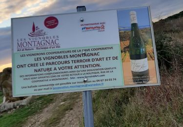
Trail Walking Montagnac - MONTAGNAC 34 . Le parcours d art et de nature o  - Photo
Walking
GUIDE
RobinMicheline

Walking

Medium
Montagnac, Occitania, Hérault, France
17.9 km | 21 km-effort
4h 34min
Yes
Trail On foot Saint-Maime - SAINT MAIME . Brives , le Pin Blanc o - Photo
On foot
GUIDE
RobinMicheline

On foot

Easy
(1)
Saint-Maime, Provence-Alpes-Côte d'Azur, Alpes-de-Haute-Provence, France
13.9 km | 18.6 km-effort
Unknown
Yes

Close
My subscriptions