![](/images/other/stat-length.png)
Brescia, Lombardy: Best trails, routes and walks
Brescia: Discover the best trails: 483 hiking trails and 1 bike and mountain-bike routes. All these trails, routes and outdoor activities are available in our SityTrail applications for smartphones and tablets.
The best trails (487)
![Trail On foot Pertica Bassa - Anello Vaiale Corna Blacca Gardo - Photo](https://media.geolcdn.com/t/350/260/72c225cf-fbb5-45f7-b6aa-815f1ae894fc.jpeg&format=jpg&maxdim=2)
![On foot On foot](https://static1.geolcdn.com/sitytour/trail-icons/100.png)
Km
On foot
![](/images/other/stat-length.png)
![](https://static1.geolcdn.com/siteimages/upload/files/1508320355ic_sort_den_pos_24dp.png)
![](https://static1.geolcdn.com/siteimages/upload/files/1508320355ic_sort_den_neg_24dp.png)
![](https://static1.geolcdn.com/siteimages/upload/files/16400158638029165_repeat_loop_refresh_sync_direction_icon.png)
• Trail created by Vivilavalsabbia.
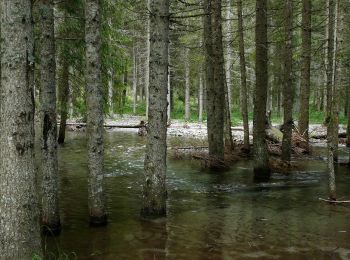
![Trail On foot Breno - anello escursionistico piana del Gaver - Photo](https://media.geolcdn.com/t/350/260/77cb3a12-bf1e-4548-9cc8-7696546ad313.jpeg&format=jpg&maxdim=2)
![On foot On foot](https://static1.geolcdn.com/sitytour/trail-icons/100.png)
Km
On foot
![](/images/other/stat-length.png)
![](https://static1.geolcdn.com/siteimages/upload/files/1508320355ic_sort_den_pos_24dp.png)
![](https://static1.geolcdn.com/siteimages/upload/files/1508320355ic_sort_den_neg_24dp.png)
![](https://static1.geolcdn.com/siteimages/upload/files/16400158638029165_repeat_loop_refresh_sync_direction_icon.png)
• Trail created by Sci di fondo Gaver.
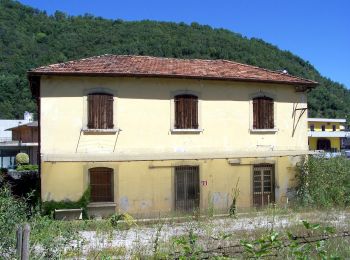
![Trail On foot Roè Volciano - Percorso sud-ovest Roè Volciano - Photo](https://media.geolcdn.com/t/350/260/611349f3-7b57-42fc-87ed-c1495e3ba734.jpeg&format=jpg&maxdim=2)
![On foot On foot](https://static1.geolcdn.com/sitytour/trail-icons/100.png)
Km
On foot
![](/images/other/stat-length.png)
![](https://static1.geolcdn.com/siteimages/upload/files/1508320355ic_sort_den_pos_24dp.png)
![](https://static1.geolcdn.com/siteimages/upload/files/1508320355ic_sort_den_neg_24dp.png)
![](https://static1.geolcdn.com/siteimages/upload/files/16400158638029165_repeat_loop_refresh_sync_direction_icon.png)
• Trail created by Comune di Roè Volciano.
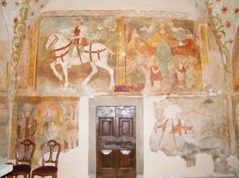
![Trail On foot Braone - Camminata Alta - Photo](https://media.geolcdn.com/t/350/260/ae4b5343-9d8f-46fc-9fd6-1225a52f7144.jpeg&format=jpg&maxdim=2)
![On foot On foot](https://static1.geolcdn.com/sitytour/trail-icons/100.png)
Km
On foot
![](/images/other/stat-length.png)
![](https://static1.geolcdn.com/siteimages/upload/files/1508320355ic_sort_den_pos_24dp.png)
![](https://static1.geolcdn.com/siteimages/upload/files/1508320355ic_sort_den_neg_24dp.png)
![](https://static1.geolcdn.com/siteimages/upload/files/16400158638029165_repeat_loop_refresh_sync_direction_icon.png)
• Trail created by Parco dell'Adamello.
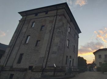
![Trail On foot Lumezzane - Via del Sacro - Photo](https://media.geolcdn.com/t/350/260/ee7a6f42-fb6b-4c8e-8663-19cf2f9fcc71.jpeg&format=jpg&maxdim=2)
![On foot On foot](https://static1.geolcdn.com/sitytour/trail-icons/100.png)
Km
On foot
![](/images/other/stat-length.png)
![](https://static1.geolcdn.com/siteimages/upload/files/1508320355ic_sort_den_pos_24dp.png)
![](https://static1.geolcdn.com/siteimages/upload/files/1508320355ic_sort_den_neg_24dp.png)
![](https://static1.geolcdn.com/siteimages/upload/files/16400158638029165_repeat_loop_refresh_sync_direction_icon.png)
• Trail created by Club Alpino Italiano - Sezione di Lumezzane. Symbol: unmarked Website: http://www.cailumezzane.it...
![Trail On foot Lumezzane - Via del Sacro da Lumezzane (Fontana) - San Bernardo - Photo](https://media.geolcdn.com/t/350/260/ee7a6f42-fb6b-4c8e-8663-19cf2f9fcc71.jpeg&format=jpg&maxdim=2)
![On foot On foot](https://static1.geolcdn.com/sitytour/trail-icons/100.png)
Km
On foot
![](/images/other/stat-length.png)
![](https://static1.geolcdn.com/siteimages/upload/files/1508320355ic_sort_den_pos_24dp.png)
![](https://static1.geolcdn.com/siteimages/upload/files/1508320355ic_sort_den_neg_24dp.png)
![](https://static1.geolcdn.com/siteimages/upload/files/16400158638029165_repeat_loop_refresh_sync_direction_icon.png)
• Trail created by Club Alpino Italiano - Sezione di Lumezzane. Symbol: unmarked Website: http://www.cailumezzane.it...
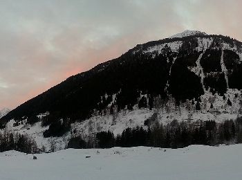
![Trail On foot Ponte di Legno - Garòfui - Photo](https://media.geolcdn.com/t/350/260/c7ae20ef-0d02-40dc-af9a-8e628c06f150.jpeg&format=jpg&maxdim=2)
![On foot On foot](https://static1.geolcdn.com/sitytour/trail-icons/100.png)
Km
On foot
![](/images/other/stat-length.png)
![](https://static1.geolcdn.com/siteimages/upload/files/1508320355ic_sort_den_pos_24dp.png)
![](https://static1.geolcdn.com/siteimages/upload/files/1508320355ic_sort_den_neg_24dp.png)
![](https://static1.geolcdn.com/siteimages/upload/files/16400158638029165_repeat_loop_refresh_sync_direction_icon.png)
• Symbol: horizontal light blue upper bar and white lower
![Trail On foot Vezza d'Oglio - Slaàse - Photo](https://media.geolcdn.com/t/350/260/522d254e-628c-47ee-a777-01e74ed314de.jpeg&format=jpg&maxdim=2)
![On foot On foot](https://static1.geolcdn.com/sitytour/trail-icons/100.png)
Km
On foot
![](/images/other/stat-length.png)
![](https://static1.geolcdn.com/siteimages/upload/files/1508320355ic_sort_den_pos_24dp.png)
![](https://static1.geolcdn.com/siteimages/upload/files/1508320355ic_sort_den_neg_24dp.png)
![](https://static1.geolcdn.com/siteimages/upload/files/16400158638029165_repeat_loop_refresh_sync_direction_icon.png)
• DA COMPLETARE Symbol: unmarked
![Trail On foot Vione - Pè de corf - Photo](https://media.geolcdn.com/t/350/260/d0a32cac-de56-4a09-8b2e-d67f8d67ed7a.jpeg&format=jpg&maxdim=2)
![On foot On foot](https://static1.geolcdn.com/sitytour/trail-icons/100.png)
Km
On foot
![](/images/other/stat-length.png)
![](https://static1.geolcdn.com/siteimages/upload/files/1508320355ic_sort_den_pos_24dp.png)
![](https://static1.geolcdn.com/siteimages/upload/files/1508320355ic_sort_den_neg_24dp.png)
![](https://static1.geolcdn.com/siteimages/upload/files/16400158638029165_repeat_loop_refresh_sync_direction_icon.png)
• DA COMPLETARE Symbol: unmarked
![Trail On foot Ponte di Legno - Scursài - Photo](https://media.geolcdn.com/t/350/260/d573452b-969e-48cd-960b-ab0ef5e9bf87.jpeg&format=jpg&maxdim=2)
![On foot On foot](https://static1.geolcdn.com/sitytour/trail-icons/100.png)
Km
On foot
![](/images/other/stat-length.png)
![](https://static1.geolcdn.com/siteimages/upload/files/1508320355ic_sort_den_pos_24dp.png)
![](https://static1.geolcdn.com/siteimages/upload/files/1508320355ic_sort_den_neg_24dp.png)
![](https://static1.geolcdn.com/siteimages/upload/files/16400158638029165_repeat_loop_refresh_sync_direction_icon.png)
• Symbol: horizontal light blue upper bar and white lower
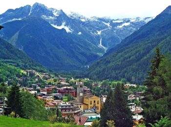
![Trail On foot Ponte di Legno - Muràcc - Photo](https://media.geolcdn.com/t/350/260/5999e8a1-4604-48b9-8158-4812de5e0db8.jpeg&format=jpg&maxdim=2)
![On foot On foot](https://static1.geolcdn.com/sitytour/trail-icons/100.png)
Km
On foot
![](/images/other/stat-length.png)
![](https://static1.geolcdn.com/siteimages/upload/files/1508320355ic_sort_den_pos_24dp.png)
![](https://static1.geolcdn.com/siteimages/upload/files/1508320355ic_sort_den_neg_24dp.png)
![](https://static1.geolcdn.com/siteimages/upload/files/16400158638029165_repeat_loop_refresh_sync_direction_icon.png)
• Symbol: horizontal light blue upper bar and white lower
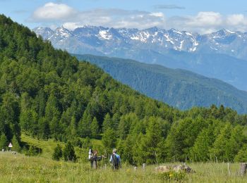
![Trail On foot Monno - Sentiero Brigata Fiamme Verdi Antonio Schivardi - Luigi Tosetti - Photo](https://media.geolcdn.com/t/350/260/89589908-54de-4ed7-9c59-b2b43d399f07.jpeg&format=jpg&maxdim=2)
![On foot On foot](https://static1.geolcdn.com/sitytour/trail-icons/100.png)
Km
On foot
![](/images/other/stat-length.png)
![](https://static1.geolcdn.com/siteimages/upload/files/1508320355ic_sort_den_pos_24dp.png)
![](https://static1.geolcdn.com/siteimages/upload/files/1508320355ic_sort_den_neg_24dp.png)
![](https://static1.geolcdn.com/siteimages/upload/files/16400158638029165_repeat_loop_refresh_sync_direction_icon.png)
• Trail created by Gruppo Operativo Volontario Sentieri della Resistenza Bresciana. Symbol: 23 on green white red flag
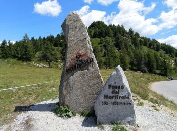
![Trail On foot Monno - Moiàc - Photo](https://media.geolcdn.com/t/350/260/c4620166-1825-43f8-b0d5-c34992d0bcee.jpeg&format=jpg&maxdim=2)
![On foot On foot](https://static1.geolcdn.com/sitytour/trail-icons/100.png)
Km
On foot
![](/images/other/stat-length.png)
![](https://static1.geolcdn.com/siteimages/upload/files/1508320355ic_sort_den_pos_24dp.png)
![](https://static1.geolcdn.com/siteimages/upload/files/1508320355ic_sort_den_neg_24dp.png)
![](https://static1.geolcdn.com/siteimages/upload/files/16400158638029165_repeat_loop_refresh_sync_direction_icon.png)
• Symbol: unmarked
![Trail On foot Caino - Caino (Villa Sera) - Santuario di Conche - Colle di Sant'Eusebio - Photo](https://media.geolcdn.com/t/350/260/4b0740ff-5686-42ae-a7d5-9b597447c366.jpeg&format=jpg&maxdim=2)
![On foot On foot](https://static1.geolcdn.com/sitytour/trail-icons/100.png)
Km
On foot
![](/images/other/stat-length.png)
![](https://static1.geolcdn.com/siteimages/upload/files/1508320355ic_sort_den_pos_24dp.png)
![](https://static1.geolcdn.com/siteimages/upload/files/1508320355ic_sort_den_neg_24dp.png)
![](https://static1.geolcdn.com/siteimages/upload/files/16400158638029165_repeat_loop_refresh_sync_direction_icon.png)
• Trail created by Gruppo Escursionisti Caino. Symbol: 381 on white red flag
![Trail On foot Lumezzane - Via del Sacro - Percorso principale - Photo](https://media.geolcdn.com/t/350/260/ee7a6f42-fb6b-4c8e-8663-19cf2f9fcc71.jpeg&format=jpg&maxdim=2)
![On foot On foot](https://static1.geolcdn.com/sitytour/trail-icons/100.png)
Km
On foot
![](/images/other/stat-length.png)
![](https://static1.geolcdn.com/siteimages/upload/files/1508320355ic_sort_den_pos_24dp.png)
![](https://static1.geolcdn.com/siteimages/upload/files/1508320355ic_sort_den_neg_24dp.png)
![](https://static1.geolcdn.com/siteimages/upload/files/16400158638029165_repeat_loop_refresh_sync_direction_icon.png)
• Trail created by Club Alpino Italiano - Sezione di Lumezzane. Symbol: unmarked Website: http://www.cailumezzane.it...
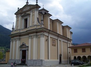
![Trail On foot Borno - Sentiero delle pietre e degli Dei - Photo](https://media.geolcdn.com/t/350/260/3faf213d-3b46-4728-b8d4-0365a279735a.jpeg&format=jpg&maxdim=2)
![On foot On foot](https://static1.geolcdn.com/sitytour/trail-icons/100.png)
Km
On foot
![](/images/other/stat-length.png)
![](https://static1.geolcdn.com/siteimages/upload/files/1508320355ic_sort_den_pos_24dp.png)
![](https://static1.geolcdn.com/siteimages/upload/files/1508320355ic_sort_den_neg_24dp.png)
![](https://static1.geolcdn.com/siteimages/upload/files/16400158638029165_repeat_loop_refresh_sync_direction_icon.png)
• Descrizione del percorso: Da Piazza Giovanni Paolo II percorrere via Vittorio Emanuele e imboccare viale Marconi. Olt...
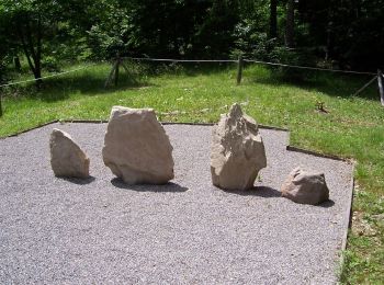
![Trail On foot Borno - Trekking dell'Altopiano del Sole - Photo](https://media.geolcdn.com/t/350/260/726c06fc-babe-4740-aace-a8f70bd7bade.jpeg&format=jpg&maxdim=2)
![On foot On foot](https://static1.geolcdn.com/sitytour/trail-icons/100.png)
Km
On foot
![](/images/other/stat-length.png)
![](https://static1.geolcdn.com/siteimages/upload/files/1508320355ic_sort_den_pos_24dp.png)
![](https://static1.geolcdn.com/siteimages/upload/files/1508320355ic_sort_den_neg_24dp.png)
![](https://static1.geolcdn.com/siteimages/upload/files/16400158638029165_repeat_loop_refresh_sync_direction_icon.png)
• Trail created by GAL Val di Scalve Vallecamonica. Symbol: unmarked
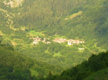
![Trail On foot Lozio - Trekking tra malghe e menhir anello 7: Dosso della Sella - Malga Rò - Photo](https://media.geolcdn.com/t/350/260/147aa4f6-49a6-42db-91cc-527fd88592c9.jpeg&format=jpg&maxdim=2)
![On foot On foot](https://static1.geolcdn.com/sitytour/trail-icons/100.png)
Km
On foot
![](/images/other/stat-length.png)
![](https://static1.geolcdn.com/siteimages/upload/files/1508320355ic_sort_den_pos_24dp.png)
![](https://static1.geolcdn.com/siteimages/upload/files/1508320355ic_sort_den_neg_24dp.png)
![](https://static1.geolcdn.com/siteimages/upload/files/16400158638029165_repeat_loop_refresh_sync_direction_icon.png)
• Trail created by Consorzio Forestale Pizzo Camino. Symbol: unmarked
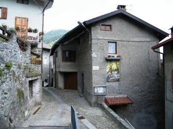
![Trail On foot Lozio - Brigata Fiamme Verdi Giacomo Cappellini - Photo](https://media.geolcdn.com/t/350/260/bc709bbb-34b3-4f38-abd5-16d0218cfdbd.jpeg&format=jpg&maxdim=2)
![On foot On foot](https://static1.geolcdn.com/sitytour/trail-icons/100.png)
Km
On foot
![](/images/other/stat-length.png)
![](https://static1.geolcdn.com/siteimages/upload/files/1508320355ic_sort_den_pos_24dp.png)
![](https://static1.geolcdn.com/siteimages/upload/files/1508320355ic_sort_den_neg_24dp.png)
![](https://static1.geolcdn.com/siteimages/upload/files/16400158638029165_repeat_loop_refresh_sync_direction_icon.png)
• Trail created by Gruppo Operativo Volontario Sentieri della Resistenza Bresciana. DA COMPLETARE Symbol: 20 on green...
![Trail On foot Borno - Trekking tra malghe e menhir anello 8: Trekking menhir e incisioni rupestri - Photo](https://media.geolcdn.com/t/350/260/3faf213d-3b46-4728-b8d4-0365a279735a.jpeg&format=jpg&maxdim=2)
![On foot On foot](https://static1.geolcdn.com/sitytour/trail-icons/100.png)
Km
On foot
![](/images/other/stat-length.png)
![](https://static1.geolcdn.com/siteimages/upload/files/1508320355ic_sort_den_pos_24dp.png)
![](https://static1.geolcdn.com/siteimages/upload/files/1508320355ic_sort_den_neg_24dp.png)
![](https://static1.geolcdn.com/siteimages/upload/files/16400158638029165_repeat_loop_refresh_sync_direction_icon.png)
• Trail created by Consorzio Forestale Pizzo Camino. Symbol: unmarked
20 trails displayed on 487
FREE GPS app for hiking
Activities
Nearby regions
- Agnosine
- Anfo
- Angolo Terme
- Artogne
- Bagolino
- Berzo Demo
- Berzo Inferiore
- Bienno
- Borno
- Botticino
- Bovegno
- Bovezzo
- Braone
- Breno
- Brescia
- Brione
- Caino
- Capovalle
- Capriolo
- Casto
- Cerveno
- Cevo
- Cimbergo
- Collebeato
- Collio
- Concesio
- Corteno Golgi
- Darfo Boario Terme
- Desenzano del Garda
- Edolo
- Esine
- Gardone Riviera
- Gardone Val Trompia
- Gargnano
- Gavardo
- Gianico
- Gussago
- Idro
- Incudine
- Irma
- Iseo
- Lavenone
- Limone sul Garda
- Lonato del Garda
- Losine
- Lozio
- Lumezzane
- Magasa
- Malonno
- Manerba del Garda
- Marcheno
- Marmentino
- Marone
- Moniga del Garda
- Monno
- Monte Isola
- Monticelli Brusati
- Nave
- Odolo
- Ome
- Ono San Pietro
- Orzinuovi
- Paisco Loveno
- Paspardo
- Pertica Alta
- Pertica Bassa
- Pezzaze
- Pisogne
- Polaveno
- Ponte di Legno
- Pozzolengo
- Preseglie
- Provaglio Val Sabbia
- Provaglio d'Iseo
- Puegnago del Garda
- Rezzato
- Rodengo Saiano
- Roè Volciano
- Sabbio Chiese
- Sale Marasino
- Salò
- San Felice del Benaco
- Sarezzo
- Saviore dell'Adamello
- Serle
- Sirmione
- Sonico
- Sulzano
- Tavernole sul Mella
- Temù
- Tignale
- Toscolano Maderno
- Tremosine sul Garda
- Treviso Bresciano
- Vallio Terme
- Valvestino
- Vestone
- Vezza d'Oglio
- Villa Carcina
- Villanuova sul Clisi
- Vione
- Vobarno
- Zone