![](/images/other/stat-length.png)
Rezzato, Brescia: Best trails, routes and walks
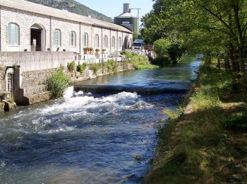
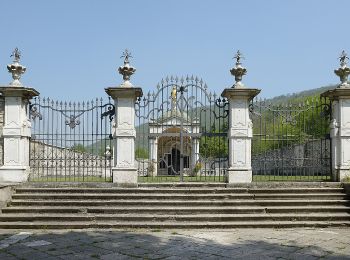
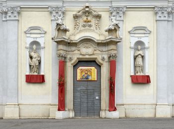
Rezzato: Discover the best trails: 6 hiking trails. All these trails, routes and outdoor activities are available in our SityTrail applications for smartphones and tablets.
The best trails (6)
![Trail On foot Rezzato - Sentiero del Carso Bresciano - Photo](https://media.geolcdn.com/t/350/260/848a7eff-f106-4532-8259-a6add4494fca.jpeg&format=jpg&maxdim=2)
![On foot On foot](https://static1.geolcdn.com/sitytour/trail-icons/100.png)
Km
On foot
![](/images/other/stat-length.png)
![](https://static1.geolcdn.com/siteimages/upload/files/1508320355ic_sort_den_pos_24dp.png)
![](https://static1.geolcdn.com/siteimages/upload/files/1508320355ic_sort_den_neg_24dp.png)
![](https://static1.geolcdn.com/siteimages/upload/files/16400158638029165_repeat_loop_refresh_sync_direction_icon.png)
• Symbol: 530 on white red flag
![Trail On foot Rezzato - Sentiero della Valle di Virle - Photo](https://media.geolcdn.com/t/350/260/66b825ed-1989-4055-ab0e-da9716a36cda.jpeg&format=jpg&maxdim=2)
![On foot On foot](https://static1.geolcdn.com/sitytour/trail-icons/100.png)
Km
On foot
![](/images/other/stat-length.png)
![](https://static1.geolcdn.com/siteimages/upload/files/1508320355ic_sort_den_pos_24dp.png)
![](https://static1.geolcdn.com/siteimages/upload/files/1508320355ic_sort_den_neg_24dp.png)
![](https://static1.geolcdn.com/siteimages/upload/files/16400158638029165_repeat_loop_refresh_sync_direction_icon.png)
• Trail created by Gruppo Ecologico di Virle. Symbol: 932 on white red flag
![Trail On foot Rezzato - Sentiero dei fiori - Photo](https://media.geolcdn.com/t/350/260/1b85821e-3789-4594-ad9a-484eeae6a04c.jpeg&format=jpg&maxdim=2)
![On foot On foot](https://static1.geolcdn.com/sitytour/trail-icons/100.png)
Km
On foot
![](/images/other/stat-length.png)
![](https://static1.geolcdn.com/siteimages/upload/files/1508320355ic_sort_den_pos_24dp.png)
![](https://static1.geolcdn.com/siteimages/upload/files/1508320355ic_sort_den_neg_24dp.png)
![](https://static1.geolcdn.com/siteimages/upload/files/16400158638029165_repeat_loop_refresh_sync_direction_icon.png)
• Trail created by Gruppo Anti Incendio Boschivo Monte Regogna. Symbol: 934 on white red flag
![Trail On foot Rezzato - Sentiero della storia - Photo](https://media.geolcdn.com/t/350/260/65776d5f-c676-4406-a62f-6bb4a03445d8.jpeg&format=jpg&maxdim=2)
![On foot On foot](https://static1.geolcdn.com/sitytour/trail-icons/100.png)
Km
On foot
![](/images/other/stat-length.png)
![](https://static1.geolcdn.com/siteimages/upload/files/1508320355ic_sort_den_pos_24dp.png)
![](https://static1.geolcdn.com/siteimages/upload/files/1508320355ic_sort_den_neg_24dp.png)
![](https://static1.geolcdn.com/siteimages/upload/files/16400158638029165_repeat_loop_refresh_sync_direction_icon.png)
• Trail created by Gruppo Alpini di Rezzato. Symbol: 933 on white red flag
![Trail On foot Rezzato - Sentiero della Rasa - Photo](https://media.geolcdn.com/t/350/260/c41ac1de-0290-4005-83d6-c128b47696b8.jpeg&format=jpg&maxdim=2)
![On foot On foot](https://static1.geolcdn.com/sitytour/trail-icons/100.png)
Km
On foot
![](/images/other/stat-length.png)
![](https://static1.geolcdn.com/siteimages/upload/files/1508320355ic_sort_den_pos_24dp.png)
![](https://static1.geolcdn.com/siteimages/upload/files/1508320355ic_sort_den_neg_24dp.png)
![](https://static1.geolcdn.com/siteimages/upload/files/16400158638029165_repeat_loop_refresh_sync_direction_icon.png)
• Trail created by Movimento Adulti Scout Cattolici Italiani di Rezzato. Symbol: 931 on white red flag
![Trail On foot Rezzato - Sentiero principale Valverde - Photo](https://media.geolcdn.com/t/350/260/1ff45c06-29b9-4795-ae05-570c20e9842c.jpeg&format=jpg&maxdim=2)
![On foot On foot](https://static1.geolcdn.com/sitytour/trail-icons/100.png)
Km
On foot
![](/images/other/stat-length.png)
![](https://static1.geolcdn.com/siteimages/upload/files/1508320355ic_sort_den_pos_24dp.png)
![](https://static1.geolcdn.com/siteimages/upload/files/1508320355ic_sort_den_neg_24dp.png)
![](https://static1.geolcdn.com/siteimages/upload/files/16400158638029165_repeat_loop_refresh_sync_direction_icon.png)
• Trail created by Comune di Botticino. Symbol: yellow-red horizontal bars
6 trails displayed on 6
FREE GPS app for hiking