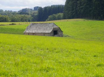
![](/images/other/stat-length.png)
Aveyron, Occitania, On foot: Best trails, routes and walks
Aveyron: Discover the best trails: 240 on foot, 2158 walking, 86 nordic walking, 101 running and 31 trail. All these trails, routes and outdoor activities are available in our SityTrail applications for smartphones and tablets.
The best trails (2609)
![Trail Walking La Couvertoirade - autour de la Couvertoirade - Photo](https://media.geolcdn.com/t/350/260/db94c7b2-96b3-48b8-be29-9666f969dfb2.jpg&format=jpg&maxdim=2)
![Walking Walking](https://static1.geolcdn.com/sitytour/trail-icons/101.png)
Km
Walking
![](/images/other/stat-length.png)
![](https://static1.geolcdn.com/siteimages/upload/files/1508320355ic_sort_den_pos_24dp.png)
![](https://static1.geolcdn.com/siteimages/upload/files/1508320355ic_sort_den_neg_24dp.png)
![](https://static1.geolcdn.com/siteimages/upload/files/16400158638029165_repeat_loop_refresh_sync_direction_icon.png)
![Trail Walking Conques-en-Rouergue - Les Pelies La Vinzelle : boucle rapide - Photo](https://media.geolcdn.com/t/350/260/ext.jpg?maxdim=2&url=https%3A%2F%2Fservices.sitytrail.com%2FGeolivesWS%2FDownloadMedia.ashx%3FTrailID%3D815525%26Media%3D20170822112933.jpg)
![Walking Walking](https://static1.geolcdn.com/sitytour/trail-icons/101.png)
Km
Walking
![](/images/other/stat-length.png)
![](https://static1.geolcdn.com/siteimages/upload/files/1508320355ic_sort_den_pos_24dp.png)
![](https://static1.geolcdn.com/siteimages/upload/files/1508320355ic_sort_den_neg_24dp.png)
![](https://static1.geolcdn.com/siteimages/upload/files/16400158638029165_repeat_loop_refresh_sync_direction_icon.png)
• On part du manoir des Pelies , chambre d hôtes et on monte rapidement sur la gauche à travers des prairies a moutons ...
![Trail Walking Entraygues-sur-Truyère - Entraygues-sur-Truyère PR 10 - Photo](https://media.geolcdn.com/t/350/260/ext.jpg?maxdim=2&url=https%3A%2F%2Fservices.sitytrail.com%2FGeolivesWS%2FDownloadMedia.ashx%3FTrailID%3D787240%26Media%3Dfix__20170710144026.jpg)
![Walking Walking](https://static1.geolcdn.com/sitytour/trail-icons/101.png)
Km
Walking
![](/images/other/stat-length.png)
![](https://static1.geolcdn.com/siteimages/upload/files/1508320355ic_sort_den_pos_24dp.png)
![](https://static1.geolcdn.com/siteimages/upload/files/1508320355ic_sort_den_neg_24dp.png)
![](https://static1.geolcdn.com/siteimages/upload/files/16400158638029165_repeat_loop_refresh_sync_direction_icon.png)
• Très belle rando ,petit sentier, beaucoup de panorama. L' arrivé se fait sur 2 km de route ,dommage.
![Trail Walking Mostuéjouls - Cirque de Saint Marcellin - Mostuéjouls - Liaucous - Photo](https://media.geolcdn.com/t/350/260/ext.jpg?maxdim=2&url=https%3A%2F%2Fservices.sitytrail.com%2FGeolivesWS%2FDownloadMedia.ashx%3FTrailID%3D173134%26Media%3D14690_6.jpg)
![Walking Walking](https://static1.geolcdn.com/sitytour/trail-icons/101.png)
Km
Walking
![](/images/other/stat-length.png)
![](https://static1.geolcdn.com/siteimages/upload/files/1508320355ic_sort_den_pos_24dp.png)
![](https://static1.geolcdn.com/siteimages/upload/files/1508320355ic_sort_den_neg_24dp.png)
![](https://static1.geolcdn.com/siteimages/upload/files/16400158638029165_repeat_loop_refresh_sync_direction_icon.png)
![Trail Walking Viala-du-Pas-de-Jaux - Du Viala du Pas de Jaux à Saint Paul des Fonts - Photo](https://media.geolcdn.com/t/350/260/ext.jpg?maxdim=2&url=https%3A%2F%2Fservices.sitytrail.com%2FGeolivesWS%2FDownloadMedia.ashx%3FTrailID%3D172524%26Media%3D13883_5.jpg)
![Walking Walking](https://static1.geolcdn.com/sitytour/trail-icons/101.png)
Km
Walking
![](/images/other/stat-length.png)
![](https://static1.geolcdn.com/siteimages/upload/files/1508320355ic_sort_den_pos_24dp.png)
![](https://static1.geolcdn.com/siteimages/upload/files/1508320355ic_sort_den_neg_24dp.png)
![](https://static1.geolcdn.com/siteimages/upload/files/16400158638029165_repeat_loop_refresh_sync_direction_icon.png)
![Trail Walking Millau - les cades - Photo](https://media.geolcdn.com/t/350/260/ext.jpg?maxdim=2&url=https%3A%2F%2Fservices.sitytrail.com%2FGeolivesWS%2FDownloadMedia.ashx%3FTrailID%3D171967%26Media%3D20130128160604.jpg)
![Walking Walking](https://static1.geolcdn.com/sitytour/trail-icons/101.png)
Km
Walking
![](/images/other/stat-length.png)
![](https://static1.geolcdn.com/siteimages/upload/files/1508320355ic_sort_den_pos_24dp.png)
![](https://static1.geolcdn.com/siteimages/upload/files/1508320355ic_sort_den_neg_24dp.png)
![](https://static1.geolcdn.com/siteimages/upload/files/16400158638029165_repeat_loop_refresh_sync_direction_icon.png)
• Rando tres facile
![Trail Walking Brousse-le-Château - Brousse Le Chateau et les alentours - Photo](https://media.geolcdn.com/t/350/260/ext.jpg?maxdim=2&url=https%3A%2F%2Fservices.sitytrail.com%2FGeolivesWS%2FDownloadMedia.ashx%3FTrailID%3D136506%26Media%3D20120630200246.jpg)
![Walking Walking](https://static1.geolcdn.com/sitytour/trail-icons/101.png)
Km
Walking
![](/images/other/stat-length.png)
![](https://static1.geolcdn.com/siteimages/upload/files/1508320355ic_sort_den_pos_24dp.png)
![](https://static1.geolcdn.com/siteimages/upload/files/1508320355ic_sort_den_neg_24dp.png)
![](https://static1.geolcdn.com/siteimages/upload/files/16400158638029165_repeat_loop_refresh_sync_direction_icon.png)
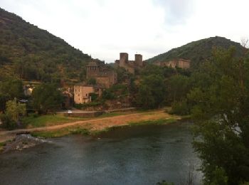
• Le départ de la randonnée s’effectue depuis le parking de Brousse le Château, l’un des plus beau village de France. P...
![Trail Walking Najac - Boucle le long de l'Aveyron - Najac nord - Photo](https://media.geolcdn.com/t/350/260/ext.jpg?maxdim=2&url=https%3A%2F%2Fservices.sitytrail.com%2FGeolivesWS%2FDownloadMedia.ashx%3FTrailID%3D129870%26Media%3D13435_3.jpg)
![Walking Walking](https://static1.geolcdn.com/sitytour/trail-icons/101.png)
Km
Walking
![](/images/other/stat-length.png)
![](https://static1.geolcdn.com/siteimages/upload/files/1508320355ic_sort_den_pos_24dp.png)
![](https://static1.geolcdn.com/siteimages/upload/files/1508320355ic_sort_den_neg_24dp.png)
![](https://static1.geolcdn.com/siteimages/upload/files/16400158638029165_repeat_loop_refresh_sync_direction_icon.png)
![Trail Walking Vimenet - Les crêtes de Vimenet - Photo](https://media.geolcdn.com/t/350/260/ext.jpg?maxdim=2&url=https%3A%2F%2Fservices.sitytrail.com%2FGeolivesWS%2FDownloadMedia.ashx%3FTrailID%3D118835%26Media%3D13052_4.jpg)
![Walking Walking](https://static1.geolcdn.com/sitytour/trail-icons/101.png)
Km
Walking
![](/images/other/stat-length.png)
![](https://static1.geolcdn.com/siteimages/upload/files/1508320355ic_sort_den_pos_24dp.png)
![](https://static1.geolcdn.com/siteimages/upload/files/1508320355ic_sort_den_neg_24dp.png)
![](https://static1.geolcdn.com/siteimages/upload/files/16400158638029165_repeat_loop_refresh_sync_direction_icon.png)
![Trail Walking Conques-en-Rouergue - La Vinzelle - Grand Vabre - Photo](https://media.geolcdn.com/t/350/260/ext.jpg?maxdim=2&url=https%3A%2F%2Fservices.sitytrail.com%2FGeolivesWS%2FDownloadMedia.ashx%3FTrailID%3D107259%26Media%3D12139_6.jpg)
![Walking Walking](https://static1.geolcdn.com/sitytour/trail-icons/101.png)
Km
Walking
![](/images/other/stat-length.png)
![](https://static1.geolcdn.com/siteimages/upload/files/1508320355ic_sort_den_pos_24dp.png)
![](https://static1.geolcdn.com/siteimages/upload/files/1508320355ic_sort_den_neg_24dp.png)
![](https://static1.geolcdn.com/siteimages/upload/files/16400158638029165_repeat_loop_refresh_sync_direction_icon.png)
![Trail Walking Salles-la-Source - Salles la Source - Pont les Bains - Photo](https://media.geolcdn.com/t/350/260/ext.jpg?maxdim=2&url=https%3A%2F%2Fservices.sitytrail.com%2FGeolivesWS%2FDownloadMedia.ashx%3FTrailID%3D106455%26Media%3D10967_6.jpg)
![Walking Walking](https://static1.geolcdn.com/sitytour/trail-icons/101.png)
Km
Walking
![](/images/other/stat-length.png)
![](https://static1.geolcdn.com/siteimages/upload/files/1508320355ic_sort_den_pos_24dp.png)
![](https://static1.geolcdn.com/siteimages/upload/files/1508320355ic_sort_den_neg_24dp.png)
![](https://static1.geolcdn.com/siteimages/upload/files/16400158638029165_repeat_loop_refresh_sync_direction_icon.png)
![Trail Walking Millau - Randonnée autour du Viaduc de Millau - Photo](https://media.geolcdn.com/t/350/260/ext.jpg?maxdim=2&url=https%3A%2F%2Fservices.sitytrail.com%2FGeolivesWS%2FDownloadMedia.ashx%3FTrailID%3D103144%26Media%3D4952_6.jpg)
![Walking Walking](https://static1.geolcdn.com/sitytour/trail-icons/101.png)
Km
Walking
![](/images/other/stat-length.png)
![](https://static1.geolcdn.com/siteimages/upload/files/1508320355ic_sort_den_pos_24dp.png)
![](https://static1.geolcdn.com/siteimages/upload/files/1508320355ic_sort_den_neg_24dp.png)
![](https://static1.geolcdn.com/siteimages/upload/files/16400158638029165_repeat_loop_refresh_sync_direction_icon.png)
![Trail Walking Campuac - campuac - Photo](https://media.geolcdn.com/t/350/260/ext.jpg?maxdim=2&url=https%3A%2F%2Fservices.sitytrail.com%2FGeolivesWS%2FDownloadMedia.ashx%3FTrailID%3D940683%26Media%3Dfix__20180410163131.jpg)
![Walking Walking](https://static1.geolcdn.com/sitytour/trail-icons/101.png)
Km
Walking
![](/images/other/stat-length.png)
![](https://static1.geolcdn.com/siteimages/upload/files/1508320355ic_sort_den_pos_24dp.png)
![](https://static1.geolcdn.com/siteimages/upload/files/1508320355ic_sort_den_neg_24dp.png)
![](https://static1.geolcdn.com/siteimages/upload/files/16400158638029165_repeat_loop_refresh_sync_direction_icon.png)
![Trail Walking Espalion - Compostelle 08 - Espalion -> Estaing - Photo](https://media.geolcdn.com/t/350/260/ext.jpg?maxdim=2&url=https%3A%2F%2Fservices.sitytrail.com%2FGeolivesWS%2FDownloadMedia.ashx%3FTrailID%3D442134%26Media%3D20120624142259.jpg)
![Walking Walking](https://static1.geolcdn.com/sitytour/trail-icons/101.png)
Km
Walking
![](/images/other/stat-length.png)
![](https://static1.geolcdn.com/siteimages/upload/files/1508320355ic_sort_den_pos_24dp.png)
![](https://static1.geolcdn.com/siteimages/upload/files/1508320355ic_sort_den_neg_24dp.png)
![](https://static1.geolcdn.com/siteimages/upload/files/16400158638029165_repeat_loop_refresh_sync_direction_icon.png)
• Chemin de St Jacques de Compostelle Espalion -> Estaing
![Trail Walking Valzergues - pr1 valzergues - Photo](https://media.geolcdn.com/t/350/260/ext.jpg?maxdim=2&url=https%3A%2F%2Fservices.sitytrail.com%2FGeolivesWS%2FDownloadMedia.ashx%3FTrailID%3D162321%26Media%3D20121111160109.jpg)
![Walking Walking](https://static1.geolcdn.com/sitytour/trail-icons/101.png)
Km
Walking
![](/images/other/stat-length.png)
![](https://static1.geolcdn.com/siteimages/upload/files/1508320355ic_sort_den_pos_24dp.png)
![](https://static1.geolcdn.com/siteimages/upload/files/1508320355ic_sort_den_neg_24dp.png)
![](https://static1.geolcdn.com/siteimages/upload/files/16400158638029165_repeat_loop_refresh_sync_direction_icon.png)
•
![Trail Walking Livinhac-le-Haut - Livinhac le Haut - Figeac - Chemin de St-Jacques de Compostelle - Photo](https://media.geolcdn.com/t/350/260/ext.jpg?maxdim=2&url=https%3A%2F%2Fservices.sitytrail.com%2FGeolivesWS%2FDownloadMedia.ashx%3FTrailID%3D108748%26Media%3D1843_2.jpg)
![Walking Walking](https://static1.geolcdn.com/sitytour/trail-icons/101.png)
Km
Walking
![](/images/other/stat-length.png)
![](https://static1.geolcdn.com/siteimages/upload/files/1508320355ic_sort_den_pos_24dp.png)
![](https://static1.geolcdn.com/siteimages/upload/files/1508320355ic_sort_den_neg_24dp.png)
![](https://static1.geolcdn.com/siteimages/upload/files/16400158638029165_repeat_loop_refresh_sync_direction_icon.png)
![Trail Walking Conques-en-Rouergue - Noailhac - Livinhac le Haut - Chemin de St-Jacques de Compostelle - Photo](https://media.geolcdn.com/t/350/260/ext.jpg?maxdim=2&url=https%3A%2F%2Fservices.sitytrail.com%2FGeolivesWS%2FDownloadMedia.ashx%3FTrailID%3D108747%26Media%3D1842_2.jpg)
![Walking Walking](https://static1.geolcdn.com/sitytour/trail-icons/101.png)
Km
Walking
![](/images/other/stat-length.png)
![](https://static1.geolcdn.com/siteimages/upload/files/1508320355ic_sort_den_pos_24dp.png)
![](https://static1.geolcdn.com/siteimages/upload/files/1508320355ic_sort_den_neg_24dp.png)
![](https://static1.geolcdn.com/siteimages/upload/files/16400158638029165_repeat_loop_refresh_sync_direction_icon.png)
![Trail Walking Estaing - Estaing - Espeyrac - Chemin de St-Jacques de Compostelle - Photo](https://media.geolcdn.com/t/350/260/ext.jpg?maxdim=2&url=https%3A%2F%2Fservices.sitytrail.com%2FGeolivesWS%2FDownloadMedia.ashx%3FTrailID%3D108745%26Media%3D1840_1.jpg)
![Walking Walking](https://static1.geolcdn.com/sitytour/trail-icons/101.png)
Km
Walking
![](/images/other/stat-length.png)
![](https://static1.geolcdn.com/siteimages/upload/files/1508320355ic_sort_den_pos_24dp.png)
![](https://static1.geolcdn.com/siteimages/upload/files/1508320355ic_sort_den_neg_24dp.png)
![](https://static1.geolcdn.com/siteimages/upload/files/16400158638029165_repeat_loop_refresh_sync_direction_icon.png)
![Trail Walking Saint-Chély-d'Aubrac - Aubrac - St Côme d'Olt - Chemin de St-Jacques de Compostelle - Photo](https://media.geolcdn.com/t/350/260/ext.jpg?maxdim=2&url=https%3A%2F%2Fservices.sitytrail.com%2FGeolivesWS%2FDownloadMedia.ashx%3FTrailID%3D108743%26Media%3D1838_2.jpg)
![Walking Walking](https://static1.geolcdn.com/sitytour/trail-icons/101.png)
Km
Walking
![](/images/other/stat-length.png)
![](https://static1.geolcdn.com/siteimages/upload/files/1508320355ic_sort_den_pos_24dp.png)
![](https://static1.geolcdn.com/siteimages/upload/files/1508320355ic_sort_den_neg_24dp.png)
![](https://static1.geolcdn.com/siteimages/upload/files/16400158638029165_repeat_loop_refresh_sync_direction_icon.png)
20 trails displayed on 2609
FREE GPS app for hiking
Activities
Nearby regions
- Agen-d'Aveyron
- Aguessac
- Almont-les-Junies
- Alrance
- Ambeyrac
- Anglars-Saint-Félix
- Argences en Aubrac
- Arnac-sur-Dourdou
- Arvieu
- Asprières
- Aubin
- Auriac-Lagast
- Auzits
- Ayssènes
- Balaguier-d'Olt
- Balaguier-sur-Rance
- Baraqueville
- Belcastel
- Belmont-sur-Rance
- Bertholène
- Bessuéjouls
- Boisse-Penchot
- Bor-et-Bar
- Bouillac
- Bournazel
- Boussac
- Bozouls
- Brandonnet
- Brasc
- Brommat
- Broquiès
- Brousse-le-Château
- Brusque
- Cabanès
- Calmels-et-le-Viala
- Calmont
- Camarès
- Camboulazet
- Camjac
- Campagnac
- Campouriez
- Campuac
- Canet-de-Salars
- Cantoin
- Capdenac-Gare
- Cassagnes-Bégonhès
- Cassuéjouls
- Castanet
- Castelmary
- Castelnau-Pégayrols
- Castelnau-de-Mandailles
- Causse-et-Diège
- Centrès
- Clairvaux-d'Aveyron
- Colombiès
- Combret
- Compeyre
- Compolibat
- Comprégnac
- Comps-la-Grand-Ville
- Condom-d'Aubrac
- Connac
- Conques-en-Rouergue
- Cornus
- Coubisou
- Coupiac
- Cransac
- Creissels
- Crespin
- Curan
- Curières
- Decazeville
- Druelle Balsac
- Durenque
- Entraygues-sur-Truyère
- Escandolières
- Espalion
- Espeyrac
- Estaing
- Fayet
- Firmi
- Flagnac
- Flavin
- Florentin-la-Capelle
- Foissac
- Fondamente
- Gabriac
- Gaillac-d'Aveyron
- Gissac
- Golinhac
- Goutrens
- Gramond
- Huparlac
- L'Hospitalet-du-Larzac
- La Bastide-Pradines
- La Bastide-Solages
- La Capelle-Balaguier
- La Capelle-Bleys
- La Capelle-Bonance
- La Cavalerie
- La Couvertoirade
- La Cresse
- La Fouillade
- La Loubière
- La Roque-Sainte-Marguerite
- La Rouquette
- La Salvetat-Peyralès
- La Selve
- La Serre
- Lacroix-Barrez
- Laguiole
- Laissac-Sévérac l'Église
- Lanuéjouls
- Lapanouse-de-Cernon
- Lassouts
- Laval-Roquecezière
- Le Bas Ségala
- Le Cayrol
- Le Clapier
- Le Fel
- Le Monastère
- Le Nayrac
- Le Truel
- Le Vibal
- Lédergues
- Les Albres
- Les Costes-Gozon
- Lescure-Jaoul
- Lestrade-et-Thouels
- Livinhac-le-Haut
- Luc-la-Primaube
- Lunac
- Maleville
- Manhac
- Marcillac-Vallon
- Marnhagues-et-Latour
- Martiel
- Martrin
- Mayran
- Mélagues
- Meljac
- Millau
- Montagnol
- Montbazens
- Montclar
- Monteils
- Montézic
- Montfranc
- Montjaux
- Montlaur
- Montpeyroux
- Montrozier
- Montsalès
- Morlhon-le-Haut
- Mostuéjouls
- Mounes-Prohencoux
- Mouret
- Moyrazès
- Mur-de-Barrez
- Murasson
- Muret-le-Château
- Murols
- Najac
- Nant
- Naucelle
- Naussac
- Nauviale
- Olemps
- Ols-et-Rinhodes
- Onet-le-Château
- Palmas d'Aveyron
- Paulhe
- Peux-et-Couffouleux
- Peyreleau
- Peyrusse-le-Roc
- Pierrefiche
- Plaisance
- Pomayrols
- Pont-de-Salars
- Pousthomy
- Prades-Salars
- Prades-d'Aubrac
- Pradinas
- Prévinquières
- Privezac
- Pruines
- Quins
- Rebourguil
- Réquista
- Rieupeyroux
- Rignac
- Rivière-sur-Tarn
- Rodelle
- Rodez
- Roquefort-sur-Soulzon
- Roussennac
- Rullac-Saint-Cirq
- Saint Geniez d'Olt et d'Aubrac
- Saint-Affrique
- Saint-Amans-des-Cots
- Saint-André-de-Najac
- Saint-André-de-Vézines
- Saint-Beaulize
- Saint-Beauzély
- Saint-Chély-d'Aubrac
- Saint-Christophe-Vallon
- Saint-Côme-d'Olt
- Saint-Félix-de-Lunel
- Saint-Félix-de-Sorgues
- Saint-Georges-de-Luzençon
- Saint-Hippolyte
- Saint-Izaire
- Saint-Jean-Delnous
- Saint-Jean-d'Alcapiès
- Saint-Jean-du-Bruel
- Saint-Jean-et-Saint-Paul
- Saint-Juéry
- Saint-Just-sur-Viaur
- Saint-Laurent-d'Olt
- Saint-Laurent-de-Lévézou
- Saint-Léons
- Saint-Martin-de-Lenne
- Saint-Parthem
- Saint-Rémy
- Saint-Rome-de-Cernon
- Saint-Rome-de-Tarn
- Saint-Santin
- Saint-Saturnin-de-Lenne
- Saint-Sernin-sur-Rance
- Saint-Sever-du-Moustier
- Saint-Symphorien-de-Thénières
- Saint-Victor-et-Melvieu
- Sainte-Croix
- Sainte-Eulalie-d'Olt
- Sainte-Eulalie-de-Cernon
- Sainte-Juliette-sur-Viaur
- Sainte-Radegonde
- Salles-Courbatiès
- Salles-Curan
- Salles-la-Source
- Salmiech
- Salvagnac-Cajarc
- Sanvensa
- Sauclières
- Saujac
- Sauveterre-de-Rouergue
- Savignac
- Sébazac-Concourès
- Sébrazac
- Ségur
- Sénergues
- Sévérac d'Aveyron
- Sonnac
- Soulages-Bonneval
- Sylvanès
- Tauriac-de-Camarès
- Tauriac-de-Naucelle
- Taussac
- Tayrac
- Thérondels
- Toulonjac
- Tournemire
- Trémouilles
- Vabres-l'Abbaye
- Vailhourles
- Valady
- Valzergues
- Verrières
- Versols-et-Lapeyre
- Veyreau
- Vézins-de-Lévézou
- Viala-du-Pas-de-Jaux
- Viala-du-Tarn
- Villecomtal
- Villefranche-de-Panat
- Villefranche-de-Rouergue
- Villeneuve
- Vimenet
- Viviez