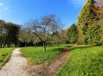
![](/images/other/stat-length.png)
Landkreis Bayreuth, Beieren, Te voet: Top van de beste wandelroutes, trajecten, tochten en wandelingen
Landkreis Bayreuth: Ontdek de beste tochten: 186 te voet. Al deze tochten, trajecten, routes en outdoor activiteiten zijn beschikbaar in onze SityTrail-apps voor smartphones en tablets.
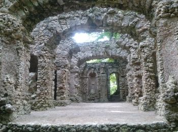
De beste trajecten (186)
![Tocht Te voet Aufseß - Rote-Spitze-Weg Sachsendorf - Photo](https://media.geolcdn.com/t/350/260/aee1f1db-9eec-4bb2-b907-311e2f25417b.jpeg&format=jpg&maxdim=2)
![Te voet Te voet](https://static1.geolcdn.com/sitytour/trail-icons/100.png)
Km
Te voet
![](/images/other/stat-length.png)
![](https://static1.geolcdn.com/siteimages/upload/files/1508320355ic_sort_den_pos_24dp.png)
![](https://static1.geolcdn.com/siteimages/upload/files/1508320355ic_sort_den_neg_24dp.png)
![](https://static1.geolcdn.com/siteimages/upload/files/16400158638029165_repeat_loop_refresh_sync_direction_icon.png)
• Trail created by Gemeinde Aufseß. Symbol: Rotes liegendes Dreieck auf weißem Hintergrund
![Tocht Te voet Aufseß - Gelb-Ring-Weg Aufseß - Photo](https://media.geolcdn.com/t/350/260/f568ee6e-1027-4ec0-96f1-c2e9b90eecf2.jpeg&format=jpg&maxdim=2)
![Te voet Te voet](https://static1.geolcdn.com/sitytour/trail-icons/100.png)
Km
Te voet
![](/images/other/stat-length.png)
![](https://static1.geolcdn.com/siteimages/upload/files/1508320355ic_sort_den_pos_24dp.png)
![](https://static1.geolcdn.com/siteimages/upload/files/1508320355ic_sort_den_neg_24dp.png)
![](https://static1.geolcdn.com/siteimages/upload/files/16400158638029165_repeat_loop_refresh_sync_direction_icon.png)
• Trail created by Gemeinde Aufseß. Symbol: Gelber Ring auf weißem Hintergrund
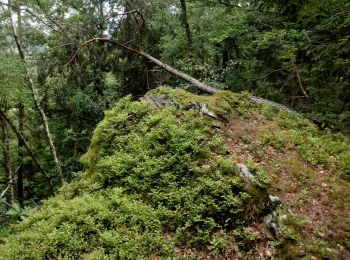
![Tocht Te voet Aufseß - Rundweg Aufseß - Photo](https://media.geolcdn.com/t/350/260/8cfc2767-9dca-4eed-8336-6bcb22b2ea82.jpeg&format=jpg&maxdim=2)
![Te voet Te voet](https://static1.geolcdn.com/sitytour/trail-icons/100.png)
Km
Te voet
![](/images/other/stat-length.png)
![](https://static1.geolcdn.com/siteimages/upload/files/1508320355ic_sort_den_pos_24dp.png)
![](https://static1.geolcdn.com/siteimages/upload/files/1508320355ic_sort_den_neg_24dp.png)
![](https://static1.geolcdn.com/siteimages/upload/files/16400158638029165_repeat_loop_refresh_sync_direction_icon.png)
• Trail created by Gemeinde Aufseß. Symbol: Schwarzes Gemeindewappen auf weißem Hintergrund
![Tocht Te voet Aufseß - Rundweg Hochstahl - Photo](https://media.geolcdn.com/t/350/260/303aa3d8-bba5-4e75-a8b5-846fd32d750e.jpeg&format=jpg&maxdim=2)
![Te voet Te voet](https://static1.geolcdn.com/sitytour/trail-icons/100.png)
Km
Te voet
![](/images/other/stat-length.png)
![](https://static1.geolcdn.com/siteimages/upload/files/1508320355ic_sort_den_pos_24dp.png)
![](https://static1.geolcdn.com/siteimages/upload/files/1508320355ic_sort_den_neg_24dp.png)
![](https://static1.geolcdn.com/siteimages/upload/files/16400158638029165_repeat_loop_refresh_sync_direction_icon.png)
• Trail created by Gemeinde Aufseß. Symbol: Gemeindewappen Hochstall
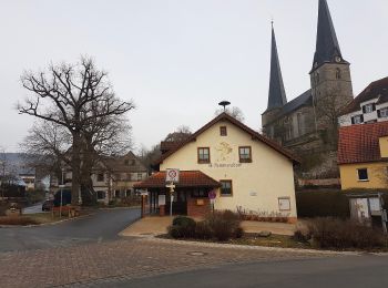
![Tocht Te voet Hollfeld - Kurat-Hollfelder-Weg - Photo](https://media.geolcdn.com/t/350/260/303aa3d8-bba5-4e75-a8b5-846fd32d750e.jpeg&format=jpg&maxdim=2)
![Te voet Te voet](https://static1.geolcdn.com/sitytour/trail-icons/100.png)
Km
Te voet
![](/images/other/stat-length.png)
![](https://static1.geolcdn.com/siteimages/upload/files/1508320355ic_sort_den_pos_24dp.png)
![](https://static1.geolcdn.com/siteimages/upload/files/1508320355ic_sort_den_neg_24dp.png)
![](https://static1.geolcdn.com/siteimages/upload/files/16400158638029165_repeat_loop_refresh_sync_direction_icon.png)
• Trail created by Gemeinde Aufseß. Beschilderung nur in eine Richtung Symbol: Wappen auf weißem Grund
![Tocht Te voet Hollfeld - Aktiv-Park Roter Trail - Photo](https://media.geolcdn.com/t/350/260/4fbb2beb-fa40-4dbc-8f1d-e1c9a176d165.jpeg&format=jpg&maxdim=2)
![Te voet Te voet](https://static1.geolcdn.com/sitytour/trail-icons/100.png)
Km
Te voet
![](/images/other/stat-length.png)
![](https://static1.geolcdn.com/siteimages/upload/files/1508320355ic_sort_den_pos_24dp.png)
![](https://static1.geolcdn.com/siteimages/upload/files/1508320355ic_sort_den_neg_24dp.png)
![](https://static1.geolcdn.com/siteimages/upload/files/16400158638029165_repeat_loop_refresh_sync_direction_icon.png)
• Trail created by Bayernwerk. Symbol: Roter Pfeil auf weißem Hintergrund
![Tocht Te voet Hollfeld - Aktiv-Park Schwarzer Trail - Photo](https://media.geolcdn.com/t/350/260/4fbb2beb-fa40-4dbc-8f1d-e1c9a176d165.jpeg&format=jpg&maxdim=2)
![Te voet Te voet](https://static1.geolcdn.com/sitytour/trail-icons/100.png)
Km
Te voet
![](/images/other/stat-length.png)
![](https://static1.geolcdn.com/siteimages/upload/files/1508320355ic_sort_den_pos_24dp.png)
![](https://static1.geolcdn.com/siteimages/upload/files/1508320355ic_sort_den_neg_24dp.png)
![](https://static1.geolcdn.com/siteimages/upload/files/16400158638029165_repeat_loop_refresh_sync_direction_icon.png)
• Trail created by Bayernwerk. Symbol: Schwarzer Pfeill auf weißem Hintergrund
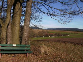
![Tocht Te voet Hollfeld - Kurat Hollfelder Gedächtnisweg - Photo](https://media.geolcdn.com/t/350/260/4fbb2beb-fa40-4dbc-8f1d-e1c9a176d165.jpeg&format=jpg&maxdim=2)
![Te voet Te voet](https://static1.geolcdn.com/sitytour/trail-icons/100.png)
Km
Te voet
![](/images/other/stat-length.png)
![](https://static1.geolcdn.com/siteimages/upload/files/1508320355ic_sort_den_pos_24dp.png)
![](https://static1.geolcdn.com/siteimages/upload/files/1508320355ic_sort_den_neg_24dp.png)
![](https://static1.geolcdn.com/siteimages/upload/files/16400158638029165_repeat_loop_refresh_sync_direction_icon.png)
• Trail created by Stadt Hollfeld. Symbol: Schwarzer Kopf auf weißem Hintergrund
![Tocht Te voet Mistelgau - Mistelgau Rundwanderweg](https://media.geolcdn.com/t/350/260/12b62dae-1c4d-4e77-b7a8-feb1a6612fdc.jpeg&format=jpg&maxdim=2)
![Te voet Te voet](https://static1.geolcdn.com/sitytour/trail-icons/100.png)
Km
Te voet
![](/images/other/stat-length.png)
![](https://static1.geolcdn.com/siteimages/upload/files/1508320355ic_sort_den_pos_24dp.png)
![](https://static1.geolcdn.com/siteimages/upload/files/1508320355ic_sort_den_neg_24dp.png)
![](https://static1.geolcdn.com/siteimages/upload/files/16400158638029165_repeat_loop_refresh_sync_direction_icon.png)
• Symbol: grüner Kreis
![Tocht Te voet Mistelgau - Mistelgau Rundwanderweg](https://media.geolcdn.com/t/350/260/12b62dae-1c4d-4e77-b7a8-feb1a6612fdc.jpeg&format=jpg&maxdim=2)
![Te voet Te voet](https://static1.geolcdn.com/sitytour/trail-icons/100.png)
Km
Te voet
![](/images/other/stat-length.png)
![](https://static1.geolcdn.com/siteimages/upload/files/1508320355ic_sort_den_pos_24dp.png)
![](https://static1.geolcdn.com/siteimages/upload/files/1508320355ic_sort_den_neg_24dp.png)
![](https://static1.geolcdn.com/siteimages/upload/files/16400158638029165_repeat_loop_refresh_sync_direction_icon.png)
• Symbol: roter Punkt
![Tocht Te voet Hollfeld - Wonsees Erbachtal-Wanderweg - Photo](https://media.geolcdn.com/t/350/260/54f4ddc7-7b19-4108-94f7-351eb7b67f18.jpeg&format=jpg&maxdim=2)
![Te voet Te voet](https://static1.geolcdn.com/sitytour/trail-icons/100.png)
Km
Te voet
![](/images/other/stat-length.png)
![](https://static1.geolcdn.com/siteimages/upload/files/1508320355ic_sort_den_pos_24dp.png)
![](https://static1.geolcdn.com/siteimages/upload/files/1508320355ic_sort_den_neg_24dp.png)
![](https://static1.geolcdn.com/siteimages/upload/files/16400158638029165_repeat_loop_refresh_sync_direction_icon.png)
• Symbol: Gelbe Raute auf weißem Hintergrund
![Tocht Te voet Hollfeld - Hollfeld Rundweg](https://media.geolcdn.com/t/350/260/17ff9b12-24a9-448c-88e0-9143c9b3a5c9.jpeg&format=jpg&maxdim=2)
![Te voet Te voet](https://static1.geolcdn.com/sitytour/trail-icons/100.png)
Km
Te voet
![](/images/other/stat-length.png)
![](https://static1.geolcdn.com/siteimages/upload/files/1508320355ic_sort_den_pos_24dp.png)
![](https://static1.geolcdn.com/siteimages/upload/files/1508320355ic_sort_den_neg_24dp.png)
![](https://static1.geolcdn.com/siteimages/upload/files/16400158638029165_repeat_loop_refresh_sync_direction_icon.png)
• Trail created by Stadt Hollfeld. Symbol: Gelbe Spitze auf weißem Hintergrund
![Tocht Te voet Warmensteinach - Wurzbachweiher-Jägersteig - Photo](https://media.geolcdn.com/t/350/260/fa2901a3-c356-4b22-bed0-2230c159cd9c.jpeg&format=jpg&maxdim=2)
![Te voet Te voet](https://static1.geolcdn.com/sitytour/trail-icons/100.png)
Km
Te voet
![](/images/other/stat-length.png)
![](https://static1.geolcdn.com/siteimages/upload/files/1508320355ic_sort_den_pos_24dp.png)
![](https://static1.geolcdn.com/siteimages/upload/files/1508320355ic_sort_den_neg_24dp.png)
![](https://static1.geolcdn.com/siteimages/upload/files/16400158638029165_repeat_loop_refresh_sync_direction_icon.png)
• Symbol: blauer Punkt mit grünem Ring
![Tocht Te voet Hollfeld - Hollfeld Rundweg](https://media.geolcdn.com/t/350/260/4fbb2beb-fa40-4dbc-8f1d-e1c9a176d165.jpeg&format=jpg&maxdim=2)
![Te voet Te voet](https://static1.geolcdn.com/sitytour/trail-icons/100.png)
Km
Te voet
![](/images/other/stat-length.png)
![](https://static1.geolcdn.com/siteimages/upload/files/1508320355ic_sort_den_pos_24dp.png)
![](https://static1.geolcdn.com/siteimages/upload/files/1508320355ic_sort_den_neg_24dp.png)
![](https://static1.geolcdn.com/siteimages/upload/files/16400158638029165_repeat_loop_refresh_sync_direction_icon.png)
• Trail created by Stadt Hollfeld. Symbol: Rote Raute auf weißem Hintergrund
![Tocht Te voet Hollfeld - Von Burg zu Burg - Photo](https://media.geolcdn.com/t/350/260/b8dfbade-9986-48d0-b2b5-4128ccc147c5.jpeg&format=jpg&maxdim=2)
![Te voet Te voet](https://static1.geolcdn.com/sitytour/trail-icons/100.png)
Km
Te voet
![](/images/other/stat-length.png)
![](https://static1.geolcdn.com/siteimages/upload/files/1508320355ic_sort_den_pos_24dp.png)
![](https://static1.geolcdn.com/siteimages/upload/files/1508320355ic_sort_den_neg_24dp.png)
![](https://static1.geolcdn.com/siteimages/upload/files/16400158638029165_repeat_loop_refresh_sync_direction_icon.png)
• Symbol: Blauer Punkt auf weißem Grund
![Tocht Te voet Weidenberg - Sophienthal Rundwanderweg Nr. 2 - Photo](https://media.geolcdn.com/t/350/260/9b284bb3-747b-4be1-b974-753527ce3c04.jpeg&format=jpg&maxdim=2)
![Te voet Te voet](https://static1.geolcdn.com/sitytour/trail-icons/100.png)
Km
Te voet
![](/images/other/stat-length.png)
![](https://static1.geolcdn.com/siteimages/upload/files/1508320355ic_sort_den_pos_24dp.png)
![](https://static1.geolcdn.com/siteimages/upload/files/1508320355ic_sort_den_neg_24dp.png)
![](https://static1.geolcdn.com/siteimages/upload/files/16400158638029165_repeat_loop_refresh_sync_direction_icon.png)
• Trail created by Fichtelgebirgsverein Weidenberg. Symbol: weiße 2
![Tocht Te voet Goldkronach - Nemmersdorf St.Jobst-Weg - Photo](https://media.geolcdn.com/t/350/260/6da356bb-2476-4283-8e94-b535b7bd2907.jpeg&format=jpg&maxdim=2)
![Te voet Te voet](https://static1.geolcdn.com/sitytour/trail-icons/100.png)
Km
Te voet
![](/images/other/stat-length.png)
![](https://static1.geolcdn.com/siteimages/upload/files/1508320355ic_sort_den_pos_24dp.png)
![](https://static1.geolcdn.com/siteimages/upload/files/1508320355ic_sort_den_neg_24dp.png)
![](https://static1.geolcdn.com/siteimages/upload/files/16400158638029165_repeat_loop_refresh_sync_direction_icon.png)
• Symbol: weißes St. Jobst auf braunem Hintergrund
![Tocht Te voet Weidenberg - GEO-Erlebnisweg Weidenberger Erdblicke - Kulm-Runde - Photo](https://media.geolcdn.com/t/350/260/e66e4e90-66fb-48ab-b926-8a307ead959a.jpeg&format=jpg&maxdim=2)
![Te voet Te voet](https://static1.geolcdn.com/sitytour/trail-icons/100.png)
Km
Te voet
![](/images/other/stat-length.png)
![](https://static1.geolcdn.com/siteimages/upload/files/1508320355ic_sort_den_pos_24dp.png)
![](https://static1.geolcdn.com/siteimages/upload/files/1508320355ic_sort_den_neg_24dp.png)
![](https://static1.geolcdn.com/siteimages/upload/files/16400158638029165_repeat_loop_refresh_sync_direction_icon.png)
• Trail created by Geopark Bayern - Böhmen.
![Tocht Te voet Glashütten - Glashütten Salzlecken-Rundweg - Photo](https://media.geolcdn.com/t/350/260/33369dca-6851-47d0-8754-60e95d7b3bdc.jpeg&format=jpg&maxdim=2)
![Te voet Te voet](https://static1.geolcdn.com/sitytour/trail-icons/100.png)
Km
Te voet
![](/images/other/stat-length.png)
![](https://static1.geolcdn.com/siteimages/upload/files/1508320355ic_sort_den_pos_24dp.png)
![](https://static1.geolcdn.com/siteimages/upload/files/1508320355ic_sort_den_neg_24dp.png)
![](https://static1.geolcdn.com/siteimages/upload/files/16400158638029165_repeat_loop_refresh_sync_direction_icon.png)
• Symbol: Roter Ring
![Tocht Te voet Glashüttener Forst - Glashütten Höhen-Rundweg - Photo](https://media.geolcdn.com/t/350/260/9b85b44a-ea53-439a-bbb5-3828cda03d61.jpeg&format=jpg&maxdim=2)
![Te voet Te voet](https://static1.geolcdn.com/sitytour/trail-icons/100.png)
Km
Te voet
![](/images/other/stat-length.png)
![](https://static1.geolcdn.com/siteimages/upload/files/1508320355ic_sort_den_pos_24dp.png)
![](https://static1.geolcdn.com/siteimages/upload/files/1508320355ic_sort_den_neg_24dp.png)
![](https://static1.geolcdn.com/siteimages/upload/files/16400158638029165_repeat_loop_refresh_sync_direction_icon.png)
• Symbol: Gelber Ring
20 tochten weergegeven op 186
Gratisgps-wandelapplicatie
Activiteiten
Nabije regio's
- Ahorntal
- Aufseß
- Bad Berneck im Fichtelgebirge
- Betzenstein
- Bischofsgrün
- Bischofsgrüner Forst
- Creußen
- Eckersdorf
- Emtmannsberg
- Fichtelberg
- Gefrees
- Gesees
- Glashütten
- Glashüttener Forst
- Goldkronach
- Heinersreuth
- Heinersreuther Forst
- Hollfeld
- Hummeltal
- Kirchenpingarten
- Mehlmeisel
- Mistelbach
- Mistelgau
- Pegnitz
- Plankenfels
- Plech
- Pottenstein
- Seybothenreuth
- Speichersdorf
- Veldensteiner Forst
- Waischenfeld
- Warmensteinach
- Weidenberg