![](/images/other/stat-length.png)
- Randonnées
- Outdoor
- France
- Bourgogne-Franche-Comté
- Côte-d'Or
Côte-d'Or, Bourgogne-Franche-Comté : Les meilleures randonnées, itinéraires, parcours, balades et promenades
Côte-d'Or : découvrez les meilleures randonnées : 1 495 pédestres, 737 à vélo ou VTT et 45 parcours équestres. Tous ces circuits, parcours, itinéraires et activités en plein air sont disponibles dans nos applications SityTrail pour smartphones et tablettes.
Les meilleurs parcours (2455)
![Randonnée Marche Dijon - Parcours Félix Batier - Dijon - Nuits Saint Georges - Photo](https://media.geolcdn.com/t/350/260/ext.jpg?maxdim=2&url=https%3A%2F%2Fservices.sitytrail.com%2FGeolivesWS%2FDownloadMedia.ashx%3FTrailID%3D104673%26Media%3D8076_1.jpg)
![Marche Marche](https://static1.geolcdn.com/sitytour/trail-icons/101.png)
Km
Marche
![](/images/other/stat-length.png)
![](https://static1.geolcdn.com/siteimages/upload/files/1508320355ic_sort_den_pos_24dp.png)
![](https://static1.geolcdn.com/siteimages/upload/files/1508320355ic_sort_den_neg_24dp.png)
![](https://static1.geolcdn.com/siteimages/upload/files/16400158638029165_repeat_loop_refresh_sync_direction_icon.png)
• Parcours Félix Batier Randonnée de 52 km "très sportifs" ralliant Dijon à Nuits-Saint-Georges. 13 à 14 heures, 2000 m...
![Randonnée Marche Santenay - Santenay Le Moulin de Santenay page 165 - Photo](https://media.geolcdn.com/t/350/260/959aad95-3ace-4b9a-b3e0-f1e7f87da723.jpg&format=jpg&maxdim=2)
![Marche Marche](https://static1.geolcdn.com/sitytour/trail-icons/101.png)
Km
Marche
![](/images/other/stat-length.png)
![](https://static1.geolcdn.com/siteimages/upload/files/1508320355ic_sort_den_pos_24dp.png)
![](https://static1.geolcdn.com/siteimages/upload/files/1508320355ic_sort_den_neg_24dp.png)
![](https://static1.geolcdn.com/siteimages/upload/files/16400158638029165_repeat_loop_refresh_sync_direction_icon.png)
• Très belle rando
![Randonnée Marche Marsannay-la-Côte - Marsannay la Côte 2021-03-02 repérage CAF - Photo](https://media.geolcdn.com/t/350/260/a8946688-d158-4deb-8004-8983d24f20f3.jpg&format=jpg&maxdim=2)
![Marche Marche](https://static1.geolcdn.com/sitytour/trail-icons/101.png)
Km
Marche
![](/images/other/stat-length.png)
![](https://static1.geolcdn.com/siteimages/upload/files/1508320355ic_sort_den_pos_24dp.png)
![](https://static1.geolcdn.com/siteimages/upload/files/1508320355ic_sort_den_neg_24dp.png)
![](https://static1.geolcdn.com/siteimages/upload/files/16400158638029165_repeat_loop_refresh_sync_direction_icon.png)
• IBP 74
![Randonnée Marche Sainte-Marie-sur-Ouche - Pont de Pany - Photo](https://media.geolcdn.com/t/350/260/880c73c5-f480-4d0e-b6d7-7819f4768403.jpg&format=jpg&maxdim=2)
![Marche Marche](https://static1.geolcdn.com/sitytour/trail-icons/101.png)
Km
Marche
![](/images/other/stat-length.png)
![](https://static1.geolcdn.com/siteimages/upload/files/1508320355ic_sort_den_pos_24dp.png)
![](https://static1.geolcdn.com/siteimages/upload/files/1508320355ic_sort_den_neg_24dp.png)
![](https://static1.geolcdn.com/siteimages/upload/files/16400158638029165_repeat_loop_refresh_sync_direction_icon.png)
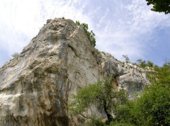
• désescalade au pied de la roche d'Anse et passages ludiques de rochers sur le retour
![Randonnée Marche Semezanges - circuit des vestiges disparus - Photo](https://media.geolcdn.com/t/350/260/ext.jpg?maxdim=2&url=https%3A%2F%2Fservices.sitytrail.com%2FGeolivesWS%2FDownloadMedia.ashx%3FTrailID%3D658184%26Media%3Dfix__20161026182707.jpg)
![Marche Marche](https://static1.geolcdn.com/sitytour/trail-icons/101.png)
Km
Marche
![](/images/other/stat-length.png)
![](https://static1.geolcdn.com/siteimages/upload/files/1508320355ic_sort_den_pos_24dp.png)
![](https://static1.geolcdn.com/siteimages/upload/files/1508320355ic_sort_den_neg_24dp.png)
![](https://static1.geolcdn.com/siteimages/upload/files/16400158638029165_repeat_loop_refresh_sync_direction_icon.png)
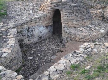
• Ce parcours exclusivement boisé,serpente entre différents vestiges des activités humaines,vieux de quelques années à ...
![Randonnée Marche Brochon - falaises et plateau - Photo](https://media.geolcdn.com/t/350/260/ext.jpg?maxdim=2&url=https%3A%2F%2Fservices.sitytrail.com%2FGeolivesWS%2FDownloadMedia.ashx%3FTrailID%3D640375%26Media%3Dfix__20161002163015.jpg)
![Marche Marche](https://static1.geolcdn.com/sitytour/trail-icons/101.png)
Km
Marche
![](/images/other/stat-length.png)
![](https://static1.geolcdn.com/siteimages/upload/files/1508320355ic_sort_den_pos_24dp.png)
![](https://static1.geolcdn.com/siteimages/upload/files/1508320355ic_sort_den_neg_24dp.png)
![](https://static1.geolcdn.com/siteimages/upload/files/16400158638029165_repeat_loop_refresh_sync_direction_icon.png)
• parcours mixte entre roches et plateaux forestier au départ de Chamboeuf
![Randonnée Marche Dijon - Combe St Joseph 21km Prj P8 MC 20220928 - Photo](https://media.geolcdn.com/t/350/260/e4ec7260-8a8c-4801-b869-91a5e0f7e844.jpg&format=jpg&maxdim=2)
![Marche Marche](https://static1.geolcdn.com/sitytour/trail-icons/101.png)
Km
Marche
![](/images/other/stat-length.png)
![](https://static1.geolcdn.com/siteimages/upload/files/1508320355ic_sort_den_pos_24dp.png)
![](https://static1.geolcdn.com/siteimages/upload/files/1508320355ic_sort_den_neg_24dp.png)
![](https://static1.geolcdn.com/siteimages/upload/files/16400158638029165_repeat_loop_refresh_sync_direction_icon.png)
![Randonnée Marche Velars-sur-Ouche - velars - Photo](https://media.geolcdn.com/t/350/260/f45fee3d-ded1-4c45-b841-446eb883a8de.jpg&format=jpg&maxdim=2)
![Marche Marche](https://static1.geolcdn.com/sitytour/trail-icons/101.png)
Km
Marche
![](/images/other/stat-length.png)
![](https://static1.geolcdn.com/siteimages/upload/files/1508320355ic_sort_den_pos_24dp.png)
![](https://static1.geolcdn.com/siteimages/upload/files/1508320355ic_sort_den_neg_24dp.png)
![](https://static1.geolcdn.com/siteimages/upload/files/16400158638029165_repeat_loop_refresh_sync_direction_icon.png)
![Randonnée Marche Hauteville-lès-Dijon - Ballade rapide au sud d'Hauteville - Photo](https://media.geolcdn.com/t/350/260/ext.jpg?maxdim=2&url=https%3A%2F%2Fservices.sitytrail.com%2FGeolivesWS%2FDownloadMedia.ashx%3FTrailID%3D723121%26Media%3Dfix__20170329193828.jpg)
![Marche Marche](https://static1.geolcdn.com/sitytour/trail-icons/101.png)
Km
Marche
![](/images/other/stat-length.png)
![](https://static1.geolcdn.com/siteimages/upload/files/1508320355ic_sort_den_pos_24dp.png)
![](https://static1.geolcdn.com/siteimages/upload/files/1508320355ic_sort_den_neg_24dp.png)
![](https://static1.geolcdn.com/siteimages/upload/files/16400158638029165_repeat_loop_refresh_sync_direction_icon.png)
• Le final est un bord de route ce qui n'est pas très cool. Mais bon...
![Randonnée Marche Urcy - Les environs d'Urcy - Photo](https://media.geolcdn.com/t/350/260/ext.jpg?maxdim=2&url=https%3A%2F%2Fservices.sitytrail.com%2FGeolivesWS%2FDownloadMedia.ashx%3FTrailID%3D104689%26Media%3D8092_1.jpg)
![Marche Marche](https://static1.geolcdn.com/sitytour/trail-icons/101.png)
Km
Marche
![](/images/other/stat-length.png)
![](https://static1.geolcdn.com/siteimages/upload/files/1508320355ic_sort_den_pos_24dp.png)
![](https://static1.geolcdn.com/siteimages/upload/files/1508320355ic_sort_den_neg_24dp.png)
![](https://static1.geolcdn.com/siteimages/upload/files/16400158638029165_repeat_loop_refresh_sync_direction_icon.png)
• Les environs d'Urcy Très agréable randonnée de 19,1 km parmi les rentes et fermes des environs d'Urcy (6 heures). Une...
![Randonnée Marche Barbirey-sur-Ouche - Le Tour de Barbiriacum - Barbirey sur Ouche - Photo](https://media.geolcdn.com/t/350/260/ext.jpg?maxdim=2&url=https%3A%2F%2Fservices.sitytrail.com%2FGeolivesWS%2FDownloadMedia.ashx%3FTrailID%3D104688%26Media%3D8091_1.jpg)
![Marche Marche](https://static1.geolcdn.com/sitytour/trail-icons/101.png)
Km
Marche
![](/images/other/stat-length.png)
![](https://static1.geolcdn.com/siteimages/upload/files/1508320355ic_sort_den_pos_24dp.png)
![](https://static1.geolcdn.com/siteimages/upload/files/1508320355ic_sort_den_neg_24dp.png)
![](https://static1.geolcdn.com/siteimages/upload/files/16400158638029165_repeat_loop_refresh_sync_direction_icon.png)
• Le Tour de Barbiriacum Une boucle de 11 km, avec 500 m de dénivelé, partant de la mairie de Barbirey-sur-Ouche. Bel i...
![Randonnée Marche Sainte-Marie-sur-Ouche - Belvédères sur la vallée de l'Ouche - Pont de Pany - Photo](https://media.geolcdn.com/t/350/260/ext.jpg?maxdim=2&url=https%3A%2F%2Fservices.sitytrail.com%2FGeolivesWS%2FDownloadMedia.ashx%3FTrailID%3D104685%26Media%3D8088_1.jpg)
![Marche Marche](https://static1.geolcdn.com/sitytour/trail-icons/101.png)
Km
Marche
![](/images/other/stat-length.png)
![](https://static1.geolcdn.com/siteimages/upload/files/1508320355ic_sort_den_pos_24dp.png)
![](https://static1.geolcdn.com/siteimages/upload/files/1508320355ic_sort_den_neg_24dp.png)
![](https://static1.geolcdn.com/siteimages/upload/files/16400158638029165_repeat_loop_refresh_sync_direction_icon.png)
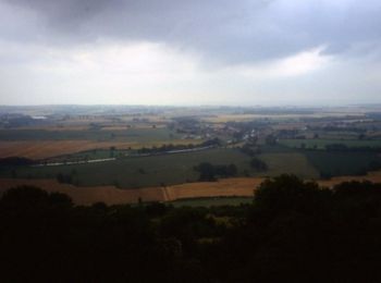
• Belvédères sur la vallée de l'Ouche 20,5 km en boucle à partir de Pont-de-Pany (5 à 6 heures). Dénivelé : 740 m. De b...
![Randonnée Marche Mâlain - Mâlain - Charmoy - Baulme le Roche - Photo](https://media.geolcdn.com/t/350/260/ext.jpg?maxdim=2&url=https%3A%2F%2Fservices.sitytrail.com%2FGeolivesWS%2FDownloadMedia.ashx%3FTrailID%3D104684%26Media%3D8087_1.jpg)
![Marche Marche](https://static1.geolcdn.com/sitytour/trail-icons/101.png)
Km
Marche
![](/images/other/stat-length.png)
![](https://static1.geolcdn.com/siteimages/upload/files/1508320355ic_sort_den_pos_24dp.png)
![](https://static1.geolcdn.com/siteimages/upload/files/1508320355ic_sort_den_neg_24dp.png)
![](https://static1.geolcdn.com/siteimages/upload/files/16400158638029165_repeat_loop_refresh_sync_direction_icon.png)
• Mâlain - Charmoy - Baulme le Roche Rando en boucle de 15,5 km, au départ de Mâlain. Stationnement dans le village Une...
![Randonnée Marche Nolay - Circuit Jean-Marc Boivin - Nolay - Photo](https://media.geolcdn.com/t/350/260/ext.jpg?maxdim=2&url=https%3A%2F%2Fservices.sitytrail.com%2FGeolivesWS%2FDownloadMedia.ashx%3FTrailID%3D104678%26Media%3D8081_1.jpg)
![Marche Marche](https://static1.geolcdn.com/sitytour/trail-icons/101.png)
Km
Marche
![](/images/other/stat-length.png)
![](https://static1.geolcdn.com/siteimages/upload/files/1508320355ic_sort_den_pos_24dp.png)
![](https://static1.geolcdn.com/siteimages/upload/files/1508320355ic_sort_den_neg_24dp.png)
![](https://static1.geolcdn.com/siteimages/upload/files/16400158638029165_repeat_loop_refresh_sync_direction_icon.png)
• Circuit Jean-Marc Boivin Départ et arrivée à la mairie de Nolay. Distance : 50 km. Dénivelé : 1500 m. Durée : 9 à 11 ...
![Randonnée Marche Velars-sur-Ouche - Parcours Jean Sage - Velars sur Ouche - Photo](https://media.geolcdn.com/t/350/260/ext.jpg?maxdim=2&url=https%3A%2F%2Fservices.sitytrail.com%2FGeolivesWS%2FDownloadMedia.ashx%3FTrailID%3D104677%26Media%3D8080_1.jpg)
![Marche Marche](https://static1.geolcdn.com/sitytour/trail-icons/101.png)
Km
Marche
![](/images/other/stat-length.png)
![](https://static1.geolcdn.com/siteimages/upload/files/1508320355ic_sort_den_pos_24dp.png)
![](https://static1.geolcdn.com/siteimages/upload/files/1508320355ic_sort_den_neg_24dp.png)
![](https://static1.geolcdn.com/siteimages/upload/files/16400158638029165_repeat_loop_refresh_sync_direction_icon.png)
• Parcours Jean Sage De Velars-sur-Ouche à Pont-de-Pany (ou inversement). Distance : 28 km, dénivelé 1.721 m, durée 8 h...
![Randonnée Marche Fleurey-sur-Ouche - Le Marathon de Fleurey sur Ouche - Photo](https://media.geolcdn.com/t/350/260/ext.jpg?maxdim=2&url=https%3A%2F%2Fservices.sitytrail.com%2FGeolivesWS%2FDownloadMedia.ashx%3FTrailID%3D104675%26Media%3D8078_1.jpg)
![Marche Marche](https://static1.geolcdn.com/sitytour/trail-icons/101.png)
Km
Marche
![](/images/other/stat-length.png)
![](https://static1.geolcdn.com/siteimages/upload/files/1508320355ic_sort_den_pos_24dp.png)
![](https://static1.geolcdn.com/siteimages/upload/files/1508320355ic_sort_den_neg_24dp.png)
![](https://static1.geolcdn.com/siteimages/upload/files/16400158638029165_repeat_loop_refresh_sync_direction_icon.png)
• Le Marathon de Fleurey sur Ouche Départ face à l'église de Fleurey-sur-Ouche. L'appellation "marathon" tient à la lon...
![Randonnée Marche La Bussière-sur-Ouche - La Bête de l'Auxois - La Bussière sur Ouche - Photo](https://media.geolcdn.com/t/350/260/ext.jpg?maxdim=2&url=https%3A%2F%2Fservices.sitytrail.com%2FGeolivesWS%2FDownloadMedia.ashx%3FTrailID%3D104674%26Media%3D8077_1.jpg)
![Marche Marche](https://static1.geolcdn.com/sitytour/trail-icons/101.png)
Km
Marche
![](/images/other/stat-length.png)
![](https://static1.geolcdn.com/siteimages/upload/files/1508320355ic_sort_den_pos_24dp.png)
![](https://static1.geolcdn.com/siteimages/upload/files/1508320355ic_sort_den_neg_24dp.png)
![](https://static1.geolcdn.com/siteimages/upload/files/16400158638029165_repeat_loop_refresh_sync_direction_icon.png)
• La Bête de l'Auxois Rando de 26 km en boucle au départ de La Bussière-sur-Ouche (6 à 8 heures). Détails complémentair...
![Randonnée Marche Messigny-et-Vantoux - Les Balcons du Suzon - Messigny et Vantoux - Photo](https://media.geolcdn.com/t/350/260/ext.jpg?maxdim=2&url=https%3A%2F%2Fservices.sitytrail.com%2FGeolivesWS%2FDownloadMedia.ashx%3FTrailID%3D104672%26Media%3D8075_1.jpg)
![Marche Marche](https://static1.geolcdn.com/sitytour/trail-icons/101.png)
Km
Marche
![](/images/other/stat-length.png)
![](https://static1.geolcdn.com/siteimages/upload/files/1508320355ic_sort_den_pos_24dp.png)
![](https://static1.geolcdn.com/siteimages/upload/files/1508320355ic_sort_den_neg_24dp.png)
![](https://static1.geolcdn.com/siteimages/upload/files/16400158638029165_repeat_loop_refresh_sync_direction_icon.png)
• Les Balcons du Suzon Boucle de 21 km au départ de Messigny-et-Vantoux. Une randonnée du Club Alpin Français de l'Oues...
![Randonnée Vélo électrique Dijon - Canal de Bourgogne_Etape 7 - Photo](https://media.geolcdn.com/t/350/260/ext.jpg?maxdim=2&url=https%3A%2F%2Fstatic1.geolcdn.com%2Fsiteimages%2Fupload%2Ffiles%2F1524743154velo.jpg)
![Vélo électrique Vélo électrique](https://static1.geolcdn.com/sitytour/trail-icons/205.png)
Km
Vélo électrique
![](/images/other/stat-length.png)
![](https://static1.geolcdn.com/siteimages/upload/files/1508320355ic_sort_den_pos_24dp.png)
![](https://static1.geolcdn.com/siteimages/upload/files/1508320355ic_sort_den_neg_24dp.png)
![](https://static1.geolcdn.com/siteimages/upload/files/16400158638029165_repeat_loop_refresh_sync_direction_icon.png)
• Dijon vers St jean de losne
![Randonnée Vélo électrique Sainte-Marie-sur-Ouche - Canal de Bourgogne_Etape 6 - Photo](https://media.geolcdn.com/t/350/260/ext.jpg?maxdim=2&url=https%3A%2F%2Fstatic1.geolcdn.com%2Fsiteimages%2Fupload%2Ffiles%2F1524743154velo.jpg)
![Vélo électrique Vélo électrique](https://static1.geolcdn.com/sitytour/trail-icons/205.png)
Km
Vélo électrique
![](/images/other/stat-length.png)
![](https://static1.geolcdn.com/siteimages/upload/files/1508320355ic_sort_den_pos_24dp.png)
![](https://static1.geolcdn.com/siteimages/upload/files/1508320355ic_sort_den_neg_24dp.png)
![](https://static1.geolcdn.com/siteimages/upload/files/16400158638029165_repeat_loop_refresh_sync_direction_icon.png)
• Sainte Marie sur Ouche vers Fontaine d'Ouche (Dijon)
20 randonnées affichées sur 2455
Application GPS de randonnée GRATUITE
Activités
Régions proches
- Agencourt
- Agey
- Ahuy
- Aignay-le-Duc
- Aiserey
- Aisey-sur-Seine
- Aisy-sous-Thil
- Alise-Sainte-Reine
- Allerey
- Aloxe-Corton
- Ampilly-le-Sec
- Ancey
- Antheuil
- Antigny-la-Ville
- Arc-sur-Tille
- Arceau
- Arcenant
- Arcey
- Argilly
- Arnay-le-Duc
- Arnay-sous-Vitteaux
- Arrans
- Asnières-lès-Dijon
- Athée
- Athie
- Aubaine
- Aubigny-en-Plaine
- Aubigny-la-Ronce
- Aubigny-lès-Sombernon
- Autricourt
- Auvillars-sur-Saône
- Auxant
- Auxey-Duresses
- Auxonne
- Avelanges
- Avosnes
- Avot
- Bagnot
- Baigneux-les-Juifs
- Barbirey-sur-Ouche
- Bard-le-Régulier
- Bard-lès-Époisses
- Barges
- Baubigny
- Baulme-la-Roche
- Beaulieu
- Beaune
- Beaunotte
- Beire-le-Châtel
- Beire-le-Fort
- Bellefond
- Belleneuve
- Bellenot-sous-Pouilly
- Beneuvre
- Bessey-en-Chaume
- Bessey-lès-Cîteaux
- Beurey-Bauguay
- Beurizot
- Bévy
- Bèze
- Billy-lès-Chanceaux
- Binges
- Bissey-la-Côte
- Bissey-la-Pierre
- Blagny-sur-Vingeanne
- Blaisy-Bas
- Blaisy-Haut
- Blanot
- Bligny-le-Sec
- Bligny-lès-Beaune
- Bligny-sur-Ouche
- Boncourt-le-Bois
- Bonnencontre
- Bouhey
- Bouilland
- Bourberain
- Boussenois
- Boussey
- Boux-sous-Salmaise
- Bouze-lès-Beaune
- Brain
- Braux
- Brazey-en-Morvan
- Brazey-en-Plaine
- Brémur-et-Vaurois
- Bressey-sur-Tille
- Bretenière
- Bretigny
- Brianny
- Brion-sur-Ource
- Brochon
- Buffon
- Bure-les-Templiers
- Busserotte-et-Montenaille
- Bussy-la-Pesle
- Bussy-le-Grand
- Censerey
- Cessey-sur-Tille
- Chaignay
- Chailly-sur-Armançon
- Chambeire
- Chambolle-Musigny
- Chambœuf
- Chamesson
- Champagne-sur-Vingeanne
- Champagny
- Champdôtre
- Champeau-en-Morvan
- Champrenault
- Chanceaux
- Charmes
- Chassagne-Montrachet
- Châteauneuf
- Châtellenot
- Châtillon-sur-Seine
- Chaudenay-la-Ville
- Chaudenay-le-Château
- Chaume-et-Courchamp
- Chaume-lès-Baigneux
- Chaumont-le-Bois
- Chaux
- Chemin-d'Aisey
- Chenôve
- Cheuge
- Chevannay
- Chevannes
- Chevigny-Saint-Sauveur
- Chevigny-en-Valière
- Chivres
- Chorey-les-Beaune
- Cirey-lès-Pontailler
- Civry-en-Montagne
- Clamerey
- Clénay
- Clomot
- Collonges-et-Premières
- Collonges-lès-Bévy
- Colombier
- Combertault
- Comblanchien
- Commarin
- Corberon
- Corcelles-les-Arts
- Corcelles-lès-Cîteaux
- Corcelles-les-Monts
- Corgoloin
- Cormot-Vauchignon
- Corpeau
- Corpoyer-la-Chapelle
- Corsaint
- Couchey
- Coulmier-le-Sec
- Courban
- Courcelles-Frémoy
- Courcelles-lès-Montbard
- Courcelles-lès-Semur
- Courtivron
- Couternon
- Créancey
- Crécey-sur-Tille
- Crépand
- Crugey
- Curley
- Curtil-Saint-Seine
- Curtil-Vergy
- Cussey-les-Forges
- Cussy-la-Colonne
- Cussy-le-Châtel
- Daix
- Dampierre-et-Flée
- Darcey
- Darois
- Détain-et-Bruant
- Diénay
- Dijon
- Dompierre-en-Morvan
- Drée
- Duesme
- Ébaty
- Échalot
- Échannay
- Échenon
- Échevannes
- Échevronne
- Échigey
- Éguilly
- Épagny
- Épernay-sous-Gevrey
- Époisses
- Essarois
- Étais
- Étalante
- Étaules
- Fain-lès-Montbard
- Fain-lès-Moutiers
- Fauverney
- Fénay
- Fixin
- Flacey
- Flagey-Echézeaux
- Flavignerot
- Flavigny-sur-Ozerain
- Fleurey-sur-Ouche
- Foissy
- Foncegrive
- Fontaine-Française
- Fontaine-lès-Dijon
- Fontangy
- Fontenelle
- Forléans
- Francheville
- Frénois
- Frôlois
- Fussey
- Gemeaux
- Genlis
- Gergueil
- Gerland
- Gevrey-Chambertin
- Gilly-lès-Cîteaux
- Gissey-le-Vieil
- Gissey-sous-Flavigny
- Gissey-sur-Ouche
- Glanon
- Grancey-le-Château-Neuvelle
- Grancey-sur-Ource
- Grenant-lès-Sombernon
- Grésigny-Sainte-Reine
- Grosbois-en-Montagne
- Gurgy-la-Ville
- Gurgy-le-Château
- Hauteroche
- Hauteville-lès-Dijon
- Heuilley-sur-Saône
- Is-sur-Tille
- Izeure
- Izier
- Jailly-les-Moulins
- Jallanges
- Jouey
- Juillenay
- L'Étang-Vergy
- La Bussière-sur-Ouche
- La Chaume
- La Motte-Ternant
- La Roche-Vanneau
- La Roche-en-Brenil
- La Rochepot
- La Villeneuve-les-Convers
- Labergement-Foigney
- Lacanche
- Ladoix-Serrigny
- Laignes
- Lamarche-sur-Saône
- Lamargelle
- Lantenay
- Lantilly
- Le Meix
- Le Val-Larrey
- Lechâtelet
- Léry
- Les Maillys
- Leuglay
- Levernois
- Licey-sur-Vingeanne
- Liernais
- Lignerolles
- Longchamp
- Longecourt-en-Plaine
- Longvic
- Losne
- Lucey
- Lusigny-sur-Ouche
- Lux
- Maconge
- Magnien
- Magny-Lambert
- Magny-Montarlot
- Magny-Saint-Médard
- Magny-lès-Villers
- Magny-sur-Tille
- Mâlain
- Maligny
- Manlay
- Marcenay
- Marcheseuil
- Marcigny-sous-Thil
- Marcilly-Ogny
- Marcilly-sur-Tille
- Marey-lès-Fussey
- Marey-sur-Tille
- Marigny-le-Cahouët
- Marliens
- Marmagne
- Marsannay-la-Côte
- Marsannay-le-Bois
- Martrois
- Massingy
- Massingy-lès-Semur
- Mauvilly
- Mavilly-Mandelot
- Maxilly-sur-Saône
- Meilly-sur-Rouvres
- Meloisey
- Menesble
- Ménessaire
- Ménétreux-le-Pitois
- Merceuil
- Mesmont
- Messanges
- Messigny-et-Vantoux
- Meuilley
- Meulson
- Meursanges
- Meursault
- Millery
- Mimeure
- Minot
- Mirebeau-sur-Bèze
- Missery
- Molesme
- Molinot
- Moloy
- Molphey
- Mont-Saint-Jean
- Montagny-lès-Beaune
- Montbard
- Montberthault
- Montceau-et-Écharnant
- Monthelie
- Montigny-Montfort
- Montigny-Mornay-Villeneuve-sur-Vingeanne
- Montigny-sur-Armançon
- Montlay-en-Auxois
- Montliot-et-Courcelles
- Montoillot
- Montot
- Morey-Saint-Denis
- Moutiers-Saint-Jean
- Nantoux
- Nesle-et-Massoult
- Neuilly-Crimolois
- Nod-sur-Seine
- Nogent-lès-Montbard
- Noiron-sous-Gevrey
- Noiron-sur-Bèze
- Nolay
- Norges-la-Ville
- Normier
- Nuits-Saint-Georges
- Oigny
- Oisilly
- Orgeux
- Origny
- Orret
- Orville
- Ouges
- Pagny-la-Ville
- Panges
- Pasques
- Pellerey
- Pernand-Vergelesses
- Perrigny-lès-Dijon
- Perrigny-sur-l'Ognon
- Pichanges
- Planay
- Plombières-lès-Dijon
- Pluvet
- Poiseul-la-Grange
- Poiseul-la-Ville-et-Laperrière
- Poiseul-lès-Saulx
- Pommard
- Poncey-lès-Athée
- Poncey-sur-l'Ignon
- Pont-et-Massène
- Pontailler-sur-Saône
- Pothières
- Pouillenay
- Pouilly-en-Auxois
- Pouilly-sur-Saône
- Prâlon
- Précy-sous-Thil
- Premeaux-Prissey
- Prenois
- Puits
- Puligny-Montrachet
- Quetigny
- Quincerot
- Quincey
- Quincy-le-Vicomte
- Recey-sur-Ource
- Remilly-en-Montagne
- Remilly-sur-Tille
- Renève
- Reulle-Vergy
- Rochefort-sur-Brévon
- Roilly
- Rougemont
- Rouvray
- Rouvres-en-Plaine
- Rouvres-sous-Meilly
- Ruffey-lès-Beaune
- Ruffey-lès-Echirey
- Sacquenay
- Saffres
- Saint-Anthot
- Saint-Apollinaire
- Saint-Aubin
- Saint-Bernard
- Saint-Broing-les-Moines
- Saint-Didier
- Saint-Euphrône
- Saint-Germain-de-Modéon
- Saint-Germain-le-Rocheux
- Saint-Jean-de-Bœuf
- Saint-Jean-de-Losne
- Saint-Julien
- Saint-Léger-Triey
- Saint-Marc-sur-Seine
- Saint-Martin-de-la-Mer
- Saint-Martin-du-Mont
- Saint-Mesmin
- Saint-Nicolas-lès-Cîteaux
- Saint-Philibert
- Saint-Pierre-en-Vaux
- Saint-Prix-lès-Arnay
- Saint-Rémy
- Saint-Romain
- Saint-Seine-en-Bâche
- Saint-Seine-l'Abbaye
- Saint-Seine-sur-Vingeanne
- Saint-Symphorien-sur-Saône
- Saint-Thibault
- Saint-Usage
- Saint-Victor-sur-Ouche
- Sainte-Colombe-en-Auxois
- Sainte-Colombe-sur-Seine
- Sainte-Marie-la-Blanche
- Sainte-Marie-sur-Ouche
- Sainte-Sabine
- Salives
- Salmaise
- Samerey
- Santenay
- Santosse
- Saulieu
- Saulon-la-Chapelle
- Saulon-la-Rue
- Saulx-le-Duc
- Saussy
- Savigny-le-Sec
- Savigny-lès-Beaune
- Savigny-sous-Mâlain
- Savilly
- Savoisy
- Savolles
- Savouges
- Segrois
- Selongey
- Semarey
- Semezanges
- Semond
- Semur-en-Auxois
- Senailly
- Sennecey-lès-Dijon
- Seurre
- Soirans
- Sombernon
- Souhey
- Source-Seine
- Soussey-sur-Brionne
- Spoy
- Sussey
- Tailly
- Talant
- Talmay
- Tarsul
- Tart
- Tellecey
- Ternant
- Terrefondrée
- Thenissey
- Thoisy-la-Berchère
- Thoisy-le-Désert
- Thomirey
- Thorey-sur-Ouche
- Thury
- Til-Châtel
- Tillenay
- Touillon
- Toutry
- Trochères
- Trouhans
- Trouhaut
- Trugny
- Turcey
- Uncey-le-Franc
- Urcy
- Val-Mont
- Val-Suzon
- Valforêt
- Vandenesse-en-Auxois
- Vanvey
- Varanges
- Varois-et-Chaignot
- Vaux-Saules
- Veilly
- Velars-sur-Ouche
- Venarey-les-Laumes
- Verdonnet
- Vernois-lès-Vesvres
- Vernot
- Véronnes
- Verrey-sous-Drée
- Verrey-sous-Salmaise
- Vertault
- Vesvres
- Veuvey-sur-Ouche
- Veuxhaulles-sur-Aube
- Vianges
- Vic-de-Chassenay
- Vic-sous-Thil
- Vielverge
- Vieux-Château
- Viévigne
- Viévy
- Vignoles
- Villaines-en-Duesmois
- Villaines-les-Prévôtes
- Villargoix
- Villars-Fontaine
- Villeberny
- Villebichot
- Villecomte
- Villedieu
- Villeferry
- Villeneuve-sous-Charigny
- Villers-Patras
- Villers-la-Faye
- Villey-sur-Tille
- Villiers-le-Duc
- Villy-en-Auxois
- Villy-le-Moutier
- Viserny
- Vitteaux
- Vix
- Volnay
- Vosne-Romanée
- Voudenay
- Vougeot
- Voulaines-les-Templiers