![](/images/other/stat-length.png)
- Excursiones
- A pie
- France
- Occitania
- Aveyron
Aveyron, Occitania, A pie: Los mejores itinerarios de excursión, recorridos, paseos y sendas
Aveyron: Descubra las mejores excursiones: 240 a pie, 2158 senderismo, 86 marcha nórdica, 101 carrera y 31 ruta. Todos estos circuitos, recorridos, itinerarios y actividades al aire libre están disponibles en nuestras aplicaciones SityTrail para smartphone y tablet.
Los mejores recorridos (2609)
![Excursión Senderismo La Couvertoirade - autour de la Couvertoirade - Photo](https://media.geolcdn.com/t/350/260/db94c7b2-96b3-48b8-be29-9666f969dfb2.jpg&format=jpg&maxdim=2)
![Senderismo Senderismo](https://static1.geolcdn.com/sitytour/trail-icons/101.png)
Km
Senderismo
![](/images/other/stat-length.png)
![](https://static1.geolcdn.com/siteimages/upload/files/1508320355ic_sort_den_pos_24dp.png)
![](https://static1.geolcdn.com/siteimages/upload/files/1508320355ic_sort_den_neg_24dp.png)
![](https://static1.geolcdn.com/siteimages/upload/files/16400158638029165_repeat_loop_refresh_sync_direction_icon.png)
![Excursión Senderismo Conques-en-Rouergue - Les Pelies La Vinzelle : boucle rapide - Photo](https://media.geolcdn.com/t/350/260/ext.jpg?maxdim=2&url=https%3A%2F%2Fservices.sitytrail.com%2FGeolivesWS%2FDownloadMedia.ashx%3FTrailID%3D815525%26Media%3D20170822112933.jpg)
![Senderismo Senderismo](https://static1.geolcdn.com/sitytour/trail-icons/101.png)
Km
Senderismo
![](/images/other/stat-length.png)
![](https://static1.geolcdn.com/siteimages/upload/files/1508320355ic_sort_den_pos_24dp.png)
![](https://static1.geolcdn.com/siteimages/upload/files/1508320355ic_sort_den_neg_24dp.png)
![](https://static1.geolcdn.com/siteimages/upload/files/16400158638029165_repeat_loop_refresh_sync_direction_icon.png)
• On part du manoir des Pelies , chambre d hôtes et on monte rapidement sur la gauche à travers des prairies a moutons ...
![Excursión Senderismo Entraygues-sur-Truyère - Entraygues-sur-Truyère PR 10 - Photo](https://media.geolcdn.com/t/350/260/ext.jpg?maxdim=2&url=https%3A%2F%2Fservices.sitytrail.com%2FGeolivesWS%2FDownloadMedia.ashx%3FTrailID%3D787240%26Media%3Dfix__20170710144026.jpg)
![Senderismo Senderismo](https://static1.geolcdn.com/sitytour/trail-icons/101.png)
Km
Senderismo
![](/images/other/stat-length.png)
![](https://static1.geolcdn.com/siteimages/upload/files/1508320355ic_sort_den_pos_24dp.png)
![](https://static1.geolcdn.com/siteimages/upload/files/1508320355ic_sort_den_neg_24dp.png)
![](https://static1.geolcdn.com/siteimages/upload/files/16400158638029165_repeat_loop_refresh_sync_direction_icon.png)
• Très belle rando ,petit sentier, beaucoup de panorama. L' arrivé se fait sur 2 km de route ,dommage.
![Excursión Senderismo Mostuéjouls - Cirque de Saint Marcellin - Mostuéjouls - Liaucous - Photo](https://media.geolcdn.com/t/350/260/ext.jpg?maxdim=2&url=https%3A%2F%2Fservices.sitytrail.com%2FGeolivesWS%2FDownloadMedia.ashx%3FTrailID%3D173134%26Media%3D14690_6.jpg)
![Senderismo Senderismo](https://static1.geolcdn.com/sitytour/trail-icons/101.png)
Km
Senderismo
![](/images/other/stat-length.png)
![](https://static1.geolcdn.com/siteimages/upload/files/1508320355ic_sort_den_pos_24dp.png)
![](https://static1.geolcdn.com/siteimages/upload/files/1508320355ic_sort_den_neg_24dp.png)
![](https://static1.geolcdn.com/siteimages/upload/files/16400158638029165_repeat_loop_refresh_sync_direction_icon.png)
![Excursión Senderismo Viala-du-Pas-de-Jaux - Du Viala du Pas de Jaux à Saint Paul des Fonts - Photo](https://media.geolcdn.com/t/350/260/ext.jpg?maxdim=2&url=https%3A%2F%2Fservices.sitytrail.com%2FGeolivesWS%2FDownloadMedia.ashx%3FTrailID%3D172524%26Media%3D13883_5.jpg)
![Senderismo Senderismo](https://static1.geolcdn.com/sitytour/trail-icons/101.png)
Km
Senderismo
![](/images/other/stat-length.png)
![](https://static1.geolcdn.com/siteimages/upload/files/1508320355ic_sort_den_pos_24dp.png)
![](https://static1.geolcdn.com/siteimages/upload/files/1508320355ic_sort_den_neg_24dp.png)
![](https://static1.geolcdn.com/siteimages/upload/files/16400158638029165_repeat_loop_refresh_sync_direction_icon.png)
![Excursión Senderismo Millau - les cades - Photo](https://media.geolcdn.com/t/350/260/ext.jpg?maxdim=2&url=https%3A%2F%2Fservices.sitytrail.com%2FGeolivesWS%2FDownloadMedia.ashx%3FTrailID%3D171967%26Media%3D20130128160604.jpg)
![Senderismo Senderismo](https://static1.geolcdn.com/sitytour/trail-icons/101.png)
Km
Senderismo
![](/images/other/stat-length.png)
![](https://static1.geolcdn.com/siteimages/upload/files/1508320355ic_sort_den_pos_24dp.png)
![](https://static1.geolcdn.com/siteimages/upload/files/1508320355ic_sort_den_neg_24dp.png)
![](https://static1.geolcdn.com/siteimages/upload/files/16400158638029165_repeat_loop_refresh_sync_direction_icon.png)
• Rando tres facile
![Excursión Senderismo Brousse-le-Château - Brousse Le Chateau et les alentours - Photo](https://media.geolcdn.com/t/350/260/ext.jpg?maxdim=2&url=https%3A%2F%2Fservices.sitytrail.com%2FGeolivesWS%2FDownloadMedia.ashx%3FTrailID%3D136506%26Media%3D20120630200246.jpg)
![Senderismo Senderismo](https://static1.geolcdn.com/sitytour/trail-icons/101.png)
Km
Senderismo
![](/images/other/stat-length.png)
![](https://static1.geolcdn.com/siteimages/upload/files/1508320355ic_sort_den_pos_24dp.png)
![](https://static1.geolcdn.com/siteimages/upload/files/1508320355ic_sort_den_neg_24dp.png)
![](https://static1.geolcdn.com/siteimages/upload/files/16400158638029165_repeat_loop_refresh_sync_direction_icon.png)
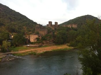
• Le départ de la randonnée s’effectue depuis le parking de Brousse le Château, l’un des plus beau village de France. P...
![Excursión Senderismo Najac - Boucle le long de l'Aveyron - Najac nord - Photo](https://media.geolcdn.com/t/350/260/ext.jpg?maxdim=2&url=https%3A%2F%2Fservices.sitytrail.com%2FGeolivesWS%2FDownloadMedia.ashx%3FTrailID%3D129870%26Media%3D13435_3.jpg)
![Senderismo Senderismo](https://static1.geolcdn.com/sitytour/trail-icons/101.png)
Km
Senderismo
![](/images/other/stat-length.png)
![](https://static1.geolcdn.com/siteimages/upload/files/1508320355ic_sort_den_pos_24dp.png)
![](https://static1.geolcdn.com/siteimages/upload/files/1508320355ic_sort_den_neg_24dp.png)
![](https://static1.geolcdn.com/siteimages/upload/files/16400158638029165_repeat_loop_refresh_sync_direction_icon.png)
![Excursión Senderismo Vimenet - Les crêtes de Vimenet - Photo](https://media.geolcdn.com/t/350/260/ext.jpg?maxdim=2&url=https%3A%2F%2Fservices.sitytrail.com%2FGeolivesWS%2FDownloadMedia.ashx%3FTrailID%3D118835%26Media%3D13052_4.jpg)
![Senderismo Senderismo](https://static1.geolcdn.com/sitytour/trail-icons/101.png)
Km
Senderismo
![](/images/other/stat-length.png)
![](https://static1.geolcdn.com/siteimages/upload/files/1508320355ic_sort_den_pos_24dp.png)
![](https://static1.geolcdn.com/siteimages/upload/files/1508320355ic_sort_den_neg_24dp.png)
![](https://static1.geolcdn.com/siteimages/upload/files/16400158638029165_repeat_loop_refresh_sync_direction_icon.png)
![Excursión Senderismo Conques-en-Rouergue - La Vinzelle - Grand Vabre - Photo](https://media.geolcdn.com/t/350/260/ext.jpg?maxdim=2&url=https%3A%2F%2Fservices.sitytrail.com%2FGeolivesWS%2FDownloadMedia.ashx%3FTrailID%3D107259%26Media%3D12139_6.jpg)
![Senderismo Senderismo](https://static1.geolcdn.com/sitytour/trail-icons/101.png)
Km
Senderismo
![](/images/other/stat-length.png)
![](https://static1.geolcdn.com/siteimages/upload/files/1508320355ic_sort_den_pos_24dp.png)
![](https://static1.geolcdn.com/siteimages/upload/files/1508320355ic_sort_den_neg_24dp.png)
![](https://static1.geolcdn.com/siteimages/upload/files/16400158638029165_repeat_loop_refresh_sync_direction_icon.png)
![Excursión Senderismo Salles-la-Source - Salles la Source - Pont les Bains - Photo](https://media.geolcdn.com/t/350/260/ext.jpg?maxdim=2&url=https%3A%2F%2Fservices.sitytrail.com%2FGeolivesWS%2FDownloadMedia.ashx%3FTrailID%3D106455%26Media%3D10967_6.jpg)
![Senderismo Senderismo](https://static1.geolcdn.com/sitytour/trail-icons/101.png)
Km
Senderismo
![](/images/other/stat-length.png)
![](https://static1.geolcdn.com/siteimages/upload/files/1508320355ic_sort_den_pos_24dp.png)
![](https://static1.geolcdn.com/siteimages/upload/files/1508320355ic_sort_den_neg_24dp.png)
![](https://static1.geolcdn.com/siteimages/upload/files/16400158638029165_repeat_loop_refresh_sync_direction_icon.png)
![Excursión Senderismo Millau - Randonnée autour du Viaduc de Millau - Photo](https://media.geolcdn.com/t/350/260/ext.jpg?maxdim=2&url=https%3A%2F%2Fservices.sitytrail.com%2FGeolivesWS%2FDownloadMedia.ashx%3FTrailID%3D103144%26Media%3D4952_6.jpg)
![Senderismo Senderismo](https://static1.geolcdn.com/sitytour/trail-icons/101.png)
Km
Senderismo
![](/images/other/stat-length.png)
![](https://static1.geolcdn.com/siteimages/upload/files/1508320355ic_sort_den_pos_24dp.png)
![](https://static1.geolcdn.com/siteimages/upload/files/1508320355ic_sort_den_neg_24dp.png)
![](https://static1.geolcdn.com/siteimages/upload/files/16400158638029165_repeat_loop_refresh_sync_direction_icon.png)
![Excursión Senderismo Campuac - campuac - Photo](https://media.geolcdn.com/t/350/260/ext.jpg?maxdim=2&url=https%3A%2F%2Fservices.sitytrail.com%2FGeolivesWS%2FDownloadMedia.ashx%3FTrailID%3D940683%26Media%3Dfix__20180410163131.jpg)
![Senderismo Senderismo](https://static1.geolcdn.com/sitytour/trail-icons/101.png)
Km
Senderismo
![](/images/other/stat-length.png)
![](https://static1.geolcdn.com/siteimages/upload/files/1508320355ic_sort_den_pos_24dp.png)
![](https://static1.geolcdn.com/siteimages/upload/files/1508320355ic_sort_den_neg_24dp.png)
![](https://static1.geolcdn.com/siteimages/upload/files/16400158638029165_repeat_loop_refresh_sync_direction_icon.png)
![Excursión Senderismo Espalion - Compostelle 08 - Espalion -> Estaing - Photo](https://media.geolcdn.com/t/350/260/ext.jpg?maxdim=2&url=https%3A%2F%2Fservices.sitytrail.com%2FGeolivesWS%2FDownloadMedia.ashx%3FTrailID%3D442134%26Media%3D20120624142259.jpg)
![Senderismo Senderismo](https://static1.geolcdn.com/sitytour/trail-icons/101.png)
Km
Senderismo
![](/images/other/stat-length.png)
![](https://static1.geolcdn.com/siteimages/upload/files/1508320355ic_sort_den_pos_24dp.png)
![](https://static1.geolcdn.com/siteimages/upload/files/1508320355ic_sort_den_neg_24dp.png)
![](https://static1.geolcdn.com/siteimages/upload/files/16400158638029165_repeat_loop_refresh_sync_direction_icon.png)
• Chemin de St Jacques de Compostelle Espalion -> Estaing
![Excursión Senderismo Valzergues - pr1 valzergues - Photo](https://media.geolcdn.com/t/350/260/ext.jpg?maxdim=2&url=https%3A%2F%2Fservices.sitytrail.com%2FGeolivesWS%2FDownloadMedia.ashx%3FTrailID%3D162321%26Media%3D20121111160109.jpg)
![Senderismo Senderismo](https://static1.geolcdn.com/sitytour/trail-icons/101.png)
Km
Senderismo
![](/images/other/stat-length.png)
![](https://static1.geolcdn.com/siteimages/upload/files/1508320355ic_sort_den_pos_24dp.png)
![](https://static1.geolcdn.com/siteimages/upload/files/1508320355ic_sort_den_neg_24dp.png)
![](https://static1.geolcdn.com/siteimages/upload/files/16400158638029165_repeat_loop_refresh_sync_direction_icon.png)
•
![Excursión Senderismo Livinhac-le-Haut - Livinhac le Haut - Figeac - Chemin de St-Jacques de Compostelle - Photo](https://media.geolcdn.com/t/350/260/ext.jpg?maxdim=2&url=https%3A%2F%2Fservices.sitytrail.com%2FGeolivesWS%2FDownloadMedia.ashx%3FTrailID%3D108748%26Media%3D1843_2.jpg)
![Senderismo Senderismo](https://static1.geolcdn.com/sitytour/trail-icons/101.png)
Km
Senderismo
![](/images/other/stat-length.png)
![](https://static1.geolcdn.com/siteimages/upload/files/1508320355ic_sort_den_pos_24dp.png)
![](https://static1.geolcdn.com/siteimages/upload/files/1508320355ic_sort_den_neg_24dp.png)
![](https://static1.geolcdn.com/siteimages/upload/files/16400158638029165_repeat_loop_refresh_sync_direction_icon.png)
![Excursión Senderismo Conques-en-Rouergue - Noailhac - Livinhac le Haut - Chemin de St-Jacques de Compostelle - Photo](https://media.geolcdn.com/t/350/260/ext.jpg?maxdim=2&url=https%3A%2F%2Fservices.sitytrail.com%2FGeolivesWS%2FDownloadMedia.ashx%3FTrailID%3D108747%26Media%3D1842_2.jpg)
![Senderismo Senderismo](https://static1.geolcdn.com/sitytour/trail-icons/101.png)
Km
Senderismo
![](/images/other/stat-length.png)
![](https://static1.geolcdn.com/siteimages/upload/files/1508320355ic_sort_den_pos_24dp.png)
![](https://static1.geolcdn.com/siteimages/upload/files/1508320355ic_sort_den_neg_24dp.png)
![](https://static1.geolcdn.com/siteimages/upload/files/16400158638029165_repeat_loop_refresh_sync_direction_icon.png)
![Excursión Senderismo Estaing - Estaing - Espeyrac - Chemin de St-Jacques de Compostelle - Photo](https://media.geolcdn.com/t/350/260/ext.jpg?maxdim=2&url=https%3A%2F%2Fservices.sitytrail.com%2FGeolivesWS%2FDownloadMedia.ashx%3FTrailID%3D108745%26Media%3D1840_1.jpg)
![Senderismo Senderismo](https://static1.geolcdn.com/sitytour/trail-icons/101.png)
Km
Senderismo
![](/images/other/stat-length.png)
![](https://static1.geolcdn.com/siteimages/upload/files/1508320355ic_sort_den_pos_24dp.png)
![](https://static1.geolcdn.com/siteimages/upload/files/1508320355ic_sort_den_neg_24dp.png)
![](https://static1.geolcdn.com/siteimages/upload/files/16400158638029165_repeat_loop_refresh_sync_direction_icon.png)
![Excursión Senderismo Saint-Chély-d'Aubrac - Aubrac - St Côme d'Olt - Chemin de St-Jacques de Compostelle - Photo](https://media.geolcdn.com/t/350/260/ext.jpg?maxdim=2&url=https%3A%2F%2Fservices.sitytrail.com%2FGeolivesWS%2FDownloadMedia.ashx%3FTrailID%3D108743%26Media%3D1838_2.jpg)
![Senderismo Senderismo](https://static1.geolcdn.com/sitytour/trail-icons/101.png)
Km
Senderismo
![](/images/other/stat-length.png)
![](https://static1.geolcdn.com/siteimages/upload/files/1508320355ic_sort_den_pos_24dp.png)
![](https://static1.geolcdn.com/siteimages/upload/files/1508320355ic_sort_den_neg_24dp.png)
![](https://static1.geolcdn.com/siteimages/upload/files/16400158638029165_repeat_loop_refresh_sync_direction_icon.png)
20 excursiones mostradas en 2609
Aplicación GPS de excursión GRATIS
Actividades
Regiones próximas
- Agen-d'Aveyron
- Aguessac
- Almont-les-Junies
- Alrance
- Ambeyrac
- Anglars-Saint-Félix
- Argences en Aubrac
- Arnac-sur-Dourdou
- Arvieu
- Asprières
- Aubin
- Auriac-Lagast
- Auzits
- Ayssènes
- Balaguier-d'Olt
- Balaguier-sur-Rance
- Baraqueville
- Belcastel
- Belmont-sur-Rance
- Bertholène
- Bessuéjouls
- Boisse-Penchot
- Bor-et-Bar
- Bouillac
- Bournazel
- Boussac
- Bozouls
- Brandonnet
- Brasc
- Brommat
- Broquiès
- Brousse-le-Château
- Brusque
- Cabanès
- Calmels-et-le-Viala
- Calmont
- Camarès
- Camboulazet
- Camjac
- Campagnac
- Campouriez
- Campuac
- Canet-de-Salars
- Cantoin
- Capdenac-Gare
- Cassagnes-Bégonhès
- Cassuéjouls
- Castanet
- Castelmary
- Castelnau-Pégayrols
- Castelnau-de-Mandailles
- Causse-et-Diège
- Centrès
- Clairvaux-d'Aveyron
- Colombiès
- Combret
- Compeyre
- Compolibat
- Comprégnac
- Comps-la-Grand-Ville
- Condom-d'Aubrac
- Connac
- Conques-en-Rouergue
- Cornus
- Coubisou
- Coupiac
- Cransac
- Creissels
- Crespin
- Curan
- Curières
- Decazeville
- Druelle Balsac
- Durenque
- Entraygues-sur-Truyère
- Escandolières
- Espalion
- Espeyrac
- Estaing
- Fayet
- Firmi
- Flagnac
- Flavin
- Florentin-la-Capelle
- Foissac
- Fondamente
- Gabriac
- Gaillac-d'Aveyron
- Gissac
- Golinhac
- Goutrens
- Gramond
- Huparlac
- L'Hospitalet-du-Larzac
- La Bastide-Pradines
- La Bastide-Solages
- La Capelle-Balaguier
- La Capelle-Bleys
- La Capelle-Bonance
- La Cavalerie
- La Couvertoirade
- La Cresse
- La Fouillade
- La Loubière
- La Roque-Sainte-Marguerite
- La Rouquette
- La Salvetat-Peyralès
- La Selve
- La Serre
- Lacroix-Barrez
- Laguiole
- Laissac-Sévérac l'Église
- Lanuéjouls
- Lapanouse-de-Cernon
- Lassouts
- Laval-Roquecezière
- Le Bas Ségala
- Le Cayrol
- Le Clapier
- Le Fel
- Le Monastère
- Le Nayrac
- Le Truel
- Le Vibal
- Lédergues
- Les Albres
- Les Costes-Gozon
- Lescure-Jaoul
- Lestrade-et-Thouels
- Livinhac-le-Haut
- Luc-la-Primaube
- Lunac
- Maleville
- Manhac
- Marcillac-Vallon
- Marnhagues-et-Latour
- Martiel
- Martrin
- Mayran
- Mélagues
- Meljac
- Millau
- Montagnol
- Montbazens
- Montclar
- Monteils
- Montézic
- Montfranc
- Montjaux
- Montlaur
- Montpeyroux
- Montrozier
- Montsalès
- Morlhon-le-Haut
- Mostuéjouls
- Mounes-Prohencoux
- Mouret
- Moyrazès
- Mur-de-Barrez
- Murasson
- Muret-le-Château
- Murols
- Najac
- Nant
- Naucelle
- Naussac
- Nauviale
- Olemps
- Ols-et-Rinhodes
- Onet-le-Château
- Palmas d'Aveyron
- Paulhe
- Peux-et-Couffouleux
- Peyreleau
- Peyrusse-le-Roc
- Pierrefiche
- Plaisance
- Pomayrols
- Pont-de-Salars
- Pousthomy
- Prades-Salars
- Prades-d'Aubrac
- Pradinas
- Prévinquières
- Privezac
- Pruines
- Quins
- Rebourguil
- Réquista
- Rieupeyroux
- Rignac
- Rivière-sur-Tarn
- Rodelle
- Rodez
- Roquefort-sur-Soulzon
- Roussennac
- Rullac-Saint-Cirq
- Saint Geniez d'Olt et d'Aubrac
- Saint-Affrique
- Saint-Amans-des-Cots
- Saint-André-de-Najac
- Saint-André-de-Vézines
- Saint-Beaulize
- Saint-Beauzély
- Saint-Chély-d'Aubrac
- Saint-Christophe-Vallon
- Saint-Côme-d'Olt
- Saint-Félix-de-Lunel
- Saint-Félix-de-Sorgues
- Saint-Georges-de-Luzençon
- Saint-Hippolyte
- Saint-Izaire
- Saint-Jean-Delnous
- Saint-Jean-d'Alcapiès
- Saint-Jean-du-Bruel
- Saint-Jean-et-Saint-Paul
- Saint-Juéry
- Saint-Just-sur-Viaur
- Saint-Laurent-d'Olt
- Saint-Laurent-de-Lévézou
- Saint-Léons
- Saint-Martin-de-Lenne
- Saint-Parthem
- Saint-Rémy
- Saint-Rome-de-Cernon
- Saint-Rome-de-Tarn
- Saint-Santin
- Saint-Saturnin-de-Lenne
- Saint-Sernin-sur-Rance
- Saint-Sever-du-Moustier
- Saint-Symphorien-de-Thénières
- Saint-Victor-et-Melvieu
- Sainte-Croix
- Sainte-Eulalie-d'Olt
- Sainte-Eulalie-de-Cernon
- Sainte-Juliette-sur-Viaur
- Sainte-Radegonde
- Salles-Courbatiès
- Salles-Curan
- Salles-la-Source
- Salmiech
- Salvagnac-Cajarc
- Sanvensa
- Sauclières
- Saujac
- Sauveterre-de-Rouergue
- Savignac
- Sébazac-Concourès
- Sébrazac
- Ségur
- Sénergues
- Sévérac d'Aveyron
- Sonnac
- Soulages-Bonneval
- Sylvanès
- Tauriac-de-Camarès
- Tauriac-de-Naucelle
- Taussac
- Tayrac
- Thérondels
- Toulonjac
- Tournemire
- Trémouilles
- Vabres-l'Abbaye
- Vailhourles
- Valady
- Valzergues
- Verrières
- Versols-et-Lapeyre
- Veyreau
- Vézins-de-Lévézou
- Viala-du-Pas-de-Jaux
- Viala-du-Tarn
- Villecomtal
- Villefranche-de-Panat
- Villefranche-de-Rouergue
- Villeneuve
- Vimenet
- Viviez