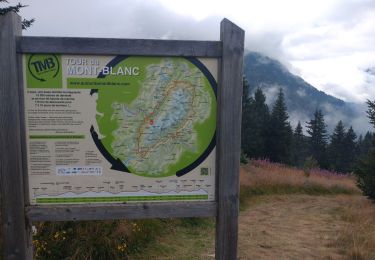
okfred26

Offline

Trails

Trail Walking Chastel-Arnaud - CRESTA le POIRIER - CHASTEL ARNAUD - Photo
Walking
okfred26

Walking

Very difficult
Chastel-Arnaud, Auvergne-Rhône-Alpes, Drôme, France
12.4 km | 21 km-effort
4h 45min
Yes
Trail Walking Hauterives - reco rando facteur CHEVAL/Hauterives  - Photo
Walking
okfred26

Walking

Difficult
Hauterives, Auvergne-Rhône-Alpes, Drôme, France
14.4 km | 18.3 km-effort
4h 9min
Yes
Trail Walking Corrençon-en-Vercors - Tête de la Chaudière  - Photo
Walking
okfred26

Walking

Difficult
Corrençon-en-Vercors, Auvergne-Rhône-Alpes, Isère, France
9.9 km | 21 km-effort
4h 44min
Yes
Trail Walking Corrençon-en-Vercors - Tête des Chaudière via Roche du Coin/pas de la Balme - Photo
Walking
okfred26

Walking

Very difficult
Corrençon-en-Vercors, Auvergne-Rhône-Alpes, Isère, France
11.5 km | 25 km-effort
5h 42min
Yes
Trail sport Le Dévoluy - 2023-10-16_08h10m57_SityTrail - Rocher Rond-Aller-Retour-reconnaissance du 12-10-2023 (ibp 124 ) - Photo
sport
okfred26

sport

Very easy
Le Dévoluy, Provence-Alpes-Côte d'Azur, Hautes-Alpes, France
11.5 km | 25 km-effort
Unknown
Yes
Trail Walking Le Dévoluy - Rocher Rond Aller / Retour-reconnaissance du 12-10-2023 - Photo
Walking
okfred26

Walking

Very difficult
Le Dévoluy, Provence-Alpes-Côte d'Azur, Hautes-Alpes, France
11.5 km | 25 km-effort
6h 5min
Yes
Trail Walking Le Dévoluy - 2023-10-04_21h12m05_rocher-rond - Photo
Walking
okfred26

Walking

Very difficult
Le Dévoluy, Provence-Alpes-Côte d'Azur, Hautes-Alpes, France
8.8 km | 23 km-effort
5h 9min
Yes
Trail Walking Châtel-en-Trièves - L'Aiguille n° 1-par Cordéac-massif du Dévoluy - Photo
Walking
okfred26

Walking

Very difficult
Châtel-en-Trièves, Auvergne-Rhône-Alpes, Isère, France
14.1 km | 29 km-effort
6h 31min
Yes
Trail Walking Châtel-en-Trièves - L'Aiguille N° 3 -Massif du Dévoluy - Photo
Walking
okfred26

Walking

Very difficult
Châtel-en-Trièves, Auvergne-Rhône-Alpes, Isère, France
13.5 km | 27 km-effort
6h 2min
Yes
Trail sport Le Dévoluy - 2023-10-04_21h28m07_le-grand-ferrand-par-la-voie-normale - Photo
sport
okfred26

sport

Very easy
Le Dévoluy, Provence-Alpes-Côte d'Azur, Hautes-Alpes, France
16 km | 35 km-effort
Unknown
Yes
Trail Walking Hauterives - autour du palais du facteur CHEVAL / HAUTERIVES - Photo
Walking
okfred26

Walking

Very difficult
Hauterives, Auvergne-Rhône-Alpes, Drôme, France
14.7 km | 19.2 km-effort
4h 21min
Yes
Trail sport Corrençon-en-Vercors - 2023-08-26_08h28m48_SityTrail Fred-Les trois-cabanes de-Corrençon à Ernadant-Rochers-de-la-Balme -GPX - Photo
sport
okfred26

sport

Very easy
Corrençon-en-Vercors, Auvergne-Rhône-Alpes, Isère, France
15.2 km | 28 km-effort
Unknown
Yes
Trail Walking Omblèze - roc de Toulaud /tête de la Dame / mur des Chartreux - Photo
Walking
okfred26

Walking

Very difficult
Omblèze, Auvergne-Rhône-Alpes, Drôme, France
17.8 km | 28 km-effort
7h 31min
Yes
Trail Walking Les Contamines-Montjoie - TMB JOUR 7 - CONTAMINES MONTJOIS / LES HOUCHES - Photo
Walking
okfred26

Walking

Very difficult
Les Contamines-Montjoie, Auvergne-Rhône-Alpes, Upper Savoy, France
19.3 km | 33 km-effort
7h 17min
No
Trail sport Chamonix-Mont-Blanc - 2023-07-19_00h17m45_GPX-SityTrail TMB- Complet 167 km - Photo
sport
okfred26

sport

Very easy
Chamonix-Mont-Blanc, Auvergne-Rhône-Alpes, Upper Savoy, France
167 km | 300 km-effort
Unknown
Yes
Trail On foot Villard-de-Lans - rando digestive Multipattes - Photo
On foot
okfred26

On foot

Easy
Villard-de-Lans, Auvergne-Rhône-Alpes, Isère, France
5.9 km | 8.4 km-effort
1h 54min
Yes
Trail Walking Saint-Christophe - la voie SARDE / tunnel des l'Echelles /st Christophe sur Guiers - Photo
Walking
okfred26

Walking

Very difficult
Saint-Christophe, Auvergne-Rhône-Alpes, Savoy, France
15.1 km | 23 km-effort
5h 12min
Yes
Trail Walking Valdrôme - Torsimoure / parking Valdrome - Photo
Walking
okfred26

Walking

Very difficult
Valdrôme, Auvergne-Rhône-Alpes, Drôme, France
17.3 km | 29 km-effort
8h 8min
Yes
Trail Walking Saint-Pierre-d'Entremont - le Grand Som- 13km - Photo
Walking
okfred26

Walking

Very difficult
Saint-Pierre-d'Entremont, Auvergne-Rhône-Alpes, Isère, France
13 km | 28 km-effort
6h 21min
Yes
Trail Walking Chichilianne - 2023-05-05_20h59m57_J2 ROCHER PARQUET MODIFIE - Photo
Walking
okfred26

Walking

Very difficult
Chichilianne, Auvergne-Rhône-Alpes, Isère, France
16.7 km | 31 km-effort
6h 59min
Yes
Trail Walking Die - les Balcons du Glandasse,rando Cathy - Photo
Walking
okfred26

Walking

Medium
Die, Auvergne-Rhône-Alpes, Drôme, France
14.3 km | 30 km-effort
6h 28min
Yes

Close
My subscriptions