PapouBertrand

Offline

Trails

Trail Walking Sisteron - Le Trou de l'Argent Via Sisteron - Photo
Walking
PapouBertrand

Walking

Difficult
(1)
Sisteron, Provence-Alpes-Côte d'Azur, Alpes-de-Haute-Provence, France
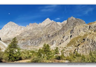
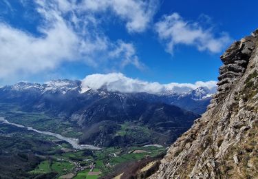
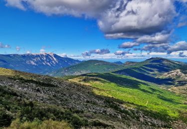
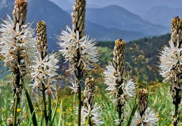
9.1 km | 17.9 km-effort
4h 4min
Yes
Trail Walking La Bâtie-des-Fonds - Roc De La Tour Via La Bâtie des Fonds - Source de la Drôme - Photo
Walking
PapouBertrand

Walking

Medium
La Bâtie-des-Fonds, Auvergne-Rhône-Alpes, Drôme, France
12.5 km | 21 km-effort
5h 4min
Yes
Trail Walking Joucas - Gorges de Véroncle Via Joucas - Photo
Walking
PapouBertrand

Walking

Difficult
Joucas, Provence-Alpes-Côte d'Azur, Vaucluse, France
11.6 km | 16.4 km-effort
3h 43min
Yes
Trail Walking Saint-Vincent-sur-Jabron - Crête Montagne de Mare Via St Vincent sur Jabron - Photo
Walking
PapouBertrand

Walking

Very difficult
Saint-Vincent-sur-Jabron, Provence-Alpes-Côte d'Azur, Alpes-de-Haute-Provence, France
14.8 km | 25 km-effort
5h 44min
Yes
Trail Walking Uvernet-Fours - Col de la Cloche - Croix de Saint Médard Via Villard d'Abas - Photo
Walking
PapouBertrand

Walking

Very difficult
(1)
Uvernet-Fours, Provence-Alpes-Côte d'Azur, Alpes-de-Haute-Provence, France
10.5 km | 19.6 km-effort
4h 27min
Yes
Trail Walking Beaujeu - Sommet Barre des Tremblès Via St Pierre - Photo
Walking
PapouBertrand

Walking

Very difficult
Beaujeu, Provence-Alpes-Côte d'Azur, Alpes-de-Haute-Provence, France
11.4 km | 19.1 km-effort
4h 20min
Yes
Trail Walking Châteauneuf-Miravail - Tour de la Montagne de Saint Michel + Le Pousterlon Via St Vincent / Jabron - Photo
Walking
PapouBertrand

Walking

Very difficult
Châteauneuf-Miravail, Provence-Alpes-Côte d'Azur, Alpes-de-Haute-Provence, France
12.2 km | 21 km-effort
4h 43min
No
Trail Walking Glandage - Tour Montagne de belle Motte et sucettes de Borne Via Glandage - Photo
Walking
PapouBertrand

Walking

Very difficult
Glandage, Auvergne-Rhône-Alpes, Drôme, France
13.3 km | 25 km-effort
5h 46min
No
Trail Walking Mollans-sur-Ouvèze - Le Toulourenc Via Veaux - Photo
Walking
PapouBertrand

Walking

Difficult
Mollans-sur-Ouvèze, Auvergne-Rhône-Alpes, Drôme, France
11.8 km | 17.8 km-effort
4h 2min
Yes
Trail Walking Saint-Michel-de-Chaillol - Sous Le Caire_Trou de la Fée Depuis Les Marrons - Photo
Walking
PapouBertrand

Walking

Very difficult
Saint-Michel-de-Chaillol, Provence-Alpes-Côte d'Azur, Hautes-Alpes, France
14.9 km | 27 km-effort
6h 1min
Yes
Trail Walking La Salette-Fallavaux - Croix de Rougny via ND de la Salette - Photo
Walking
PapouBertrand

Walking

Very difficult
(1)
La Salette-Fallavaux, Auvergne-Rhône-Alpes, Isère, France
10.5 km | 21 km-effort
4h 45min
Yes
Trail Walking Cervières - Le Grand Charvia et 11 lacs via Cervières - Photo
Walking
PapouBertrand

Walking

Very difficult
Cervières, Provence-Alpes-Côte d'Azur, Hautes-Alpes, France
14.5 km | 26 km-effort
5h 51min
Yes
Trail Walking Vallouise-Pelvoux - Refuge du Glacier Blanc via Pré Mme Carle - Photo
Walking
PapouBertrand

Walking

Very difficult
Vallouise-Pelvoux, Provence-Alpes-Côte d'Azur, Hautes-Alpes, France
11.1 km | 23 km-effort
6h 21min
Yes
Trail Walking Aspres-lès-Corps - Le Grand Journal (Jonquilles) via Aspres Les Corps - Photo
Walking
PapouBertrand

Walking

Very difficult
Aspres-lès-Corps, Provence-Alpes-Côte d'Azur, Hautes-Alpes, France
9.6 km | 22 km-effort
5h 19min
Yes
Trail Walking Mévouillon - Montagne du Buc via Le Col Meivouillon - Photo
Walking
PapouBertrand

Walking

Difficult
Mévouillon, Auvergne-Rhône-Alpes, Drôme, France
9.2 km | 16.5 km-effort
4h 20min
Yes
Trail Walking Méolans-Revel - Tête de Louis XVI via Les Clots - Photo
Walking
PapouBertrand

Walking

Very difficult
Méolans-Revel, Provence-Alpes-Côte d'Azur, Alpes-de-Haute-Provence, France
10.8 km | 24 km-effort
5h 26min
Yes
Trail Walking Gap - 3-pics-gleize_randonnee-40057005 - Photo
Walking
PapouBertrand

Walking

Difficult
Gap, Provence-Alpes-Côte d'Azur, Hautes-Alpes, France
6.9 km | 13.7 km-effort
3h 6min
Yes
Trail Walking Saint-Michel-de-Chaillol - Pic Queyrel et l'Arche Cachée via Chaillol - Photo
Walking
PapouBertrand

Walking

Very difficult
Saint-Michel-de-Chaillol, Provence-Alpes-Côte d'Azur, Hautes-Alpes, France
10.9 km | 21 km-effort
4h 41min
Yes
Trail Walking Le Dévoluy - Les 5 cols via La Cluse - Dévoluy - Photo
Walking
PapouBertrand

Walking

Very difficult
Le Dévoluy, Provence-Alpes-Côte d'Azur, Hautes-Alpes, France
17.6 km | 29 km-effort
6h 29min
Yes
Trail Walking Val-Buëch-Méouge - Crête de Chabre via Pomet - Photo
Walking
PapouBertrand

Walking

Very difficult
Val-Buëch-Méouge, Provence-Alpes-Côte d'Azur, Hautes-Alpes, France
14.5 km | 23 km-effort
4h 31min
Yes
Trail Walking Prads-Haute-Bléone - Crête du Cadun via Serre en Haute Bléone - Photo
Walking
PapouBertrand

Walking

Very difficult
Prads-Haute-Bléone, Provence-Alpes-Côte d'Azur, Alpes-de-Haute-Provence, France
11.5 km | 24 km-effort
5h 3min
Yes

Close
My subscriptions