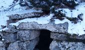
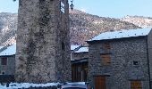
![](/images/other/stat-length.png)
![Trail Snowshoes Fontpédrouse - boucle autour du Cucurucull - Photo](https://media.geolcdn.com/t/1900/400/ext.pjpeg?maxdim=2&url=https%3A%2F%2Fservices.sitytrail.com%2FGeolivesWS%2FDownloadMedia.ashx%3FTrailID%3D911352%26Media%3Dfix__20180222143556.jpg)
boucle autour du Cucurucull
PVERTICAL
User
![Length](/images/other/stat-length.png)
Length
12.8 km
![Max alt](https://static1.geolcdn.com/siteimages/upload/files/1508320355ic_sort_altitude_max_24dp.png)
Max alt
2366 m
![Uphill gradient](https://static1.geolcdn.com/siteimages/upload/files/1508320355ic_sort_den_pos_24dp.png)
Uphill gradient
1062 m
![Km-Effort](/images/other/stat-length.png)
Km-Effort
27 km
![Min alt](https://static1.geolcdn.com/siteimages/upload/files/1508320355ic_sort_altitude_min_24dp.png)
Min alt
1316 m
![Downhill gradient](https://static1.geolcdn.com/siteimages/upload/files/1508320355ic_sort_den_neg_24dp.png)
Downhill gradient
1062 m
![Boucle](https://static1.geolcdn.com/siteimages/upload/files/16400158638029165_repeat_loop_refresh_sync_direction_icon.png)
Boucle
Yes
Creation date :
2018-04-17 19:46:10.548
Updated on :
2018-04-17 19:46:10.548
![Snowshoes](https://static1.geolcdn.com/sitytour/trail-icons/504.png)
7h21
Difficulty : Difficult
![Scan this QR Code to open this trail in the SityTrail application](https://capi.geolives.com/qq0zvz2zws4bq2lad0pu/sitytour/trails/911352/qr.png?size=200)
FREE GPS app for hiking
About
Trail Snowshoes of 12.8 km to be discovered at Occitania, Pyrénées-Orientales, Fontpédrouse. This trail is proposed by PVERTICAL.
Description
depuis Prats Balaguer et ascension du col Mitja - bien respecter le sens de la boucle (moins difficile) - possiblité de ne pas faire le col de Mitja
Positioning
Country:
France
Region :
Occitania
Department/Province :
Pyrénées-Orientales
Municipality :
Fontpédrouse
Location:
Unknown
Start:(Dec)
Start:(UTM)
431956 ; 4705493 (31T) N.
Comments
Trails nearby
![Trail Walking Thuès-Entre-Valls - boucle des gorges de Caranca - Photo](https://media.geolcdn.com/t/375/260/ext.jpg?maxdim=2&url=https%3A%2F%2Fservices.sitytrail.com%2FGeolivesWS%2FDownloadMedia.ashx%3FTrailID%3D458010%26Media%3Dfix__20150803202132.jpg)
![Walking Walking](https://static1.geolcdn.com/sitytour/trail-icons/101.png)
boucle des gorges de Caranca
Walking
Medium
(2)
Thuès-Entre-Valls,
Occitania,
Pyrénées-Orientales,
France
![](/images/other/stat-length.png)
7.2 km | 15.3 km-effort
3h 1min
![](https://static1.geolcdn.com/siteimages/upload/files/16400158638029165_repeat_loop_refresh_sync_direction_icon.png)
Yes
![Trail Walking Thuès-Entre-Valls - Gorges de la garanca - Photo](https://media.geolcdn.com/t/375/260/ab886760-cfd8-4f4f-b5c8-9c9573fb7249.jpg&format=jpg&maxdim=2)
![Walking Walking](https://static1.geolcdn.com/sitytour/trail-icons/101.png)
Gorges de la garanca
Walking
Very easy
(1)
Thuès-Entre-Valls,
Occitania,
Pyrénées-Orientales,
France
![](/images/other/stat-length.png)
6.7 km | 13.1 km-effort
3h 39min
![](https://static1.geolcdn.com/siteimages/upload/files/16400158638029165_repeat_loop_refresh_sync_direction_icon.png)
No
![Trail Walking Fontpédrouse - Tour du Cucurucull - Photo](https://media.geolcdn.com/t/375/260/ext.jpg?maxdim=2&url=https%3A%2F%2Fservices.sitytrail.com%2FGeolivesWS%2FDownloadMedia.ashx%3FTrailID%3D376769%26Media%3Dfix__20150112140709.jpg)
![Walking Walking](https://static1.geolcdn.com/sitytour/trail-icons/101.png)
Tour du Cucurucull
Walking
Medium
(1)
Fontpédrouse,
Occitania,
Pyrénées-Orientales,
France
![](/images/other/stat-length.png)
9.3 km | 18.5 km-effort
3h 24min
![](https://static1.geolcdn.com/siteimages/upload/files/16400158638029165_repeat_loop_refresh_sync_direction_icon.png)
Yes
![Trail Walking Planès - étang de Planès - Photo](https://media.geolcdn.com/t/375/260/ext.jpg?maxdim=2&url=https%3A%2F%2Fservices.sitytrail.com%2FGeolivesWS%2FDownloadMedia.ashx%3FTrailID%3D330882%26Media%3Dfix__20140804135744.jpg)
![Walking Walking](https://static1.geolcdn.com/sitytour/trail-icons/101.png)
étang de Planès
Walking
Medium
(2)
Planès,
Occitania,
Pyrénées-Orientales,
France
![](/images/other/stat-length.png)
10.8 km | 19.6 km-effort
3h 54min
![](https://static1.geolcdn.com/siteimages/upload/files/16400158638029165_repeat_loop_refresh_sync_direction_icon.png)
No
![Trail Walking Fontpédrouse - fontpérouse sentier des canaux et sources chaudes naturelles_T - Photo](https://media.geolcdn.com/t/375/260/ext.jpg?maxdim=2&url=https%3A%2F%2Fservices.sitytrail.com%2FGeolivesWS%2FDownloadMedia.ashx%3FTrailID%3D327463%26Media%3Dfix__20140724100812.jpg)
![Walking Walking](https://static1.geolcdn.com/sitytour/trail-icons/101.png)
fontpérouse sentier des canaux et sources chaudes naturelles_T
Walking
Medium
(1)
Fontpédrouse,
Occitania,
Pyrénées-Orientales,
France
![](/images/other/stat-length.png)
13.7 km | 25 km-effort
5h 9min
![](https://static1.geolcdn.com/siteimages/upload/files/16400158638029165_repeat_loop_refresh_sync_direction_icon.png)
Yes
![Trail Walking Fontpédrouse - Carenza à la perche - Photo](https://media.geolcdn.com/t/375/260/e5129642-9fc2-49eb-8e63-ecc481cd1928.jpg&format=jpg&maxdim=2)
![Walking Walking](https://static1.geolcdn.com/sitytour/trail-icons/101.png)
Carenza à la perche
Walking
Difficult
Fontpédrouse,
Occitania,
Pyrénées-Orientales,
France
![](/images/other/stat-length.png)
23 km | 38 km-effort
8h 57min
![](https://static1.geolcdn.com/siteimages/upload/files/16400158638029165_repeat_loop_refresh_sync_direction_icon.png)
No
![Trail Walking La Cabanasse - Mois pontpedrouse après montée en train jaune - Photo](https://media.geolcdn.com/t/375/260/faab2c37-8bf8-419b-a8bb-43eea6c57cc7.jpg&format=jpg&maxdim=2)
![Walking Walking](https://static1.geolcdn.com/sitytour/trail-icons/101.png)
Mois pontpedrouse après montée en train jaune
Walking
Very easy
La Cabanasse,
Occitania,
Pyrénées-Orientales,
France
![](/images/other/stat-length.png)
9.2 km | 14.3 km-effort
3h 33min
![](https://static1.geolcdn.com/siteimages/upload/files/16400158638029165_repeat_loop_refresh_sync_direction_icon.png)
No
![Trail Walking Thuès-Entre-Valls - Thuès-Entre-Valls - Gorges de la Cartança - 13.1km D 4h30mn (30mn) - 2018 09 11 - Photo](https://media.geolcdn.com/t/375/260/ext.jpg?maxdim=2&url=https%3A%2F%2Fservices.sitytrail.com%2FGeolivesWS%2FDownloadMedia.ashx%3FTrailID%3D1042072%26Media%3Dfix__20180911103923.jpg)
![Walking Walking](https://static1.geolcdn.com/sitytour/trail-icons/101.png)
Thuès-Entre-Valls - Gorges de la Cartança - 13.1km D 4h30mn (30mn) - 2018 09 11
Walking
Difficult
Thuès-Entre-Valls,
Occitania,
Pyrénées-Orientales,
France
![](/images/other/stat-length.png)
12.3 km | 23 km-effort
4h 30min
![](https://static1.geolcdn.com/siteimages/upload/files/16400158638029165_repeat_loop_refresh_sync_direction_icon.png)
Yes
![Trail Walking Saint-Pierre-dels-Forcats - bains de St Thomas - Photo](https://media.geolcdn.com/t/375/260/ext.jpg?maxdim=2&url=https%3A%2F%2Fstatic1.geolcdn.com%2Fsiteimages%2Fupload%2Ffiles%2F1553511878bg_sport_marche.png)
![Walking Walking](https://static1.geolcdn.com/sitytour/trail-icons/101.png)
bains de St Thomas
Walking
Medium
(1)
Saint-Pierre-dels-Forcats,
Occitania,
Pyrénées-Orientales,
France
![](/images/other/stat-length.png)
8.6 km | 12.2 km-effort
2h 42min
![](https://static1.geolcdn.com/siteimages/upload/files/16400158638029165_repeat_loop_refresh_sync_direction_icon.png)
No