


3.1 km | 3.9 km-effort


Tous les sentiers balisés d’Europe GUIDE+


FREE GPS app for hiking
 SityTrail
IGN / Geographical institutes
SityTrail World
The world is yours!
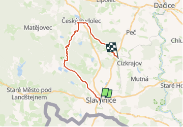
Trail On foot of 17.7 km to be discovered at Southwest, Jihočeský kraj, Slavonice. This trail is proposed by SityTrail - itinéraires balisés pédestres.
Trail created by cz:KČT.
 - Slavonice - Photo 1")
 - Slavonice - Photo 2")
 - Slavonice - Photo 3")
 - Slavonice - Photo 4")
 - Slavonice - Photo 5")
 - Slavonice - Photo 6")
 - Slavonice - Photo 7")
 - Slavonice - Photo 8")
 - Slavonice - Photo 9")
 - Slavonice - Photo 10")
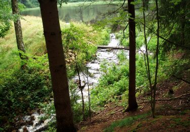
![Trail On foot Slavonice - [Z] U Pfaffenshlagu - U Velkého rákosního rybníku - Photo](https://media.geolcdn.com/t/375/260/211566f5-2838-442e-b8a8-1eb4141d961e.jpeg&format=jpg&maxdim=2)
On foot
On foot