![](/images/other/stat-length.png)
- Trails
- Outdoor
- Czech Republic
- Southwest
- Jihočeský kraj
- Slavonice
Slavonice, Jihočeský kraj: Best trails, routes and walks
Slavonice: Discover the best trails: 3 hiking trails. All these trails, routes and outdoor activities are available in our SityTrail applications for smartphones and tablets.
The best trails (3)
![Trail On foot Slavonice - NS Pohádkovým lesem - Photo](https://media.geolcdn.com/t/350/260/d7a65147-1182-46e6-b53c-592ff6e119f3.jpeg&format=jpg&maxdim=2)
![On foot On foot](https://static1.geolcdn.com/sitytour/trail-icons/100.png)
Km
#1 - NS Pohádkovým lesem
On foot
Easy
Slavonice,
Southwest,
Jihočeský kraj,
Czech Republic
![](/images/other/stat-length.png)
3.4 km | 4.5 km-effort
1h 1min
![](https://static1.geolcdn.com/siteimages/upload/files/1508320355ic_sort_den_pos_24dp.png)
77 m
![](https://static1.geolcdn.com/siteimages/upload/files/1508320355ic_sort_den_neg_24dp.png)
85 m
![](https://static1.geolcdn.com/siteimages/upload/files/16400158638029165_repeat_loop_refresh_sync_direction_icon.png)
No
SityTrail - itinéraires balisés pédestres
• Trail created by cz:KČT.
![Trail On foot Slavonice - Graselova stezka (G) - Slavonice - Photo](https://media.geolcdn.com/t/350/260/63ffc000-7ae9-476b-9091-a50878743435.jpeg&format=jpg&maxdim=2)
![On foot On foot](https://static1.geolcdn.com/sitytour/trail-icons/100.png)
Km
#2 - Graselova stezka (G) - Slavonice
On foot
Medium
Slavonice,
Southwest,
Jihočeský kraj,
Czech Republic
![](/images/other/stat-length.png)
17.7 km | 22 km-effort
4h 53min
![](https://static1.geolcdn.com/siteimages/upload/files/1508320355ic_sort_den_pos_24dp.png)
272 m
![](https://static1.geolcdn.com/siteimages/upload/files/1508320355ic_sort_den_neg_24dp.png)
324 m
![](https://static1.geolcdn.com/siteimages/upload/files/16400158638029165_repeat_loop_refresh_sync_direction_icon.png)
No
SityTrail - itinéraires balisés pédestres
• Trail created by cz:KČT.
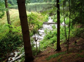
![Trail On foot Slavonice - [Z] U Pfaffenshlagu - U Velkého rákosního rybníku - Photo](https://media.geolcdn.com/t/350/260/211566f5-2838-442e-b8a8-1eb4141d961e.jpeg&format=jpg&maxdim=2)
![On foot On foot](https://static1.geolcdn.com/sitytour/trail-icons/100.png)
Km
#3 - [Z] U Pfaffenshlagu - U Velkého rákosního rybníku
On foot
Easy
Slavonice,
Southwest,
Jihočeský kraj,
Czech Republic
![](/images/other/stat-length.png)
3.1 km | 3.9 km-effort
52min
![](https://static1.geolcdn.com/siteimages/upload/files/1508320355ic_sort_den_pos_24dp.png)
77 m
![](https://static1.geolcdn.com/siteimages/upload/files/1508320355ic_sort_den_neg_24dp.png)
9 m
![](https://static1.geolcdn.com/siteimages/upload/files/16400158638029165_repeat_loop_refresh_sync_direction_icon.png)
No
SityTrail - itinéraires balisés pédestres
• Trail created by cz:KČT.
3 trails displayed on 3
FREE GPS app for hiking