![](/images/other/stat-length.png)
![Trail Walking Cervières - Circuit du Lac des Cordes - Photo](https://media.geolcdn.com/t/1900/400/773a9233-b719-442d-b7b1-75196ce74f87.jpg&format=pjpeg&maxdim=2)
Circuit du Lac des Cordes
GuyVachet
User
![Length](/images/other/stat-length.png)
![Max alt](https://static1.geolcdn.com/siteimages/upload/files/1508320355ic_sort_altitude_max_24dp.png)
![Uphill gradient](https://static1.geolcdn.com/siteimages/upload/files/1508320355ic_sort_den_pos_24dp.png)
![Km-Effort](/images/other/stat-length.png)
![Min alt](https://static1.geolcdn.com/siteimages/upload/files/1508320355ic_sort_altitude_min_24dp.png)
![Downhill gradient](https://static1.geolcdn.com/siteimages/upload/files/1508320355ic_sort_den_neg_24dp.png)
![Boucle](https://static1.geolcdn.com/siteimages/upload/files/16400158638029165_repeat_loop_refresh_sync_direction_icon.png)
![Walking](https://static1.geolcdn.com/sitytour/trail-icons/101.png)
3h55
Difficulty : Difficult
![Scan this QR Code to open this trail in the SityTrail application](https://capi.geolives.com/qq0zvz2zws4bq2lad0pu/sitytour/trails/4142287/qr.png?size=200)
FREE GPS app for hiking
About
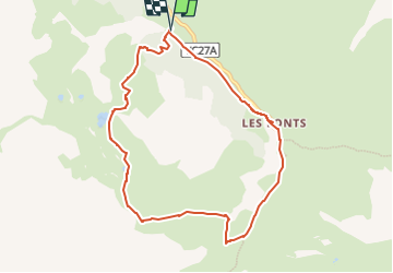
Trail Walking of 8.7 km to be discovered at Provence-Alpes-Côte d'Azur, Hautes-Alpes, Cervières. This trail is proposed by GuyVachet.
Description
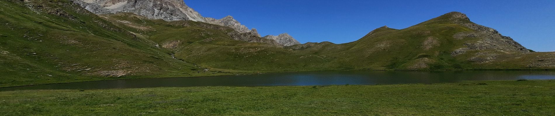
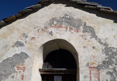
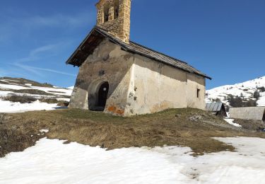
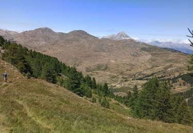
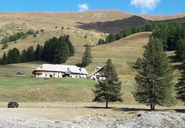
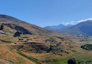
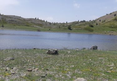
Boucle classique dans un bel environnement de montagne en empruntant la variante du GR58. La montée régulière commence dans les mélèzes puis après un court passage assuré par un câble, le sentier débouche en alpage. La vue s'ouvre au lac des Cordes et la montée au Col des Marsailles s'enchaine sans problème. La pente modérée de la descente permet de profiter du paysage pour arriver aux Fonts de Cervières avec son refuge et il ne reste qu'à suivre la rive gauche de la Cerveyrette pour rejoindre le parking.
Positioning
Comments
Trails nearby
![Trail Walking Cervières - Le Petit rochebrune par col de péas - Photo](https://media.geolcdn.com/t/375/260/e12553c6-5b67-4a21-b5b9-83e83e9c9741.jpg&format=jpg&maxdim=2)
![Walking Walking](https://static1.geolcdn.com/sitytour/trail-icons/101.png)
Walking
![](/images/other/stat-length.png)
![](https://static1.geolcdn.com/siteimages/upload/files/16400158638029165_repeat_loop_refresh_sync_direction_icon.png)
![Trail Walking Cervières - le lac des Cordes et le pic du vallon Crouzet - Photo](https://media.geolcdn.com/t/375/260/ext.jpg?maxdim=2&url=https%3A%2F%2Fservices.sitytrail.com%2FGeolivesWS%2FDownloadMedia.ashx%3FTrailID%3D787861%26Media%3Dfix__20170710153913.jpg)
![Walking Walking](https://static1.geolcdn.com/sitytour/trail-icons/101.png)
Walking
![](/images/other/stat-length.png)
![](https://static1.geolcdn.com/siteimages/upload/files/16400158638029165_repeat_loop_refresh_sync_direction_icon.png)
![Trail Walking Cervières - Cerviere lac Gignoux - Photo](https://media.geolcdn.com/t/375/260/fb49a4e5-e730-4029-93ed-5953862acf9b.jpg&format=jpg&maxdim=2)
![Walking Walking](https://static1.geolcdn.com/sitytour/trail-icons/101.png)
Walking
![](/images/other/stat-length.png)
![](https://static1.geolcdn.com/siteimages/upload/files/16400158638029165_repeat_loop_refresh_sync_direction_icon.png)
![Trail Touring skiing Cervières - PT 2944 crête de Dormillouse - Photo](https://media.geolcdn.com/t/375/260/9199c634-7f71-48f6-bcd5-441d1eaab9cb.jpg&format=jpg&maxdim=2)
![Touring skiing Touring skiing](https://static1.geolcdn.com/sitytour/trail-icons/503.png)
Touring skiing
![](/images/other/stat-length.png)
![](https://static1.geolcdn.com/siteimages/upload/files/16400158638029165_repeat_loop_refresh_sync_direction_icon.png)
![Trail Walking Cervières - le lasseron col de chaude maison - Photo](https://media.geolcdn.com/t/375/260/a0498023-fd7f-45a6-ba40-c354c806ca60.jpg&format=jpg&maxdim=2)
![Walking Walking](https://static1.geolcdn.com/sitytour/trail-icons/101.png)
Walking
![](/images/other/stat-length.png)
![](https://static1.geolcdn.com/siteimages/upload/files/16400158638029165_repeat_loop_refresh_sync_direction_icon.png)
![Trail Walking Cervières - Le Lac des cordes - Photo](https://media.geolcdn.com/t/375/260/4677ed4c-abf4-4114-9dfd-57192ba7a290.jpg&format=jpg&maxdim=2)
![Walking Walking](https://static1.geolcdn.com/sitytour/trail-icons/101.png)
Walking
![](/images/other/stat-length.png)
![](https://static1.geolcdn.com/siteimages/upload/files/16400158638029165_repeat_loop_refresh_sync_direction_icon.png)
![Trail Walking Cervières - Le Grand Charvia - Photo](https://media.geolcdn.com/t/375/260/a4ced1e8-abe2-4941-8584-b75521bbb768.jpg&format=jpg&maxdim=2)
![Walking Walking](https://static1.geolcdn.com/sitytour/trail-icons/101.png)
Walking
![](/images/other/stat-length.png)
![](https://static1.geolcdn.com/siteimages/upload/files/16400158638029165_repeat_loop_refresh_sync_direction_icon.png)
![Trail Walking Cervières - Cervières - Photo](https://media.geolcdn.com/t/375/260/f561040d-b80f-418b-add3-8cdb93f1c691.jpg&format=jpg&maxdim=2)
![Walking Walking](https://static1.geolcdn.com/sitytour/trail-icons/101.png)
Walking
![](/images/other/stat-length.png)
![](https://static1.geolcdn.com/siteimages/upload/files/16400158638029165_repeat_loop_refresh_sync_direction_icon.png)
![Trail Walking Cervières - Arsem Les fonts de Cervieres - Photo](https://media.geolcdn.com/t/375/260/1c663feb-cf6d-4c05-adc4-11e78d8381cd.jpg&format=jpg&maxdim=2)
![Walking Walking](https://static1.geolcdn.com/sitytour/trail-icons/101.png)
Walking
![](/images/other/stat-length.png)
![](https://static1.geolcdn.com/siteimages/upload/files/16400158638029165_repeat_loop_refresh_sync_direction_icon.png)