Cervières, Hautes-Alpes: Best trails, routes and walks

16 comments

Cervières: Discover the best trails: 138 hiking trails and 10 bike and mountain-bike routes. All these trails, routes and outdoor activities are available in our SityTrail applications for smartphones and tablets.


The best trails (222)

Trail Touring skiing Cervières - bas de Rochebrune - Photo
Touring skiing 15.101
Km
GUIDE

Touring skiing

Medium
Cervières, Provence-Alpes-Côte d'Azur, Hautes-Alpes, France
15.1 km | 29 km-effort
4h 5min
1076 m
1064 m
No
nadd73

Trail Walking Cervières - Peyre moutte - Photo
Walking 6.214
Km
GUIDE

Walking

Easy
Cervières, Provence-Alpes-Côte d'Azur, Hautes-Alpes, France
6.2 km | 13.5 km-effort
2h 41min
551 m
547 m
Yes
nadd73

Trail Touring skiing Cervières - Chaude maison  - Photo
Touring skiing 14.287
Km
GUIDE

Touring skiing

Medium
Cervières, Provence-Alpes-Côte d'Azur, Hautes-Alpes, France
14.3 km | 33 km-effort
6h 12min
1383 m
1383 m
Yes
nadd73

Trail Touring skiing Cervières - Chaude maison  - Photo
Touring skiing 14.287
Km
GUIDE

Touring skiing

Medium
Cervières, Provence-Alpes-Côte d'Azur, Hautes-Alpes, France
14.3 km | 33 km-effort
6h 9min
1383 m
1383 m
Yes
nadd73

Trail Walking Cervières - pic de Rochebrune - Photo
Walking 10.776
Km
GUIDE

Walking

Very difficult
Cervières, Provence-Alpes-Côte d'Azur, Hautes-Alpes, France
10.8 km | 26 km-effort
8h 10min
1111 m
1109 m
Yes
amiral13

Trail Walking Cervières - Le Petit rochebrune par col de péas - Photo
Walking 15.239
Km
GUIDE

Walking

Difficult
Cervières, Provence-Alpes-Côte d'Azur, Hautes-Alpes, France
15.2 km | 31 km-effort
8h 8min
1158 m
1159 m
Yes
amiral13

Trail Walking Cervières - le lac des Cordes et le pic du vallon Crouzet - Photo
Walking 11.827
Km
GUIDE

Walking

Easy
Cervières, Provence-Alpes-Côte d'Azur, Hautes-Alpes, France
11.8 km | 22 km-effort
4h 26min
755 m
757 m
Yes
amiral13

Trail Other activity Cervières - crête de Bugnet.  crête des Granges. Col des Peygus  - Photo
Other activity 14.313
Km
GUIDE

Other activity

Medium
Cervières, Provence-Alpes-Côte d'Azur, Hautes-Alpes, France
14.3 km | 30 km-effort
8h 17min
1185 m
1185 m
Yes
nadd73

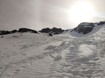
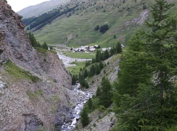
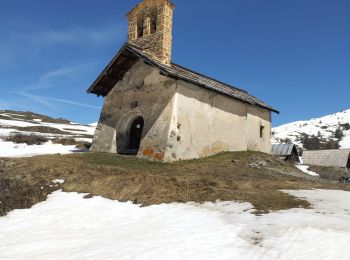
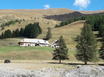
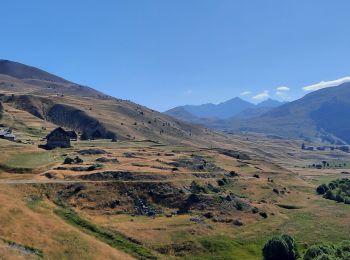
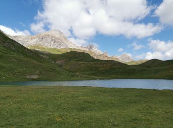
• Départ route du col d'Izoard. Le Laus vers 2144m se garer au virage direction les chalets d'Izoard. Nous avons voul...

Trail Snowshoes Cervières - Le Laus - Vers Izoard par le sentier de la Mule - Photo
Snowshoes 12.333
Km

Snowshoes

Difficult
(3)
Cervières, Provence-Alpes-Côte d'Azur, Hautes-Alpes, France
12.3 km | 20 km-effort
5h 18min
590 m
590 m
Yes
Pek56

Trail Walking Cervières - Circuit du Lac des Cordes - Photo
Walking 8.69
Km

Walking

Difficult
Cervières, Provence-Alpes-Côte d'Azur, Hautes-Alpes, France
8.7 km | 17.2 km-effort
3h 55min
641 m
642 m
Yes
GuyVachet

Trail Walking Cervières - Cerviere lac Gignoux - Photo
Walking 9.098
Km

Walking

Medium
(1)
Cervières, Provence-Alpes-Côte d'Azur, Hautes-Alpes, France
9.1 km | 15.3 km-effort
3h 18min
468 m
468 m
Yes
Sorriaux

Trail Touring skiing Cervières - PT 2944 crête de Dormillouse  - Photo
Touring skiing 8.692
Km
GUIDE

Touring skiing

Medium
Cervières, Provence-Alpes-Côte d'Azur, Hautes-Alpes, France
8.7 km | 12.6 km-effort
1h 25min
37 m
1073 m
No
nadd73

Trail Walking Cervières - le lasseron col de chaude maison  - Photo
Walking 13.309
Km

Walking

Difficult
Cervières, Provence-Alpes-Côte d'Azur, Hautes-Alpes, France
13.3 km | 28 km-effort
9h 54min
1136 m
1132 m
Yes
Evenc

Trail Walking Cervières - Le Lac des cordes  - Photo
Walking 10.033
Km

Walking

Difficult
Cervières, Provence-Alpes-Côte d'Azur, Hautes-Alpes, France
10 km | 18.7 km-effort
3h 42min
642 m
670 m
No
Sorriaux

Trail Walking Cervières - Le Grand Charvia - Photo
Walking 10.858
Km

Walking

Very difficult
Cervières, Provence-Alpes-Côte d'Azur, Hautes-Alpes, France
10.9 km | 21 km-effort
4h 43min
745 m
747 m
Yes
GuyVachet

Trail Walking Cervières - Cervières - Photo
Walking 7.701
Km

Walking

Difficult
Cervières, Provence-Alpes-Côte d'Azur, Hautes-Alpes, France
7.7 km | 13.4 km-effort
3h 6min
430 m
421 m
Yes
pensionisten71

Trail Walking Cervières - Arsem Les fonts de Cervieres - Photo
Walking 13.443
Km

Walking

Medium
Cervières, Provence-Alpes-Côte d'Azur, Hautes-Alpes, France
13.4 km | 23 km-effort
5h 44min
698 m
734 m
No
labarone

Trail Winter toboggan Cervières - refuge Les Fonts à Chalp - Photo
Winter toboggan 22.146
Km

Winter toboggan

Difficult
Cervières, Provence-Alpes-Côte d'Azur, Hautes-Alpes, France
22 km | 35 km-effort
7h 1min
868 m
1248 m
No
jeff2

Trail Walking Cervières - cime saurel - Photo
Walking 10.87
Km

Walking

Easy
Cervières, Provence-Alpes-Côte d'Azur, Hautes-Alpes, France
10.9 km | 18.1 km-effort
5h 5min
544 m
544 m
Yes
gibello

Trail Walking Cervières - Lac des Cordes - Photo
Walking 3.208
Km

Walking

Difficult
Cervières, Provence-Alpes-Côte d'Azur, Hautes-Alpes, France
3.2 km | 8.2 km-effort
1h 44min
492 m
17 m
No
Jacques-WIRTH

20 trails displayed on 222

FREE GPS app for hiking

Logo SityTrail SityTrail

IGN / Geographical institutes

Download SityTrail from the App Store Download SityTrail from Google Play

Logo SityTrail SityTrail World

The world is yours!

Download SityTrail from the App Store Download SityTrail from Google Play Download SityTrail on Huawei AppGallery

Activities

Close
My subscriptions