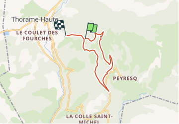
Trail Walking Thorame-Haute - Serpegier retour Champlatte - Photo
 dan0406
dan0406

User

© OpenStreetMap contributors
Length
Length
11.4 km
Max alt
Max alt
1766 m
Uphill gradient
Uphill gradient
414 m
Km-Effort
Km-Effort  
16.8 km
Min alt
Min alt
1458 m
Downhill gradient
Downhill gradient
380 m
Boucle
Boucle
No
Creation date :
2024-06-14 05:22:43.697
Updated on :
2024-06-14 05:24:23.034

(0 Reviews)

Walking
Walking
3h49
Difficulty : Difficult

Scan this QR Code to open this trail in the SityTrail application

FREE GPS app for hiking

Logo SityTrail SityTrail

IGN / Geographical institutes

Download SityTrail from the App Store Download SityTrail from Google Play

Logo SityTrail SityTrail World

The world is yours!

Download SityTrail from the App Store Download SityTrail from Google Play Download SityTrail on Huawei AppGallery

About

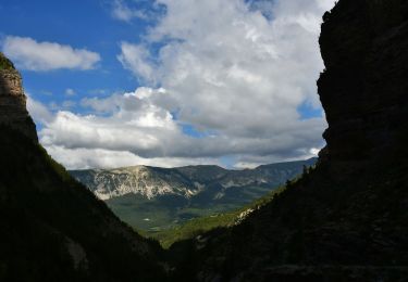
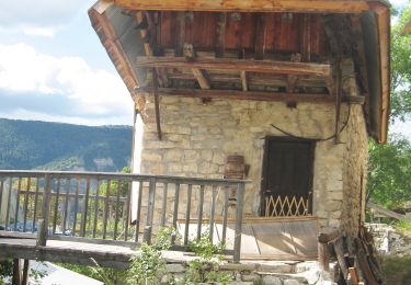
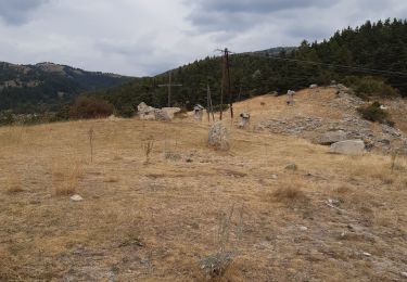
Trail Walking of 11.4 km to be discovered at Provence-Alpes-Côte d'Azur, Alpes-de-Haute-Provence, Thorame-Haute. This trail is proposed by dan0406.

Description

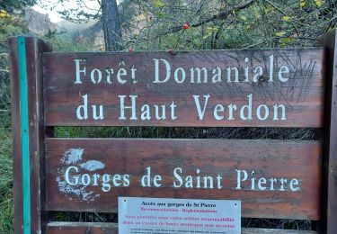
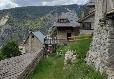
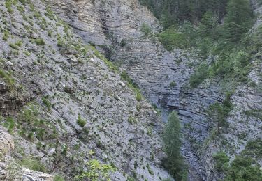
Forêt de Serpegier et retour par Champlatte
Départ de la randonnée par la route de Peyresq.

Elevation profile

Positioning

Country:
France
Region :
Provence-Alpes-Côte d'Azur
Department/Province :
Alpes-de-Haute-Provence
Municipality :
Thorame-Haute
Location:
Unknown
Start:(UTM)
307097 ; 4884404 (32T) N.

Trails nearby

Trail Walking Beauvezer - les gorges de St-Pierre - Photo
Walking
GUIDE
amiral13

Walking

Easy
Beauvezer, Provence-Alpes-Côte d'Azur, Alpes-de-Haute-Provence, France
6.5 km | 12.7 km-effort
2h 3min
Yes
Trail Walking Beauvezer - 04.gorges st pierre 03.08.23 - Photo
Walking
randodyssée

Walking

Easy
Beauvezer, Provence-Alpes-Côte d'Azur, Alpes-de-Haute-Provence, France
4.6 km | 9 km-effort
1h 29min
No
Trail Walking Beauvezer - 12-07-2023 Gorges de Saint Pierre  - Photo
Walking
GUIDE
Kargil

Walking

Difficult
Beauvezer, Provence-Alpes-Côte d'Azur, Alpes-de-Haute-Provence, France
13.4 km | 25 km-effort
5h 36min
Yes
Trail Walking Beauvezer - Gorges de St Pierre-21-09-21 - Photo
Walking
Christiancordin

Walking

Difficult
Beauvezer, Provence-Alpes-Côte d'Azur, Alpes-de-Haute-Provence, France
20 km | 37 km-effort
5h 21min
Yes
Trail Walking Thorame-Haute - peyrus.le couradour  - Photo
Walking
Joel26400

Walking

Medium
Thorame-Haute, Provence-Alpes-Côte d'Azur, Alpes-de-Haute-Provence, France
13.3 km | 22 km-effort
4h 10min
Yes
Trail Walking Beauvezer - les gorges st pierre. Colmars les Alpes. Villars  - Photo
Walking
Joel26400

Walking

Medium
Beauvezer, Provence-Alpes-Côte d'Azur, Alpes-de-Haute-Provence, France
15.9 km | 28 km-effort
5h 2min
Yes
Trail Walking Beauvezer - Gorges de Saint Pierre - Photo
Walking
LtZIP

Walking

Medium
Beauvezer, Provence-Alpes-Côte d'Azur, Alpes-de-Haute-Provence, France
11.6 km | 22 km-effort
4h 22min
Yes
Trail Walking Thorame-Haute - pic de courradour  - Photo
Walking
daniel256

Walking

Easy
Thorame-Haute, Provence-Alpes-Côte d'Azur, Alpes-de-Haute-Provence, France
16 km | 31 km-effort
4h 28min
No
Trail Walking Beauvezer - gorges de st Pierre Plateau fe pisse en l'air - Photo
Walking
puchol

Walking

Difficult
Beauvezer, Provence-Alpes-Côte d'Azur, Alpes-de-Haute-Provence, France
17.2 km | 33 km-effort
6h 54min
Yes


Close
My subscriptions