


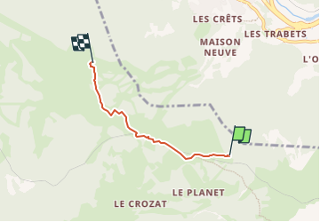

7.3 km | 11.4 km-effort


User GUIDE


FREE GPS app for hiking
 SityTrail
IGN / Geographical institutes
SityTrail World
The world is yours!
Trail Walking of 3.3 km to be discovered at Auvergne-Rhône-Alpes, Upper Savoy, Saint-Gervais-les-Bains. This trail is proposed by mumu.larandonneuse.
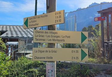
À la sortie du téléphérique, descendre à gauche sous l’ancien hôtel de Bellevue,
vue sur les Aiguilles de Bionnassay et du Goûter, en longeant la voie ferrée
du Tramway du Mont-Blanc. En dessous, à droite, un alpage toujours utilisé.
Rejoindre le Col de Voza (1 653 m). Suivre le chemin qui part sur la droite et qui
monte vers l’Hôtel du Prarion et la gare de télécabine LHSG (1 853 m).
Possible de partir des Houches.
Plus de renseignements disponibles à l'Office de Tourisme ou l'Office de Haute-Montagne et dans notre guide sentier.
Attention : Les conditions des sentiers sont susceptibles de changer, pensez à vous renseigner avant de partir.
ℹ️ https://www.savoie-mont-blanc.com/randonnees-et-balades/grand-balcon-nord-bellevue-prarion-77006/
.

Walking

Walking

Walking

Walking
Walking
Walking
Walking
Walking
Walking