![](/images/other/stat-length.png)
![Trail On foot Lantosque - Forêt de la Maïris - Photo](https://media.geolcdn.com/t/1900/400/ext.pjpeg?maxdim=2&url=https%3A%2F%2Fstatic1.geolcdn.com%2Fsiteimages%2Fupload%2Ffiles%2F1545311037marcheuse_200dpi.jpg)
Forêt de la Maïris
SityTrail - itinéraires balisés pédestres
Tous les sentiers balisés d’Europe GUIDE+
![Length](/images/other/stat-length.png)
![Max alt](https://static1.geolcdn.com/siteimages/upload/files/1508320355ic_sort_altitude_max_24dp.png)
![Uphill gradient](https://static1.geolcdn.com/siteimages/upload/files/1508320355ic_sort_den_pos_24dp.png)
![Km-Effort](/images/other/stat-length.png)
![Min alt](https://static1.geolcdn.com/siteimages/upload/files/1508320355ic_sort_altitude_min_24dp.png)
![Downhill gradient](https://static1.geolcdn.com/siteimages/upload/files/1508320355ic_sort_den_neg_24dp.png)
![Boucle](https://static1.geolcdn.com/siteimages/upload/files/16400158638029165_repeat_loop_refresh_sync_direction_icon.png)
![On foot](https://static1.geolcdn.com/sitytour/trail-icons/100.png)
6h11
Difficulty : Medium
![Scan this QR Code to open this trail in the SityTrail application](https://capi.geolives.com/qq0zvz2zws4bq2lad0pu/sitytour/trails/3123754/qr.png?size=200)
FREE GPS app for hiking
About
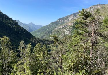
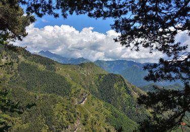
Trail On foot of 14.5 km to be discovered at Provence-Alpes-Côte d'Azur, Maritime Alps, Lantosque. This trail is proposed by SityTrail - itinéraires balisés pédestres.
Description
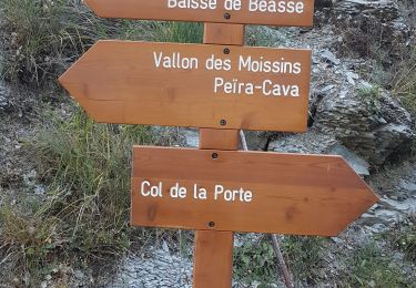
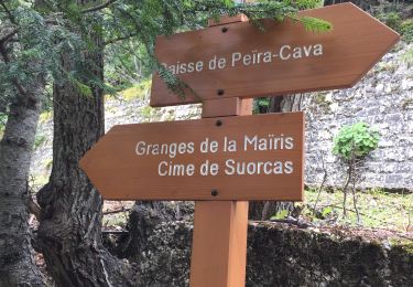
Randonnée pédestre - Au départ de Lantosque, hameau de Saint-Colomban (740 m)
Website: https://randoxygene.departement06.fr/vesubie/foret-de-la-mairis-9378.html
Positioning
Comments
Trails nearby
![Trail Walking Lantosque - cime de Suorcas en boucle - Photo](https://media.geolcdn.com/t/375/260/0ecdc4ca-4a6f-455e-849d-12769607394f.jpg&format=jpg&maxdim=2)
![Walking Walking](https://static1.geolcdn.com/sitytour/trail-icons/101.png)
Walking
![](/images/other/stat-length.png)
![](https://static1.geolcdn.com/siteimages/upload/files/16400158638029165_repeat_loop_refresh_sync_direction_icon.png)
![Trail Walking Lantosque - Granges de la Brasque - Photo](https://media.geolcdn.com/t/375/260/ee8b4883-5501-49f9-8eb7-bed82abe2c28.jpg&format=jpg&maxdim=2)
![Walking Walking](https://static1.geolcdn.com/sitytour/trail-icons/101.png)
Walking
![](/images/other/stat-length.png)
![](https://static1.geolcdn.com/siteimages/upload/files/16400158638029165_repeat_loop_refresh_sync_direction_icon.png)
![Trail Walking Lantosque - lant - Photo](https://media.geolcdn.com/t/375/260/ccdde91d-2181-4ba3-bd55-5ffd51b62cfd.jpg&format=jpg&maxdim=2)
![Walking Walking](https://static1.geolcdn.com/sitytour/trail-icons/101.png)
Walking
![](/images/other/stat-length.png)
![](https://static1.geolcdn.com/siteimages/upload/files/16400158638029165_repeat_loop_refresh_sync_direction_icon.png)
![Trail Walking Lucéram - Beasse Peira Cava - Photo](https://media.geolcdn.com/t/375/260/8bfc2976-571d-4ab2-a3ea-c6cbad9359c4.jpg&format=jpg&maxdim=2)
![Walking Walking](https://static1.geolcdn.com/sitytour/trail-icons/101.png)
Walking
![](/images/other/stat-length.png)
![](https://static1.geolcdn.com/siteimages/upload/files/16400158638029165_repeat_loop_refresh_sync_direction_icon.png)
![Trail Walking Lantosque - les Granges de la Brasque - Photo](https://media.geolcdn.com/t/375/260/0b01a371-8f82-4039-b884-9c76d0823460.jpg&format=jpg&maxdim=2)
![Walking Walking](https://static1.geolcdn.com/sitytour/trail-icons/101.png)
Walking
![](/images/other/stat-length.png)
![](https://static1.geolcdn.com/siteimages/upload/files/16400158638029165_repeat_loop_refresh_sync_direction_icon.png)
![Trail Walking Lantosque - Champignons - Photo](https://media.geolcdn.com/t/375/260/0d272018-6164-4ec7-8202-841759b1c2d9.jpg&format=jpg&maxdim=2)
![Walking Walking](https://static1.geolcdn.com/sitytour/trail-icons/101.png)
Walking
![](/images/other/stat-length.png)
![](https://static1.geolcdn.com/siteimages/upload/files/16400158638029165_repeat_loop_refresh_sync_direction_icon.png)
![Trail Walking Lantosque - hameau de beasse - Photo](https://media.geolcdn.com/t/375/260/1dc4932b-450f-444e-a096-dfa0d61169ec.jpg&format=jpg&maxdim=2)
![Walking Walking](https://static1.geolcdn.com/sitytour/trail-icons/101.png)
Walking
![](/images/other/stat-length.png)
![](https://static1.geolcdn.com/siteimages/upload/files/16400158638029165_repeat_loop_refresh_sync_direction_icon.png)
![Trail Nordic walking La Bollène-Vésubie - Etape 4 - Photo](https://media.geolcdn.com/t/375/260/ab8221d5-1230-491e-8566-80cfdd292945.jpg&format=jpg&maxdim=2)
![Nordic walking Nordic walking](https://static1.geolcdn.com/sitytour/trail-icons/102.png)
Nordic walking
![](/images/other/stat-length.png)
![](https://static1.geolcdn.com/siteimages/upload/files/16400158638029165_repeat_loop_refresh_sync_direction_icon.png)
![Trail Walking Lantosque - lanbolan - Photo](https://media.geolcdn.com/t/375/260/5874a425-0aba-4929-b083-9a4b38147bfd.jpg&format=jpg&maxdim=2)
![Walking Walking](https://static1.geolcdn.com/sitytour/trail-icons/101.png)
Walking
![](/images/other/stat-length.png)
![](https://static1.geolcdn.com/siteimages/upload/files/16400158638029165_repeat_loop_refresh_sync_direction_icon.png)