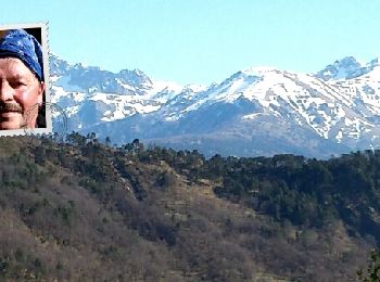
Lantosque, Maritime Alps: Best trails, routes and walks

Lantosque: Discover the best trails: 48 hiking trails and 15 bike and mountain-bike routes. All these trails, routes and outdoor activities are available in our SityTrail applications for smartphones and tablets.


The best trails (70)

Trail Walking Lantosque - cime de Suorcas en boucle  - Photo
Walking 14.519
Km
GUIDE

Walking

Very difficult
Lantosque, Provence-Alpes-Côte d'Azur, Maritime Alps, France
14.5 km | 25 km-effort
4h 4min
814 m
813 m
Yes
nadd73

Trail On foot Lantosque - Circuit du Tournairet - Photo
On foot 9.579
Km
GUIDE+

On foot

Easy
Lantosque, Provence-Alpes-Côte d'Azur, Maritime Alps, France
9.6 km | 16.2 km-effort
3h 41min
496 m
502 m
Yes
SityTrail - itinéraires balisés pédestres

• Trail created by Département des Alpes-Maritimes.
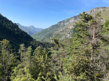
Trail Walking Lantosque - Granges de la Brasque  - Photo
Walking 21.859
Km

Walking

Difficult
Lantosque, Provence-Alpes-Côte d'Azur, Maritime Alps, France
22 km | 37 km-effort
5h 28min
1172 m
1171 m
Yes
ETMU5496

Trail On foot Lantosque - Granges de la Brasque - Photo
On foot 19.119
Km
GUIDE+

On foot

Difficult
Lantosque, Provence-Alpes-Côte d'Azur, Maritime Alps, France
19.1 km | 34 km-effort
7h 49min
1147 m
1153 m
Yes
SityTrail - itinéraires balisés pédestres

• Randonnée pédestre - Au départ de Lantosque, hameau de Pélasque (650 m) Website: https://randoxygene.depart...
Trail Walking Lantosque - lant - Photo
Walking 10.746
Km

Walking

Difficult
Lantosque, Provence-Alpes-Côte d'Azur, Maritime Alps, France
10.7 km | 21 km-effort
2h 59min
777 m
775 m
No
jlgott

Trail Walking Lantosque - Champignons  - Photo
Walking 6.107
Km

Walking

Easy
Lantosque, Provence-Alpes-Côte d'Azur, Maritime Alps, France
6.1 km | 9.2 km-effort
5h 35min
234 m
231 m
Yes
Renefrt

Trail Walking Lantosque - hameau de beasse  - Photo
Walking 10.939
Km

Walking

Difficult
Lantosque, Provence-Alpes-Côte d'Azur, Maritime Alps, France
10.9 km | 16.2 km-effort
5h 13min
399 m
392 m
Yes
Mariephil

Trail Walking Lantosque - lanbolan - Photo
Walking 11.151
Km

Walking

Medium
Lantosque, Provence-Alpes-Côte d'Azur, Maritime Alps, France
11.2 km | 22 km-effort
2h 57min
781 m
775 m
Yes
jlgott

Trail Walking Lantosque - Loda Hameau de Beasse Lantosque - Photo
Walking 11.426
Km

Walking

Easy
Lantosque, Provence-Alpes-Côte d'Azur, Maritime Alps, France
11.4 km | 18 km-effort
4h 13min
495 m
490 m
Yes
GrouGary

Trail On foot Lantosque - Forêt de la Maïris - Photo
On foot 14.539
Km
GUIDE+

On foot

Medium
Lantosque, Provence-Alpes-Côte d'Azur, Maritime Alps, France
14.5 km | 27 km-effort
6h 11min
954 m
951 m
Yes
SityTrail - itinéraires balisés pédestres

• Randonnée pédestre - Au départ de Lantosque, hameau de Saint-Colomban (740 m) Website: https://randoxygene.departeme...
Trail Walking Lantosque - Sauma Longa - Photo
Walking 11.225
Km

Walking

Medium
Lantosque, Provence-Alpes-Côte d'Azur, Maritime Alps, France
11.2 km | 18.2 km-effort
5h 27min
523 m
522 m
Yes
Renefrt

Trail Walking Lantosque - grange de Suorcas et Mairis - Photo
Walking 11.372
Km

Walking

Medium
Lantosque, Provence-Alpes-Côte d'Azur, Maritime Alps, France
11.4 km | 17.9 km-effort
5h 59min
486 m
488 m
Yes
Renefrt

Trail Walking Lantosque - les Granges de la Brasque - Photo
Walking 20.08
Km

Walking

Difficult
Lantosque, Provence-Alpes-Côte d'Azur, Maritime Alps, France
20 km | 36 km-effort
5h 54min
1180 m
1179 m
Yes
donda

Trail Walking Lantosque - les granges de la brasque par pelasque  - Photo
Walking 21.348
Km

Walking

Difficult
Lantosque, Provence-Alpes-Côte d'Azur, Maritime Alps, France
21 km | 38 km-effort
8h 47min
1223 m
1223 m
Yes
Rosalie06

Trail Walking Lantosque - les granges de la brasque par pelasque  - Photo
Walking 21.348
Km

Walking

Difficult
Lantosque, Provence-Alpes-Côte d'Azur, Maritime Alps, France
21 km | 38 km-effort
8h 47min
1223 m
1223 m
Yes
Rosalie06

Trail Walking Lantosque - Baus du Chastel - Photo
Walking 26.438
Km

Walking

Medium
Lantosque, Provence-Alpes-Côte d'Azur, Maritime Alps, France
26 km | 69 km-effort
10h 42min
3391 m
2668 m
No
Benteux

Trail Walking Lantosque - lantosque - Photo
Walking 4.185
Km

Walking

Easy
Lantosque, Provence-Alpes-Côte d'Azur, Maritime Alps, France
4.2 km | 7.8 km-effort
4h 27min
268 m
274 m
Yes
Benteux

Trail Walking Lantosque - lantosque - Photo
Walking 4.191
Km

Walking

Easy
Lantosque, Provence-Alpes-Côte d'Azur, Maritime Alps, France
4.2 km | 7.8 km-effort
1h 37min
269 m
275 m
Yes
Benteux

Trail Walking Lantosque - Cime de l'Haution 1504m  - Photo
Walking 11.637
Km

Walking

Difficult
Lantosque, Provence-Alpes-Côte d'Azur, Maritime Alps, France
11.6 km | 24 km-effort
8h 25min
920 m
917 m
Yes
Benteux

• A decouvert

Trail Walking Lantosque - Tête de Colle Basse - Photo
Walking 10.646
Km

Walking

Medium
Lantosque, Provence-Alpes-Côte d'Azur, Maritime Alps, France
10.6 km | 19.4 km-effort
5h 33min
657 m
652 m
Yes
Benteux

• agréable

20 trails displayed on 70

FREE GPS app for hiking

Logo SityTrail SityTrail

IGN / Geographical institutes

Download SityTrail from the App Store Download SityTrail from Google Play

Logo SityTrail SityTrail World

The world is yours!

Download SityTrail from the App Store Download SityTrail from Google Play Download SityTrail on Huawei AppGallery

Activities

Close
My subscriptions