![](/images/other/stat-length.png)
![Trail On foot Faßberg - Südheide 'Kieselgur - das Gold der Heide' W5m (mittlere Tour) - Photo](https://media.geolcdn.com/t/1900/400/3555edef-0186-4411-99f9-d0fa1c69e96a.jpeg&format=pjpeg&maxdim=2)
Südheide 'Kieselgur - das Gold der Heide' W5m (mittlere Tour)
SityTrail - itinéraires balisés pédestres
Tous les sentiers balisés d’Europe GUIDE+
![Length](/images/other/stat-length.png)
![Max alt](https://static1.geolcdn.com/siteimages/upload/files/1508320355ic_sort_altitude_max_24dp.png)
![Uphill gradient](https://static1.geolcdn.com/siteimages/upload/files/1508320355ic_sort_den_pos_24dp.png)
![Km-Effort](/images/other/stat-length.png)
![Min alt](https://static1.geolcdn.com/siteimages/upload/files/1508320355ic_sort_altitude_min_24dp.png)
![Downhill gradient](https://static1.geolcdn.com/siteimages/upload/files/1508320355ic_sort_den_neg_24dp.png)
![Boucle](https://static1.geolcdn.com/siteimages/upload/files/16400158638029165_repeat_loop_refresh_sync_direction_icon.png)
![On foot](https://static1.geolcdn.com/sitytour/trail-icons/100.png)
1h04
Difficulty : Easy
![Scan this QR Code to open this trail in the SityTrail application](https://capi.geolives.com/qq0zvz2zws4bq2lad0pu/sitytour/trails/3101183/qr.png?size=200)
FREE GPS app for hiking
About
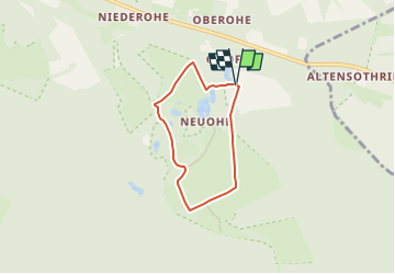
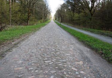
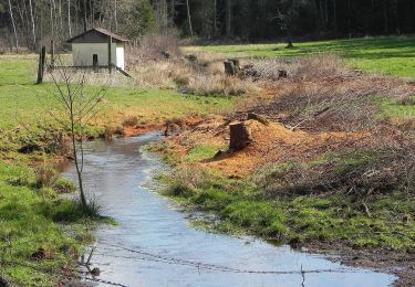
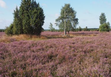
Trail On foot of 4.2 km to be discovered at Lower Saxony, Landkreis Celle, Faßberg. This trail is proposed by SityTrail - itinéraires balisés pédestres.
Description
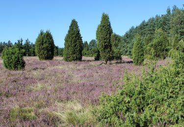
Die Touren des W5 "Kieselgur, das Gold der Heide" führen über ausgedehnte Heideflächen durch das ehemalige Kieselgur-Abbaugebiet Oberohe und zum Ki
Website: https://www.lueneburger-heide.de/9123
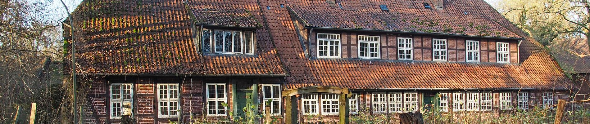
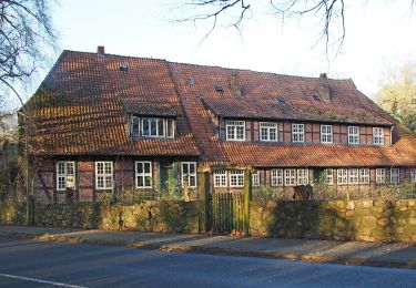
Positioning
Comments
Trails nearby
![Trail On foot Faßberg - Südheide 'Kieselgur - das Gold der Heide' W5l (lange Tour) - Photo](https://media.geolcdn.com/t/375/260/54bf5156-66e4-415f-8629-aa416bfecc07.jpeg&format=jpg&maxdim=2)
![On foot On foot](https://static1.geolcdn.com/sitytour/trail-icons/100.png)
On foot
![](/images/other/stat-length.png)
![](https://static1.geolcdn.com/siteimages/upload/files/16400158638029165_repeat_loop_refresh_sync_direction_icon.png)
![Trail On foot Faßberg - Südheide 'Kieselgur - das Gold der Heide' W5k (kurze Tour) - Photo](https://media.geolcdn.com/t/375/260/3555edef-0186-4411-99f9-d0fa1c69e96a.jpeg&format=jpg&maxdim=2)
![On foot On foot](https://static1.geolcdn.com/sitytour/trail-icons/100.png)
On foot
![](/images/other/stat-length.png)
![](https://static1.geolcdn.com/siteimages/upload/files/16400158638029165_repeat_loop_refresh_sync_direction_icon.png)
![Trail On foot Südheide - Südheide 'Gauß'scher Vermessungspunkt im Bergland der Südheide' W7m (mittlere Tour) - Photo](https://media.geolcdn.com/t/375/260/a7f8ab60-3650-4396-99b1-73fbb949c38a.jpeg&format=jpg&maxdim=2)
![On foot On foot](https://static1.geolcdn.com/sitytour/trail-icons/100.png)
On foot
![](/images/other/stat-length.png)
![](https://static1.geolcdn.com/siteimages/upload/files/16400158638029165_repeat_loop_refresh_sync_direction_icon.png)
![Trail On foot Südheide - Südheide 'Gauß'scher Vermessungspunkt im Bergland der Südheide' W7l (lange Tour) - Photo](https://media.geolcdn.com/t/375/260/54bf5156-66e4-415f-8629-aa416bfecc07.jpeg&format=jpg&maxdim=2)
![On foot On foot](https://static1.geolcdn.com/sitytour/trail-icons/100.png)
On foot
![](/images/other/stat-length.png)
![](https://static1.geolcdn.com/siteimages/upload/files/16400158638029165_repeat_loop_refresh_sync_direction_icon.png)
![Trail On foot Faßberg - Südheide 'Wo der Wald mit der Heide kuselt' W2k (kurze Tour) - Photo](https://media.geolcdn.com/t/375/260/fa23967d-b9cd-48de-89d6-a3e53fa4cf9b.jpeg&format=jpg&maxdim=2)
![On foot On foot](https://static1.geolcdn.com/sitytour/trail-icons/100.png)
On foot
![](/images/other/stat-length.png)
![](https://static1.geolcdn.com/siteimages/upload/files/16400158638029165_repeat_loop_refresh_sync_direction_icon.png)
![Trail On foot Faßberg - Südheide 'Wo der Wald mit der Heide kuselt' W2m (mittlere Tour) - Photo](https://media.geolcdn.com/t/375/260/fa23967d-b9cd-48de-89d6-a3e53fa4cf9b.jpeg&format=jpg&maxdim=2)
![On foot On foot](https://static1.geolcdn.com/sitytour/trail-icons/100.png)
On foot
![](/images/other/stat-length.png)
![](https://static1.geolcdn.com/siteimages/upload/files/16400158638029165_repeat_loop_refresh_sync_direction_icon.png)
![Trail On foot Faßberg - Südheide 'Wo der Wald mit der Heide kuselt' W2l (lange Tour) - Photo](https://media.geolcdn.com/t/375/260/fa23967d-b9cd-48de-89d6-a3e53fa4cf9b.jpeg&format=jpg&maxdim=2)
![On foot On foot](https://static1.geolcdn.com/sitytour/trail-icons/100.png)
On foot
![](/images/other/stat-length.png)
![](https://static1.geolcdn.com/siteimages/upload/files/16400158638029165_repeat_loop_refresh_sync_direction_icon.png)
![Trail On foot Faßberg - Südheide 'Wacholderwald in der Teufelsheide' W1m (mittlere Tour) - Photo](https://media.geolcdn.com/t/375/260/508d9259-9599-4bbb-8494-8facc5c629ea.jpeg&format=jpg&maxdim=2)
![On foot On foot](https://static1.geolcdn.com/sitytour/trail-icons/100.png)
On foot
![](/images/other/stat-length.png)
![](https://static1.geolcdn.com/siteimages/upload/files/16400158638029165_repeat_loop_refresh_sync_direction_icon.png)
![Trail On foot Faßberg - Südheide 'Wacholderwald in der Teufelsheide' W1k (kurze Tour) - Photo](https://media.geolcdn.com/t/375/260/508d9259-9599-4bbb-8494-8facc5c629ea.jpeg&format=jpg&maxdim=2)
![On foot On foot](https://static1.geolcdn.com/sitytour/trail-icons/100.png)
On foot
![](/images/other/stat-length.png)
![](https://static1.geolcdn.com/siteimages/upload/files/16400158638029165_repeat_loop_refresh_sync_direction_icon.png)