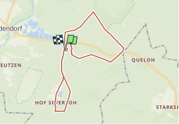
![](/images/other/stat-length.png)
![Trail On foot Südheide - Südheide 'Auf den Spuren des großen Waldbrandes' W11l (lange Tour) - Photo](https://media.geolcdn.com/t/1900/400/846828bc-e0e3-4c57-bd53-395e709b2ffc.jpeg&format=pjpeg&maxdim=2)
Südheide 'Auf den Spuren des großen Waldbrandes' W11l (lange Tour)
SityTrail - itinéraires balisés pédestres
Tous les sentiers balisés d’Europe GUIDE+
![Length](/images/other/stat-length.png)
![Max alt](https://static1.geolcdn.com/siteimages/upload/files/1508320355ic_sort_altitude_max_24dp.png)
![Uphill gradient](https://static1.geolcdn.com/siteimages/upload/files/1508320355ic_sort_den_pos_24dp.png)
![Km-Effort](/images/other/stat-length.png)
![Min alt](https://static1.geolcdn.com/siteimages/upload/files/1508320355ic_sort_altitude_min_24dp.png)
![Downhill gradient](https://static1.geolcdn.com/siteimages/upload/files/1508320355ic_sort_den_neg_24dp.png)
![Boucle](https://static1.geolcdn.com/siteimages/upload/files/16400158638029165_repeat_loop_refresh_sync_direction_icon.png)
![On foot](https://static1.geolcdn.com/sitytour/trail-icons/100.png)
3h51
Difficulty : Easy
![Scan this QR Code to open this trail in the SityTrail application](https://capi.geolives.com/qq0zvz2zws4bq2lad0pu/sitytour/trails/3101175/qr.png?size=200)
FREE GPS app for hiking
About
Trail On foot of 15.3 km to be discovered at Lower Saxony, Landkreis Celle, Südheide. This trail is proposed by SityTrail - itinéraires balisés pédestres.
Description
Die Wanderungen des W11 "Auf den Spuren des großen Waldbrandes" veranschaulichen, wie sich die Natur die Landschaft nach einer Waldbrandkatastrophe z
Website: https://www.lueneburger-heide.de/9202
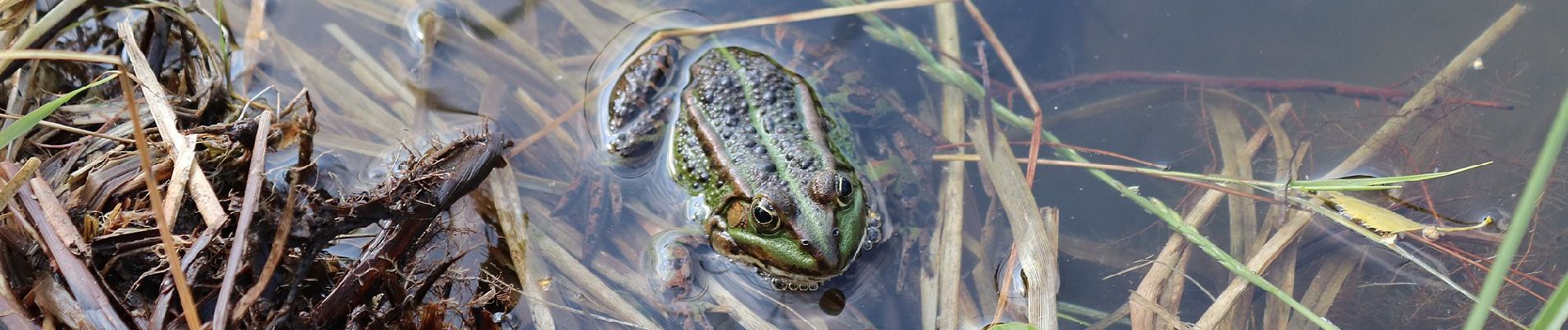
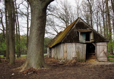
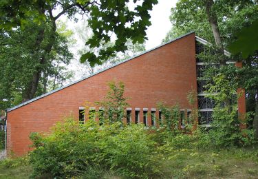
Positioning
Comments
Trails nearby
![Trail On foot Südheide - Südheide 'Auf den Spuren des großen Waldbrandes' W11m (mittlere Tour) - Photo](https://media.geolcdn.com/t/375/260/846828bc-e0e3-4c57-bd53-395e709b2ffc.jpeg&format=jpg&maxdim=2)
![On foot On foot](https://static1.geolcdn.com/sitytour/trail-icons/100.png)
On foot
![](/images/other/stat-length.png)
![](https://static1.geolcdn.com/siteimages/upload/files/16400158638029165_repeat_loop_refresh_sync_direction_icon.png)
![Trail On foot Eschede - Südheide 'Dem Förster über die Schulter geschaut' W12l (lange Tour) - Photo](https://media.geolcdn.com/t/375/260/8ea2d961-7f4f-41b3-9ce6-e49a68c13c58.jpeg&format=jpg&maxdim=2)
![On foot On foot](https://static1.geolcdn.com/sitytour/trail-icons/100.png)
On foot
![](/images/other/stat-length.png)
![](https://static1.geolcdn.com/siteimages/upload/files/16400158638029165_repeat_loop_refresh_sync_direction_icon.png)
![Trail On foot Südheide - Südheide 'Im Reich der Heidschnucken' W10l (lange Tour) - Photo](https://media.geolcdn.com/t/375/260/27a108f9-f9d7-4ad1-b78d-c6fcc650549c.jpeg&format=jpg&maxdim=2)
![On foot On foot](https://static1.geolcdn.com/sitytour/trail-icons/100.png)
On foot
![](/images/other/stat-length.png)
![](https://static1.geolcdn.com/siteimages/upload/files/16400158638029165_repeat_loop_refresh_sync_direction_icon.png)
![Trail On foot Südheide - Südheide 'In einem Bächlein helle' W6l (lange Tour) - Photo](https://media.geolcdn.com/t/375/260/23f24924-672d-438f-8d23-0fd0f383ce7a.jpeg&format=jpg&maxdim=2)
![On foot On foot](https://static1.geolcdn.com/sitytour/trail-icons/100.png)
On foot
![](/images/other/stat-length.png)
![](https://static1.geolcdn.com/siteimages/upload/files/16400158638029165_repeat_loop_refresh_sync_direction_icon.png)
![Trail On foot Südheide - Südheide 'In einem Bächlein helle' W6m (mittlere Tour) - Photo](https://media.geolcdn.com/t/375/260/c4c87f59-a37f-4aeb-9af1-0eb0f440b18b.jpeg&format=jpg&maxdim=2)
![On foot On foot](https://static1.geolcdn.com/sitytour/trail-icons/100.png)
On foot
![](/images/other/stat-length.png)
![](https://static1.geolcdn.com/siteimages/upload/files/16400158638029165_repeat_loop_refresh_sync_direction_icon.png)
![Trail On foot Südheide - Südheide 'In einem Bächlein helle' W6k (kurze Tour) - Photo](https://media.geolcdn.com/t/375/260/861a0def-8066-41af-a881-07851c1183c8.jpeg&format=jpg&maxdim=2)
![On foot On foot](https://static1.geolcdn.com/sitytour/trail-icons/100.png)
On foot
![](/images/other/stat-length.png)
![](https://static1.geolcdn.com/siteimages/upload/files/16400158638029165_repeat_loop_refresh_sync_direction_icon.png)
![Trail On foot Südheide - Südheide 'Im Reich der Heidschnucken' W10m (mittlere Tour) = Heidepanoramaweg - Photo](https://media.geolcdn.com/t/375/260/999cc457-1b41-48b9-9cc5-5373c9fcfa38.jpeg&format=jpg&maxdim=2)
![On foot On foot](https://static1.geolcdn.com/sitytour/trail-icons/100.png)
On foot
![](/images/other/stat-length.png)
![](https://static1.geolcdn.com/siteimages/upload/files/16400158638029165_repeat_loop_refresh_sync_direction_icon.png)
![Trail On foot Südheide - Früher Europäischer Fernwanderweg E1, Hermannsburg - Photo](https://media.geolcdn.com/t/375/260/23f24924-672d-438f-8d23-0fd0f383ce7a.jpeg&format=jpg&maxdim=2)
![On foot On foot](https://static1.geolcdn.com/sitytour/trail-icons/100.png)
On foot
![](/images/other/stat-length.png)
![](https://static1.geolcdn.com/siteimages/upload/files/16400158638029165_repeat_loop_refresh_sync_direction_icon.png)
![Trail On foot Eschede - Südheide 'Dem Förster über die Schulter geschaut' W12k (kurze Tour) - Photo](https://media.geolcdn.com/t/375/260/ext.jpg?maxdim=2&url=https%3A%2F%2Fstatic1.geolcdn.com%2Fsiteimages%2Fupload%2Ffiles%2F1545311037marcheuse_200dpi.jpg)
![On foot On foot](https://static1.geolcdn.com/sitytour/trail-icons/100.png)
On foot
![](/images/other/stat-length.png)
![](https://static1.geolcdn.com/siteimages/upload/files/16400158638029165_repeat_loop_refresh_sync_direction_icon.png)