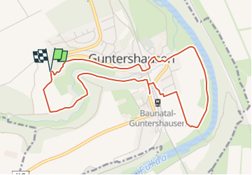
![](/images/other/stat-length.png)
![Trail On foot Baunatal - Eco-Pfad Guntershausen - Photo](https://media.geolcdn.com/t/1900/400/9dc9c0c3-f96e-4d5a-b604-45206d531a40.jpeg&format=pjpeg&maxdim=2)
Eco-Pfad Guntershausen
SityTrail - itinéraires balisés pédestres
Tous les sentiers balisés d’Europe GUIDE+
![Length](/images/other/stat-length.png)
![Max alt](https://static1.geolcdn.com/siteimages/upload/files/1508320355ic_sort_altitude_max_24dp.png)
![Uphill gradient](https://static1.geolcdn.com/siteimages/upload/files/1508320355ic_sort_den_pos_24dp.png)
![Km-Effort](/images/other/stat-length.png)
![Min alt](https://static1.geolcdn.com/siteimages/upload/files/1508320355ic_sort_altitude_min_24dp.png)
![Downhill gradient](https://static1.geolcdn.com/siteimages/upload/files/1508320355ic_sort_den_neg_24dp.png)
![Boucle](https://static1.geolcdn.com/siteimages/upload/files/16400158638029165_repeat_loop_refresh_sync_direction_icon.png)
![On foot](https://static1.geolcdn.com/sitytour/trail-icons/100.png)
1h16
Difficulty : Easy
![Scan this QR Code to open this trail in the SityTrail application](https://capi.geolives.com/qq0zvz2zws4bq2lad0pu/sitytour/trails/3095566/qr.png?size=200)
FREE GPS app for hiking
About
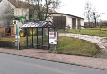
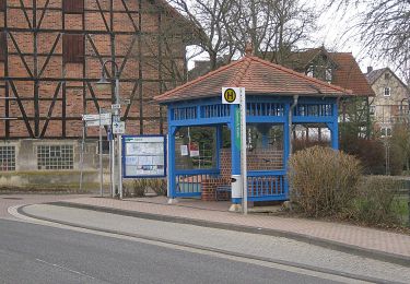
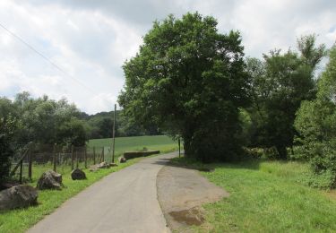
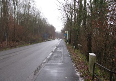
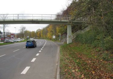
Trail On foot of 4.7 km to be discovered at Hesse, Landkreis Kassel, Baunatal. This trail is proposed by SityTrail - itinéraires balisés pédestres.
Description
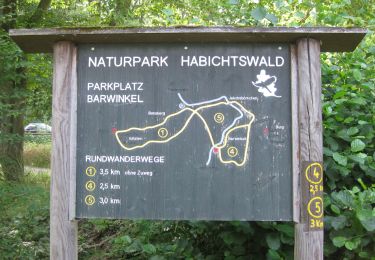
Die Eco Pfade im Landkreis Kassel sollen dazu anregen, sich mit der Geschichte der Region zu beschäftigen, Zeugen der Vergangenheit mit anderen Augen zu sehen und sie damit auch für die Zukunft zu bewahren.
Website: http://www.eco-pfade.de/gunt-00.html
Positioning
Comments
Trails nearby
![Trail On foot Baunatal - Dorothea-Viehmann-Weg - Photo](https://media.geolcdn.com/t/375/260/f537450a-b0fa-4491-8687-74c10f24c785.jpeg&format=jpg&maxdim=2)
![On foot On foot](https://static1.geolcdn.com/sitytour/trail-icons/100.png)
On foot
![](/images/other/stat-length.png)
![](https://static1.geolcdn.com/siteimages/upload/files/16400158638029165_repeat_loop_refresh_sync_direction_icon.png)
![Trail On foot Baunatal - Eco Pfad Großenritte - Photo](https://media.geolcdn.com/t/375/260/af5c4d57-02bc-462b-9005-697af9d99fba.jpeg&format=jpg&maxdim=2)
![On foot On foot](https://static1.geolcdn.com/sitytour/trail-icons/100.png)
On foot
![](/images/other/stat-length.png)
![](https://static1.geolcdn.com/siteimages/upload/files/16400158638029165_repeat_loop_refresh_sync_direction_icon.png)
![Trail On foot Baunatal - Eco-Pfad Hertingshausen/Kirchbauna - Photo](https://media.geolcdn.com/t/375/260/6b6c0e40-9a88-44b1-9c36-494a3c0b11a4.jpeg&format=jpg&maxdim=2)
![On foot On foot](https://static1.geolcdn.com/sitytour/trail-icons/100.png)
On foot
![](/images/other/stat-length.png)
![](https://static1.geolcdn.com/siteimages/upload/files/16400158638029165_repeat_loop_refresh_sync_direction_icon.png)
![Trail On foot Baunatal - Kirchbauna - Bensberg - Photo](https://media.geolcdn.com/t/375/260/bfb72d95-5cb7-4f65-9187-058d0e214181.jpeg&format=jpg&maxdim=2)
![On foot On foot](https://static1.geolcdn.com/sitytour/trail-icons/100.png)
On foot
![](/images/other/stat-length.png)
![](https://static1.geolcdn.com/siteimages/upload/files/16400158638029165_repeat_loop_refresh_sync_direction_icon.png)
![Trail On foot Baunatal - Baunatal-Guntershausen, Rundweg 1 - Photo](https://media.geolcdn.com/t/375/260/1d473907-b6b0-471a-8fd9-8710e0d1204f.jpeg&format=jpg&maxdim=2)
![On foot On foot](https://static1.geolcdn.com/sitytour/trail-icons/100.png)
On foot
![](/images/other/stat-length.png)
![](https://static1.geolcdn.com/siteimages/upload/files/16400158638029165_repeat_loop_refresh_sync_direction_icon.png)
![Trail On foot Baunatal - Baunatal-Guntershausen, Rundweg 2 - Photo](https://media.geolcdn.com/t/375/260/9dc9c0c3-f96e-4d5a-b604-45206d531a40.jpeg&format=jpg&maxdim=2)
![On foot On foot](https://static1.geolcdn.com/sitytour/trail-icons/100.png)
On foot
![](/images/other/stat-length.png)
![](https://static1.geolcdn.com/siteimages/upload/files/16400158638029165_repeat_loop_refresh_sync_direction_icon.png)
![Trail On foot Baunatal - Baunatal-Guntershausen, Rundweg 3 - Photo](https://media.geolcdn.com/t/375/260/4111a2fc-0a84-437b-bc08-a02c7dc44456.jpeg&format=jpg&maxdim=2)
![On foot On foot](https://static1.geolcdn.com/sitytour/trail-icons/100.png)
On foot
![](/images/other/stat-length.png)
![](https://static1.geolcdn.com/siteimages/upload/files/16400158638029165_repeat_loop_refresh_sync_direction_icon.png)
![Trail On foot Baunatal - Guntershausen - Bilsteiner Born - Photo](https://media.geolcdn.com/t/375/260/d9654b06-06a0-4fbd-9439-9ae522bf17ff.jpeg&format=jpg&maxdim=2)
![On foot On foot](https://static1.geolcdn.com/sitytour/trail-icons/100.png)
On foot
![](/images/other/stat-length.png)
![](https://static1.geolcdn.com/siteimages/upload/files/16400158638029165_repeat_loop_refresh_sync_direction_icon.png)
![Trail On foot Baunatal - Baunatal-Altenritte, Rundweg 2 - Photo](https://media.geolcdn.com/t/375/260/d4ef9e65-5bd1-4d0b-ac7f-c9b9611bb367.jpeg&format=jpg&maxdim=2)
![On foot On foot](https://static1.geolcdn.com/sitytour/trail-icons/100.png)
On foot
![](/images/other/stat-length.png)
![](https://static1.geolcdn.com/siteimages/upload/files/16400158638029165_repeat_loop_refresh_sync_direction_icon.png)