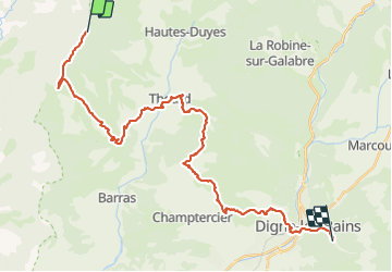
Trail Mountain bike Le Castellard-Mélan - Étape 1 chemin du soleil  - Photo
© OpenStreetMap contributors
Length
Length
35 km
Max alt
Max alt
1432 m
Uphill gradient
Uphill gradient
922 m
Km-Effort
Km-Effort  
50 km
Min alt
Min alt
589 m
Downhill gradient
Downhill gradient
1682 m
Boucle
Boucle
No
Creation date :
2021-07-12 09:04:00.0
Updated on :
2021-07-13 06:38:28.532

(0 Reviews)

Mountain bike
Mountain bike
5h28
Difficulty : Very difficult

Scan this QR Code to open this trail in the SityTrail application

FREE GPS app for hiking

Logo SityTrail SityTrail

IGN / Geographical institutes

Download SityTrail from the App Store Download SityTrail from Google Play

Logo SityTrail SityTrail World

The world is yours!

Download SityTrail from the App Store Download SityTrail from Google Play Download SityTrail on Huawei AppGallery

About

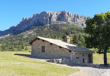
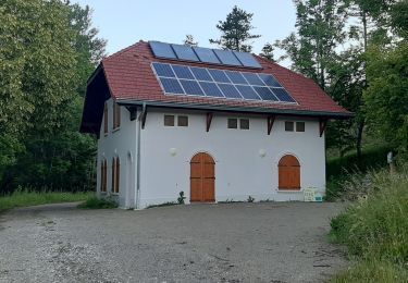
Trail Mountain bike of 35 km to be discovered at Provence-Alpes-Côte d'Azur, Alpes-de-Haute-Provence, Le Castellard-Mélan. This trail is proposed by lorenzot54.

Description

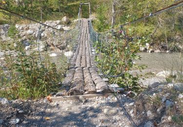
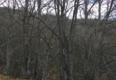
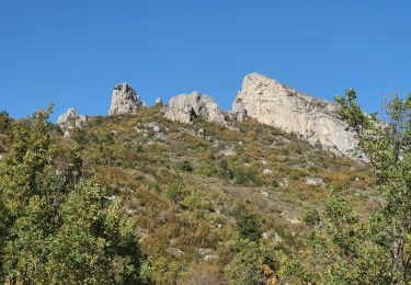
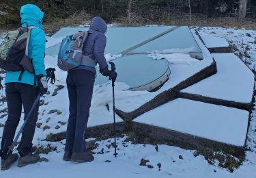
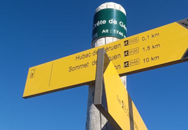
Chemin de crête sublime marqué par quelques poussette. Traversée de champ de lavande. Chemin parfois engagé

Elevation profile

Positioning

Country:
France
Region :
Provence-Alpes-Côte d'Azur
Department/Province :
Alpes-de-Haute-Provence
Municipality :
Le Castellard-Mélan
Location:
Unknown
Start:(UTM)
267872 ; 4896037 (32T) N.

Trails nearby

Trail Walking Thoard - la Bigue par Thoard - Photo
Walking
FPOL04

Walking

Medium
(1)
Thoard, Provence-Alpes-Côte d'Azur, Alpes-de-Haute-Provence, France
17.5 km | 30 km-effort
7h 43min
No
Trail Walking Saint-Geniez - 28-10-2022 Tour du Dromon - Photo
Walking
GUIDE
Kargil

Walking

Easy
Saint-Geniez, Provence-Alpes-Côte d'Azur, Alpes-de-Haute-Provence, France
12.8 km | 19.7 km-effort
4h 12min
Yes
Trail Walking Thoard - thoar courbon 1000m22kms - Photo
Walking
GUIDE
Danielba

Walking

Medium
Thoard, Provence-Alpes-Côte d'Azur, Alpes-de-Haute-Provence, France
22 km | 35 km-effort
8h 6min
Yes
Trail Walking Entrepierres - vaumuse  - Photo
Walking
GUIDE
Danielba

Walking

Very difficult
Entrepierres, Provence-Alpes-Côte d'Azur, Alpes-de-Haute-Provence, France
16.2 km | 30 km-effort
8h 6min
Yes
Trail Walking Le Castellard-Mélan - Mélan Parua Taulisson Le Cognet Col de Mounis Mélan - Photo
Walking
jalien04

Walking

Medium
Le Castellard-Mélan, Provence-Alpes-Côte d'Azur, Alpes-de-Haute-Provence, France
7 km | 10 km-effort
1h 57min
Yes
Trail Walking Le Castellard-Mélan - Sentier des Brigants - Photo
Walking
PapouBertrand

Walking

Very difficult
Le Castellard-Mélan, Provence-Alpes-Côte d'Azur, Alpes-de-Haute-Provence, France
15.6 km | 24 km-effort
5h 4min
Yes
Trail Walking Le Castellard-Mélan - Boucle Fontbarlière (D3) La Tuilere-Vaumuse-Le Castellard  - Photo
Walking
jalien04

Walking

Medium
Le Castellard-Mélan, Provence-Alpes-Côte d'Azur, Alpes-de-Haute-Provence, France
13.2 km | 22 km-effort
4h 11min
Yes
Trail Walking Le Castellard-Mélan - Auribeau depuis Melan - Photo
Walking
jalien04

Walking

Medium
Le Castellard-Mélan, Provence-Alpes-Côte d'Azur, Alpes-de-Haute-Provence, France
11.1 km | 16.7 km-effort
3h 48min
Yes
Trail Walking Le Castellard-Mélan - Grotte de st Vincent et Grande Aiguille au départ-arrivée le col de Fontbelle - Photo
Walking
jalien04

Walking

Medium
Le Castellard-Mélan, Provence-Alpes-Côte d'Azur, Alpes-de-Haute-Provence, France
10.4 km | 17.8 km-effort
4h 0min
Yes


Close
My subscriptions