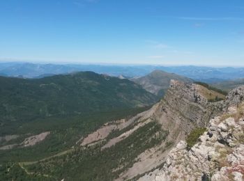
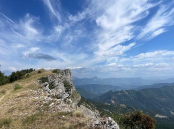
Le Castellard-Mélan, Alpes-de-Haute-Provence: Best trails, routes and walks

9 comments

Le Castellard-Mélan: Discover the best trails: 59 hiking trails, 4 bike and mountain-bike routes and 2 equestrian circuits. All these trails, routes and outdoor activities are available in our SityTrail applications for smartphones and tablets.


The best trails (67)

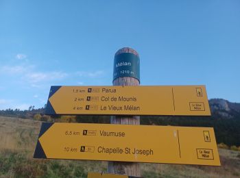
Trail Walking Le Castellard-Mélan - Mélan Parua Taulisson Le Cognet Col de Mounis Mélan - Photo
Walking 6.95
Km

Walking

Medium
Le Castellard-Mélan, Provence-Alpes-Côte d'Azur, Alpes-de-Haute-Provence, France
7 km | 10 km-effort
1h 57min
230 m
229 m
Yes
jalien04

Trail Walking Le Castellard-Mélan - Sentier des Brigants - Photo
Walking 15.59
Km

Walking

Very difficult
Le Castellard-Mélan, Provence-Alpes-Côte d'Azur, Alpes-de-Haute-Provence, France
15.6 km | 24 km-effort
5h 4min
614 m
612 m
Yes
PapouBertrand

Trail Walking Le Castellard-Mélan - Boucle Fontbarlière (D3) La Tuilere-Vaumuse-Le Castellard  - Photo
Walking 13.233
Km

Walking

Medium
Le Castellard-Mélan, Provence-Alpes-Côte d'Azur, Alpes-de-Haute-Provence, France
13.2 km | 22 km-effort
4h 11min
673 m
670 m
Yes
jalien04

Trail Walking Le Castellard-Mélan - Auribeau depuis Melan - Photo
Walking 11.089
Km

Walking

Medium
Le Castellard-Mélan, Provence-Alpes-Côte d'Azur, Alpes-de-Haute-Provence, France
11.1 km | 16.7 km-effort
3h 48min
423 m
416 m
Yes
jalien04

Trail Walking Le Castellard-Mélan - Grotte de st Vincent et Grande Aiguille au départ-arrivée le col de Fontbelle - Photo
Walking 10.443
Km

Walking

Medium
Le Castellard-Mélan, Provence-Alpes-Côte d'Azur, Alpes-de-Haute-Provence, France
10.4 km | 17.8 km-effort
4h 0min
551 m
551 m
Yes
jalien04

Trail Walking Le Castellard-Mélan - Cretes du castellard et anciens chemins de Sisteron, col de Mounis, église et point de vue de depuis Mélan - Photo
Walking 13.858
Km

Walking

Medium
Le Castellard-Mélan, Provence-Alpes-Côte d'Azur, Alpes-de-Haute-Provence, France
13.9 km | 21 km-effort
4h 45min
547 m
544 m
Yes
jalien04

Trail Walking Le Castellard-Mélan - Geruen au départ du col de Fontbelle  - Photo
Walking 15.056
Km

Walking

Easy
Le Castellard-Mélan, Provence-Alpes-Côte d'Azur, Alpes-de-Haute-Provence, France
15.1 km | 25 km-effort
6h 51min
738 m
738 m
Yes
jalien04

Trail sport Le Castellard-Mélan - Crête de Géruen - Photo
sport 14.955
Km

sport

Very easy
(1)
Le Castellard-Mélan, Provence-Alpes-Côte d'Azur, Alpes-de-Haute-Provence, France
15 km | 25 km-effort
Unknown
723 m
726 m
Yes
Nathy8913

Trail Walking Le Castellard-Mélan - AUTHON Fontbelle,  piste forestière du Pras au pied de Gueruen,  col d Ainac AR o l s - Photo
Walking 14.722
Km

Walking

Easy
Le Castellard-Mélan, Provence-Alpes-Côte d'Azur, Alpes-de-Haute-Provence, France
14.7 km | 21 km-effort
3h 37min
437 m
441 m
Yes
RobinMicheline

Trail Walking Le Castellard-Mélan - AUTHON  .Fontbelle  . Crete de  Gueruen AR  l s o - Photo
Walking 14.059
Km

Walking

Medium
Le Castellard-Mélan, Provence-Alpes-Côte d'Azur, Alpes-de-Haute-Provence, France
14.1 km | 23 km-effort
3h 55min
672 m
672 m
Yes
RobinMicheline

Trail Walking Le Castellard-Mélan - descente du col de mounis, Le Vancon - Photo
Walking 4.986
Km

Walking

Easy
Le Castellard-Mélan, Provence-Alpes-Côte d'Azur, Alpes-de-Haute-Provence, France
5 km | 6.9 km-effort
1h 46min
15 m
537 m
No
jalien04

Trail Walking Le Castellard-Mélan - Crete de Geruen - Photo
Walking 16.26
Km

Walking

Medium
(4)
Le Castellard-Mélan, Provence-Alpes-Côte d'Azur, Alpes-de-Haute-Provence, France
16.3 km | 27 km-effort
5h 33min
789 m
788 m
Yes
GAPIAN43

Trail Walking Le Castellard-Mélan - Crête et sommet de Géruen - Photo
Walking 7.186
Km

Walking

Medium
Le Castellard-Mélan, Provence-Alpes-Côte d'Azur, Alpes-de-Haute-Provence, France
7.2 km | 13.6 km-effort
3h 4min
612 m
75 m
No
mc3c

Trail Walking Le Castellard-Mélan - Col de Fontbelle Crête de Géruen - Photo
Walking 14.16
Km

Walking

Very difficult
Le Castellard-Mélan, Provence-Alpes-Côte d'Azur, Alpes-de-Haute-Provence, France
14.2 km | 23 km-effort
5h 18min
673 m
678 m
Yes
caze

Trail Walking Le Castellard-Mélan - AUTHON . COL DE FONTBELLE .TOUR DE GUERUE.N . N . - Photo
Walking 19.305
Km

Walking

Very difficult
Le Castellard-Mélan, Provence-Alpes-Côte d'Azur, Alpes-de-Haute-Provence, France
19.3 km | 30 km-effort
5h 2min
813 m
864 m
No
RobinMicheline

Trail Walking Le Castellard-Mélan - AUTHON . COL DE FONTBELLE . LA GRANDE AIGUILLE . GROTTE S VINCENT O L S - Photo
Walking 11.429
Km

Walking

Difficult
Le Castellard-Mélan, Provence-Alpes-Côte d'Azur, Alpes-de-Haute-Provence, France
11.4 km | 19.2 km-effort
3h 37min
580 m
580 m
Yes
RobinMicheline

Trail Horseback riding Le Castellard-Mélan - 2023-09-28 Rando CVA Monges Col de Fontbelle vers Thoard - Photo
Horseback riding 19.586
Km
GUIDE

Horseback riding

Medium
Le Castellard-Mélan, Provence-Alpes-Côte d'Azur, Alpes-de-Haute-Provence, France
19.6 km | 26 km-effort
3h 27min
409 m
797 m
No
holtzv

Trail Walking Le Castellard-Mélan - MELAN . Col de Mounis  , sommet du Corbeau o l s - Photo
Walking 12.768
Km

Walking

Medium
(1)
Le Castellard-Mélan, Provence-Alpes-Côte d'Azur, Alpes-de-Haute-Provence, France
12.8 km | 19 km-effort
4h 30min
469 m
469 m
Yes
RobinMicheline

Trail Walking Le Castellard-Mélan - Sentier de découverte du Col de Fontbelle - Photo
Walking 2.16
Km

Walking

Easy
Le Castellard-Mélan, Provence-Alpes-Côte d'Azur, Alpes-de-Haute-Provence, France
2.2 km | 3.1 km-effort
59min
68 m
69 m
Yes
jalien04

Trail Walking Le Castellard-Mélan - col de fontbelle - Photo
Walking 11.461
Km

Walking

Medium
Le Castellard-Mélan, Provence-Alpes-Côte d'Azur, Alpes-de-Haute-Provence, France
11.5 km | 19.1 km-effort
4h 20min
572 m
571 m
Yes
hueco

20 trails displayed on 67

FREE GPS app for hiking

Logo SityTrail SityTrail

IGN / Geographical institutes

Download SityTrail from the App Store Download SityTrail from Google Play

Logo SityTrail SityTrail World

The world is yours!

Download SityTrail from the App Store Download SityTrail from Google Play Download SityTrail on Huawei AppGallery

Activities

Close
My subscriptions