![](/images/other/stat-length.png)
![Trail Other activity Saint-Laurent-sous-Coiron - proj_Chante Épine Roche de Luchon - Photo](https://media.geolcdn.com/t/1900/400/ext.pjpeg?maxdim=2&url=https%3A%2F%2Fservices.sitytrail.com%2FGeolivesWS%2FDownloadMedia.ashx%3FTrailID%3D959759%26Media%3Dfix__20140314163954.jpg)
proj_Chante Épine Roche de Luchon
pb07
User
![Length](/images/other/stat-length.png)
![Max alt](https://static1.geolcdn.com/siteimages/upload/files/1508320355ic_sort_altitude_max_24dp.png)
![Uphill gradient](https://static1.geolcdn.com/siteimages/upload/files/1508320355ic_sort_den_pos_24dp.png)
![Km-Effort](/images/other/stat-length.png)
![Min alt](https://static1.geolcdn.com/siteimages/upload/files/1508320355ic_sort_altitude_min_24dp.png)
![Downhill gradient](https://static1.geolcdn.com/siteimages/upload/files/1508320355ic_sort_den_neg_24dp.png)
![Boucle](https://static1.geolcdn.com/siteimages/upload/files/16400158638029165_repeat_loop_refresh_sync_direction_icon.png)
![Other activity](https://static1.geolcdn.com/sitytour/trail-icons/900.png)
3h37
Difficulty : Medium
![Scan this QR Code to open this trail in the SityTrail application](https://capi.geolives.com/qq0zvz2zws4bq2lad0pu/sitytour/trails/2271525/qr.png?size=200)
FREE GPS app for hiking
About
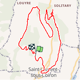
Trail Other activity of 12.8 km to be discovered at Auvergne-Rhône-Alpes, Ardèche, Saint-Laurent-sous-Coiron. This trail is proposed by pb07.
Description
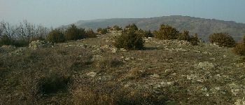
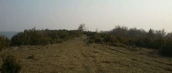
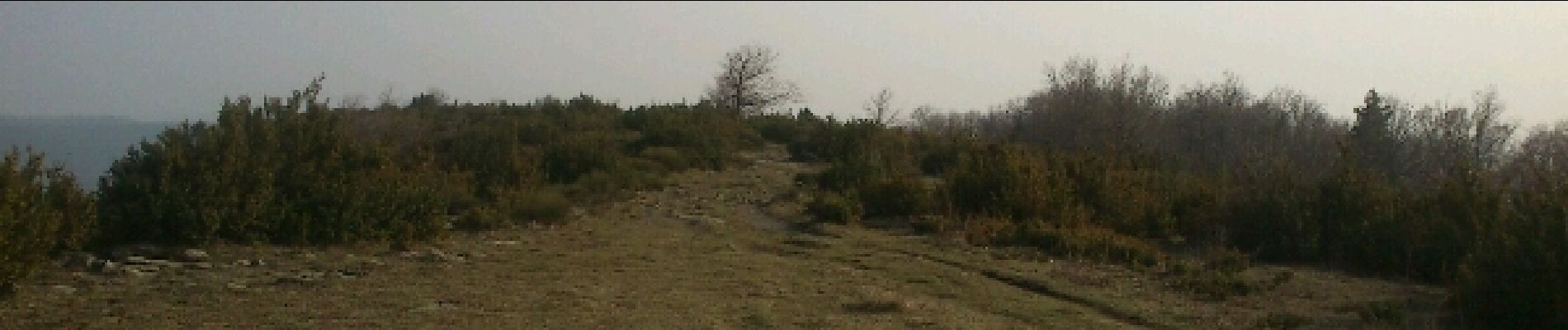
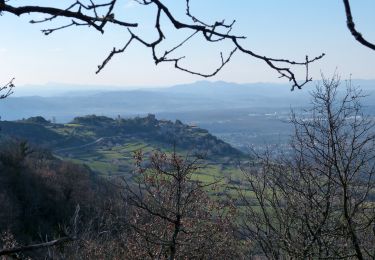
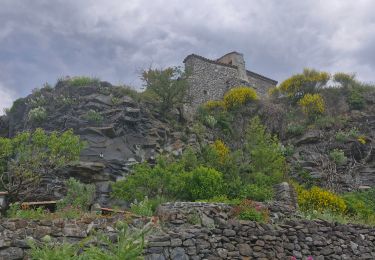
Randonnée sur le rebord du Coiron. Contraste entre la crête calcaire de Chante Epine et la crête basaltique entre la Roche de Luchon et St Laurent Sous Coiron.
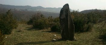
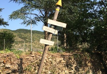
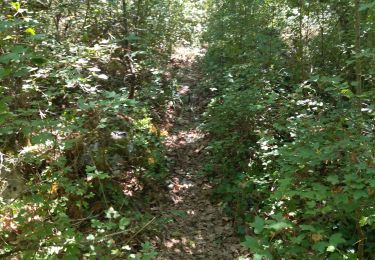
Itinéraire suivant en partie les indication du circuit préhistorique de St Laurent sous Coiron. Pas toujours balisé mais bornes aux croisements principaux ou aux points d'intérêt (Dolmen du Devès du Serre, menhir de Peyregrosse). Attention cependant, un peu avant La Combe (repère 1) le chemin est barré. Au niveau des Cros (repère 2) il faut donc couper à travers les prés pour rejoindre la route au dessus.
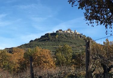
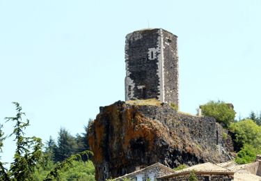
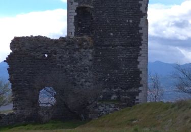
L'accès à la Roche de Luchon se fait à la limite du versant ouest de la crête, au débouché du chemin descendant sur Vernets. Les autres côtés sont impraticables à cause des buis.
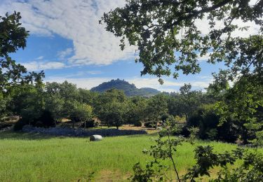
Descente en dessous de St Laurent par un chemin puis à travers le pré, puis sur la route.
Positioning
Comments
Trails nearby
![Trail Walking Saint-Laurent-sous-Coiron - SityTrail - 2460537 - st-laurent - Photo](https://media.geolcdn.com/t/375/260/248a6b55-9b40-4f3e-9231-07b72c1a2693.jpg&format=jpg&maxdim=2)
![Walking Walking](https://static1.geolcdn.com/sitytour/trail-icons/101.png)
Walking
![](/images/other/stat-length.png)
![](https://static1.geolcdn.com/siteimages/upload/files/16400158638029165_repeat_loop_refresh_sync_direction_icon.png)
![Trail Walking Vesseaux - Vesseaux - Photo](https://media.geolcdn.com/t/375/260/ext.jpg?maxdim=2&url=https%3A%2F%2Fservices.sitytrail.com%2FGeolivesWS%2FDownloadMedia.ashx%3FTrailID%3D442802%26Media%3D20150708175142.jpg)
![Walking Walking](https://static1.geolcdn.com/sitytour/trail-icons/101.png)
Walking
![](/images/other/stat-length.png)
![](https://static1.geolcdn.com/siteimages/upload/files/16400158638029165_repeat_loop_refresh_sync_direction_icon.png)
![Walking Walking](https://static1.geolcdn.com/sitytour/trail-icons/101.png)
Walking
![](/images/other/stat-length.png)
![](https://static1.geolcdn.com/siteimages/upload/files/16400158638029165_repeat_loop_refresh_sync_direction_icon.png)
![Walking Walking](https://static1.geolcdn.com/sitytour/trail-icons/101.png)
Walking
![](/images/other/stat-length.png)
![](https://static1.geolcdn.com/siteimages/upload/files/16400158638029165_repeat_loop_refresh_sync_direction_icon.png)
![Trail Walking Mirabel - 2025-01-25_15h34m21_SityTrail - 3633141 - mirabel-11km-den367m- - Photo](https://media.geolcdn.com/t/375/260/e7aad9c3-6c53-4829-ad7f-8298786bbba5.jpg&format=jpg&maxdim=2)
![Walking Walking](https://static1.geolcdn.com/sitytour/trail-icons/101.png)
Walking
![](/images/other/stat-length.png)
![](https://static1.geolcdn.com/siteimages/upload/files/16400158638029165_repeat_loop_refresh_sync_direction_icon.png)
![Trail Walking Saint-Laurent-sous-Coiron - St-Laurent sous-Coiron](https://media.geolcdn.com/t/375/260/af45344e-33a5-4544-8743-643b0c5ac849.jpg&format=jpg&maxdim=2)
![Walking Walking](https://static1.geolcdn.com/sitytour/trail-icons/101.png)
Walking
![](/images/other/stat-length.png)
![](https://static1.geolcdn.com/siteimages/upload/files/16400158638029165_repeat_loop_refresh_sync_direction_icon.png)
![Trail Walking Lussas - 07 loutre gorges 09.07.2033 - Photo](https://media.geolcdn.com/t/375/260/b383ddff-373b-408a-8d2a-0f2891f1c4a5.jpg&format=jpg&maxdim=2)
![Walking Walking](https://static1.geolcdn.com/sitytour/trail-icons/101.png)
Walking
![](/images/other/stat-length.png)
![](https://static1.geolcdn.com/siteimages/upload/files/16400158638029165_repeat_loop_refresh_sync_direction_icon.png)
![Trail Walking Saint-Laurent-sous-Coiron - St Laurent sous Coiron La Louyre 19km - Photo](https://media.geolcdn.com/t/375/260/612250e6-8070-48f5-a522-aa1665a3802f.jpg&format=jpg&maxdim=2)
![Walking Walking](https://static1.geolcdn.com/sitytour/trail-icons/101.png)
Walking
![](/images/other/stat-length.png)
![](https://static1.geolcdn.com/siteimages/upload/files/16400158638029165_repeat_loop_refresh_sync_direction_icon.png)
![Trail Walking Mirabel - 07 mirabel - Photo](https://media.geolcdn.com/t/375/260/915b720a-5cae-485d-9914-36e4a159eaad.jpg&format=jpg&maxdim=2)
![Walking Walking](https://static1.geolcdn.com/sitytour/trail-icons/101.png)
Walking
![](/images/other/stat-length.png)
![](https://static1.geolcdn.com/siteimages/upload/files/16400158638029165_repeat_loop_refresh_sync_direction_icon.png)