Trail Equestrian Comprégnac - Joaquim Ribeiro - Photo
© OpenStreetMap contributors
Length
Length
24 km
Max alt
Max alt
587 m
Uphill gradient
Uphill gradient
688 m
Km-Effort
Km-Effort  
33 km
Min alt
Min alt
336 m
Downhill gradient
Downhill gradient
634 m
Boucle
Boucle
No
Creation date :
2014-12-10 00:00:00.0
Updated on :
2014-12-10 00:00:00.0

(0 Reviews)

Equestrian
Equestrian
3h53
Difficulty : Easy

Scan this QR Code to open this trail in the SityTrail application

FREE GPS app for hiking

Logo SityTrail SityTrail

IGN / Geographical institutes

Download SityTrail from the App Store Download SityTrail from Google Play

Logo SityTrail SityTrail World

The world is yours!

Download SityTrail from the App Store Download SityTrail from Google Play Download SityTrail on Huawei AppGallery

About

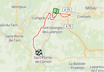
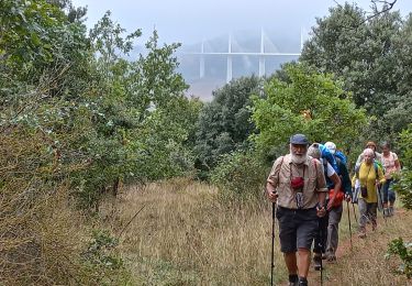
Trail Equestrian of 24 km to be discovered at Occitania, Aveyron, Comprégnac. This trail is proposed by jribeiro12.

Description

Peyre - Saint Rome de Cernon
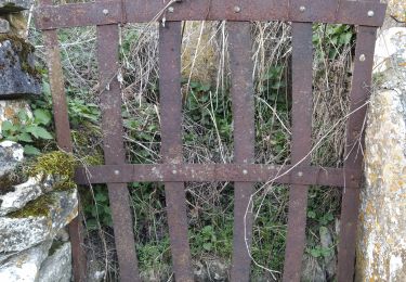
Par pont en fer et ST. Georges de Luzençon

Elevation profile

Positioning

Country:
France
Region :
Occitania
Department/Province :
Aveyron
Municipality :
Comprégnac
Location:
Unknown
Start:(UTM)
498822 ; 4881190 (31T) N.

Trails nearby

Trail Walking Millau - Randonnée autour du Viaduc  de Millau - Photo
Walking
tracegps

Walking

Difficult
(2)
Millau, Occitania, Aveyron, France
18.5 km | 26 km-effort
5h 30min
Yes
Trail Walking Saint-Georges-de-Luzençon - J9: St Georges de Luzençon- St Rome du Tarn-170522 - Photo
Walking
canardDenis

Walking

Medium
Saint-Georges-de-Luzençon, Occitania, Aveyron, France
20 km | 27 km-effort
6h 10min
No
Trail Walking Comprégnac - parcours 5 - Photo
Walking
ginomania

Walking

Difficult
(1)
Comprégnac, Occitania, Aveyron, France
28 km | 41 km-effort
Unknown
Yes
Trail Cycle Comprégnac - Des marches du Lévézou au plus haut viaduc du monde ! - Peyre - Photo
Cycle
tracegps

Cycle

Difficult
Comprégnac, Occitania, Aveyron, France
74 km | 93 km-effort
4h 45min
Yes
Trail Walking Saint-Georges-de-Luzençon - Saint Georges Reco - Photo
Walking
JAMMESHubert

Walking

Medium
(1)
Saint-Georges-de-Luzençon, Occitania, Aveyron, France
16 km | 22 km-effort
4h 6min
Yes
Trail Walking Saint-Georges-de-Luzençon - St Geniez de bertrand - Photo
Walking
at12

Walking

Medium
Saint-Georges-de-Luzençon, Occitania, Aveyron, France
6 km | 9.8 km-effort
2h 4min
Yes
Trail Walking Comprégnac - Peyre (Millau) - Photo
Walking
DENNEBECQ

Walking

Medium
Comprégnac, Occitania, Aveyron, France
11.6 km | 17.4 km-effort
4h 23min
No
Trail Walking Millau - Soulobres Therondels Peyre - Photo
Walking
at12

Walking

Very easy
Millau, Occitania, Aveyron, France
11.2 km | 17.6 km-effort
2h 50min
Yes
Trail Walking Millau - galettes chapelle de brocuejouls - Photo
Walking
colber

Walking

Very easy
Millau, Occitania, Aveyron, France
6.7 km | 8.6 km-effort
1h 52min
No


Close
My subscriptions