Trail Walking Sainte-Colombe - La crête de la Montagne de Chabre - Ste Colombe - Photo

La crête de la Montagne de Chabre - Ste Colombe

 tracegps
tracegps

User

© OpenStreetMap contributors
Length
Length
23 km
Max alt
Max alt
1337 m
Uphill gradient
Uphill gradient
1008 m
Km-Effort
Km-Effort  
37 km
Min alt
Min alt
857 m
Downhill gradient
Downhill gradient
1008 m
Boucle
Boucle
Yes
Creation date :
2014-12-10 00:00:00.0
Updated on :
2014-12-10 00:00:00.0

(0 Reviews)

Walking
Walking
7h00
Difficulty : Very difficult

Scan this QR Code to open this trail in the SityTrail application

FREE GPS app for hiking

Logo SityTrail SityTrail

IGN / Geographical institutes

Download SityTrail from the App Store Download SityTrail from Google Play

Logo SityTrail SityTrail World

The world is yours!

Download SityTrail from the App Store Download SityTrail from Google Play Download SityTrail on Huawei AppGallery

About

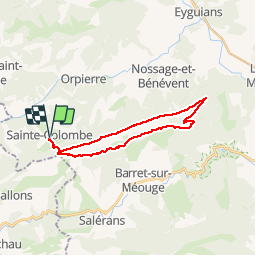
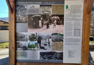
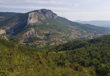
Trail Walking of 23 km to be discovered at Provence-Alpes-Côte d'Azur, Hautes-Alpes, Sainte-Colombe. This trail is proposed by tracegps.

Description

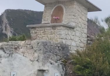
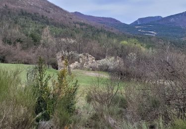
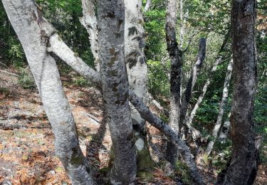
Longue rando sur une crête entre la terre et le ciel avec des vues magnifiques, une véritable splendeur. Parking à Ste Colombe. Partir au sud et monter vers la crête, parvenu à un col au dessus de la Touisse, prendre à gauche le sentier de crête. Itinéraire assez tortueux mais balisé. Passer au col de st Ange et poursuivre direction est jusqu'aux antennes puis à une table d'orientation. Quitter la crête et descendre la route goudronnée (hélas), couper une épingle et prendre un chemin forestier. Couper une autre épingle avant de passer au col de la Crousette. Continuer sur ce chemin forestier et prendre à droite à chaque fourche (balisage) pour retourner au col du départ, et descendre sur Ste Colombe. Bonne randonnée. PS: la rando peut être écourtée en allant garer la voiture à la "maison forestière de Beynaves" au pied du col st anges par le GR puis suivre la trace GPS et retour au col de la Crousette et le col st Anges.
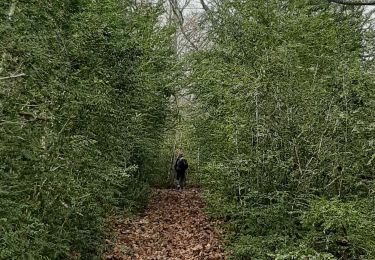
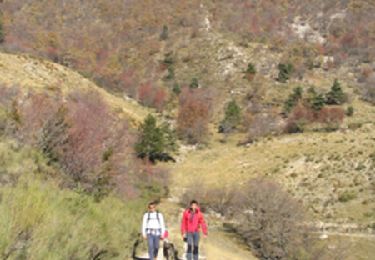
Elevation profile

Photos

Positioning

Country:
France
Region :
Provence-Alpes-Côte d'Azur
Department/Province :
Hautes-Alpes
Municipality :
Sainte-Colombe
Location:
Unknown
Start:(UTM)
712985 ; 4906894 (31T) N.

Trails nearby

Trail Walking Sainte-Colombe - st colombe la
Walking
margotte

Walking

Medium
Sainte-Colombe, Provence-Alpes-Côte d'Azur, Hautes-Alpes, France
11.6 km | 17.9 km-effort
3h 4min
Yes
Trail Walking Orpierre - rocher st Michel - Photo
Walking
margotte

Walking

Medium
Orpierre, Provence-Alpes-Côte d'Azur, Hautes-Alpes, France
9 km | 16 km-effort
3h 41min
Yes
Trail Walking Sainte-Colombe - catoyes  - Photo
Walking
céline BORLOZ

Walking

Very difficult
Sainte-Colombe, Provence-Alpes-Côte d'Azur, Hautes-Alpes, France
17 km | 27 km-effort
6h 26min
Yes
Trail Walking Sainte-Colombe - 100423 Plan de Cuques - Photo
Walking
mzonzon05

Walking

Difficult
Sainte-Colombe, Provence-Alpes-Côte d'Azur, Hautes-Alpes, France
11.7 km | 17.4 km-effort
3h 12min
No
Trail Walking Orpierre - 220822 La Louze - Photo
Walking
mzonzon05

Walking

Very difficult
Orpierre, Provence-Alpes-Côte d'Azur, Hautes-Alpes, France
12.5 km | 19.4 km-effort
2h 42min
Yes
Trail Walking Sainte-Colombe - SAINTE COLOMBE , les Bègues,  autour des versants du Céans o l - Photo
Walking
RobinMicheline

Walking

Medium
Sainte-Colombe, Provence-Alpes-Côte d'Azur, Hautes-Alpes, France
11.3 km | 17.3 km-effort
3h 9min
Yes
Trail Walking Sainte-Colombe - SAINTE COLOMBE . 05 . Pas de Sainte  Colombe o m s - Photo
Walking
RobinMicheline

Walking

Medium
Sainte-Colombe, Provence-Alpes-Côte d'Azur, Hautes-Alpes, France
8 km | 13.3 km-effort
2h 56min
Yes
Trail Walking Orpierre - st Michel - Photo
Walking
aubr

Walking

Difficult
Orpierre, Provence-Alpes-Côte d'Azur, Hautes-Alpes, France
8.4 km | 15.1 km-effort
3h 2min
Yes
Trail Walking Orpierre - Tour des Baronnies du Buëch - Orpierre - Trescléoux - Photo
Walking
tracegps

Walking

Difficult
Orpierre, Provence-Alpes-Côte d'Azur, Hautes-Alpes, France
11.9 km | 21 km-effort
4h 30min
No


Close
My subscriptions