Sainte-Colombe, Hautes-Alpes: Best trails, routes and walks

1 comments

Sainte-Colombe: Discover the best trails: 19 hiking trails and 8 bike and mountain-bike routes. All these trails, routes and outdoor activities are available in our SityTrail applications for smartphones and tablets.


The best trails (27)
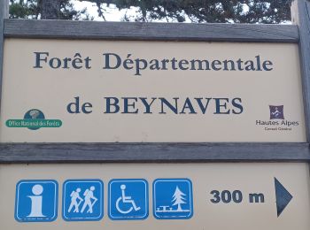
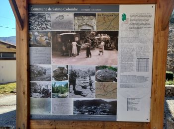
Trail Walking Sainte-Colombe - ORPIERRES . DEPART CHEVALET . BEYNAVES . MONTAGNE SAINT MICHEL . AR   N - Photo
Walking 10.091
Km
GUIDE

Walking

Difficult
Sainte-Colombe, Provence-Alpes-Côte d'Azur, Hautes-Alpes, France
10.1 km | 15.2 km-effort
2h 50min
387 m
387 m
Yes
RobinMicheline

Trail Walking Sainte-Colombe - SAINTE COLOMBE , les Bègues,  autour des versants du Céans o l - Photo
Walking 11.326
Km
GUIDE

Walking

Medium
Sainte-Colombe, Provence-Alpes-Côte d'Azur, Hautes-Alpes, France
11.3 km | 17.3 km-effort
3h 9min
447 m
453 m
Yes
RobinMicheline

Trail Walking Sainte-Colombe - SAINTE COLOMBE . 05 . Pas de Sainte  Colombe o m s - Photo
Walking 7.95
Km
GUIDE

Walking

Medium
Sainte-Colombe, Provence-Alpes-Côte d'Azur, Hautes-Alpes, France
8 km | 13.3 km-effort
2h 56min
404 m
404 m
Yes
RobinMicheline

Trail Walking Sainte-Colombe - st colombe la
Walking 11.633
Km

Walking

Medium
Sainte-Colombe, Provence-Alpes-Côte d'Azur, Hautes-Alpes, France
11.6 km | 17.9 km-effort
3h 4min
470 m
462 m
Yes
margotte

• casse ittinerante

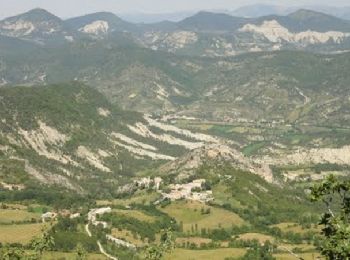
Trail Walking Sainte-Colombe - catoyes  - Photo
Walking 17.002
Km

Walking

Very difficult
Sainte-Colombe, Provence-Alpes-Côte d'Azur, Hautes-Alpes, France
17 km | 27 km-effort
6h 26min
729 m
727 m
Yes
céline BORLOZ

Trail Walking Sainte-Colombe - 100423 Plan de Cuques - Photo
Walking 11.684
Km

Walking

Difficult
Sainte-Colombe, Provence-Alpes-Côte d'Azur, Hautes-Alpes, France
11.7 km | 17.4 km-effort
3h 12min
412 m
476 m
No
mzonzon05

Trail Walking Sainte-Colombe - La crête de la Montagne de Chabre - Ste Colombe - Photo
Walking 23.204
Km

Walking

Very difficult
Sainte-Colombe, Provence-Alpes-Côte d'Azur, Hautes-Alpes, France
23 km | 37 km-effort
7h 0min
1008 m
1008 m
Yes
tracegps

Trail On foot Sainte-Colombe - Ste Colombe (1) - Photo
On foot 13.155
Km
GUIDE

On foot

Medium
Sainte-Colombe, Provence-Alpes-Côte d'Azur, Hautes-Alpes, France
13.2 km | 21 km-effort
4h 51min
619 m
619 m
Yes
RobinMicheline

Trail On foot Sainte-Colombe - Ste Colombe la Magnifique depart Les Begues - Photo
On foot 10.784
Km

On foot

Medium
Sainte-Colombe, Provence-Alpes-Côte d'Azur, Hautes-Alpes, France
10.8 km | 17 km-effort
Unknown
464 m
465 m
Yes
claude nier

Trail Walking Sainte-Colombe - Les Versants du Ceans - Photo
Walking 11.835
Km

Walking

Medium
Sainte-Colombe, Provence-Alpes-Côte d'Azur, Hautes-Alpes, France
11.8 km | 0 m-effort
4h 47min
0 m
0 m
Yes
claude nier

Trail Walking Sainte-Colombe - Les Versants du Ceans   Les Begues - Photo
Walking 11.61
Km

Walking

Medium
(1)
Sainte-Colombe, Provence-Alpes-Côte d'Azur, Hautes-Alpes, France
11.6 km | 17.7 km-effort
3h 55min
457 m
466 m
Yes
claude nier

Trail Walking Sainte-Colombe - montagne chabre - Photo
Walking 12.012
Km

Walking

Medium
Sainte-Colombe, Provence-Alpes-Côte d'Azur, Hautes-Alpes, France
12 km | 19.1 km-effort
5h 41min
534 m
533 m
Yes
sabine38

Trail Walking Sainte-Colombe - montagne de chambre tracé  - Photo
Walking 11.814
Km

Walking

Difficult
Sainte-Colombe, Provence-Alpes-Côte d'Azur, Hautes-Alpes, France
11.8 km | 18.9 km-effort
4h 29min
529 m
527 m
Yes
Yeti38

Trail Road bike Sainte-Colombe - orpierre roussieu lau - Photo
Road bike 55.981
Km

Road bike

Medium
Sainte-Colombe, Provence-Alpes-Côte d'Azur, Hautes-Alpes, France
56 km | 70 km-effort
3h 27min
1085 m
1084 m
Yes
BELLETGE

Trail Road bike Sainte-Colombe - orpierre col St Jean + - Photo
Road bike 27.65
Km

Road bike

Easy
Sainte-Colombe, Provence-Alpes-Côte d'Azur, Hautes-Alpes, France
28 km | 36 km-effort
2h 11min
633 m
630 m
Yes
BELLETGE

Trail Road bike Sainte-Colombe - orpierre forêt ste colombe - Photo
Road bike 27.738
Km

Road bike

Medium
Sainte-Colombe, Provence-Alpes-Côte d'Azur, Hautes-Alpes, France
28 km | 36 km-effort
2h 18min
637 m
638 m
Yes
BELLETGE

Trail Road bike Sainte-Colombe - orpierre col reychasset plus - Photo
Road bike 44.823
Km

Road bike

Medium
Sainte-Colombe, Provence-Alpes-Côte d'Azur, Hautes-Alpes, France
45 km | 58 km-effort
3h 2min
962 m
961 m
Yes
BELLETGE

Trail Road bike Sainte-Colombe - orpierres col de perty - Photo
Road bike 27.573
Km

Road bike

Easy
Sainte-Colombe, Provence-Alpes-Côte d'Azur, Hautes-Alpes, France
28 km | 36 km-effort
1h 49min
607 m
604 m
Yes
BELLETGE

Trail Walking Sainte-Colombe - St Colombe Monfroc cheval - Photo
Walking 23.302
Km

Walking

Very difficult
Sainte-Colombe, Provence-Alpes-Côte d'Azur, Hautes-Alpes, France
23 km | 37 km-effort
8h 25min
1000 m
1139 m
No
Spinnaker

Trail Walking Sainte-Colombe - le belvédère du terac - Photo
Walking 15.419
Km

Walking

Medium
Sainte-Colombe, Provence-Alpes-Côte d'Azur, Hautes-Alpes, France
15.4 km | 23 km-effort
3h 51min
574 m
576 m
Yes
margotte

20 trails displayed on 27

FREE GPS app for hiking

Logo SityTrail SityTrail

IGN / Geographical institutes

Download SityTrail from the App Store Download SityTrail from Google Play

Logo SityTrail SityTrail World

The world is yours!

Download SityTrail from the App Store Download SityTrail from Google Play Download SityTrail on Huawei AppGallery

Activities

Close
My subscriptions