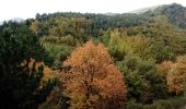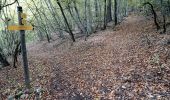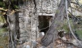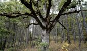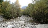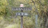

descente du col de mounis, Le Vancon

jalien04
User

Length
5 km

Max alt
1246 m

Uphill gradient
15 m

Km-Effort
6.9 km

Min alt
710 m

Downhill gradient
537 m
Boucle
No
Creation date :
2019-05-07 01:46:47.95
Updated on :
2021-08-04 14:38:24.937
1h46
Difficulty : Easy

FREE GPS app for hiking
About
Trail Walking of 5 km to be discovered at Provence-Alpes-Côte d'Azur, Alpes-de-Haute-Provence, Le Castellard-Mélan. This trail is proposed by jalien04.
Description
Accès au col de Mounis, à pied (2 km) depuis le parking public à proximité du cimetière église de Mélan. Retour par le même chemin ou poursuivre en direction de Saint-Geniez.
Positioning
Country:
France
Region :
Provence-Alpes-Côte d'Azur
Department/Province :
Alpes-de-Haute-Provence
Municipality :
Le Castellard-Mélan
Location:
Unknown
Start:(Dec)
Start:(UTM)
269749 ; 4898983 (32T) N.
Comments
Trails nearby
S GENIEZ . ABROS . LA FOREST . COL DE MOUNIS . O L M


Walking
Difficult
(1)
Saint-Geniez,
Provence-Alpes-Côte d'Azur,
Alpes-de-Haute-Provence,
France

12.5 km | 20 km-effort
4h 33min
Yes
MELAN . Col de Mounis , sommet du Corbeau o l s


Walking
Medium
(1)
Le Castellard-Mélan,
Provence-Alpes-Côte d'Azur,
Alpes-de-Haute-Provence,
France

12.8 km | 19 km-effort
4h 30min
Yes
20180912_Monges_Authon_Boucle_Sommet Coste belle


Walking
Difficult
(1)
Authon,
Provence-Alpes-Côte d'Azur,
Alpes-de-Haute-Provence,
France

15.2 km | 28 km-effort
5h 35min
Yes
Autour de Fontbelle 18/12/2024


Walking
Difficult
Le Castellard-Mélan,
Provence-Alpes-Côte d'Azur,
Alpes-de-Haute-Provence,
France

9.4 km | 15 km-effort
3h 24min
Yes
AUTHON. GROTTE. COL DE L AIGUILLE O L


Walking
Difficult
Authon,
Provence-Alpes-Côte d'Azur,
Alpes-de-Haute-Provence,
France

12.1 km | 20 km-effort
3h 46min
No
AUTHON . COL DE LA SAPIE .CRETE DU CLOT DES MARTHES . CABAN DE CHINE N


Walking
Difficult
Authon,
Provence-Alpes-Côte d'Azur,
Alpes-de-Haute-Provence,
France

13.6 km | 22 km-effort
4h 15min
Yes
28-10-2022 Tour du Dromon


Walking
Easy
Saint-Geniez,
Provence-Alpes-Côte d'Azur,
Alpes-de-Haute-Provence,
France

12.8 km | 19.7 km-effort
4h 12min
Yes
SityTrail - Les Monges au départ de Authon


On foot
Difficult
Authon,
Provence-Alpes-Côte d'Azur,
Alpes-de-Haute-Provence,
France

14.2 km | 27 km-effort
6h 2min
Yes
AUTHON Fontbelle, piste forestière du Pras au pied de Gueruen, col d Ainac ...


Walking
Easy
Le Castellard-Mélan,
Provence-Alpes-Côte d'Azur,
Alpes-de-Haute-Provence,
France

14.7 km | 21 km-effort
3h 37min
Yes


 SityTrail


