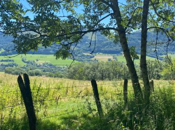
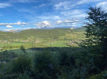
Habère-Poche, Upper Savoy: Best trails, routes and walks

4 comments

Habère-Poche: Discover the best trails: 13 hiking trails and 10 bike and mountain-bike routes. All these trails, routes and outdoor activities are available in our SityTrail applications for smartphones and tablets.


The best trails (30)
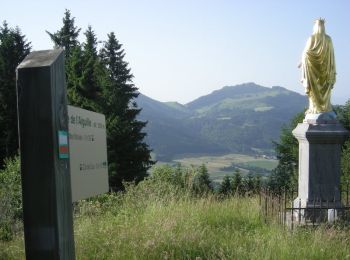
Trail Walking Habère-Poche - Mont Forchat - Habère Poche - Ramble - Photo
Walking 10.713
Km

Walking

Medium
(2)
Habère-Poche, Auvergne-Rhône-Alpes, Upper Savoy, France
10.7 km | 18.6 km-effort
4h 0min
590 m
589 m
Yes
tracegps

Trail Walking Habère-Poche - Le mont forchat  - Photo
Walking 12.439
Km

Walking

Very difficult
Habère-Poche, Auvergne-Rhône-Alpes, Upper Savoy, France
12.4 km | 19.9 km-effort
6h 49min
562 m
566 m
Yes
colomb24

Trail Walking Habère-Poche - Rando VV - Photo
Walking 13.404
Km

Walking

Medium
Habère-Poche, Auvergne-Rhône-Alpes, Upper Savoy, France
13.4 km | 19.1 km-effort
3h 39min
368 m
599 m
No
thierry.berthouze

Trail Mountain bike Habère-Poche - rando VTT Habere Poche 2017 - Photo
Mountain bike 71.45
Km

Mountain bike

Very difficult
Habère-Poche, Auvergne-Rhône-Alpes, Upper Savoy, France
71 km | 105 km-effort
6h 20min
2543 m
2549 m
Yes
leclaude74

• Superbe rando vtt a Habere Poche . avec au col de l'Encrenaz un portage de velo sur 100 m une vingtaine de minute ma...

Trail Walking Habère-Poche - moises - Photo
Walking 9.478
Km

Walking

Difficult
Habère-Poche, Auvergne-Rhône-Alpes, Upper Savoy, France
9.5 km | 17.2 km-effort
3h 13min
579 m
578 m
Yes
Bugeat

Trail Walking Habère-Poche - Mont Forchat - Photo
Walking 10.251
Km

Walking

Medium
Habère-Poche, Auvergne-Rhône-Alpes, Upper Savoy, France
10.3 km | 18 km-effort
4h 59min
579 m
577 m
Yes
Chabard

Trail Walking Habère-Poche - Tête du Char - Photo
Walking 5.34
Km

Walking

Medium
Habère-Poche, Auvergne-Rhône-Alpes, Upper Savoy, France
5.3 km | 7.8 km-effort
1h 50min
181 m
180 m
Yes
thierry.berthouze

Trail On foot Habère-Poche - GR Balcon du Léman - Photo
On foot 24.161
Km
GUIDE+

On foot

Difficult
Habère-Poche, Auvergne-Rhône-Alpes, Upper Savoy, France
24 km | 38 km-effort
8h 35min
934 m
1282 m
No
SityTrail - itinéraires balisés pédestres

Trail Touring skiing Habère-Poche - suuntoapp-SkiTouring-2021-03-21T07-19-52Z-track - Photo
Touring skiing 6.659
Km

Touring skiing

Very easy
Habère-Poche, Auvergne-Rhône-Alpes, Upper Savoy, France
6.7 km | 13.6 km-effort
3h 15min
522 m
519 m
Yes
Myrostates

Trail Touring skiing Habère-Poche - suuntoapp-SkiTouring-2021-02-13T09-00-08Z-track - Photo
Touring skiing 7.274
Km

Touring skiing

Very easy
Habère-Poche, Auvergne-Rhône-Alpes, Upper Savoy, France
7.3 km | 14.3 km-effort
3h 16min
529 m
530 m
Yes
Myrostates

Trail Touring skiing Habère-Poche - suuntoapp-SkiTouring-2020-12-05T14-26-08Z-track - Photo
Touring skiing 5.316
Km

Touring skiing

Very easy
Habère-Poche, Auvergne-Rhône-Alpes, Upper Savoy, France
5.3 km | 10.8 km-effort
2h 6min
411 m
419 m
Yes
Myrostates

Trail Mountain bike Habère-Poche -  RANDO HABERE POCHE - Photo
Mountain bike 55.76
Km

Mountain bike

Very easy
(1)
Habère-Poche, Auvergne-Rhône-Alpes, Upper Savoy, France
56 km | 80 km-effort
6h 46min
1813 m
1816 m
Yes
leclaude74

Trail Walking Habère-Poche - Mont Forchat par cool du Cou en boucle - 29 juin 2019 - Photo
Walking 11.671
Km

Walking

Medium
Habère-Poche, Auvergne-Rhône-Alpes, Upper Savoy, France
11.7 km | 19.6 km-effort
5h 28min
596 m
594 m
Yes
morganee

Trail Mountain bike Habère-Poche - Rando VTT Habere Poche 46 KM - Photo
Mountain bike 46.598
Km

Mountain bike

Difficult
Habère-Poche, Auvergne-Rhône-Alpes, Upper Savoy, France
47 km | 70 km-effort
4h 16min
1750 m
1744 m
Yes
leclaude74

• Départ place du village , avec beau parcours autour d Habere Poche

Trail Walking Habère-Poche - Le mont forçat en boucle - Photo
Walking 12.916
Km

Walking

Very difficult
Habère-Poche, Auvergne-Rhône-Alpes, Upper Savoy, France
12.9 km | 21 km-effort
5h 32min
577 m
573 m
Yes
FILLIONJEAN

Trail Walking Habère-Poche - Col des Moises et Mont Forchat - Photo
Walking 13.73
Km

Walking

Difficult
Habère-Poche, Auvergne-Rhône-Alpes, Upper Savoy, France
13.7 km | 24 km-effort
5h 28min
775 m
776 m
Yes
cron

Trail Trail Habère-Poche - Forchat - Photo
Trail 10.622
Km

Trail

Habère-Poche, Auvergne-Rhône-Alpes, Upper Savoy, France
10.6 km | 18.3 km-effort
1h 56min
576 m
576 m
Yes
Lydie Bouvet

Trail sport Habère-Poche - 2021-11-29_20h49m45_2)_Centre_Vac_vers_Mont_Forchat-13846156-1635595669-649 - Photo
sport 12.385
Km

sport

Very easy
Habère-Poche, Auvergne-Rhône-Alpes, Upper Savoy, France
12.4 km | 23 km-effort
Unknown
792 m
793 m
Yes
aucamus

Trail sport Habère-Poche - 2021-11-29_20h47m34_1)_Centre_de_Vac_vers_Tête_du__Char-13846229-1635595640-968 - Photo
sport 13.878
Km

sport

Very easy
Habère-Poche, Auvergne-Rhône-Alpes, Upper Savoy, France
13.9 km | 22 km-effort
Unknown
640 m
592 m
Yes
aucamus

Trail Mountain bike Habère-Poche - Habere Poche Vallée Verte - Photo
Mountain bike 43.191
Km

Mountain bike

Medium
Habère-Poche, Auvergne-Rhône-Alpes, Upper Savoy, France
43 km | 56 km-effort
3h 10min
949 m
953 m
Yes
ropo

20 trails displayed on 30

FREE GPS app for hiking

Logo SityTrail SityTrail

IGN / Geographical institutes

Download SityTrail from the App Store Download SityTrail from Google Play

Logo SityTrail SityTrail World

The world is yours!

Download SityTrail from the App Store Download SityTrail from Google Play Download SityTrail on Huawei AppGallery

Activities

Close
My subscriptions