Landkreis Weimarer Land, Thuringia: Best trails, routes and walks

Landkreis Weimarer Land: Discover the best trails: 27 hiking trails. All these trails, routes and outdoor activities are available in our SityTrail applications for smartphones and tablets.


The best trails (27)

Trail On foot Kranichfeld - Kranich-Rundwanderweg 1 - Photo
On foot 7.742
Km
PRO

On foot

Easy
Kranichfeld, Thuringia, Landkreis Weimarer Land, Germany
7.7 km | 10.5 km-effort
2h 23min
207 m
207 m
Yes
SityTrail - itinéraires balisés pédestres

• Trail created by Kranichfeld. Symbol: Weiße 1 auf schwarzem Hintergrund, drüber ein schwarzer Kranich auf weißem Gru...

Trail On foot Kranichfeld - Kranich-Rundwanderweg 2 - Photo
On foot 14.059
Km
PRO

On foot

Easy
Kranichfeld, Thuringia, Landkreis Weimarer Land, Germany
14.1 km | 18.2 km-effort
4h 8min
310 m
310 m
Yes
SityTrail - itinéraires balisés pédestres

• Trail created by Kranichfeld. Symbol: Schwarze 2 auf gelbgrünem Hintergrund, drüber ein schwarzer Kranich auf weißem...

Trail On foot Kranichfeld - Kranich-Rundwanderweg 5 - Photo
On foot 10.998
Km
PRO

On foot

Easy
Kranichfeld, Thuringia, Landkreis Weimarer Land, Germany
11 km | 15.2 km-effort
3h 26min
312 m
316 m
Yes
SityTrail - itinéraires balisés pédestres

• Trail created by Kranichfeld. Symbol: Weiße 5 auf dunkelgrünem Hintergrund, drüber ein schwarzer Kranich auf weißem ...

Trail On foot Kranichfeld - Kranich-Rundwanderweg 4 - Photo
On foot 11.666
Km
PRO

On foot

Easy
Kranichfeld, Thuringia, Landkreis Weimarer Land, Germany
11.7 km | 14.9 km-effort
3h 23min
243 m
243 m
Yes
SityTrail - itinéraires balisés pédestres

• Trail created by Kranichfeld. Symbol: Schwarze 4 auf rosa Hintergrund, drüber ein schwarzer Kranich auf weißem Grund.

Trail On foot Bad Berka - Ludwig-Geist-Weg - Photo
On foot 5.085
Km
PRO

On foot

Easy
Bad Berka, Thuringia, Landkreis Weimarer Land, Germany
5.1 km | 7.3 km-effort
1h 39min
165 m
165 m
Yes
SityTrail - itinéraires balisés pédestres

• Trail created by Bad Berka. Symbol: schwarze 3 auf mittig senkrecht geteiltem, links blauen, rechts gelben Kreis

Trail On foot Bad Berka - Heinrich-Schütz-Weg - Photo
On foot 8.996
Km
PRO

On foot

Easy
Bad Berka, Thuringia, Landkreis Weimarer Land, Germany
9 km | 11.1 km-effort
2h 31min
161 m
160 m
Yes
SityTrail - itinéraires balisés pédestres

• Trail created by Bad Berka. Symbol: schwarze 1 auf mittig senkrecht geteiltem, links baluen, rechts gelben Kreis

Trail On foot Bad Berka - Justizrat-Reinhard-Weg - Photo
On foot 5.02
Km
PRO

On foot

Easy
Bad Berka, Thuringia, Landkreis Weimarer Land, Germany
5 km | 6.6 km-effort
1h 30min
122 m
119 m
Yes
SityTrail - itinéraires balisés pédestres

• Trail created by Bad Berka. Symbol: schwarze 2 auf mittig senkrecht geteiltem, links blauen, rechts gelben Kreis

Trail On foot Bad Sulza - Weinwanderweg Bad Sulza - Photo
On foot 8.38
Km
PRO

On foot

Easy
Bad Sulza, Thuringia, Landkreis Weimarer Land, Germany
8.4 km | 10.8 km-effort
2h 27min
185 m
183 m
Yes
SityTrail - itinéraires balisés pédestres

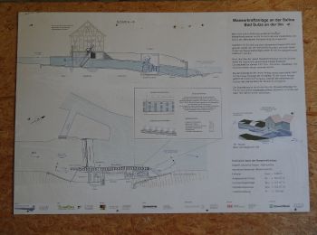
• Trail created by Touristinformation Bad Sulza. created by Johanna Müller

Trail On foot Großheringen - Rundweg Kaatschen-Tultewitz - Photo
On foot 5.009
Km
PRO

On foot

Easy
Großheringen, Thuringia, Landkreis Weimarer Land, Germany
5 km | 6.7 km-effort
1h 31min
127 m
127 m
Yes
SityTrail - itinéraires balisés pédestres

• unmarkiert

Trail On foot Bad Berka - Ludwig-Häfner-Weg - Photo
On foot 10.192
Km
PRO

On foot

Easy
Bad Berka, Thuringia, Landkreis Weimarer Land, Germany
10.2 km | 14.6 km-effort
3h 18min
328 m
330 m
Yes
SityTrail - itinéraires balisés pédestres

• Trail created by Bad Berka. Symbol: schwarze 7 auf mittig senkrecht geteiltem, links blauen, rechts gelben Kreis

Trail On foot Bad Berka - Hexenberg-Rundweg - Photo
On foot 5.025
Km
PRO

On foot

Easy
Bad Berka, Thuringia, Landkreis Weimarer Land, Germany
5 km | 7.3 km-effort
1h 39min
182 m
140 m
No
SityTrail - itinéraires balisés pédestres

• Symbol: schwarze 6 auf mittig senkrecht geteiltem, links blauen, rechts gelben Kreis

Trail On foot Bad Berka - grüner Balken Tannroda - Photo
On foot 4.124
Km
PRO

On foot

Easy
Bad Berka, Thuringia, Landkreis Weimarer Land, Germany
4.1 km | 5.6 km-effort
1h 15min
105 m
119 m
No
SityTrail - itinéraires balisés pédestres

• Wanderweg Grüner Balken Raum Tannroda

Trail On foot Ilmtal-Weinstraße - Wanderweg - Photo
On foot 4.182
Km
PRO

On foot

Easy
Ilmtal-Weinstraße, Thuringia, Landkreis Weimarer Land, Germany
4.2 km | 4.6 km-effort
1h 2min
29 m
31 m
No
SityTrail - itinéraires balisés pédestres

• Symbol: Grüner Strich auf weißem Grund

Trail On foot Kranichfeld - lokales Wegenetz Gelber Balken - Photo
On foot 12.846
Km
PRO

On foot

Easy
Kranichfeld, Thuringia, Landkreis Weimarer Land, Germany
12.8 km | 16.2 km-effort
3h 41min
241 m
295 m
No
SityTrail - itinéraires balisés pédestres

• Symbol: Gelber Querbalken auf weißem Grund

Trail On foot Klettbach - lokales Wegenetz Grüner Balken - Photo
On foot 8.723
Km
PRO

On foot

Easy
Klettbach, Thuringia, Landkreis Weimarer Land, Germany
8.7 km | 10.2 km-effort
2h 19min
57 m
272 m
No
SityTrail - itinéraires balisés pédestres

• Symbol: Grüner Querbalken auf weißem Grund

Trail On foot Bad Sulza - Im Brühlgrund - Photo
On foot 3.051
Km
PRO

On foot

Easy
Bad Sulza, Thuringia, Landkreis Weimarer Land, Germany
3.1 km | 3.7 km-effort
51min
54 m
47 m
Yes
SityTrail - itinéraires balisés pédestres

Trail On foot Bad Sulza - Schlachtfelder Bad Sulza - Photo
On foot 11.849
Km
PRO

On foot

Easy
Bad Sulza, Thuringia, Landkreis Weimarer Land, Germany
11.8 km | 15.7 km-effort
3h 34min
294 m
281 m
No
SityTrail - itinéraires balisés pédestres

Trail On foot Bad Sulza - Utenbach Wanderweg - Photo
On foot 4.252
Km
PRO

On foot

Easy
Bad Sulza, Thuringia, Landkreis Weimarer Land, Germany
4.3 km | 5.3 km-effort
1h 12min
102 m
19 m
No
SityTrail - itinéraires balisés pédestres

Trail On foot Bad Sulza - Himmelreich Rundweg Bad Sulza - Photo
On foot 13.409
Km
PRO

On foot

Easy
Bad Sulza, Thuringia, Landkreis Weimarer Land, Germany
13.4 km | 17.6 km-effort
3h 59min
310 m
319 m
Yes
SityTrail - itinéraires balisés pédestres

Trail On foot Bad Sulza - Panorama Rundweg - Photo
On foot 3.054
Km
PRO

On foot

Easy
Bad Sulza, Thuringia, Landkreis Weimarer Land, Germany
3.1 km | 4.4 km-effort
59min
119 m
45 m
No
SityTrail - itinéraires balisés pédestres

20 trails displayed on 27

FREE GPS app for hiking

Logo SityTrail SityTrail

IGN / Geographical institutes

Download SityTrail from the App Store Download SityTrail from Google Play

Logo SityTrail SityTrail World

The world is yours!

Download SityTrail from the App Store Download SityTrail from Google Play Download SityTrail on Huawei AppGallery

Activities

Nearby regions

Close
My subscriptions