![](/images/other/stat-length.png)
- Trails
- Outdoor
- Austria
- Upper Austria
- Bezirk Perg
Bezirk Perg, Upper Austria: Best trails, routes and walks
Bezirk Perg: Discover the best trails: 38 hiking trails and 6 bike and mountain-bike routes. All these trails, routes and outdoor activities are available in our SityTrail applications for smartphones and tablets.
The best trails (44)
![Trail On foot Bad Kreuzen - Kneipp-Weg - Photo](https://media.geolcdn.com/t/350/260/9400c472-a79c-4c42-9f82-cf214a296dc0.jpeg&format=jpg&maxdim=2)
![On foot On foot](https://static1.geolcdn.com/sitytour/trail-icons/100.png)
Km
On foot
![](/images/other/stat-length.png)
![](https://static1.geolcdn.com/siteimages/upload/files/1508320355ic_sort_den_pos_24dp.png)
![](https://static1.geolcdn.com/siteimages/upload/files/1508320355ic_sort_den_neg_24dp.png)
![](https://static1.geolcdn.com/siteimages/upload/files/16400158638029165_repeat_loop_refresh_sync_direction_icon.png)
• Trail created by Tourismusverein Bad Kreuzen. https://www.donauregion.at/linz-grein/bad-kreuzen/oesterreich-tour/det...
![Trail On foot Bad Kreuzen - Anton Bruckner Weg - Photo](https://media.geolcdn.com/t/350/260/084c1519-9d1f-4ac4-987f-f4f8f94859ba.jpeg&format=jpg&maxdim=2)
![On foot On foot](https://static1.geolcdn.com/sitytour/trail-icons/100.png)
Km
On foot
![](/images/other/stat-length.png)
![](https://static1.geolcdn.com/siteimages/upload/files/1508320355ic_sort_den_pos_24dp.png)
![](https://static1.geolcdn.com/siteimages/upload/files/1508320355ic_sort_den_neg_24dp.png)
![](https://static1.geolcdn.com/siteimages/upload/files/16400158638029165_repeat_loop_refresh_sync_direction_icon.png)
• Trail created by Tourismusverein Bad Kreuzen. https://www.donauregion.at/linz-grein/bad-kreuzen/oesterreich-tour/det...
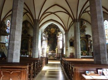
![Trail On foot Bad Kreuzen - Stillensteinklamm - Photo](https://media.geolcdn.com/t/350/260/f684559a-7f3f-4524-9d18-325ac54717b9.jpeg&format=jpg&maxdim=2)
![On foot On foot](https://static1.geolcdn.com/sitytour/trail-icons/100.png)
Km
On foot
![](/images/other/stat-length.png)
![](https://static1.geolcdn.com/siteimages/upload/files/1508320355ic_sort_den_pos_24dp.png)
![](https://static1.geolcdn.com/siteimages/upload/files/1508320355ic_sort_den_neg_24dp.png)
![](https://static1.geolcdn.com/siteimages/upload/files/16400158638029165_repeat_loop_refresh_sync_direction_icon.png)
• Trail created by Arge Wanderregion Strudengau.
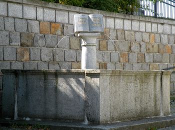
![Trail On foot Pabneukirchen - Drei-Dörfer-Rundweg - Photo](https://media.geolcdn.com/t/350/260/027a37a4-b40a-48b7-9b50-29da9e3f7960.jpeg&format=jpg&maxdim=2)
![On foot On foot](https://static1.geolcdn.com/sitytour/trail-icons/100.png)
Km
On foot
![](/images/other/stat-length.png)
![](https://static1.geolcdn.com/siteimages/upload/files/1508320355ic_sort_den_pos_24dp.png)
![](https://static1.geolcdn.com/siteimages/upload/files/1508320355ic_sort_den_neg_24dp.png)
![](https://static1.geolcdn.com/siteimages/upload/files/16400158638029165_repeat_loop_refresh_sync_direction_icon.png)
• Symbol: Gelbe Tafel
![Trail On foot Pabneukirchen - Unter-Pabneukirchen Rundweg - Photo](https://media.geolcdn.com/t/350/260/baad22a6-9f57-4109-9b39-0d5f1204fa7a.jpeg&format=jpg&maxdim=2)
![On foot On foot](https://static1.geolcdn.com/sitytour/trail-icons/100.png)
Km
On foot
![](/images/other/stat-length.png)
![](https://static1.geolcdn.com/siteimages/upload/files/1508320355ic_sort_den_pos_24dp.png)
![](https://static1.geolcdn.com/siteimages/upload/files/1508320355ic_sort_den_neg_24dp.png)
![](https://static1.geolcdn.com/siteimages/upload/files/16400158638029165_repeat_loop_refresh_sync_direction_icon.png)
• Symbol: Gelbe Tafel
![Trail On foot Pabneukirchen - Stilles Tal Rundweg - Photo](https://media.geolcdn.com/t/350/260/7a95d285-03dc-48f5-b1b5-139c93e1019b.jpeg&format=jpg&maxdim=2)
![On foot On foot](https://static1.geolcdn.com/sitytour/trail-icons/100.png)
Km
On foot
![](/images/other/stat-length.png)
![](https://static1.geolcdn.com/siteimages/upload/files/1508320355ic_sort_den_pos_24dp.png)
![](https://static1.geolcdn.com/siteimages/upload/files/1508320355ic_sort_den_neg_24dp.png)
![](https://static1.geolcdn.com/siteimages/upload/files/16400158638029165_repeat_loop_refresh_sync_direction_icon.png)
• Symbol: Gelbe Tafel
![Trail On foot Pabneukirchen - Schnitzer-Rundweg - Photo](https://media.geolcdn.com/t/350/260/78e6f358-d850-4ce0-ae6b-02b51479020e.jpeg&format=jpg&maxdim=2)
![On foot On foot](https://static1.geolcdn.com/sitytour/trail-icons/100.png)
Km
On foot
![](/images/other/stat-length.png)
![](https://static1.geolcdn.com/siteimages/upload/files/1508320355ic_sort_den_pos_24dp.png)
![](https://static1.geolcdn.com/siteimages/upload/files/1508320355ic_sort_den_neg_24dp.png)
![](https://static1.geolcdn.com/siteimages/upload/files/16400158638029165_repeat_loop_refresh_sync_direction_icon.png)
• Symbol: Gelbe Tafel
![Trail On foot Pabneukirchen - Stilles Tal Weg - Photo](https://media.geolcdn.com/t/350/260/7a95d285-03dc-48f5-b1b5-139c93e1019b.jpeg&format=jpg&maxdim=2)
![On foot On foot](https://static1.geolcdn.com/sitytour/trail-icons/100.png)
Km
On foot
![](/images/other/stat-length.png)
![](https://static1.geolcdn.com/siteimages/upload/files/1508320355ic_sort_den_pos_24dp.png)
![](https://static1.geolcdn.com/siteimages/upload/files/1508320355ic_sort_den_neg_24dp.png)
![](https://static1.geolcdn.com/siteimages/upload/files/16400158638029165_repeat_loop_refresh_sync_direction_icon.png)
• Symbol: Gelbe Tafel
![Trail On foot Pabneukirchen - Hubertus-Hochbuchberg-Rundweg - Photo](https://media.geolcdn.com/t/350/260/027a37a4-b40a-48b7-9b50-29da9e3f7960.jpeg&format=jpg&maxdim=2)
![On foot On foot](https://static1.geolcdn.com/sitytour/trail-icons/100.png)
Km
On foot
![](/images/other/stat-length.png)
![](https://static1.geolcdn.com/siteimages/upload/files/1508320355ic_sort_den_pos_24dp.png)
![](https://static1.geolcdn.com/siteimages/upload/files/1508320355ic_sort_den_neg_24dp.png)
![](https://static1.geolcdn.com/siteimages/upload/files/16400158638029165_repeat_loop_refresh_sync_direction_icon.png)
• Trail created by Gemeinde Pabneukirchen.
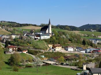
![Trail On foot Pabneukirchen - Romantiktal-Maseldorf - Photo](https://media.geolcdn.com/t/350/260/78e6f358-d850-4ce0-ae6b-02b51479020e.jpeg&format=jpg&maxdim=2)
![On foot On foot](https://static1.geolcdn.com/sitytour/trail-icons/100.png)
Km
On foot
![](/images/other/stat-length.png)
![](https://static1.geolcdn.com/siteimages/upload/files/1508320355ic_sort_den_pos_24dp.png)
![](https://static1.geolcdn.com/siteimages/upload/files/1508320355ic_sort_den_neg_24dp.png)
![](https://static1.geolcdn.com/siteimages/upload/files/16400158638029165_repeat_loop_refresh_sync_direction_icon.png)
• Symbol: Gelbe Tafel Website: http://www.region-strudengau.at/index.aspx?rubriknr=7588
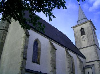
![Trail On foot Windhaag bei Perg - Falkensteinweg - Photo](https://media.geolcdn.com/t/350/260/78efe76c-2fc0-455b-9477-e99a631d349b.jpeg&format=jpg&maxdim=2)
![On foot On foot](https://static1.geolcdn.com/sitytour/trail-icons/100.png)
Km
On foot
![](/images/other/stat-length.png)
![](https://static1.geolcdn.com/siteimages/upload/files/1508320355ic_sort_den_pos_24dp.png)
![](https://static1.geolcdn.com/siteimages/upload/files/1508320355ic_sort_den_neg_24dp.png)
![](https://static1.geolcdn.com/siteimages/upload/files/16400158638029165_repeat_loop_refresh_sync_direction_icon.png)
• Symbol: gelber Hinweispfeil mit dem Text "6 Falkensteiweg"
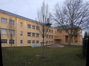
![Trail On foot Perg - Naturfreundeweg - Photo](https://media.geolcdn.com/t/350/260/0257230b-a569-485f-9136-ca75baadabe7.jpeg&format=jpg&maxdim=2)
![On foot On foot](https://static1.geolcdn.com/sitytour/trail-icons/100.png)
Km
On foot
![](/images/other/stat-length.png)
![](https://static1.geolcdn.com/siteimages/upload/files/1508320355ic_sort_den_pos_24dp.png)
![](https://static1.geolcdn.com/siteimages/upload/files/1508320355ic_sort_den_neg_24dp.png)
![](https://static1.geolcdn.com/siteimages/upload/files/16400158638029165_repeat_loop_refresh_sync_direction_icon.png)
• Symbol: gelbe Ziffer 4 auf schwarzem Kreis auf gelbem Grund, daneben die Bezeichnung Naturfreundeweg in schwarzer Sch...
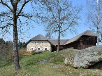
![Trail On foot Rechberg - Der Naturparkweg - Photo](https://media.geolcdn.com/t/350/260/00512289-f987-447a-ab17-ceceb9e1f3a0.jpeg&format=jpg&maxdim=2)
![On foot On foot](https://static1.geolcdn.com/sitytour/trail-icons/100.png)
Km
On foot
![](/images/other/stat-length.png)
![](https://static1.geolcdn.com/siteimages/upload/files/1508320355ic_sort_den_pos_24dp.png)
![](https://static1.geolcdn.com/siteimages/upload/files/1508320355ic_sort_den_neg_24dp.png)
![](https://static1.geolcdn.com/siteimages/upload/files/16400158638029165_repeat_loop_refresh_sync_direction_icon.png)
• Rechberg Website: https://www.rechberg.at/Freizeit_und_Tourismus/Allgemeine_Information
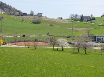
![Trail On foot Rechberg - Weg Schwammerling - Photo](https://media.geolcdn.com/t/350/260/8ad41e96-6c1e-442a-b845-0992d1acc119.jpeg&format=jpg&maxdim=2)
![On foot On foot](https://static1.geolcdn.com/sitytour/trail-icons/100.png)
Km
On foot
![](/images/other/stat-length.png)
![](https://static1.geolcdn.com/siteimages/upload/files/1508320355ic_sort_den_pos_24dp.png)
![](https://static1.geolcdn.com/siteimages/upload/files/1508320355ic_sort_den_neg_24dp.png)
![](https://static1.geolcdn.com/siteimages/upload/files/16400158638029165_repeat_loop_refresh_sync_direction_icon.png)
• Rechberg Website: http://www.rechberg.at/Freizeit_und_Tourismus/Allgemeine_Information
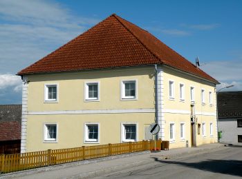
![Trail On foot Windhaag bei Perg - Route IV Schwertmühle - Photo](https://media.geolcdn.com/t/350/260/21383be9-9604-4cab-b26e-efc7d15a0996.jpeg&format=jpg&maxdim=2)
![On foot On foot](https://static1.geolcdn.com/sitytour/trail-icons/100.png)
Km
On foot
![](/images/other/stat-length.png)
![](https://static1.geolcdn.com/siteimages/upload/files/1508320355ic_sort_den_pos_24dp.png)
![](https://static1.geolcdn.com/siteimages/upload/files/1508320355ic_sort_den_neg_24dp.png)
![](https://static1.geolcdn.com/siteimages/upload/files/16400158638029165_repeat_loop_refresh_sync_direction_icon.png)
• Trail created by Gemeinde Windhaag bei Perg.
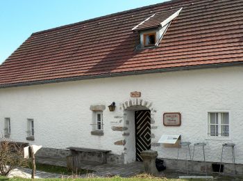
![Trail On foot Windhaag bei Perg - Route III Hausbergbach - Photo](https://media.geolcdn.com/t/350/260/7c7eb67f-f880-4c43-9835-70b1a007e6a8.jpeg&format=jpg&maxdim=2)
![On foot On foot](https://static1.geolcdn.com/sitytour/trail-icons/100.png)
Km
On foot
![](/images/other/stat-length.png)
![](https://static1.geolcdn.com/siteimages/upload/files/1508320355ic_sort_den_pos_24dp.png)
![](https://static1.geolcdn.com/siteimages/upload/files/1508320355ic_sort_den_neg_24dp.png)
![](https://static1.geolcdn.com/siteimages/upload/files/16400158638029165_repeat_loop_refresh_sync_direction_icon.png)
• Trail created by Gemeinde Windhaag bei Perg.
![Trail On foot Windhaag bei Perg - Route I Enzmilner Kulturwanderweg - Photo](https://media.geolcdn.com/t/350/260/7c7eb67f-f880-4c43-9835-70b1a007e6a8.jpeg&format=jpg&maxdim=2)
![On foot On foot](https://static1.geolcdn.com/sitytour/trail-icons/100.png)
Km
On foot
![](/images/other/stat-length.png)
![](https://static1.geolcdn.com/siteimages/upload/files/1508320355ic_sort_den_pos_24dp.png)
![](https://static1.geolcdn.com/siteimages/upload/files/1508320355ic_sort_den_neg_24dp.png)
![](https://static1.geolcdn.com/siteimages/upload/files/16400158638029165_repeat_loop_refresh_sync_direction_icon.png)
• Trail created by Gemeinde Windhaag bei Perg.
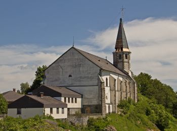
![Trail On foot Sankt Thomas am Blasenstein - Bärenlucke - Photo](https://media.geolcdn.com/t/350/260/826be4d9-8f96-4ad2-a111-e811d30005a2.jpeg&format=jpg&maxdim=2)
![On foot On foot](https://static1.geolcdn.com/sitytour/trail-icons/100.png)
Km
On foot
![](/images/other/stat-length.png)
![](https://static1.geolcdn.com/siteimages/upload/files/1508320355ic_sort_den_pos_24dp.png)
![](https://static1.geolcdn.com/siteimages/upload/files/1508320355ic_sort_den_neg_24dp.png)
![](https://static1.geolcdn.com/siteimages/upload/files/16400158638029165_repeat_loop_refresh_sync_direction_icon.png)
• Trail created by Gemeinde Sankt Thomas am Blasenstein. Symbol: grüne Tafel mit weißem Text S6
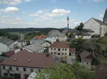
![Trail On foot Münzbach - Pechölstein - Photo](https://media.geolcdn.com/t/350/260/67b2a4c2-8f48-4bcb-b548-95484f9d1ba7.jpeg&format=jpg&maxdim=2)
![On foot On foot](https://static1.geolcdn.com/sitytour/trail-icons/100.png)
Km
On foot
![](/images/other/stat-length.png)
![](https://static1.geolcdn.com/siteimages/upload/files/1508320355ic_sort_den_pos_24dp.png)
![](https://static1.geolcdn.com/siteimages/upload/files/1508320355ic_sort_den_neg_24dp.png)
![](https://static1.geolcdn.com/siteimages/upload/files/16400158638029165_repeat_loop_refresh_sync_direction_icon.png)
• Trail created by Gemeinde Sankt Thomas am Blasenstein. Symbol: grüne Tafel mit weißem Text S4
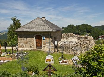
![Trail On foot Sankt Thomas am Blasenstein - AT-S9 - Photo](https://media.geolcdn.com/t/350/260/6e0f7bbe-186b-48c7-976a-d57694f65512.jpeg&format=jpg&maxdim=2)
![On foot On foot](https://static1.geolcdn.com/sitytour/trail-icons/100.png)
Km
On foot
![](/images/other/stat-length.png)
![](https://static1.geolcdn.com/siteimages/upload/files/1508320355ic_sort_den_pos_24dp.png)
![](https://static1.geolcdn.com/siteimages/upload/files/1508320355ic_sort_den_neg_24dp.png)
![](https://static1.geolcdn.com/siteimages/upload/files/16400158638029165_repeat_loop_refresh_sync_direction_icon.png)
• Trail created by Gemeinde Sankt Thomas am Blasenstein. Symbol: grüne Tafel mit weißem Text S9
20 trails displayed on 44
FREE GPS app for hiking
Activities
Nearby regions
- Allerheiligen im Mühlkreis
- Arbing
- Bad Kreuzen
- Baumgartenberg
- Grein
- Klam
- Langenstein
- Luftenberg an der Donau
- Mauthausen
- Mitterkirchen im Machland
- Münzbach
- Naarn im Machlande
- Pabneukirchen
- Perg
- Rechberg
- Sankt Georgen an der Gusen
- Sankt Nikola an der Donau
- Sankt Thomas am Blasenstein
- Waldhausen im Strudengau
- Windhaag bei Perg