![](/images/other/stat-length.png)
Lower Austria, Austria: Best trails, routes and walks
Lower Austria: Discover the best trails: 1,267 hiking trails and 6 bike and mountain-bike routes. All these trails, routes and outdoor activities are available in our SityTrail applications for smartphones and tablets.
The best trails (1274)
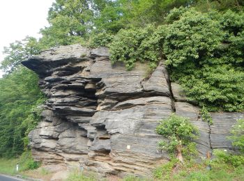
![Trail On foot Gemeinde Rossatz-Arnsdorf - St. Lorenz - Seekopf - Photo](https://media.geolcdn.com/t/350/260/f7c3b641-ea5d-4a83-b625-32a4080e0569.jpeg&format=jpg&maxdim=2)
![On foot On foot](https://static1.geolcdn.com/sitytour/trail-icons/100.png)
Km
On foot
![](/images/other/stat-length.png)
![](https://static1.geolcdn.com/siteimages/upload/files/1508320355ic_sort_den_pos_24dp.png)
![](https://static1.geolcdn.com/siteimages/upload/files/1508320355ic_sort_den_neg_24dp.png)
![](https://static1.geolcdn.com/siteimages/upload/files/16400158638029165_repeat_loop_refresh_sync_direction_icon.png)
• Der ÖTK gilt als Pionier des Fremdenverkehrs. Heute ist der ÖTK mit über 360 Kursen und geführten Touren in 50 Freize...
![Trail On foot Gemeinde Tullnerbach - Tullnerbach Pressbaum - Strohzogl - Photo](https://media.geolcdn.com/t/350/260/5184b4b3-af75-40f3-bd37-1b19c21493d3.jpeg&format=jpg&maxdim=2)
![On foot On foot](https://static1.geolcdn.com/sitytour/trail-icons/100.png)
Km
On foot
![](/images/other/stat-length.png)
![](https://static1.geolcdn.com/siteimages/upload/files/1508320355ic_sort_den_pos_24dp.png)
![](https://static1.geolcdn.com/siteimages/upload/files/1508320355ic_sort_den_neg_24dp.png)
![](https://static1.geolcdn.com/siteimages/upload/files/16400158638029165_repeat_loop_refresh_sync_direction_icon.png)
• Trail created by ÖTK Klosterneuburg. Website: https://www.oetk-klosterneuburg.at/unsere-wege/weg-zeit-plaene#Tulln...
![Trail On foot Gemeinde Hollabrunn - Tut Gut - Waldlehrpfad - Photo](https://media.geolcdn.com/t/350/260/90f0c1cb-ddff-4412-857e-f9b178cafa15.jpeg&format=jpg&maxdim=2)
![On foot On foot](https://static1.geolcdn.com/sitytour/trail-icons/100.png)
Km
On foot
![](/images/other/stat-length.png)
![](https://static1.geolcdn.com/siteimages/upload/files/1508320355ic_sort_den_pos_24dp.png)
![](https://static1.geolcdn.com/siteimages/upload/files/1508320355ic_sort_den_neg_24dp.png)
![](https://static1.geolcdn.com/siteimages/upload/files/16400158638029165_repeat_loop_refresh_sync_direction_icon.png)
• Trail created by Tut Gut Wanderwege.
![Trail On foot Gemeinde Hollabrunn - Tut Gut - Rund um den Pankraz - Photo](https://media.geolcdn.com/t/350/260/90f0c1cb-ddff-4412-857e-f9b178cafa15.jpeg&format=jpg&maxdim=2)
![On foot On foot](https://static1.geolcdn.com/sitytour/trail-icons/100.png)
Km
On foot
![](/images/other/stat-length.png)
![](https://static1.geolcdn.com/siteimages/upload/files/1508320355ic_sort_den_pos_24dp.png)
![](https://static1.geolcdn.com/siteimages/upload/files/1508320355ic_sort_den_neg_24dp.png)
![](https://static1.geolcdn.com/siteimages/upload/files/16400158638029165_repeat_loop_refresh_sync_direction_icon.png)
• Trail created by Tut Gut Wanderwege.
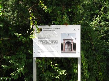
![Trail On foot Altlengbach - laufend geniessen (Hotel Lengbachhof) - Photo](https://media.geolcdn.com/t/350/260/50769c63-2c41-4d9a-a1b9-de289f89fc45.jpeg&format=jpg&maxdim=2)
![On foot On foot](https://static1.geolcdn.com/sitytour/trail-icons/100.png)
Km
On foot
![](/images/other/stat-length.png)
![](https://static1.geolcdn.com/siteimages/upload/files/1508320355ic_sort_den_pos_24dp.png)
![](https://static1.geolcdn.com/siteimages/upload/files/1508320355ic_sort_den_neg_24dp.png)
![](https://static1.geolcdn.com/siteimages/upload/files/16400158638029165_repeat_loop_refresh_sync_direction_icon.png)
• Symbol: blauer Pfeil auf gelbem Grund
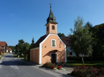
![Trail On foot Gemeinde Gföhl - 43 - Photo](https://media.geolcdn.com/t/350/260/df37aff4-75d7-437d-9e06-dc5040de26cb.jpeg&format=jpg&maxdim=2)
![On foot On foot](https://static1.geolcdn.com/sitytour/trail-icons/100.png)
Km
On foot
![](/images/other/stat-length.png)
![](https://static1.geolcdn.com/siteimages/upload/files/1508320355ic_sort_den_pos_24dp.png)
![](https://static1.geolcdn.com/siteimages/upload/files/1508320355ic_sort_den_neg_24dp.png)
![](https://static1.geolcdn.com/siteimages/upload/files/16400158638029165_repeat_loop_refresh_sync_direction_icon.png)
• Symbol: weiss-rot-weiss
![Trail On foot Gemeinde Jaidhof - 91 - Photo](https://media.geolcdn.com/t/350/260/9abdc417-ce5e-4575-b15d-5e293d86da9c.jpeg&format=jpg&maxdim=2)
![On foot On foot](https://static1.geolcdn.com/sitytour/trail-icons/100.png)
Km
On foot
![](/images/other/stat-length.png)
![](https://static1.geolcdn.com/siteimages/upload/files/1508320355ic_sort_den_pos_24dp.png)
![](https://static1.geolcdn.com/siteimages/upload/files/1508320355ic_sort_den_neg_24dp.png)
![](https://static1.geolcdn.com/siteimages/upload/files/16400158638029165_repeat_loop_refresh_sync_direction_icon.png)
• Symbol: weiss-rot-weiss
![Trail On foot Gemeinde Jaidhof - 90 - Photo](https://media.geolcdn.com/t/350/260/229fc2de-a413-4bea-9e92-3c38c481b281.jpeg&format=jpg&maxdim=2)
![On foot On foot](https://static1.geolcdn.com/sitytour/trail-icons/100.png)
Km
On foot
![](/images/other/stat-length.png)
![](https://static1.geolcdn.com/siteimages/upload/files/1508320355ic_sort_den_pos_24dp.png)
![](https://static1.geolcdn.com/siteimages/upload/files/1508320355ic_sort_den_neg_24dp.png)
![](https://static1.geolcdn.com/siteimages/upload/files/16400158638029165_repeat_loop_refresh_sync_direction_icon.png)
• Symbol: weiss-rot-weiss
![Trail On foot Gemeinde Jaidhof - 40 - Photo](https://media.geolcdn.com/t/350/260/97c7a586-414c-40f9-b294-518d4d1ffb8f.jpeg&format=jpg&maxdim=2)
![On foot On foot](https://static1.geolcdn.com/sitytour/trail-icons/100.png)
Km
On foot
![](/images/other/stat-length.png)
![](https://static1.geolcdn.com/siteimages/upload/files/1508320355ic_sort_den_pos_24dp.png)
![](https://static1.geolcdn.com/siteimages/upload/files/1508320355ic_sort_den_neg_24dp.png)
![](https://static1.geolcdn.com/siteimages/upload/files/16400158638029165_repeat_loop_refresh_sync_direction_icon.png)
• Symbol: weiss-rot-weiss
![Trail On foot Gemeinde St. Leonhard am Hornerwald - 61 - Photo](https://media.geolcdn.com/t/350/260/628ac569-d799-4998-a3c5-40cfcb76db15.jpeg&format=jpg&maxdim=2)
![On foot On foot](https://static1.geolcdn.com/sitytour/trail-icons/100.png)
Km
On foot
![](/images/other/stat-length.png)
![](https://static1.geolcdn.com/siteimages/upload/files/1508320355ic_sort_den_pos_24dp.png)
![](https://static1.geolcdn.com/siteimages/upload/files/1508320355ic_sort_den_neg_24dp.png)
![](https://static1.geolcdn.com/siteimages/upload/files/16400158638029165_repeat_loop_refresh_sync_direction_icon.png)
• Symbol: rot-weiss-rot 61
![Trail On foot Gemeinde Klosterneuburg - Rundwanderweg 4 - Photo](https://media.geolcdn.com/t/350/260/5781b571-b3f3-42cf-8768-6a9cd954d762.jpeg&format=jpg&maxdim=2)
![On foot On foot](https://static1.geolcdn.com/sitytour/trail-icons/100.png)
Km
On foot
![](/images/other/stat-length.png)
![](https://static1.geolcdn.com/siteimages/upload/files/1508320355ic_sort_den_pos_24dp.png)
![](https://static1.geolcdn.com/siteimages/upload/files/1508320355ic_sort_den_neg_24dp.png)
![](https://static1.geolcdn.com/siteimages/upload/files/16400158638029165_repeat_loop_refresh_sync_direction_icon.png)
• Trail created by Dorferneuerung Hadersfeld. Symbol: 4
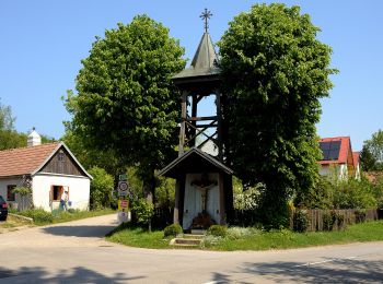
![Trail On foot Gemeinde St. Andrä-Wördern - Rundwanderweg 2 - Photo](https://media.geolcdn.com/t/350/260/5781b571-b3f3-42cf-8768-6a9cd954d762.jpeg&format=jpg&maxdim=2)
![On foot On foot](https://static1.geolcdn.com/sitytour/trail-icons/100.png)
Km
On foot
![](/images/other/stat-length.png)
![](https://static1.geolcdn.com/siteimages/upload/files/1508320355ic_sort_den_pos_24dp.png)
![](https://static1.geolcdn.com/siteimages/upload/files/1508320355ic_sort_den_neg_24dp.png)
![](https://static1.geolcdn.com/siteimages/upload/files/16400158638029165_repeat_loop_refresh_sync_direction_icon.png)
• Trail created by Dorferneuerung Hadersfeld. Symbol: 2
![Trail On foot Gemeinde Klosterneuburg - Rundwanderweg 3 - Photo](https://media.geolcdn.com/t/350/260/5781b571-b3f3-42cf-8768-6a9cd954d762.jpeg&format=jpg&maxdim=2)
![On foot On foot](https://static1.geolcdn.com/sitytour/trail-icons/100.png)
Km
On foot
![](/images/other/stat-length.png)
![](https://static1.geolcdn.com/siteimages/upload/files/1508320355ic_sort_den_pos_24dp.png)
![](https://static1.geolcdn.com/siteimages/upload/files/1508320355ic_sort_den_neg_24dp.png)
![](https://static1.geolcdn.com/siteimages/upload/files/16400158638029165_repeat_loop_refresh_sync_direction_icon.png)
• Trail created by Dorferneuerung Hadersfeld. Symbol: 3
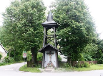
![Trail On foot Gemeinde St. Andrä-Wördern - Rundwanderweg 5 - Photo](https://media.geolcdn.com/t/350/260/06f3571b-141f-4223-a883-78f9d5802426.jpeg&format=jpg&maxdim=2)
![On foot On foot](https://static1.geolcdn.com/sitytour/trail-icons/100.png)
Km
On foot
![](/images/other/stat-length.png)
![](https://static1.geolcdn.com/siteimages/upload/files/1508320355ic_sort_den_pos_24dp.png)
![](https://static1.geolcdn.com/siteimages/upload/files/1508320355ic_sort_den_neg_24dp.png)
![](https://static1.geolcdn.com/siteimages/upload/files/16400158638029165_repeat_loop_refresh_sync_direction_icon.png)
• Trail created by Dorferneuerung Hadersfeld. Symbol: 5
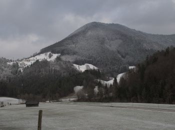
![Trail On foot Gemeinde Kleinzell - Laufend geniessen (Kurhotel Salzerbad) - Photo](https://media.geolcdn.com/t/350/260/74d82223-56ff-48b9-a3ce-97413d453d5c.jpeg&format=jpg&maxdim=2)
![On foot On foot](https://static1.geolcdn.com/sitytour/trail-icons/100.png)
Km
On foot
![](/images/other/stat-length.png)
![](https://static1.geolcdn.com/siteimages/upload/files/1508320355ic_sort_den_pos_24dp.png)
![](https://static1.geolcdn.com/siteimages/upload/files/1508320355ic_sort_den_neg_24dp.png)
![](https://static1.geolcdn.com/siteimages/upload/files/16400158638029165_repeat_loop_refresh_sync_direction_icon.png)
• Symbol: gelbes Schild mit blauem Pfeil
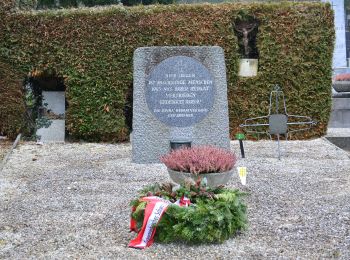
![Trail On foot Gemeinde Purkersdorf - Rundwanderweg Süßfeld - Photo](https://media.geolcdn.com/t/350/260/bd3f9cd5-d3c9-4d01-a449-f4d79f964f17.jpeg&format=jpg&maxdim=2)
![On foot On foot](https://static1.geolcdn.com/sitytour/trail-icons/100.png)
Km
On foot
![](/images/other/stat-length.png)
![](https://static1.geolcdn.com/siteimages/upload/files/1508320355ic_sort_den_pos_24dp.png)
![](https://static1.geolcdn.com/siteimages/upload/files/1508320355ic_sort_den_neg_24dp.png)
![](https://static1.geolcdn.com/siteimages/upload/files/16400158638029165_repeat_loop_refresh_sync_direction_icon.png)
• Trail created by Wienerwald Tourismus.
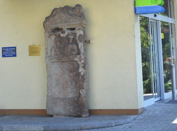
![Trail On foot Gemeinde Gablitz - Gablitz - Troppberg - Photo](https://media.geolcdn.com/t/350/260/8b853524-2e5c-4b10-85dc-ab9672d39888.jpeg&format=jpg&maxdim=2)
![On foot On foot](https://static1.geolcdn.com/sitytour/trail-icons/100.png)
Km
On foot
![](/images/other/stat-length.png)
![](https://static1.geolcdn.com/siteimages/upload/files/1508320355ic_sort_den_pos_24dp.png)
![](https://static1.geolcdn.com/siteimages/upload/files/1508320355ic_sort_den_neg_24dp.png)
![](https://static1.geolcdn.com/siteimages/upload/files/16400158638029165_repeat_loop_refresh_sync_direction_icon.png)
• Trail created by ÖTK Klosterneuburg.
![Trail On foot Gemeinde Gablitz - Gablitz - Troppberg - Photo](https://media.geolcdn.com/t/350/260/8b853524-2e5c-4b10-85dc-ab9672d39888.jpeg&format=jpg&maxdim=2)
![On foot On foot](https://static1.geolcdn.com/sitytour/trail-icons/100.png)
Km
On foot
![](/images/other/stat-length.png)
![](https://static1.geolcdn.com/siteimages/upload/files/1508320355ic_sort_den_pos_24dp.png)
![](https://static1.geolcdn.com/siteimages/upload/files/1508320355ic_sort_den_neg_24dp.png)
![](https://static1.geolcdn.com/siteimages/upload/files/16400158638029165_repeat_loop_refresh_sync_direction_icon.png)
• Trail created by Wienerwald Tourismus.
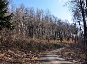
![Trail On foot Gemeinde Gablitz - Gablitz - Hochramalpe - Troppberg - Photo](https://media.geolcdn.com/t/350/260/96ce75bd-767b-4165-bda7-f6cddab95264.jpeg&format=jpg&maxdim=2)
![On foot On foot](https://static1.geolcdn.com/sitytour/trail-icons/100.png)
Km
On foot
![](/images/other/stat-length.png)
![](https://static1.geolcdn.com/siteimages/upload/files/1508320355ic_sort_den_pos_24dp.png)
![](https://static1.geolcdn.com/siteimages/upload/files/1508320355ic_sort_den_neg_24dp.png)
![](https://static1.geolcdn.com/siteimages/upload/files/16400158638029165_repeat_loop_refresh_sync_direction_icon.png)
• Trail created by Wienerwald Tourismus.
![Trail On foot Gemeinde Gablitz - Gablitz - Höbersbach - Photo](https://media.geolcdn.com/t/350/260/ded69ef3-592d-4be7-b03e-41ad75358bc1.jpeg&format=jpg&maxdim=2)
![On foot On foot](https://static1.geolcdn.com/sitytour/trail-icons/100.png)
Km
On foot
![](/images/other/stat-length.png)
![](https://static1.geolcdn.com/siteimages/upload/files/1508320355ic_sort_den_pos_24dp.png)
![](https://static1.geolcdn.com/siteimages/upload/files/1508320355ic_sort_den_neg_24dp.png)
![](https://static1.geolcdn.com/siteimages/upload/files/16400158638029165_repeat_loop_refresh_sync_direction_icon.png)
• Trail created by Wienerwald Tourismus. Auf Übersichtskarten als Rundeweg dargestellt. Markierung aber nur bis zum We...
20 trails displayed on 1274
FREE GPS app for hiking
Activities
Nearby regions
- Bezirk Amstetten
- Bezirk Baden
- Bezirk Bruck an der Leitha
- Bezirk Gänserndorf
- Bezirk Gmünd
- Bezirk Hollabrunn
- Bezirk Horn
- Bezirk Korneuburg
- Bezirk Krems
- Bezirk Lilienfeld
- Bezirk Melk
- Bezirk Mistelbach
- Bezirk Mödling
- Bezirk Neunkirchen
- Bezirk Scheibbs
- Bezirk St. Pölten
- Bezirk Tulln
- Bezirk Waidhofen an der Thaya
- Bezirk Wiener Neustadt
- Bezirk Zwettl
- Krems an der Donau
- St. Pölten
- Waidhofen an der Ybbs
- Wiener Neustadt