Manteyer, Hautes-Alpes, Winter sports: Best trails, routes and walks

8 comments

Manteyer: Discover the best trails: 8 touring skiing and 7 snowshoes. All these trails, routes and outdoor activities are available in our SityTrail applications for smartphones and tablets.


The best trails (15)
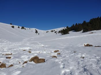
Trail Touring skiing Manteyer - Tour de Ceuse - Photo
Touring skiing 11.533
Km

Touring skiing

Medium
Manteyer, Provence-Alpes-Côte d'Azur, Hautes-Alpes, France
11.5 km | 23 km-effort
3h 40min
831 m
840 m
Yes
jlv05

Trail Snowshoes Manteyer - Ceüse - Photo
Snowshoes 7.97
Km
GUIDE

Snowshoes

Easy
Manteyer, Provence-Alpes-Côte d'Azur, Hautes-Alpes, France
8 km | 13.9 km-effort
2h 45min
441 m
446 m
Yes
R@ph

Trail Snowshoes Manteyer - Cëuze face Ouest - Photo
Snowshoes 5.511
Km

Snowshoes

Easy
Manteyer, Provence-Alpes-Côte d'Azur, Hautes-Alpes, France
5.5 km | 13.3 km-effort
2h 28min
585 m
578 m
Yes
BrunoPetignat

• Ski de randonnée

Trail Snowshoes Manteyer - Cëuse - Photo
Snowshoes 7.218
Km

Snowshoes

Very easy
Manteyer, Provence-Alpes-Côte d'Azur, Hautes-Alpes, France
7.2 km | 14.1 km-effort
4h 13min
519 m
521 m
Yes
BrunoPetignat

• Raquette et snow board

Trail Snowshoes Manteyer - Ceüse - Crête de la lumineuse - La manche - Photo
Snowshoes 8.094
Km
GUIDE

Snowshoes

Medium
Manteyer, Provence-Alpes-Côte d'Azur, Hautes-Alpes, France
8.1 km | 13.5 km-effort
4h 20min
408 m
401 m
Yes
R@ph

Trail Snowshoes Manteyer - RAQ Boucle sur Ceuse - Photo
Snowshoes 6.427
Km

Snowshoes

Easy
Manteyer, Provence-Alpes-Côte d'Azur, Hautes-Alpes, France
6.4 km | 11.3 km-effort
2h 46min
364 m
362 m
Yes
zardoc13

Trail Touring skiing Manteyer - Céûse  - Photo
Touring skiing 8.171
Km

Touring skiing

Easy
Manteyer, Provence-Alpes-Côte d'Azur, Hautes-Alpes, France
8.2 km | 15.1 km-effort
1h 45min
519 m
520 m
Yes
jlv05

Trail Touring skiing Manteyer - Céûse  - Photo
Touring skiing 8.415
Km

Touring skiing

Easy
Manteyer, Provence-Alpes-Côte d'Azur, Hautes-Alpes, France
8.4 km | 15.1 km-effort
1h 51min
504 m
503 m
Yes
jlv05

Trail Touring skiing Manteyer - Céûse  - Photo
Touring skiing 9.325
Km

Touring skiing

Easy
Manteyer, Provence-Alpes-Côte d'Azur, Hautes-Alpes, France
9.3 km | 17.8 km-effort
2h 18min
635 m
635 m
Yes
jlv05

Trail Snowshoes Manteyer - plateau CEUS en boucle - Photo
Snowshoes 8.472
Km

Snowshoes

Medium
Manteyer, Provence-Alpes-Côte d'Azur, Hautes-Alpes, France
8.5 km | 16.5 km-effort
5h 33min
600 m
595 m
Yes
PATGUSS

Trail Touring skiing Manteyer - La corniche de Ceuse - Photo
Touring skiing 8.245
Km

Touring skiing

Medium
Manteyer, Provence-Alpes-Côte d'Azur, Hautes-Alpes, France
8.2 km | 17.7 km-effort
2h 3min
719 m
688 m
No
jlv05

Trail Touring skiing Manteyer - Tour de Ceuse - Photo
Touring skiing 9.492
Km

Touring skiing

Medium
Manteyer, Provence-Alpes-Côte d'Azur, Hautes-Alpes, France
9.5 km | 17.9 km-effort
3h 0min
630 m
623 m
Yes
jlv05

Trail Touring skiing Manteyer - La Manche - Photo
Touring skiing 6.626
Km

Touring skiing

Easy
Manteyer, Provence-Alpes-Côte d'Azur, Hautes-Alpes, France
6.6 km | 11.4 km-effort
2h 38min
358 m
359 m
Yes
jlv05

Trail Touring skiing Manteyer - La Sapie Céüse - Photo
Touring skiing 6.292
Km

Touring skiing

Easy
Manteyer, Provence-Alpes-Côte d'Azur, Hautes-Alpes, France
6.3 km | 11.8 km-effort
1h 51min
414 m
397 m
Yes
jlv05

Trail Snowshoes Manteyer - Tour de Ceüse - Photo
Snowshoes 14.333
Km

Snowshoes

Medium
Manteyer, Provence-Alpes-Côte d'Azur, Hautes-Alpes, France
14.3 km | 26 km-effort
6h 40min
842 m
835 m
Yes
arno55v

15 trails displayed on 15

FREE GPS app for hiking

Logo SityTrail SityTrail

IGN / Geographical institutes

Download SityTrail from the App Store Download SityTrail from Google Play

Logo SityTrail SityTrail World

The world is yours!

Download SityTrail from the App Store Download SityTrail from Google Play Download SityTrail on Huawei AppGallery

Activities

Close
My subscriptions