![](/images/other/stat-length.png)
- Trails
- On foot
- Germany
- Thuringia
- Landkreis Weimarer Land
- Kranichfeld
Kranichfeld, Landkreis Weimarer Land, On foot: Best trails, routes and walks
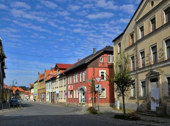
Kranichfeld: Discover the best trails: 6 on foot. All these trails, routes and outdoor activities are available in our SityTrail applications for smartphones and tablets.
The best trails (6)
![Trail On foot Kranichfeld - Kranich-Rundwanderweg 1 - Photo](https://media.geolcdn.com/t/350/260/74097348-87d2-42b2-9218-277a755d0837.jpeg&format=jpg&maxdim=2)
![On foot On foot](https://static1.geolcdn.com/sitytour/trail-icons/100.png)
Km
On foot
![](/images/other/stat-length.png)
![](https://static1.geolcdn.com/siteimages/upload/files/1508320355ic_sort_den_pos_24dp.png)
![](https://static1.geolcdn.com/siteimages/upload/files/1508320355ic_sort_den_neg_24dp.png)
![](https://static1.geolcdn.com/siteimages/upload/files/16400158638029165_repeat_loop_refresh_sync_direction_icon.png)
• Trail created by Kranichfeld. Symbol: Weiße 1 auf schwarzem Hintergrund, drüber ein schwarzer Kranich auf weißem Gru...
![Trail On foot Kranichfeld - Kranich-Rundwanderweg 2 - Photo](https://media.geolcdn.com/t/350/260/fcb27b38-9c0c-43d1-96b9-a5d3e499e0c6.jpeg&format=jpg&maxdim=2)
![On foot On foot](https://static1.geolcdn.com/sitytour/trail-icons/100.png)
Km
On foot
![](/images/other/stat-length.png)
![](https://static1.geolcdn.com/siteimages/upload/files/1508320355ic_sort_den_pos_24dp.png)
![](https://static1.geolcdn.com/siteimages/upload/files/1508320355ic_sort_den_neg_24dp.png)
![](https://static1.geolcdn.com/siteimages/upload/files/16400158638029165_repeat_loop_refresh_sync_direction_icon.png)
• Trail created by Kranichfeld. Symbol: Schwarze 2 auf gelbgrünem Hintergrund, drüber ein schwarzer Kranich auf weißem...
![Trail On foot Kranichfeld - Kranich-Rundwanderweg 5 - Photo](https://media.geolcdn.com/t/350/260/74097348-87d2-42b2-9218-277a755d0837.jpeg&format=jpg&maxdim=2)
![On foot On foot](https://static1.geolcdn.com/sitytour/trail-icons/100.png)
Km
On foot
![](/images/other/stat-length.png)
![](https://static1.geolcdn.com/siteimages/upload/files/1508320355ic_sort_den_pos_24dp.png)
![](https://static1.geolcdn.com/siteimages/upload/files/1508320355ic_sort_den_neg_24dp.png)
![](https://static1.geolcdn.com/siteimages/upload/files/16400158638029165_repeat_loop_refresh_sync_direction_icon.png)
• Trail created by Kranichfeld. Symbol: Weiße 5 auf dunkelgrünem Hintergrund, drüber ein schwarzer Kranich auf weißem ...
![Trail On foot Kranichfeld - Kranich-Rundwanderweg 4 - Photo](https://media.geolcdn.com/t/350/260/107b3b36-5566-4eb2-a5f7-0596929cc96a.jpeg&format=jpg&maxdim=2)
![On foot On foot](https://static1.geolcdn.com/sitytour/trail-icons/100.png)
Km
On foot
![](/images/other/stat-length.png)
![](https://static1.geolcdn.com/siteimages/upload/files/1508320355ic_sort_den_pos_24dp.png)
![](https://static1.geolcdn.com/siteimages/upload/files/1508320355ic_sort_den_neg_24dp.png)
![](https://static1.geolcdn.com/siteimages/upload/files/16400158638029165_repeat_loop_refresh_sync_direction_icon.png)
• Trail created by Kranichfeld. Symbol: Schwarze 4 auf rosa Hintergrund, drüber ein schwarzer Kranich auf weißem Grund.
![Trail On foot Kranichfeld - lokales Wegenetz Gelber Balken - Photo](https://media.geolcdn.com/t/350/260/0e45825d-8363-42f1-8ba7-0b70861684b0.jpeg&format=jpg&maxdim=2)
![On foot On foot](https://static1.geolcdn.com/sitytour/trail-icons/100.png)
Km
On foot
![](/images/other/stat-length.png)
![](https://static1.geolcdn.com/siteimages/upload/files/1508320355ic_sort_den_pos_24dp.png)
![](https://static1.geolcdn.com/siteimages/upload/files/1508320355ic_sort_den_neg_24dp.png)
![](https://static1.geolcdn.com/siteimages/upload/files/16400158638029165_repeat_loop_refresh_sync_direction_icon.png)
• Symbol: Gelber Querbalken auf weißem Grund
![Trail On foot Kranichfeld - DE-roter Balken - Photo](https://media.geolcdn.com/t/350/260/ext.jpg?maxdim=2&url=https%3A%2F%2Fstatic1.geolcdn.com%2Fsiteimages%2Fupload%2Ffiles%2F1545311037marcheuse_200dpi.jpg)
![On foot On foot](https://static1.geolcdn.com/sitytour/trail-icons/100.png)
Km
On foot
![](/images/other/stat-length.png)
![](https://static1.geolcdn.com/siteimages/upload/files/1508320355ic_sort_den_pos_24dp.png)
![](https://static1.geolcdn.com/siteimages/upload/files/1508320355ic_sort_den_neg_24dp.png)
![](https://static1.geolcdn.com/siteimages/upload/files/16400158638029165_repeat_loop_refresh_sync_direction_icon.png)
• Wanderweg Roter Balken Raum Tannroda
6 trails displayed on 6
FREE GPS app for hiking