![](/images/other/stat-length.png)
- Trails
- On foot
- Austria
- Lower Austria
- Bezirk Wiener Neustadt
Bezirk Wiener Neustadt, Lower Austria, On foot: Best trails, routes and walks
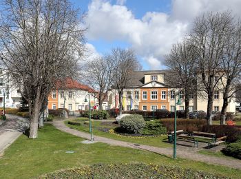
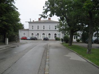
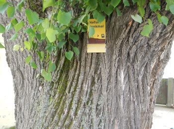
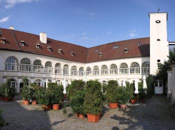
Bezirk Wiener Neustadt: Discover the best trails: 204 on foot and 1 walking. All these trails, routes and outdoor activities are available in our SityTrail applications for smartphones and tablets.
The best trails (205)
![Trail On foot Gemeinde Sollenau - Fleischer Steiner Runde (Sollenau) - Photo](https://media.geolcdn.com/t/350/260/55ae2701-11b1-495a-b7e5-b8cfa3dfeced.jpeg&format=jpg&maxdim=2)
![On foot On foot](https://static1.geolcdn.com/sitytour/trail-icons/100.png)
Km
On foot
![](/images/other/stat-length.png)
![](https://static1.geolcdn.com/siteimages/upload/files/1508320355ic_sort_den_pos_24dp.png)
![](https://static1.geolcdn.com/siteimages/upload/files/1508320355ic_sort_den_neg_24dp.png)
![](https://static1.geolcdn.com/siteimages/upload/files/16400158638029165_repeat_loop_refresh_sync_direction_icon.png)
• Symbol: brauner Pfeil und S5
![Trail On foot Gemeinde Sollenau - Eisdiele Harrer Runde - Photo](https://media.geolcdn.com/t/350/260/cfc699cd-1132-4c19-b141-19c0999db1d4.jpeg&format=jpg&maxdim=2)
![On foot On foot](https://static1.geolcdn.com/sitytour/trail-icons/100.png)
Km
On foot
![](/images/other/stat-length.png)
![](https://static1.geolcdn.com/siteimages/upload/files/1508320355ic_sort_den_pos_24dp.png)
![](https://static1.geolcdn.com/siteimages/upload/files/1508320355ic_sort_den_neg_24dp.png)
![](https://static1.geolcdn.com/siteimages/upload/files/16400158638029165_repeat_loop_refresh_sync_direction_icon.png)
• Trail created by Runnersfun. Symbol: gelber Pfeil
![Trail On foot Lanzenkirchen - Frohsdorf - Rosalia Kammweg - Photo](https://media.geolcdn.com/t/350/260/26e65d8b-778f-4f33-9521-922ffc119aa7.jpeg&format=jpg&maxdim=2)
![On foot On foot](https://static1.geolcdn.com/sitytour/trail-icons/100.png)
Km
On foot
![](/images/other/stat-length.png)
![](https://static1.geolcdn.com/siteimages/upload/files/1508320355ic_sort_den_pos_24dp.png)
![](https://static1.geolcdn.com/siteimages/upload/files/1508320355ic_sort_den_neg_24dp.png)
![](https://static1.geolcdn.com/siteimages/upload/files/16400158638029165_repeat_loop_refresh_sync_direction_icon.png)
• Symbol: rot-weiß
![Trail On foot Gemeinde Katzelsdorf - Katzelsdorfer Naturlehrpfad LEITHA-AU - Photo](https://media.geolcdn.com/t/350/260/2c8ef12c-d4f9-4a56-920a-94a3e89ac516.jpeg&format=jpg&maxdim=2)
![On foot On foot](https://static1.geolcdn.com/sitytour/trail-icons/100.png)
Km
On foot
![](/images/other/stat-length.png)
![](https://static1.geolcdn.com/siteimages/upload/files/1508320355ic_sort_den_pos_24dp.png)
![](https://static1.geolcdn.com/siteimages/upload/files/1508320355ic_sort_den_neg_24dp.png)
![](https://static1.geolcdn.com/siteimages/upload/files/16400158638029165_repeat_loop_refresh_sync_direction_icon.png)
• Trail created by Gemeinde Katzelsdorf. Symbol: grünes Schild
![Trail On foot Gemeinde Katzelsdorf - ARBÖ Runde - Photo](https://media.geolcdn.com/t/350/260/7844f2e6-138e-4b62-abd6-37300f0b50b1.jpeg&format=jpg&maxdim=2)
![On foot On foot](https://static1.geolcdn.com/sitytour/trail-icons/100.png)
Km
On foot
![](/images/other/stat-length.png)
![](https://static1.geolcdn.com/siteimages/upload/files/1508320355ic_sort_den_pos_24dp.png)
![](https://static1.geolcdn.com/siteimages/upload/files/1508320355ic_sort_den_neg_24dp.png)
![](https://static1.geolcdn.com/siteimages/upload/files/16400158638029165_repeat_loop_refresh_sync_direction_icon.png)
• Symbol: grüner Pfeil
![Trail On foot Gemeinde Lichtenwörth - Ulmen-Runde (7 km, Wanderweg 1) - Photo](https://media.geolcdn.com/t/350/260/60247c80-6f48-48d4-9078-c789aa8faa47.jpeg&format=jpg&maxdim=2)
![On foot On foot](https://static1.geolcdn.com/sitytour/trail-icons/100.png)
Km
On foot
![](/images/other/stat-length.png)
![](https://static1.geolcdn.com/siteimages/upload/files/1508320355ic_sort_den_pos_24dp.png)
![](https://static1.geolcdn.com/siteimages/upload/files/1508320355ic_sort_den_neg_24dp.png)
![](https://static1.geolcdn.com/siteimages/upload/files/16400158638029165_repeat_loop_refresh_sync_direction_icon.png)
• Trail created by Wanderverein Zur Sonne (Lichtenwörth). Symbol: oranges Schild, schwarzer Pfeil
![Trail On foot Gemeinde Lichtenwörth - Au-Runde (10 km, Wanderweg 2) - Photo](https://media.geolcdn.com/t/350/260/3395d937-a35a-4559-a7e8-d4d753fff0e0.jpeg&format=jpg&maxdim=2)
![On foot On foot](https://static1.geolcdn.com/sitytour/trail-icons/100.png)
Km
On foot
![](/images/other/stat-length.png)
![](https://static1.geolcdn.com/siteimages/upload/files/1508320355ic_sort_den_pos_24dp.png)
![](https://static1.geolcdn.com/siteimages/upload/files/1508320355ic_sort_den_neg_24dp.png)
![](https://static1.geolcdn.com/siteimages/upload/files/16400158638029165_repeat_loop_refresh_sync_direction_icon.png)
• Trail created by Wanderverein Zur Sonne (Lichtenwörth). Symbol: oranges Schild, schwarzer Pfeil
![Trail On foot Gemeinde Bad Fischau-Brunn - Rundumadum Bad Fischau - Photo](https://media.geolcdn.com/t/350/260/d9f676cb-849f-4b6d-a1cd-3b3f4aa05f85.jpeg&format=jpg&maxdim=2)
![On foot On foot](https://static1.geolcdn.com/sitytour/trail-icons/100.png)
Km
On foot
![](/images/other/stat-length.png)
![](https://static1.geolcdn.com/siteimages/upload/files/1508320355ic_sort_den_pos_24dp.png)
![](https://static1.geolcdn.com/siteimages/upload/files/1508320355ic_sort_den_neg_24dp.png)
![](https://static1.geolcdn.com/siteimages/upload/files/16400158638029165_repeat_loop_refresh_sync_direction_icon.png)
• Symbol: grünes Schild mit weißem Pfeil
![Trail On foot Gemeinde Bad Fischau-Brunn - Fischauer Runde - Photo](https://media.geolcdn.com/t/350/260/5622c93f-0b51-4396-8a6b-3f2d7cdd61d5.jpeg&format=jpg&maxdim=2)
![On foot On foot](https://static1.geolcdn.com/sitytour/trail-icons/100.png)
Km
On foot
![](/images/other/stat-length.png)
![](https://static1.geolcdn.com/siteimages/upload/files/1508320355ic_sort_den_pos_24dp.png)
![](https://static1.geolcdn.com/siteimages/upload/files/1508320355ic_sort_den_neg_24dp.png)
![](https://static1.geolcdn.com/siteimages/upload/files/16400158638029165_repeat_loop_refresh_sync_direction_icon.png)
• Symbol: gelbes Schild mit weißem Pfeil
![Trail On foot Gemeinde Bad Fischau-Brunn - Brunner Runde - Photo](https://media.geolcdn.com/t/350/260/d0cc9217-b1be-4193-bf36-55dbbada7ee7.jpeg&format=jpg&maxdim=2)
![On foot On foot](https://static1.geolcdn.com/sitytour/trail-icons/100.png)
Km
On foot
![](/images/other/stat-length.png)
![](https://static1.geolcdn.com/siteimages/upload/files/1508320355ic_sort_den_pos_24dp.png)
![](https://static1.geolcdn.com/siteimages/upload/files/1508320355ic_sort_den_neg_24dp.png)
![](https://static1.geolcdn.com/siteimages/upload/files/16400158638029165_repeat_loop_refresh_sync_direction_icon.png)
• Symbol: blaues Schild mit weißem Pfeil
![Trail On foot Gemeinde Hochneukirchen-Gschaidt - Rundwanderweg Gschaidt - Photo](https://media.geolcdn.com/t/350/260/9e21553f-bee3-48a5-8d60-50b80ad77def.jpeg&format=jpg&maxdim=2)
![On foot On foot](https://static1.geolcdn.com/sitytour/trail-icons/100.png)
Km
On foot
![](/images/other/stat-length.png)
![](https://static1.geolcdn.com/siteimages/upload/files/1508320355ic_sort_den_pos_24dp.png)
![](https://static1.geolcdn.com/siteimages/upload/files/1508320355ic_sort_den_neg_24dp.png)
![](https://static1.geolcdn.com/siteimages/upload/files/16400158638029165_repeat_loop_refresh_sync_direction_icon.png)
• Trail created by Tourismus- und Verschönerungsverein Hochneukirchen-Gschaidt. Symbol: gelber waagerechter Balken
![Trail On foot Gemeinde Hochneukirchen-Gschaidt - Hochneukirchen - Ofenegg - Dreiländerstein - Ulrichsdorf - Gschaidt - Photo](https://media.geolcdn.com/t/350/260/9e21553f-bee3-48a5-8d60-50b80ad77def.jpeg&format=jpg&maxdim=2)
![On foot On foot](https://static1.geolcdn.com/sitytour/trail-icons/100.png)
Km
On foot
![](/images/other/stat-length.png)
![](https://static1.geolcdn.com/siteimages/upload/files/1508320355ic_sort_den_pos_24dp.png)
![](https://static1.geolcdn.com/siteimages/upload/files/1508320355ic_sort_den_neg_24dp.png)
![](https://static1.geolcdn.com/siteimages/upload/files/16400158638029165_repeat_loop_refresh_sync_direction_icon.png)
• Symbol: blauer,waagrechter Balken
![Trail On foot Bad Schönau - Weg der Blicke - Photo](https://media.geolcdn.com/t/350/260/bd93f8b9-9a10-4607-ba92-df4b32511949.jpeg&format=jpg&maxdim=2)
![On foot On foot](https://static1.geolcdn.com/sitytour/trail-icons/100.png)
Km
On foot
![](/images/other/stat-length.png)
![](https://static1.geolcdn.com/siteimages/upload/files/1508320355ic_sort_den_pos_24dp.png)
![](https://static1.geolcdn.com/siteimages/upload/files/1508320355ic_sort_den_neg_24dp.png)
![](https://static1.geolcdn.com/siteimages/upload/files/16400158638029165_repeat_loop_refresh_sync_direction_icon.png)
• Symbol: Augen-Symbol
![Trail On foot Bad Schönau - Schönau - Schlägen - Habich - Photo](https://media.geolcdn.com/t/350/260/f33eb801-3939-4468-81da-35b564df7464.jpeg&format=jpg&maxdim=2)
![On foot On foot](https://static1.geolcdn.com/sitytour/trail-icons/100.png)
Km
On foot
![](/images/other/stat-length.png)
![](https://static1.geolcdn.com/siteimages/upload/files/1508320355ic_sort_den_pos_24dp.png)
![](https://static1.geolcdn.com/siteimages/upload/files/1508320355ic_sort_den_neg_24dp.png)
![](https://static1.geolcdn.com/siteimages/upload/files/16400158638029165_repeat_loop_refresh_sync_direction_icon.png)
• Symbol: blauer Balken, E4
![Trail On foot Gemeinde Katzelsdorf - Rückehaltebecken Runde - Photo](https://media.geolcdn.com/t/350/260/12e05fcc-ec11-4561-8e2b-5339cc416484.jpeg&format=jpg&maxdim=2)
![On foot On foot](https://static1.geolcdn.com/sitytour/trail-icons/100.png)
Km
On foot
![](/images/other/stat-length.png)
![](https://static1.geolcdn.com/siteimages/upload/files/1508320355ic_sort_den_pos_24dp.png)
![](https://static1.geolcdn.com/siteimages/upload/files/1508320355ic_sort_den_neg_24dp.png)
![](https://static1.geolcdn.com/siteimages/upload/files/16400158638029165_repeat_loop_refresh_sync_direction_icon.png)
• Trail created by Runnersfun. Symbol: grüner Pfeil, K2
![Trail On foot Gemeinde Katzelsdorf - Katzelsdorf Runde (Ortsrunde) - Photo](https://media.geolcdn.com/t/350/260/12e05fcc-ec11-4561-8e2b-5339cc416484.jpeg&format=jpg&maxdim=2)
![On foot On foot](https://static1.geolcdn.com/sitytour/trail-icons/100.png)
Km
On foot
![](/images/other/stat-length.png)
![](https://static1.geolcdn.com/siteimages/upload/files/1508320355ic_sort_den_pos_24dp.png)
![](https://static1.geolcdn.com/siteimages/upload/files/1508320355ic_sort_den_neg_24dp.png)
![](https://static1.geolcdn.com/siteimages/upload/files/16400158638029165_repeat_loop_refresh_sync_direction_icon.png)
• Trail created by Runnersfun. Symbol: blauer Pfeil, K1
![Trail On foot Gemeinde Katzelsdorf - Fuchs Runde](https://media.geolcdn.com/t/350/260/eb21ccf1-983d-4be7-ab26-69f005563209.jpeg&format=jpg&maxdim=2)
![On foot On foot](https://static1.geolcdn.com/sitytour/trail-icons/100.png)
Km
On foot
![](/images/other/stat-length.png)
![](https://static1.geolcdn.com/siteimages/upload/files/1508320355ic_sort_den_pos_24dp.png)
![](https://static1.geolcdn.com/siteimages/upload/files/1508320355ic_sort_den_neg_24dp.png)
![](https://static1.geolcdn.com/siteimages/upload/files/16400158638029165_repeat_loop_refresh_sync_direction_icon.png)
• Trail created by Runnersfun. Symbol: gelber Pfeil, K3
![Trail On foot Gemeinde Katzelsdorf - Waldrunde (Katzelsdorf) - Photo](https://media.geolcdn.com/t/350/260/21797c9b-6bc3-4f93-99c8-b48ec0e33ee4.jpeg&format=jpg&maxdim=2)
![On foot On foot](https://static1.geolcdn.com/sitytour/trail-icons/100.png)
Km
On foot
![](/images/other/stat-length.png)
![](https://static1.geolcdn.com/siteimages/upload/files/1508320355ic_sort_den_pos_24dp.png)
![](https://static1.geolcdn.com/siteimages/upload/files/1508320355ic_sort_den_neg_24dp.png)
![](https://static1.geolcdn.com/siteimages/upload/files/16400158638029165_repeat_loop_refresh_sync_direction_icon.png)
• Trail created by Runnersfun. Symbol: roter Pfeil, K4
![Trail On foot Gemeinde Krumbach - Krumbach - Lindenhof - Tripamer - Tiefenbach - Krumbach - Photo](https://media.geolcdn.com/t/350/260/f6542f9d-dc6f-48a3-96fb-241061cc8883.jpeg&format=jpg&maxdim=2)
![On foot On foot](https://static1.geolcdn.com/sitytour/trail-icons/100.png)
Km
On foot
![](/images/other/stat-length.png)
![](https://static1.geolcdn.com/siteimages/upload/files/1508320355ic_sort_den_pos_24dp.png)
![](https://static1.geolcdn.com/siteimages/upload/files/1508320355ic_sort_den_neg_24dp.png)
![](https://static1.geolcdn.com/siteimages/upload/files/16400158638029165_repeat_loop_refresh_sync_direction_icon.png)
• Symbol: grün-weiß Schild mit G2
![Trail On foot Gemeinde Krumbach - Krumbach - Lindenhof - Gasthof Sägemühle - Unterhaus - Heimatmuseum - Krumbach - Photo](https://media.geolcdn.com/t/350/260/e5380d94-ef00-4fd4-ba6a-df4ac6664855.jpeg&format=jpg&maxdim=2)
![On foot On foot](https://static1.geolcdn.com/sitytour/trail-icons/100.png)
Km
On foot
![](/images/other/stat-length.png)
![](https://static1.geolcdn.com/siteimages/upload/files/1508320355ic_sort_den_pos_24dp.png)
![](https://static1.geolcdn.com/siteimages/upload/files/1508320355ic_sort_den_neg_24dp.png)
![](https://static1.geolcdn.com/siteimages/upload/files/16400158638029165_repeat_loop_refresh_sync_direction_icon.png)
• Symbol: grün-weiß Schild mit G1
20 trails displayed on 205
FREE GPS app for hiking
Activities
Nearby regions
- Bad Schönau
- Felixdorf
- Gemeinde Bad Erlach
- Gemeinde Bad Fischau-Brunn
- Gemeinde Bromberg
- Gemeinde Gutenstein
- Gemeinde Hochneukirchen-Gschaidt
- Gemeinde Hochwolkersdorf
- Gemeinde Hohe Wand
- Gemeinde Hollenthon
- Gemeinde Katzelsdorf
- Gemeinde Kirchschlag
- Gemeinde Krumbach
- Gemeinde Lichtenegg
- Gemeinde Lichtenwörth
- Gemeinde Miesenbach
- Gemeinde Muggendorf
- Gemeinde Pernitz
- Gemeinde Piesting
- Gemeinde Rohr im Gebirge
- Gemeinde Schwarzenbach
- Gemeinde Sollenau
- Gemeinde Waidmannsfeld
- Gemeinde Waldegg
- Gemeinde Walpersbach
- Gemeinde Weikersdorf am Steinfelde
- Gemeinde Wiesmath
- Gemeinde Winzendorf-Muthmannsdorf
- Gemeinde Wöllersdorf-Steinabrückl
- Lanzenkirchen
- Theresienfeld