![](/images/other/stat-length.png)
- Trails
- On foot
- Austria
- Lower Austria
- Bezirk Wiener Neustadt
- Gemeinde Krumbach
Gemeinde Krumbach, Bezirk Wiener Neustadt, On foot: Best trails, routes and walks
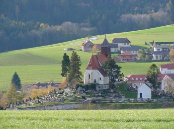
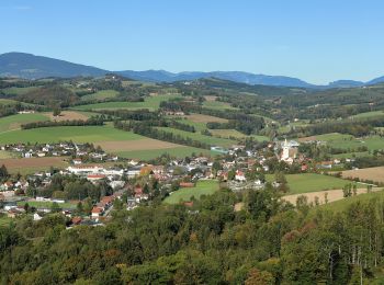
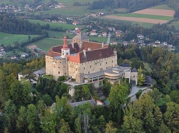
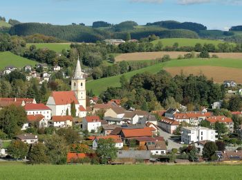
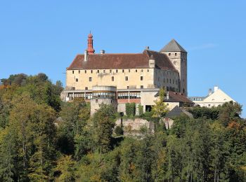
Gemeinde Krumbach: Discover the best trails: 20 on foot. All these trails, routes and outdoor activities are available in our SityTrail applications for smartphones and tablets.
The best trails (20)
![Trail On foot Gemeinde Krumbach - Krumbach - Lindenhof - Tripamer - Tiefenbach - Krumbach - Photo](https://media.geolcdn.com/t/350/260/f6542f9d-dc6f-48a3-96fb-241061cc8883.jpeg&format=jpg&maxdim=2)
![On foot On foot](https://static1.geolcdn.com/sitytour/trail-icons/100.png)
Km
On foot
![](/images/other/stat-length.png)
![](https://static1.geolcdn.com/siteimages/upload/files/1508320355ic_sort_den_pos_24dp.png)
![](https://static1.geolcdn.com/siteimages/upload/files/1508320355ic_sort_den_neg_24dp.png)
![](https://static1.geolcdn.com/siteimages/upload/files/16400158638029165_repeat_loop_refresh_sync_direction_icon.png)
• Symbol: grün-weiß Schild mit G2
![Trail On foot Gemeinde Krumbach - Krumbach - Lindenhof - Gasthof Sägemühle - Unterhaus - Heimatmuseum - Krumbach - Photo](https://media.geolcdn.com/t/350/260/e5380d94-ef00-4fd4-ba6a-df4ac6664855.jpeg&format=jpg&maxdim=2)
![On foot On foot](https://static1.geolcdn.com/sitytour/trail-icons/100.png)
Km
On foot
![](/images/other/stat-length.png)
![](https://static1.geolcdn.com/siteimages/upload/files/1508320355ic_sort_den_pos_24dp.png)
![](https://static1.geolcdn.com/siteimages/upload/files/1508320355ic_sort_den_neg_24dp.png)
![](https://static1.geolcdn.com/siteimages/upload/files/16400158638029165_repeat_loop_refresh_sync_direction_icon.png)
• Symbol: grün-weiß Schild mit G1
![Trail On foot Gemeinde Krumbach - Ponholz - Kühriegel - Weißes Kreuz - Photo](https://media.geolcdn.com/t/350/260/b18087fc-2312-456a-954f-8d0fc6f8bcaf.jpeg&format=jpg&maxdim=2)
![On foot On foot](https://static1.geolcdn.com/sitytour/trail-icons/100.png)
Km
On foot
![](/images/other/stat-length.png)
![](https://static1.geolcdn.com/siteimages/upload/files/1508320355ic_sort_den_pos_24dp.png)
![](https://static1.geolcdn.com/siteimages/upload/files/1508320355ic_sort_den_neg_24dp.png)
![](https://static1.geolcdn.com/siteimages/upload/files/16400158638029165_repeat_loop_refresh_sync_direction_icon.png)
• Symbol: grün-weiß Schild mit G6
![Trail On foot Gemeinde Krumbach - Unterhaus - Schloß Krumbach - Kraxenberg -Kölbel - Photo](https://media.geolcdn.com/t/350/260/f38cee83-f0cf-473e-8983-fcfa02adaea7.jpeg&format=jpg&maxdim=2)
![On foot On foot](https://static1.geolcdn.com/sitytour/trail-icons/100.png)
Km
On foot
![](/images/other/stat-length.png)
![](https://static1.geolcdn.com/siteimages/upload/files/1508320355ic_sort_den_pos_24dp.png)
![](https://static1.geolcdn.com/siteimages/upload/files/1508320355ic_sort_den_neg_24dp.png)
![](https://static1.geolcdn.com/siteimages/upload/files/16400158638029165_repeat_loop_refresh_sync_direction_icon.png)
• Symbol: violetter, waagerechter Balken
![Trail On foot Gemeinde Krumbach - Unterhaus - Kraxenberg - Photo](https://media.geolcdn.com/t/350/260/5d77e7f6-8ff9-490f-97d5-792344254c3a.jpeg&format=jpg&maxdim=2)
![On foot On foot](https://static1.geolcdn.com/sitytour/trail-icons/100.png)
Km
On foot
![](/images/other/stat-length.png)
![](https://static1.geolcdn.com/siteimages/upload/files/1508320355ic_sort_den_pos_24dp.png)
![](https://static1.geolcdn.com/siteimages/upload/files/1508320355ic_sort_den_neg_24dp.png)
![](https://static1.geolcdn.com/siteimages/upload/files/16400158638029165_repeat_loop_refresh_sync_direction_icon.png)
• Symbol: grüner, waagrechter Balken
![Trail On foot Gemeinde Krumbach - Schloß Krumbach - Hochhalt - Steinkreis - Photo](https://media.geolcdn.com/t/350/260/ff95792d-5c31-404f-9962-cfb29053fddc.jpeg&format=jpg&maxdim=2)
![On foot On foot](https://static1.geolcdn.com/sitytour/trail-icons/100.png)
Km
On foot
![](/images/other/stat-length.png)
![](https://static1.geolcdn.com/siteimages/upload/files/1508320355ic_sort_den_pos_24dp.png)
![](https://static1.geolcdn.com/siteimages/upload/files/1508320355ic_sort_den_neg_24dp.png)
![](https://static1.geolcdn.com/siteimages/upload/files/16400158638029165_repeat_loop_refresh_sync_direction_icon.png)
• Symbol: roter, waagrechter Balken
![Trail On foot Gemeinde Krumbach - Wolfsbühelweg (E18) - Photo](https://media.geolcdn.com/t/350/260/6007f80a-e386-4b0c-a5d4-64fa00122437.jpeg&format=jpg&maxdim=2)
![On foot On foot](https://static1.geolcdn.com/sitytour/trail-icons/100.png)
Km
On foot
![](/images/other/stat-length.png)
![](https://static1.geolcdn.com/siteimages/upload/files/1508320355ic_sort_den_pos_24dp.png)
![](https://static1.geolcdn.com/siteimages/upload/files/1508320355ic_sort_den_neg_24dp.png)
![](https://static1.geolcdn.com/siteimages/upload/files/16400158638029165_repeat_loop_refresh_sync_direction_icon.png)
• Trail created by Fremdenverkehrsverein Bad Schönau. Symbol: roter, waagrechter Balken
![Trail On foot Gemeinde Krumbach - Ernst Ferstl Gedankenweg (E23) - Photo](https://media.geolcdn.com/t/350/260/ef668ff8-7b42-4ad4-8544-ba7f5126912c.jpeg&format=jpg&maxdim=2)
![On foot On foot](https://static1.geolcdn.com/sitytour/trail-icons/100.png)
Km
On foot
![](/images/other/stat-length.png)
![](https://static1.geolcdn.com/siteimages/upload/files/1508320355ic_sort_den_pos_24dp.png)
![](https://static1.geolcdn.com/siteimages/upload/files/1508320355ic_sort_den_neg_24dp.png)
![](https://static1.geolcdn.com/siteimages/upload/files/16400158638029165_repeat_loop_refresh_sync_direction_icon.png)
• Trail created by Fremdenverkehrsverein Bad Schönau. Symbol: grüner, waagrechter Balken
![Trail On foot Gemeinde Krumbach - Krumbach Gemeindeparkpaltz - Holzbauer Kapelle - Museumsdorf - Photo](https://media.geolcdn.com/t/350/260/c5da59df-df46-472c-bc77-848f04955718.jpeg&format=jpg&maxdim=2)
![On foot On foot](https://static1.geolcdn.com/sitytour/trail-icons/100.png)
Km
On foot
![](/images/other/stat-length.png)
![](https://static1.geolcdn.com/siteimages/upload/files/1508320355ic_sort_den_pos_24dp.png)
![](https://static1.geolcdn.com/siteimages/upload/files/1508320355ic_sort_den_neg_24dp.png)
![](https://static1.geolcdn.com/siteimages/upload/files/16400158638029165_repeat_loop_refresh_sync_direction_icon.png)
• Symbol: roter, waagrechter Balken
![Trail On foot Gemeinde Krumbach - Himmelsteigrunde, Krumbach Gemeinde Parkplatz - Seisbühel - Museumsdorf - Photo](https://media.geolcdn.com/t/350/260/08c2be29-c2e1-42d3-9a08-1e55e2585c88.jpeg&format=jpg&maxdim=2)
![On foot On foot](https://static1.geolcdn.com/sitytour/trail-icons/100.png)
Km
On foot
![](/images/other/stat-length.png)
![](https://static1.geolcdn.com/siteimages/upload/files/1508320355ic_sort_den_pos_24dp.png)
![](https://static1.geolcdn.com/siteimages/upload/files/1508320355ic_sort_den_neg_24dp.png)
![](https://static1.geolcdn.com/siteimages/upload/files/16400158638029165_repeat_loop_refresh_sync_direction_icon.png)
• Symbol: blauer,waagrechter Balken
![Trail On foot Gemeinde Krumbach - Krumbach - Kapelle beim Haidhof - Ransgraben Rundwanderweg - Photo](https://media.geolcdn.com/t/350/260/d9ea0802-ebb4-42d2-9395-61d7d4e52308.jpeg&format=jpg&maxdim=2)
![On foot On foot](https://static1.geolcdn.com/sitytour/trail-icons/100.png)
Km
On foot
![](/images/other/stat-length.png)
![](https://static1.geolcdn.com/siteimages/upload/files/1508320355ic_sort_den_pos_24dp.png)
![](https://static1.geolcdn.com/siteimages/upload/files/1508320355ic_sort_den_neg_24dp.png)
![](https://static1.geolcdn.com/siteimages/upload/files/16400158638029165_repeat_loop_refresh_sync_direction_icon.png)
• Symbol: violetter, waagerechter Balken
![Trail On foot Gemeinde Krumbach - Krumbach - Dirndlbauer - Gasthof Sägemühle - Photo](https://media.geolcdn.com/t/350/260/28b4ff05-1513-42af-a5d9-af6ffeb4524e.jpeg&format=jpg&maxdim=2)
![On foot On foot](https://static1.geolcdn.com/sitytour/trail-icons/100.png)
Km
On foot
![](/images/other/stat-length.png)
![](https://static1.geolcdn.com/siteimages/upload/files/1508320355ic_sort_den_pos_24dp.png)
![](https://static1.geolcdn.com/siteimages/upload/files/1508320355ic_sort_den_neg_24dp.png)
![](https://static1.geolcdn.com/siteimages/upload/files/16400158638029165_repeat_loop_refresh_sync_direction_icon.png)
• Symbol: gelber, waagerechter Balken
![Trail On foot Gemeinde Krumbach - Krumbach - Peinthor Marterl Rundwanderweg - Photo](https://media.geolcdn.com/t/350/260/08c2be29-c2e1-42d3-9a08-1e55e2585c88.jpeg&format=jpg&maxdim=2)
![On foot On foot](https://static1.geolcdn.com/sitytour/trail-icons/100.png)
Km
On foot
![](/images/other/stat-length.png)
![](https://static1.geolcdn.com/siteimages/upload/files/1508320355ic_sort_den_pos_24dp.png)
![](https://static1.geolcdn.com/siteimages/upload/files/1508320355ic_sort_den_neg_24dp.png)
![](https://static1.geolcdn.com/siteimages/upload/files/16400158638029165_repeat_loop_refresh_sync_direction_icon.png)
• Symbol: blauer,waagrechter Balken
![Trail On foot Gemeinde Krumbach - Krumbach Gemeindeparkpaltz - Weißes Kreuz Rundwanderweg - Photo](https://media.geolcdn.com/t/350/260/c5da59df-df46-472c-bc77-848f04955718.jpeg&format=jpg&maxdim=2)
![On foot On foot](https://static1.geolcdn.com/sitytour/trail-icons/100.png)
Km
On foot
![](/images/other/stat-length.png)
![](https://static1.geolcdn.com/siteimages/upload/files/1508320355ic_sort_den_pos_24dp.png)
![](https://static1.geolcdn.com/siteimages/upload/files/1508320355ic_sort_den_neg_24dp.png)
![](https://static1.geolcdn.com/siteimages/upload/files/16400158638029165_repeat_loop_refresh_sync_direction_icon.png)
• Symbol: grüner, waagrechter Balken
![Trail On foot Gemeinde Krumbach - Schloß Krumbach - Pichl - Photo](https://media.geolcdn.com/t/350/260/4699c171-a9aa-42fd-960d-7ec70fa0960e.jpeg&format=jpg&maxdim=2)
![On foot On foot](https://static1.geolcdn.com/sitytour/trail-icons/100.png)
Km
On foot
![](/images/other/stat-length.png)
![](https://static1.geolcdn.com/siteimages/upload/files/1508320355ic_sort_den_pos_24dp.png)
![](https://static1.geolcdn.com/siteimages/upload/files/1508320355ic_sort_den_neg_24dp.png)
![](https://static1.geolcdn.com/siteimages/upload/files/16400158638029165_repeat_loop_refresh_sync_direction_icon.png)
• Symbol: gelber, waagerechter Balken
![Trail On foot Gemeinde Krumbach - Krumbach - Bad Schönau - Photo](https://media.geolcdn.com/t/350/260/b76e1625-b752-4e3e-8e5d-48ddeab0eb6d.jpeg&format=jpg&maxdim=2)
![On foot On foot](https://static1.geolcdn.com/sitytour/trail-icons/100.png)
Km
On foot
![](/images/other/stat-length.png)
![](https://static1.geolcdn.com/siteimages/upload/files/1508320355ic_sort_den_pos_24dp.png)
![](https://static1.geolcdn.com/siteimages/upload/files/1508320355ic_sort_den_neg_24dp.png)
![](https://static1.geolcdn.com/siteimages/upload/files/16400158638029165_repeat_loop_refresh_sync_direction_icon.png)
• Symbol: blauer,waagrechter Balken
![Trail On foot Gemeinde Krumbach - Unterhaus - Schloß Krumbach - Kraxenberg - Photo](https://media.geolcdn.com/t/350/260/f38cee83-f0cf-473e-8983-fcfa02adaea7.jpeg&format=jpg&maxdim=2)
![On foot On foot](https://static1.geolcdn.com/sitytour/trail-icons/100.png)
Km
On foot
![](/images/other/stat-length.png)
![](https://static1.geolcdn.com/siteimages/upload/files/1508320355ic_sort_den_pos_24dp.png)
![](https://static1.geolcdn.com/siteimages/upload/files/1508320355ic_sort_den_neg_24dp.png)
![](https://static1.geolcdn.com/siteimages/upload/files/16400158638029165_repeat_loop_refresh_sync_direction_icon.png)
![Trail On foot Gemeinde Krumbach - Schloß Krumbach - Hosien Rundwanderweg - Photo](https://media.geolcdn.com/t/350/260/4699c171-a9aa-42fd-960d-7ec70fa0960e.jpeg&format=jpg&maxdim=2)
![On foot On foot](https://static1.geolcdn.com/sitytour/trail-icons/100.png)
Km
On foot
![](/images/other/stat-length.png)
![](https://static1.geolcdn.com/siteimages/upload/files/1508320355ic_sort_den_pos_24dp.png)
![](https://static1.geolcdn.com/siteimages/upload/files/1508320355ic_sort_den_neg_24dp.png)
![](https://static1.geolcdn.com/siteimages/upload/files/16400158638029165_repeat_loop_refresh_sync_direction_icon.png)
![Trail On foot Gemeinde Krumbach - Krumbach - Bad Schönau - Photo](https://media.geolcdn.com/t/350/260/b76e1625-b752-4e3e-8e5d-48ddeab0eb6d.jpeg&format=jpg&maxdim=2)
![On foot On foot](https://static1.geolcdn.com/sitytour/trail-icons/100.png)
Km
On foot
![](/images/other/stat-length.png)
![](https://static1.geolcdn.com/siteimages/upload/files/1508320355ic_sort_den_pos_24dp.png)
![](https://static1.geolcdn.com/siteimages/upload/files/1508320355ic_sort_den_neg_24dp.png)
![](https://static1.geolcdn.com/siteimages/upload/files/16400158638029165_repeat_loop_refresh_sync_direction_icon.png)
![Trail On foot Gemeinde Krumbach - Zöbersdorfwanderweg (Zöbersdorf - Gumpoldshof - Hosien - Mölterner Höhe - Saubichl - Kranzmühle - Rodlmühle) - Photo](https://media.geolcdn.com/t/350/260/ext.jpg?maxdim=2&url=https%3A%2F%2Fstatic1.geolcdn.com%2Fsiteimages%2Fupload%2Ffiles%2F1545311037marcheuse_200dpi.jpg)
![On foot On foot](https://static1.geolcdn.com/sitytour/trail-icons/100.png)
Km
On foot
![](/images/other/stat-length.png)
![](https://static1.geolcdn.com/siteimages/upload/files/1508320355ic_sort_den_pos_24dp.png)
![](https://static1.geolcdn.com/siteimages/upload/files/1508320355ic_sort_den_neg_24dp.png)
![](https://static1.geolcdn.com/siteimages/upload/files/16400158638029165_repeat_loop_refresh_sync_direction_icon.png)
• Symbol: violetter, waagerechter Balken, G8
20 trails displayed on 20
FREE GPS app for hiking