


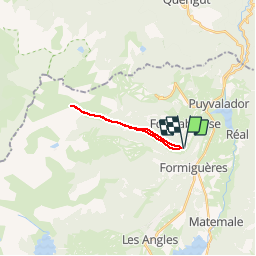

13,1 km | 26 km-effort

Gebruiker


Gratisgps-wandelapplicatie
 SityTrail
IGN / Geografische instituten
SityTrail World
De wereld gaat voor u open
Tocht Sneeuwschoenen van 15,3 km beschikbaar op Occitanië, Pyrénées-Orientales, Fontrabiouse. Deze tocht wordt voorgesteld door jpipacific.
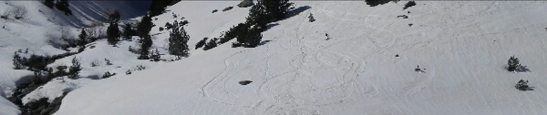
Rando magnifique sur la deuxième partie. Un peu sportif seulement après le 2ieme refuge. Le reste du temps c'est sans effort mais le retour un peu long. Raquettes obligatoires après le 2ieme refuge (mois de mars)


Sneeuwschoenen

Stappen


sport

Stappen

Stappen

Stappen

Sneeuwschoenen

Sneeuwschoenen
Sneeuwschoenen