![](/images/other/stat-length.png)
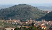
![Tocht Te voet Vicopisano - Vicopisano - Campo dei Lupi - Mandrie - Col di Cincia - Buti - Photo](https://media.geolcdn.com/t/1900/400/c18ff4bb-3e79-43e2-b2e3-588d24175233.jpeg&format=pjpeg&maxdim=2)
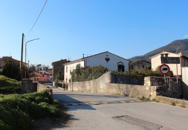
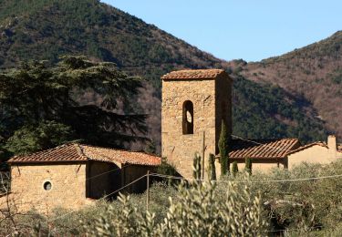
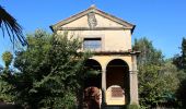
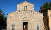
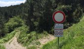
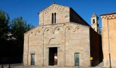
Vicopisano - Campo dei Lupi - Mandrie - Col di Cincia - Buti
SityTrail - itinéraires balisés pédestres
Tous les sentiers balisés d’Europe GUIDE+
![Lengte](/images/other/stat-length.png)
Lengte
9,7 km
![Max. hoogte](https://static1.geolcdn.com/siteimages/upload/files/1508320355ic_sort_altitude_max_24dp.png)
Max. hoogte
479 m
![Positief hoogteverschil](https://static1.geolcdn.com/siteimages/upload/files/1508320355ic_sort_den_pos_24dp.png)
Positief hoogteverschil
482 m
![Km-Effort](/images/other/stat-length.png)
Km-Effort
15,8 km
![Min. hoogte](https://static1.geolcdn.com/siteimages/upload/files/1508320355ic_sort_altitude_min_24dp.png)
Min. hoogte
19 m
![Negatief hoogteverschil](https://static1.geolcdn.com/siteimages/upload/files/1508320355ic_sort_den_neg_24dp.png)
Negatief hoogteverschil
387 m
![Boucle](https://static1.geolcdn.com/siteimages/upload/files/16400158638029165_repeat_loop_refresh_sync_direction_icon.png)
Boucle
Neen
Markering
Datum van aanmaak :
2022-02-15 03:48:16.336
Laatste wijziging :
2022-03-01 00:29:17.447
![Te voet](https://static1.geolcdn.com/sitytour/trail-icons/100.png)
3h35
Moeilijkheid : Gemakkelijk
![Scan deze QR-code om de tocht te openen in de SityTrail-applicatie](https://capi.geolives.com/qq0zvz2zws4bq2lad0pu/sitytour/trails/3114644/qr.png?size=200)
Gratisgps-wandelapplicatie
Over ons
Tocht Te voet van 9,7 km beschikbaar op Toscane, Pisa, Vicopisano. Deze tocht wordt voorgesteld door SityTrail - itinéraires balisés pédestres.
Beschrijving
Trail created by Comune di Buti / Vicopisano.
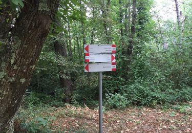
Symbol: 148 on white red flag
Plaatsbepaling
Land:
Italy
Regio :
Toscane
Departement/Provincie :
Pisa
Gemeente :
Vicopisano
Locatie:
Unknown
Vertrek:(Dec)
Vertrek:(UTM)
627281 ; 4839731 (32T) N.
Opmerkingen
Wandeltochten in de omgeving
![Tocht Te voet Calci -](https://media.geolcdn.com/t/375/260/1483be64-1271-4d8d-a967-ffbb3bdc215f.jpeg&format=jpg&maxdim=2)
![Te voet Te voet](https://static1.geolcdn.com/sitytour/trail-icons/100.png)
"Gangalandi" San Bernardo - Gangalandi - Via di Pari
Te voet
Gemakkelijk
Calci,
Toscane,
Pisa,
Italy
![](/images/other/stat-length.png)
4 km | 6,1 km-effort
1h 22min
![](https://static1.geolcdn.com/siteimages/upload/files/16400158638029165_repeat_loop_refresh_sync_direction_icon.png)
Neen
![Tocht Te voet Calci -](https://media.geolcdn.com/t/375/260/14bbf4c8-701a-4e3e-bf1d-e5f80a727da4.jpeg&format=jpg&maxdim=2)
![Te voet Te voet](https://static1.geolcdn.com/sitytour/trail-icons/100.png)
"Via Lucchese" - da Castelmaggiore a Campo di Croce
Te voet
Gemakkelijk
Calci,
Toscane,
Pisa,
Italy
![](/images/other/stat-length.png)
4,4 km | 9,3 km-effort
2h 6min
![](https://static1.geolcdn.com/siteimages/upload/files/16400158638029165_repeat_loop_refresh_sync_direction_icon.png)
Neen
![Tocht Te voet Vicopisano - Vicopisano - Campomaggio - San Jacopo - La Torre - Col di Cincia - Photo](https://media.geolcdn.com/t/375/260/f1bca7af-0963-4f34-9775-db816f259853.jpeg&format=jpg&maxdim=2)
![Te voet Te voet](https://static1.geolcdn.com/sitytour/trail-icons/100.png)
Vicopisano - Campomaggio - San Jacopo - La Torre - Col di Cincia
Te voet
Gemakkelijk
Vicopisano,
Toscane,
Pisa,
Italy
![](/images/other/stat-length.png)
5,3 km | 9,2 km-effort
2h 4min
![](https://static1.geolcdn.com/siteimages/upload/files/16400158638029165_repeat_loop_refresh_sync_direction_icon.png)
Neen
![Tocht Te voet Buti - Buti - Sorbo - Prato a Giovo - Photo](https://media.geolcdn.com/t/375/260/1e2cf47d-c92a-4c22-a171-647f2d1982a3.jpeg&format=jpg&maxdim=2)
![Te voet Te voet](https://static1.geolcdn.com/sitytour/trail-icons/100.png)
Buti - Sorbo - Prato a Giovo
Te voet
Gemakkelijk
Buti,
Toscane,
Pisa,
Italy
![](/images/other/stat-length.png)
4,4 km | 10 km-effort
2h 16min
![](https://static1.geolcdn.com/siteimages/upload/files/16400158638029165_repeat_loop_refresh_sync_direction_icon.png)
Neen
![Tocht Te voet Vicopisano -](https://media.geolcdn.com/t/375/260/f267c1b5-69e6-4892-8a7e-2b84a89c58bb.jpeg&format=jpg&maxdim=2)
![Te voet Te voet](https://static1.geolcdn.com/sitytour/trail-icons/100.png)
"Sottoverruca" Noce - Focetta - Prato Ceccottino
Te voet
Gemakkelijk
Vicopisano,
Toscane,
Pisa,
Italy
![](/images/other/stat-length.png)
3,6 km | 5 km-effort
1h 7min
![](https://static1.geolcdn.com/siteimages/upload/files/16400158638029165_repeat_loop_refresh_sync_direction_icon.png)
Neen
![Tocht Te voet Vicopisano -](https://media.geolcdn.com/t/375/260/b3c504cb-dc65-469a-9964-a0136d1cf5d2.jpeg&format=jpg&maxdim=2)
![Te voet Te voet](https://static1.geolcdn.com/sitytour/trail-icons/100.png)
"Via Butese" Caprona - Nicosia - Prato a Ceccotino - Lugnano
Te voet
Gemakkelijk
Vicopisano,
Toscane,
Pisa,
Italy
![](/images/other/stat-length.png)
7,7 km | 13,4 km-effort
3h 2min
![](https://static1.geolcdn.com/siteimages/upload/files/16400158638029165_repeat_loop_refresh_sync_direction_icon.png)
Neen
![Tocht Te voet Calci -](https://media.geolcdn.com/t/375/260/5cb2d501-6371-4102-bef4-bf63212044d1.jpeg&format=jpg&maxdim=2)
![Te voet Te voet](https://static1.geolcdn.com/sitytour/trail-icons/100.png)
"Certosa di Calci" - Montemagno - Prato a Giovo
Te voet
Gemakkelijk
Calci,
Toscane,
Pisa,
Italy
![](/images/other/stat-length.png)
4,2 km | 10 km-effort
2h 16min
![](https://static1.geolcdn.com/siteimages/upload/files/16400158638029165_repeat_loop_refresh_sync_direction_icon.png)
Neen
![Tocht Te voet Calci -](https://media.geolcdn.com/t/375/260/36b1cd29-fba0-405c-899f-a1d13a8057d1.jpeg&format=jpg&maxdim=2)
![Te voet Te voet](https://static1.geolcdn.com/sitytour/trail-icons/100.png)
"Fonte del Porco" Castelmaggiore (loc. Pirone) - Tre Colli - Bisantola - Mont...
Te voet
Gemakkelijk
Calci,
Toscane,
Pisa,
Italy
![](/images/other/stat-length.png)
3,3 km | 10,2 km-effort
2h 18min
![](https://static1.geolcdn.com/siteimages/upload/files/16400158638029165_repeat_loop_refresh_sync_direction_icon.png)
Neen
![Tocht Te voet Vicopisano -](https://media.geolcdn.com/t/375/260/97881ee9-9487-4cc9-8241-99f9010498f1.jpeg&format=jpg&maxdim=2)
![Te voet Te voet](https://static1.geolcdn.com/sitytour/trail-icons/100.png)
"Sentiero Pisa" Da San Giovanni alla Vena a Ripafratta, "Oltre Serchio" da Ri...
Te voet
Zeer moeilijk
Vicopisano,
Toscane,
Pisa,
Italy
![](/images/other/stat-length.png)
43 km | 72 km-effort
16h 19min
![](https://static1.geolcdn.com/siteimages/upload/files/16400158638029165_repeat_loop_refresh_sync_direction_icon.png)
Neen