![](/images/other/stat-length.png)
![Tocht Te voet Lecco - Sentiero Rotary Lecco - Photo](https://media.geolcdn.com/t/1900/400/506e0fb4-71e0-4999-80b7-823fec58a496.jpeg&format=pjpeg&maxdim=2)
Sentiero Rotary Lecco
SityTrail - itinéraires balisés pédestres
Tous les sentiers balisés d’Europe GUIDE+
![Lengte](/images/other/stat-length.png)
Lengte
9,2 km
![Max. hoogte](https://static1.geolcdn.com/siteimages/upload/files/1508320355ic_sort_altitude_max_24dp.png)
Max. hoogte
595 m
![Positief hoogteverschil](https://static1.geolcdn.com/siteimages/upload/files/1508320355ic_sort_den_pos_24dp.png)
Positief hoogteverschil
286 m
![Km-Effort](/images/other/stat-length.png)
Km-Effort
14 km
![Min. hoogte](https://static1.geolcdn.com/siteimages/upload/files/1508320355ic_sort_altitude_min_24dp.png)
Min. hoogte
297 m
![Negatief hoogteverschil](https://static1.geolcdn.com/siteimages/upload/files/1508320355ic_sort_den_neg_24dp.png)
Negatief hoogteverschil
580 m
![Boucle](https://static1.geolcdn.com/siteimages/upload/files/16400158638029165_repeat_loop_refresh_sync_direction_icon.png)
Boucle
Neen
Markering
Datum van aanmaak :
2022-02-15 00:10:26.992
Laatste wijziging :
2022-02-28 18:33:18.152
![Te voet](https://static1.geolcdn.com/sitytour/trail-icons/100.png)
3h11
Moeilijkheid : Gemakkelijk
![Scan deze QR-code om de tocht te openen in de SityTrail-applicatie](https://capi.geolives.com/qq0zvz2zws4bq2lad0pu/sitytour/trails/3112728/qr.png?size=200)
Gratisgps-wandelapplicatie
Over ons
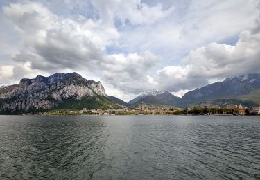
Tocht Te voet van 9,2 km beschikbaar op Lombardije, Lecco, Lecco. Deze tocht wordt voorgesteld door SityTrail - itinéraires balisés pédestres.
Beschrijving
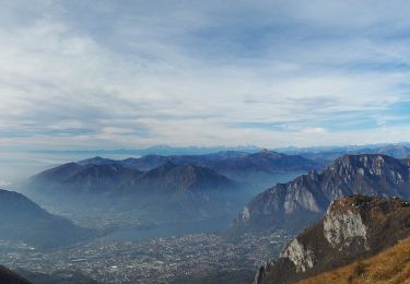
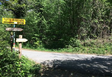
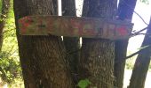
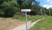
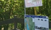
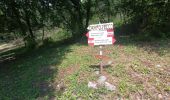
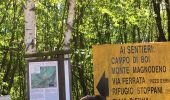
Trail created by Rotary Lecco.
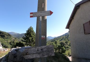
Symbol: cogwheel with text "ROTARY INTERNATIONAL", trail paint blaze red-white stripes
Plaatsbepaling
Land:
Italy
Regio :
Lombardije
Departement/Provincie :
Lecco
Gemeente :
Lecco
Locatie:
Unknown
Vertrek:(Dec)
Vertrek:(UTM)
533229 ; 5078875 (32T) N.
Opmerkingen
Wandeltochten in de omgeving
![Tocht Te voet Erve - Sentiero 831: Cappella del Corno (Erve) - M. Spedone - Nesolio - Erve - Photo](https://media.geolcdn.com/t/375/260/c22af308-c393-4424-b1e9-a24d00feb4e3.jpeg&format=jpg&maxdim=2)
![Te voet Te voet](https://static1.geolcdn.com/sitytour/trail-icons/100.png)
Sentiero 831: Cappella del Corno (Erve) - M. Spedone - Nesolio - Erve
Te voet
Gemakkelijk
Erve,
Lombardije,
Lecco,
Italy
![](/images/other/stat-length.png)
6,2 km | 12,7 km-effort
2h 52min
![](https://static1.geolcdn.com/siteimages/upload/files/16400158638029165_repeat_loop_refresh_sync_direction_icon.png)
Ja
![Tocht Te voet Erve - Variante per Prá di Rat - Photo](https://media.geolcdn.com/t/375/260/b3ff494c-2581-4b0a-a6cd-25ad3d352528.jpeg&format=jpg&maxdim=2)
![Te voet Te voet](https://static1.geolcdn.com/sitytour/trail-icons/100.png)
Variante per Prá di Rat
Te voet
Gemakkelijk
Erve,
Lombardije,
Lecco,
Italy
![](/images/other/stat-length.png)
4,6 km | 16,9 km-effort
3h 50min
![](https://static1.geolcdn.com/siteimages/upload/files/16400158638029165_repeat_loop_refresh_sync_direction_icon.png)
Neen
![Tocht Te voet Morterone - Sentiero dei Grandi Alberi - anello principale - Photo](https://media.geolcdn.com/t/375/260/b0ae6341-4f3f-457a-9fa7-59eb2b1b7750.jpeg&format=jpg&maxdim=2)
![Te voet Te voet](https://static1.geolcdn.com/sitytour/trail-icons/100.png)
Sentiero dei Grandi Alberi - anello principale
Te voet
Gemakkelijk
Morterone,
Lombardije,
Lecco,
Italy
![](/images/other/stat-length.png)
7,5 km | 12,1 km-effort
2h 45min
![](https://static1.geolcdn.com/siteimages/upload/files/16400158638029165_repeat_loop_refresh_sync_direction_icon.png)
Ja
![Tocht Te voet Morterone - Sentiero dei Grandi Alberi - Photo](https://media.geolcdn.com/t/375/260/b0ae6341-4f3f-457a-9fa7-59eb2b1b7750.jpeg&format=jpg&maxdim=2)
![Te voet Te voet](https://static1.geolcdn.com/sitytour/trail-icons/100.png)
Sentiero dei Grandi Alberi
Te voet
Gemakkelijk
Morterone,
Lombardije,
Lecco,
Italy
![](/images/other/stat-length.png)
7,5 km | 12,1 km-effort
2h 45min
![](https://static1.geolcdn.com/siteimages/upload/files/16400158638029165_repeat_loop_refresh_sync_direction_icon.png)
Ja
![Tocht Te voet Lecco - Sentiero 2 della Val Calolden - Photo](https://media.geolcdn.com/t/375/260/6a9d73e2-be77-4099-a255-f8b347ac14ac.jpeg&format=jpg&maxdim=2)
![Te voet Te voet](https://static1.geolcdn.com/sitytour/trail-icons/100.png)
Sentiero 2 della Val Calolden
Te voet
Gemakkelijk
Lecco,
Lombardije,
Lecco,
Italy
![](/images/other/stat-length.png)
3,2 km | 11,2 km-effort
2h 32min
![](https://static1.geolcdn.com/siteimages/upload/files/16400158638029165_repeat_loop_refresh_sync_direction_icon.png)
Neen
![Tocht Te voet Galbiate - Sentiero di mezzo 301: Galbiate - Pian Sciresa - Photo](https://media.geolcdn.com/t/375/260/cf2c8a80-6b26-4473-8806-ccb71f3807cc.jpeg&format=jpg&maxdim=2)
![Te voet Te voet](https://static1.geolcdn.com/sitytour/trail-icons/100.png)
Sentiero di mezzo 301: Galbiate - Pian Sciresa
Te voet
Gemakkelijk
Galbiate,
Lombardije,
Lecco,
Italy
![](/images/other/stat-length.png)
4,7 km | 8,9 km-effort
2h 0min
![](https://static1.geolcdn.com/siteimages/upload/files/16400158638029165_repeat_loop_refresh_sync_direction_icon.png)
Neen
![Tocht Te voet Lecco - Percorso Giorgio Combi - Photo](https://media.geolcdn.com/t/375/260/48ecfc1f-868d-4b17-879f-6b7b4f7605e2.jpeg&format=jpg&maxdim=2)
![Te voet Te voet](https://static1.geolcdn.com/sitytour/trail-icons/100.png)
Percorso Giorgio Combi
Te voet
Gemakkelijk
Lecco,
Lombardije,
Lecco,
Italy
![](/images/other/stat-length.png)
5,4 km | 9,4 km-effort
2h 7min
![](https://static1.geolcdn.com/siteimages/upload/files/16400158638029165_repeat_loop_refresh_sync_direction_icon.png)
Neen
![Tocht Te voet Lecco - Sentiero 18 (della Corna Cammello): Versasio - Piani d'Erna - Photo](https://media.geolcdn.com/t/375/260/8ce93a6f-64ae-432f-a2ee-6859572d3ed1.jpeg&format=jpg&maxdim=2)
![Te voet Te voet](https://static1.geolcdn.com/sitytour/trail-icons/100.png)
Sentiero 18 (della Corna Cammello): Versasio - Piani d'Erna
Te voet
Gemakkelijk
Lecco,
Lombardije,
Lecco,
Italy
![](/images/other/stat-length.png)
3,1 km | 9,8 km-effort
2h 13min
![](https://static1.geolcdn.com/siteimages/upload/files/16400158638029165_repeat_loop_refresh_sync_direction_icon.png)
Neen
![Tocht Te voet Lecco - Sentiero 1: Malnago - Rifugio Azzoni - Photo](https://media.geolcdn.com/t/375/260/9a4f72b8-2e20-4aca-b019-42666e843664.jpeg&format=jpg&maxdim=2)
![Te voet Te voet](https://static1.geolcdn.com/sitytour/trail-icons/100.png)
Sentiero 1: Malnago - Rifugio Azzoni
Te voet
Gemakkelijk
Lecco,
Lombardije,
Lecco,
Italy
![](/images/other/stat-length.png)
4,3 km | 11,4 km-effort
2h 34min
![](https://static1.geolcdn.com/siteimages/upload/files/16400158638029165_repeat_loop_refresh_sync_direction_icon.png)
Neen