![](/images/other/stat-length.png)
![Tocht Te voet Schauenburg - Habichtswaldsteig - Extratour Schauenburg - Photo](https://media.geolcdn.com/t/1900/400/ext.pjpeg?maxdim=2&url=https%3A%2F%2Fmedia.geolcdn.com%2Ff%2F032608dc-851a-4041-9641-fe96126ffeaa.jpeg)
Habichtswaldsteig - Extratour Schauenburg
SityTrail - itinéraires balisés pédestres
Tous les sentiers balisés d’Europe PRO
![Lengte](/images/other/stat-length.png)
Lengte
16,7 km
![Max. hoogte](https://static1.geolcdn.com/siteimages/upload/files/1508320355ic_sort_altitude_max_24dp.png)
Max. hoogte
485 m
![Positief hoogteverschil](https://static1.geolcdn.com/siteimages/upload/files/1508320355ic_sort_den_pos_24dp.png)
Positief hoogteverschil
462 m
![Km-Effort](/images/other/stat-length.png)
Km-Effort
23 km
![Min. hoogte](https://static1.geolcdn.com/siteimages/upload/files/1508320355ic_sort_altitude_min_24dp.png)
Min. hoogte
326 m
![Negatief hoogteverschil](https://static1.geolcdn.com/siteimages/upload/files/1508320355ic_sort_den_neg_24dp.png)
Negatief hoogteverschil
465 m
![Boucle](https://static1.geolcdn.com/siteimages/upload/files/16400158638029165_repeat_loop_refresh_sync_direction_icon.png)
Boucle
Ja
Markering
Datum van aanmaak :
2022-02-11 14:15:36.073
Laatste wijziging :
2022-02-11 14:15:36.073
![Te voet](https://static1.geolcdn.com/sitytour/trail-icons/100.png)
5h12
Moeilijkheid : Medium
![Scan deze QR-code om de tocht te openen in de SityTrail-applicatie](https://capi.geolives.com/qq0zvz2zws4bq2lad0pu/sitytour/trails/3092313/qr.png?size=200)
Gratisgps-wandelapplicatie
Over ons
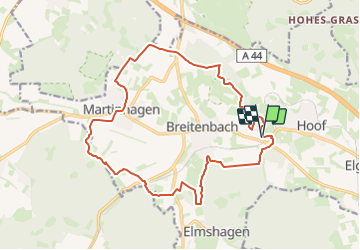
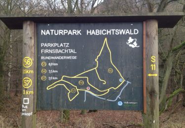
Tocht Te voet van 16,7 km beschikbaar op Hessen, Landkreis Kassel, Schauenburg. Deze tocht wordt voorgesteld door SityTrail - itinéraires balisés pédestres.
Beschrijving
Trail created by Kassel Land.
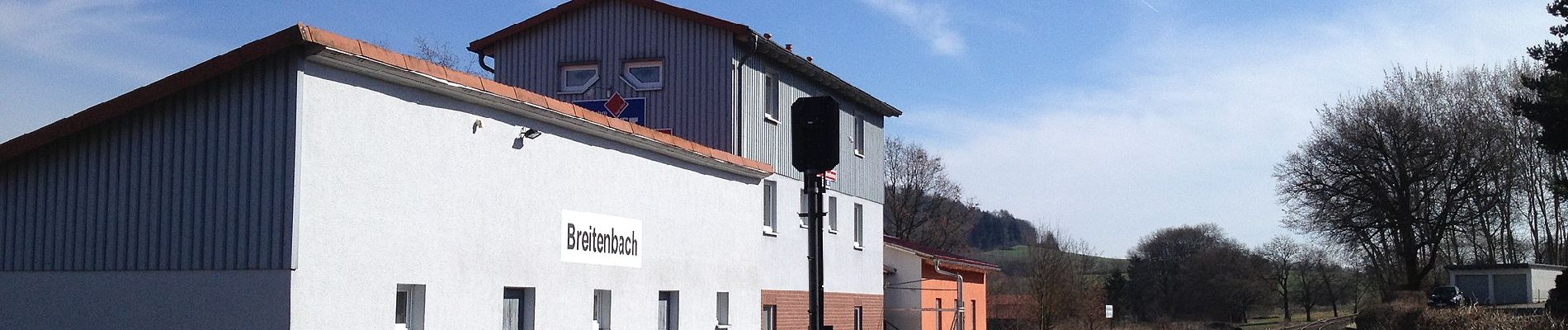
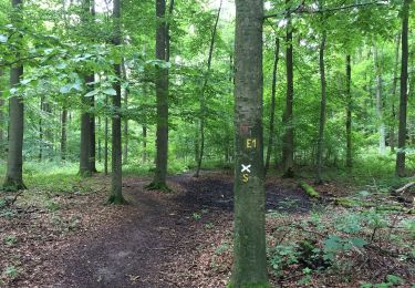
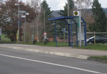
Symbol: weißer Buchstabe H und weiße tiefgestellte Zahl 4 auf purpurnem kreisförmigem Hintergrund
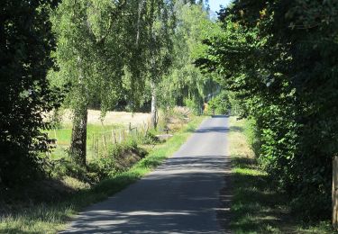
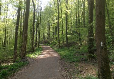
Plaatsbepaling
Land:
Germany
Regio :
Hessen
Departement/Provincie :
Landkreis Kassel
Gemeente :
Schauenburg
Locatie:
Unknown
Vertrek:(Dec)
Vertrek:(UTM)
523279 ; 5681142 (32U) N.
Opmerkingen
Wandeltochten in de omgeving
![Tocht Te voet Niedenstein - Niedenstein, N3 - Sengelsberg - Photo](https://media.geolcdn.com/t/375/260/ext.jpg?maxdim=2&url=https%3A%2F%2Fmedia.geolcdn.com%2Ff%2F4ed4a3a2-bd5e-4fad-8f78-44d080b6d336.jpeg)
![Te voet Te voet](https://static1.geolcdn.com/sitytour/trail-icons/100.png)
Niedenstein, N3 - Sengelsberg
Te voet
Gemakkelijk
Niedenstein,
Hessen,
Schwalm-Eder-Kreis,
Germany
![](/images/other/stat-length.png)
4,3 km | 5,9 km-effort
1h 20min
![](https://static1.geolcdn.com/siteimages/upload/files/16400158638029165_repeat_loop_refresh_sync_direction_icon.png)
Ja
![Tocht Te voet Onbekend - Kassel, Rundweg 15 - Photo](https://media.geolcdn.com/t/375/260/ext.jpg?maxdim=2&url=https%3A%2F%2Fmedia.geolcdn.com%2Ff%2Fd25bec82-9bf0-4f33-9ea8-9920ab67acd3.jpeg)
![Te voet Te voet](https://static1.geolcdn.com/sitytour/trail-icons/100.png)
Kassel, Rundweg 15
Te voet
Gemakkelijk
Onbekend,
Hessen,
Kassel,
Germany
![](/images/other/stat-length.png)
3,4 km | 5 km-effort
1h 7min
![](https://static1.geolcdn.com/siteimages/upload/files/16400158638029165_repeat_loop_refresh_sync_direction_icon.png)
Ja
![Tocht Te voet Baunatal - Eco Pfad Großenritte - Photo](https://media.geolcdn.com/t/375/260/ext.jpg?maxdim=2&url=https%3A%2F%2Fmedia.geolcdn.com%2Ff%2Faf5c4d57-02bc-462b-9005-697af9d99fba.jpeg)
![Te voet Te voet](https://static1.geolcdn.com/sitytour/trail-icons/100.png)
Eco Pfad Großenritte
Te voet
Gemakkelijk
Baunatal,
Hessen,
Landkreis Kassel,
Germany
![](/images/other/stat-length.png)
5,5 km | 6,4 km-effort
1h 26min
![](https://static1.geolcdn.com/siteimages/upload/files/16400158638029165_repeat_loop_refresh_sync_direction_icon.png)
Ja
![Tocht Te voet Bad Emstal - Rundwanderweg](https://media.geolcdn.com/t/375/260/ext.jpg?maxdim=2&url=https%3A%2F%2Fmedia.geolcdn.com%2Ff%2F6152dd1e-c62a-41d9-ac07-c6e6a253257c.jpeg)
![Te voet Te voet](https://static1.geolcdn.com/sitytour/trail-icons/100.png)
Rundwanderweg "5" des Naturpark Habichtswald ab Wanderparkplatz Steinbrüche
Te voet
Gemakkelijk
Bad Emstal,
Hessen,
Landkreis Kassel,
Germany
![](/images/other/stat-length.png)
4,6 km | 5,8 km-effort
1h 19min
![](https://static1.geolcdn.com/siteimages/upload/files/16400158638029165_repeat_loop_refresh_sync_direction_icon.png)
Neen
![Tocht Te voet Onbekend - Schauenburg, S13 - Photo](https://media.geolcdn.com/t/375/260/ext.jpg?maxdim=2&url=https%3A%2F%2Fmedia.geolcdn.com%2Ff%2Fa5299b0c-d460-41c3-89d8-86a465aa5941.jpeg)
![Te voet Te voet](https://static1.geolcdn.com/sitytour/trail-icons/100.png)
Schauenburg, S13
Te voet
Gemakkelijk
Onbekend,
Hessen,
Kassel,
Germany
![](/images/other/stat-length.png)
5,9 km | 7,9 km-effort
1h 47min
![](https://static1.geolcdn.com/siteimages/upload/files/16400158638029165_repeat_loop_refresh_sync_direction_icon.png)
Ja
![Tocht Te voet Onbekend - Schauenburg, S11 - Photo](https://media.geolcdn.com/t/375/260/ext.jpg?maxdim=2&url=https%3A%2F%2Fmedia.geolcdn.com%2Ff%2Fa07483e9-3f98-48af-a9d3-5daff6896e91.jpeg)
![Te voet Te voet](https://static1.geolcdn.com/sitytour/trail-icons/100.png)
Schauenburg, S11
Te voet
Gemakkelijk
Onbekend,
Hessen,
Kassel,
Germany
![](/images/other/stat-length.png)
4,2 km | 6,2 km-effort
1h 24min
![](https://static1.geolcdn.com/siteimages/upload/files/16400158638029165_repeat_loop_refresh_sync_direction_icon.png)
Ja
![Tocht Te voet Onbekend - Schauenburg, S12 - Photo](https://media.geolcdn.com/t/375/260/ext.jpg?maxdim=2&url=https%3A%2F%2Fmedia.geolcdn.com%2Ff%2Fa07483e9-3f98-48af-a9d3-5daff6896e91.jpeg)
![Te voet Te voet](https://static1.geolcdn.com/sitytour/trail-icons/100.png)
Schauenburg, S12
Te voet
Gemakkelijk
Onbekend,
Hessen,
Kassel,
Germany
![](/images/other/stat-length.png)
5,1 km | 7,2 km-effort
1h 37min
![](https://static1.geolcdn.com/siteimages/upload/files/16400158638029165_repeat_loop_refresh_sync_direction_icon.png)
Ja
![Tocht Te voet Schauenburg - Schauenburg, S6 - Photo](https://media.geolcdn.com/t/375/260/ext.jpg?maxdim=2&url=https%3A%2F%2Fmedia.geolcdn.com%2Ff%2Fd03c7f38-8ca3-44c7-ac31-682c28599382.jpeg)
![Te voet Te voet](https://static1.geolcdn.com/sitytour/trail-icons/100.png)
Schauenburg, S6
Te voet
Gemakkelijk
Schauenburg,
Hessen,
Landkreis Kassel,
Germany
![](/images/other/stat-length.png)
4,4 km | 5,8 km-effort
1h 19min
![](https://static1.geolcdn.com/siteimages/upload/files/16400158638029165_repeat_loop_refresh_sync_direction_icon.png)
Ja
![Tocht Te voet Onbekend - Kassel - Wilhelmshöhe, Rundweg 14 - Photo](https://media.geolcdn.com/t/375/260/ext.jpg?maxdim=2&url=https%3A%2F%2Fmedia.geolcdn.com%2Ff%2Fcfa01054-32fe-499a-a7f7-c6ec76a57bb9.jpeg)
![Te voet Te voet](https://static1.geolcdn.com/sitytour/trail-icons/100.png)
Kassel - Wilhelmshöhe, Rundweg 14
Te voet
Gemakkelijk
Onbekend,
Hessen,
Kassel,
Germany
![](/images/other/stat-length.png)
3,6 km | 4,2 km-effort
56min
![](https://static1.geolcdn.com/siteimages/upload/files/16400158638029165_repeat_loop_refresh_sync_direction_icon.png)
Ja