


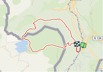

10,4 km | 19,6 km-effort


Gebruiker GUIDE


Gratisgps-wandelapplicatie
 SityTrail
IGN / Geografische instituten
SityTrail World
De wereld gaat voor u open
Tocht Te voet van 9,9 km beschikbaar op Nieuw-Aquitanië, Pyrénées-Atlantiques, Borce. Deze tocht wordt voorgesteld door marmotte65.
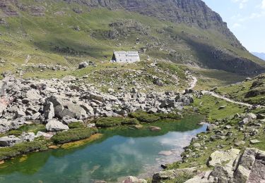
Extraordinaire balade avec quand même un passage délicat sur le retour le passage de l’échelle de fer, sinon le lac est magnifique surtout par un jour sans vent ou la montagne se reflète dans l’eau c'est tout simplement magique.

Te voet
Te voet

Te voet

Stappen
Stappen

Stappen

Stappen

Stappen
Stappen