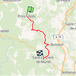
![](/images/other/stat-length.png)
![Tocht Stappen Prinsuéjols-Malbouzon - Tour des Monts d'Aubrac - De Prinsuéjols à St Laurent de Muret - Photo](https://media.geolcdn.com/t/1900/400/ext.pjpeg?maxdim=2&url=https%3A%2F%2Fservices.sitytrail.com%2FGeolivesWS%2FDownloadMedia.ashx%3FTrailID%3D172690%26Media%3D14068_4.jpg)
Tour des Monts d'Aubrac - De Prinsuéjols à St Laurent de Muret
tracegps
Gebruiker
![Lengte](/images/other/stat-length.png)
![Max. hoogte](https://static1.geolcdn.com/siteimages/upload/files/1508320355ic_sort_altitude_max_24dp.png)
![Positief hoogteverschil](https://static1.geolcdn.com/siteimages/upload/files/1508320355ic_sort_den_pos_24dp.png)
![Km-Effort](/images/other/stat-length.png)
![Min. hoogte](https://static1.geolcdn.com/siteimages/upload/files/1508320355ic_sort_altitude_min_24dp.png)
![Negatief hoogteverschil](https://static1.geolcdn.com/siteimages/upload/files/1508320355ic_sort_den_neg_24dp.png)
![Boucle](https://static1.geolcdn.com/siteimages/upload/files/16400158638029165_repeat_loop_refresh_sync_direction_icon.png)
![Stappen](https://static1.geolcdn.com/sitytour/trail-icons/101.png)
4h00
Moeilijkheid : Medium
![Scan deze QR-code om de tocht te openen in de SityTrail-applicatie](https://capi.geolives.com/qq0zvz2zws4bq2lad0pu/sitytour/trails/172690/qr.png?size=200)
Gratisgps-wandelapplicatie
Over ons
Tocht Stappen van 15 km beschikbaar op Occitanië, Lozère, Prinsuéjols-Malbouzon. Deze tocht wordt voorgesteld door tracegps.
Beschrijving
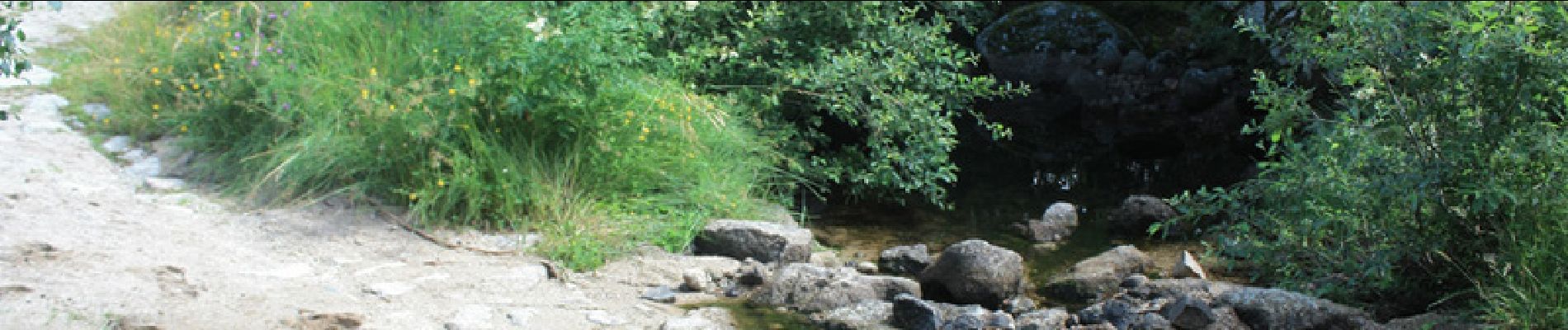
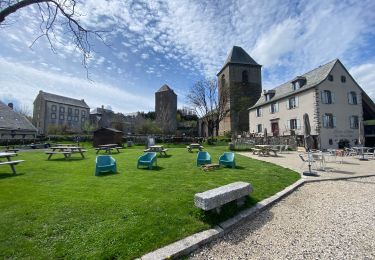
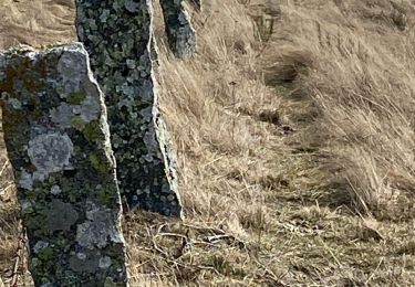
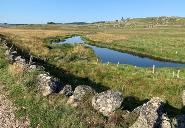
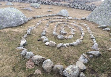
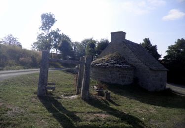
2ème étape de ce circuit qui en comporte 6. Départ à 9h du gîte car à 10h nous sommes attendus au château de la Baume pour la visite - très intéressante - nous repartons vers 11h 45 pour trouver un emplacement de pic-nic que nous trouvons dans un sous-bois à l'ombre de sapins maritimes. Arrêt de 12h20 à 14h. Les pique-niques sont formidables !!! Jean-Claude récupère Thierry à 13h, nous les retrouverons au gîte communal de St Laurent de Muret. Surprise de taille car il est plutôt petit pour tenir 10 personnes !!! J.C nous a préparé plein de bonnes choses, dans la soirée un orage éclate, la nuit fut très chaude et lourde mais le lendemain, le ciel s'éclaircit.
Plaatsbepaling
Opmerkingen
Wandeltochten in de omgeving
![Tocht Stappen Prinsuéjols-Malbouzon - Prinsuejouls GR 65 - Photo](https://media.geolcdn.com/t/375/260/27679fa8-2676-42c2-9bc1-244f0333ecc6.jpg&format=jpg&maxdim=2)
![Stappen Stappen](https://static1.geolcdn.com/sitytour/trail-icons/101.png)
Stappen
![](/images/other/stat-length.png)
![](https://static1.geolcdn.com/siteimages/upload/files/16400158638029165_repeat_loop_refresh_sync_direction_icon.png)
![Tocht Stappen Prinsuéjols-Malbouzon - Mon chemin de St Guilhem étape 2 - Photo](https://media.geolcdn.com/t/375/260/f65b24b5-3ed1-4a17-add2-d789cc20be07.jpg&format=jpg&maxdim=2)
![Stappen Stappen](https://static1.geolcdn.com/sitytour/trail-icons/101.png)
Stappen
![](/images/other/stat-length.png)
![](https://static1.geolcdn.com/siteimages/upload/files/16400158638029165_repeat_loop_refresh_sync_direction_icon.png)
![Tocht Stappen Peyre en Aubrac - Lasbros - Photo](https://media.geolcdn.com/t/375/260/c0f2421e-e54c-492c-b4c7-7d17496731f8.jpg&format=jpg&maxdim=2)
![Stappen Stappen](https://static1.geolcdn.com/sitytour/trail-icons/101.png)
Stappen
![](/images/other/stat-length.png)
![](https://static1.geolcdn.com/siteimages/upload/files/16400158638029165_repeat_loop_refresh_sync_direction_icon.png)
![Tocht Stappen Prinsuéjols-Malbouzon - Étape 2 Saint Gilhem - Photo](https://media.geolcdn.com/t/375/260/6632e795-50e4-46a6-bd0b-6f3a7d69c56f.jpg&format=jpg&maxdim=2)
![Stappen Stappen](https://static1.geolcdn.com/sitytour/trail-icons/101.png)
Stappen
![](/images/other/stat-length.png)
![](https://static1.geolcdn.com/siteimages/upload/files/16400158638029165_repeat_loop_refresh_sync_direction_icon.png)
![Tocht Stappen Prinsuéjols-Malbouzon - Malbauzon - Photo](https://media.geolcdn.com/t/375/260/00d62d64-65d3-4102-9f24-7ece2435752b.jpg&format=jpg&maxdim=2)
![Stappen Stappen](https://static1.geolcdn.com/sitytour/trail-icons/101.png)
Stappen
![](/images/other/stat-length.png)
![](https://static1.geolcdn.com/siteimages/upload/files/16400158638029165_repeat_loop_refresh_sync_direction_icon.png)
![Tocht Te voet Marchastel - Marchastel - Lac Saint-Andéol - Photo](https://media.geolcdn.com/t/375/260/fcd2fa6e-1122-44d8-a1c9-27e2eb22d32c.jpeg&format=jpg&maxdim=2)
![Te voet Te voet](https://static1.geolcdn.com/sitytour/trail-icons/100.png)
Te voet
![](/images/other/stat-length.png)
![](https://static1.geolcdn.com/siteimages/upload/files/16400158638029165_repeat_loop_refresh_sync_direction_icon.png)
![Tocht Stappen Prinsuéjols-Malbouzon - 2021 AUBRAC Étape 6 - Photo](https://media.geolcdn.com/t/375/260/847fb1d3-8256-4113-8cfd-2660f969252f.jpg&format=jpg&maxdim=2)
![Stappen Stappen](https://static1.geolcdn.com/sitytour/trail-icons/101.png)
Stappen
![](/images/other/stat-length.png)
![](https://static1.geolcdn.com/siteimages/upload/files/16400158638029165_repeat_loop_refresh_sync_direction_icon.png)
![Tocht Stappen Prinsuéjols-Malbouzon - Usanges pont du bes - Photo](https://media.geolcdn.com/t/375/260/9e9181e9-fe50-4466-a199-848e94308d05.jpg&format=jpg&maxdim=2)
![Stappen Stappen](https://static1.geolcdn.com/sitytour/trail-icons/101.png)
Stappen
![](/images/other/stat-length.png)
![](https://static1.geolcdn.com/siteimages/upload/files/16400158638029165_repeat_loop_refresh_sync_direction_icon.png)
![Tocht Stappen Prinsuéjols-Malbouzon - De Prinsuéjols à Aubrac - Photo](https://media.geolcdn.com/t/375/260/ext.jpg?maxdim=2&url=https%3A%2F%2Fservices.sitytrail.com%2FGeolivesWS%2FDownloadMedia.ashx%3FTrailID%3D172918%26Media%3D14386_6.jpg)
![Stappen Stappen](https://static1.geolcdn.com/sitytour/trail-icons/101.png)
Stappen
![](/images/other/stat-length.png)
![](https://static1.geolcdn.com/siteimages/upload/files/16400158638029165_repeat_loop_refresh_sync_direction_icon.png)